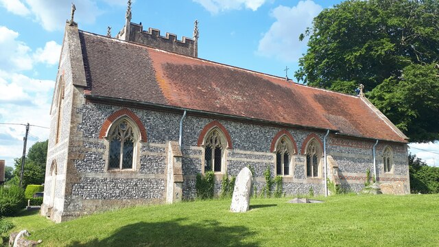
St Peter's Church
Getting here
51.30347, -1.83315
Visiting this summer
Seasonal nature notes and what to look for now
Visiting this summer
Seasonal nature notes and what to look for now
- 🌞Midsummer — early morning visits most comfortable; look for deer fawns in quieter clearings
- 🌿Foraging is at its best in summer here
- 🐕Dogs welcome — bring water in summer; the site has enough space to find shade on hot days
🌤️ Visiting this summer
- 🌞Midsummer — early morning visits most comfortable; look for deer fawns in quieter clearings
- 🌿Foraging is at its best in summer here
- 🐕Dogs welcome — bring water in summer; the site has enough space to find shade on hot days
Good to know
- £Free to visit — no entry charge
- 🐕Dogs welcome
Best for
Wildlife
Very strong match
Multi-group wildlife — Amphibians, Birds, Mammals; Multi-group wildlife — Amphibians, Birds, Mammals
Bird watching
Very strong match
Birds — Corn Bunting, Carrion Crow, Skylark +58 more · last seen 2025; Birds — Corn Bunting, Carrion Crow, Skylark +58 more · last seen 2025
Seasonal nature
Strong match
Plants — Ribwort Plantain, Red Fescue, Oxeye Daisy +75 more · last seen 2025; Plants — Ribwort Plantain, Red Fescue, Oxeye Daisy +75 more · last seen 2025
Foraging
Good match
Plants — Hogweed, Rough Hawkbit, Common Nettle +6 more foraging species
Dog walks
Good match
Dogs allowed with public access
Insect spotting
Good match
Insects — Painted Lady, Red Admiral, Small White +10 more · last seen 2021; Insects — Painted Lady, Red Admiral, Small White +10 more · last seen 2021
Trails nearby
Within roughly 5 km🚶Walking
4 signed routes nearby
Signed route nearby
Walking
Sarsen WayWalking route
White Horse TrailWalking route
Kennet and Avon Canal TrailWalking route140 km
Rivers linked by a canal. The name refers to the entire navigable length. From Bristol the way is the Avon. The canal is from Bath to Newbury. From there to Reading the way is the Kennet. 53 locks to Summit Pound (150 m asl) and 54 down to Reading.
Pewsey Vale Circular WalkWalking route
The Pewsey Vale Tourism Partnership has launched a new long-distance walking, cycling and riding route with the Vale of Pewsey at its heart.
🚴Cycling
20 signed routes nearby
Signed route nearby
Cycling
Mercian WayCycling route
EuroVelo 2 - Capitals Route - part United Kingdom 4Cycling route
National Cycle Network Route 4Cycling route
Alternative RouteCycling route142 m
Main RouteCycling route8.6 km
Main RouteCycling route10.2 km
🚵Mountain biking
1 signed route nearby
Signed route nearby
Mountain biking
King Alfred's WayMountain bike route
King Alfreds Way is 350km (220 miles) off road route designed to be ridden clockwise. It starts & ends in Winchester. It is suitable for gravel or cross-country bikes.
🐴Horse riding
2 public paths nearby
Public paths
Horse riding
Charlton Drovebyway open to all traffic · 689 m
Wildlife to spot
Photos
Weather for this location
Loading local forecast…
Nearby places
Useful places within 5 km
Own or manage this place?
Claim this listing to keep details accurate, add photos, and highlight what makes it special — free.
Claim this pageHow was your visit?
How useful was the information on this page?
id: 3190f488-687c-4ba6-a2fa-3400819c1317