Plan your visit
Getting here
56.53003, -3.54693
Visiting this summer
Seasonal nature notes and what to look for now
Visiting this summer
Seasonal nature notes and what to look for now
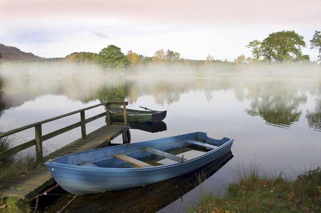
- 🌞Midsummer — dragonfly and damselfly activity peaks along water edges
- ✦Historic character is a year-round quality here — summer brings its own atmosphere to the setting
- 🐕Dogs welcome — bring water in summer; the site has enough space to find shade on hot days
🌤️ Visiting this summer
- 🌞Midsummer — dragonfly and damselfly activity peaks along water edges
- ✦Historic character is a year-round quality here — summer brings its own atmosphere to the setting
- 🐕Dogs welcome — bring water in summer; the site has enough space to find shade on hot days
Good to know
- £Free to visit — no entry charge
- 🐕Dogs welcome
Best for
Wildlife
Very strong match
Multi-group wildlife — Amphibians, Birds, Mammals, Reptiles; Multi-group wildlife — Amphibians, Birds, Mammals, Reptiles
Bird watching
Very strong match
Birds — Mallard, Moorhen, Blue Tit +83 more · last seen 2025; Birds — Mallard, Moorhen, Blue Tit +83 more · last seen 2025
Seasonal nature
Strong match
Ancient woodland — bluebells, fungi and autumn colour; Plants — Yellow Pimpernel, Heather, Sneezewort +15 more · last seen 2024
Insect spotting
Good match
Insects — Anoplotrupes stercorosus, Platycheirus, Bilberry Bumblebee +5 more · last seen 2023; Insects — Anoplotrupes stercorosus, Platycheirus, Bilberry Bumblebee +5 more · last seen 2023
Heritage
Good match
Ancient woodland — historic landscape
Trails nearby
Within roughly 5 km🚶Walking
33 signed routes nearby
Signed route nearby
Walking
Birnam Hill PathWalking route
A popular walk requiring hill fitness as the north side path is of mountain hiking grade. The ascent is worthwhile for fabulous views from this commanding peak near the Highland Boundary Fault. To the south lies gentler landscape towards Perth and Strathe
Loch of the Lowes PathWalking route
Joins Dunkeld with Loch of the Lowes Nature Reserve in a loop. Pleasant woodland walk. Some muddy sections near Fungarth.
Birnam Riverside PathWalking route
Walk beside the River Tay passing the Birnam Oak. Goes downstream past the water treatment works before turning at the Fisherman's Hut. Returns through Birnam.
Inver PathWalking route
A short but steep section at the north end may be challenging. Otherwise a great combination of riverside and forest.
Braan PathWalking route
A stunning walk taking in the Hermitage and Rumbling Bridge waterfalls, along with stunning native woodland near Tomgarrow. Note that shortcutting along the A822 is hazardous and not recommended.
🚴Cycling
28 signed routes nearby
Signed route nearby
Cycling
NCN National Route 77Cycling route
Route 83Cycling route
Dunkeld Loch Ordie Butterstone LoopCycling route24 km
Half day cycle on mostly good tracks.
Dunkeld Dull Strathtay LoopCycling route
From Dunkeld (under the A9 via the underpass) to Dull via Strathbraan and Aberfeldy. Past Aberfeldy, a short detour to Dull makes an interesting stop off. Return but stay north of the Tay and head to Strathtay. Take the Dalguise road and back to Dunkeld.
River Tay Way Cycle RouteCycling route
Combining portions of NCN 7 and 77 to provide a route between Kenmore and Dundee, roughly following the course of the River Tay
Main RouteCycling route471 m
🚵Mountain biking
3 signed routes nearby
Signed route nearby
Mountain biking
Electric BeaverMountain bike route
Hush HushMountain bike route
Rake'n'RuinMountain bike route
Wildlife to spot
Photos
Weather for this location
Loading local forecast…
Nearby places
Useful places within 5 km
Own or manage this place?
Claim this listing to keep details accurate, add photos, and highlight what makes it special — free.
Claim this pageVisitor access unverified.We don't yet have confirmed information about walking routes or public access at this reservoir. If you've visited, please help us improve this page.
How was your visit?
How useful was the information on this page?
id: ab8d0f75-4ee7-431b-b7c2-b491ef5acf79