⛳ Golf🦅 Birds🦉 Wildlife
↑ Share
Public access Paid entry Dogs welcome
Places › England › Eastern › Braintree Getting here
51.89230, 0.60797
Open directionsv Visiting this summer
Seasonal nature notes and what to look for now
▾ 🐦 52+ species recorded in this area — summer evenings are best for activity; watch for Blue Tit and Great Tit ⛳ Golf is at its best in summer here 🐕 Dogs welcome — bring water in summer; the site has enough space to find shade on hot days 🌤️ Visiting this summer
🐦 52+ species recorded in this area — summer evenings are best for activity; watch for Blue Tit and Great Tit ⛳ Golf is at its best in summer here 🐕 Dogs welcome — bring water in summer; the site has enough space to find shade on hot days 🦅 Bird watching
Very strong match
Birds — Blue Tit, Great Tit, Dunnock +49 more · last seen 2025; Birds — Blue Tit, Great Tit, Dunnock +49 more · last seen 2025
Free
🦉 Wildlife
Very strong match
Multi-group wildlife — Birds, Mammals; Multi-group wildlife — Birds, Mammals
Free
🍂 Seasonal nature
Strong match
Plants — Bluebell, Elder, Pedunculate Oak +48 more · last seen 2024; Plants — Bluebell, Elder, Pedunculate Oak +48 more · last seen 2024
Free
Plants — Elder, Pedunculate Oak, Blackthorn +8 more foraging species; Deciduous woodland — fungi, berries and wild garlic
Varies
Dogs allowed with public access
Free
Trails nearby Within roughly 5 km 4 signed routes nearby · 29 public paths nearby
Signed route nearby Public paths
John Ray Walk Walking route ▾
Named route Local walking route
Show on map Colne Valley Path Walking route 37 km ▾
Named route Length 37 km Local walking route
Show on map Grange Barn and Paycocke's House Circular Walk, Grange Barn Walking route 4.8 km ▾
Grange Barn is one of Europe's oldest timber-framed buildings. Paths are muddy and boggy after wet weather, so boots may be necessary. Please note that the river bridge is braced by metal bars which you'll need to climb over, so take care when crossing.
Named route Length 4.8 km Duration 01:30 Round trip Local walking route
Show on map Essex Way (Epping to Stratford St Mary) Walking route ▾
Named route Regional walking route
Show on map China Bridge public footpath · 14 m ▾
Public path public footpath Length 14 m Path type: footway
Show on map Footpath 31 public footpath · 956 m ▾
Although it appears to lead into a private residence, this is still a designated Public Right of Way footpath.
Public path public footpath Length 956 m Surface unpaved Path type: footway
Show on map 25 signed routes nearby
Signed route nearby
Route 16 Cycling route ▾
Named route Ref 16 National Cycle Network
Show on map Main Route Cycling route 376 m ▾
Named route Ref 16 Length 376 m National Cycle Network Traffic-free Surface asphalt
Show on map Main Route Cycling route 47 m ▾
Named route Ref 16 Length 47 m National Cycle Network Traffic-free Surface asphalt
Show on map Main Route Cycling route 126 m ▾
Named route Ref 16 Length 126 m National Cycle Network Traffic-free Surface asphalt
Show on map Main Route Cycling route 17 m ▾
Named route Ref 16 Length 17 m National Cycle Network Traffic-free Surface concrete
Show on map Main Route Cycling route 1.5 km ▾
Named route Ref 16 Length 1.5 km National Cycle Network Traffic-free Surface unsealedfirm
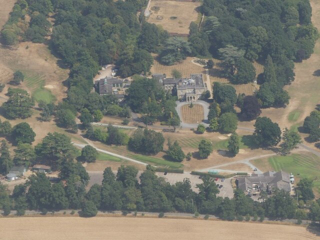
Show on map Photos Stisted Hall: aerial 2022 (2)
‹ ›
Weather for this location Next 14 days Nearby places Useful places within 5 km
All Historic
Own or manage this place?
Claim this listing to keep details accurate, add photos, and highlight what makes it special — free.
Claim this page→ How useful was the information on this page?
Something wrong on this page?
id: d082d32a-ef66-47bf-833e-fa1e0bc3a270
UK green spaces mapped from open public data — so anyone can find the woodland, trail, or nature reserve closest to them.
© 2026 Glade · Made with care for UK green spaces
Events & activities nearby Switch provider to compare local events, tours and bookable activities.
Bookable tours GetYourGuide Promote here
Wildlife to spot
1,114 records · National Biodiversity Network
▾
Wildlife to spot 1,114 records · National Biodiversity Network 🐦 Birds 32 species
spring summer
2025 ▾
Great Tit · House Sparrow · Blue Tit · Robin · Dunnock +27
Great Tit Parus major2024 House Sparrow Passer domesticus2024 Blue Tit Cyanistes caeruleus2024 Robin Erithacus rubecula2024 Dunnock Prunella modularis2024 Pheasant Phasianus colchicus2023 Greenfinch Chloris chloris2022 Woodpigeon Columba palumbus Goldfinch Carduelis carduelis Swift Apus apus2023 Blackbird Turdus merula2018 Yellowhammer Emberiza citrinella Swallow Hirundo rustica Kestrel Falco tinnunculus2024 Coal Tit Periparus ater2021 Fieldfare Turdus pilaris2018 Peregrine Falco peregrinus2018 Chiffchaff Phylloscopus collybita2018 Hawfinch Coccothraustes coccothraustes Helmeted Guineafowl Numida meleagris Rook Corvus frugilegus Skylark Alauda arvensis Moorhen Gallinula chloropus Grey Heron Ardea cinerea Greylag Goose Anser anser Egyptian Goose Alopochen aegyptiaca2023 Redwing Turdus iliacus2023 Pied Wagtail Motacilla alba2022 Linnet Linaria cannabina2022 Tawny Owl Strix aluco2018 Little Owl Athene noctua2018 Willow Warbler Phylloscopus trochilus2018 🦌 Mammals 9 species
spring summer autumn
2021 ▾
Hedgehog · Bat · Grey Squirrel · Brown Hare · Muntjac +4
Hedgehog Erinaceus europaeus Bat Chiroptera2020 Grey Squirrel Sciurus carolinensis2018 Brown Hare Lepus europaeus2018 Muntjac Muntiacus reevesi2018 🐝 Insects 6 species
spring summer
2021 ▾
Box Tree Moth · Rosemary Beetle · Hornet · Anaglyptus mysticus · Ashy Mining Bee +1
Box Tree Moth Cydalima perspectalis Rosemary Beetle Chrysolina americana2019 Hornet Vespa crabro2018 Anaglyptus mysticus Anaglyptus mysticus2020 Ashy Mining Bee Andrena cineraria2020 Cuckoo-Spit Insect 🌿 Plants 38 species
spring winter
2024 ▾
Elder · Pedunculate Oak · Himalayan Balsam · Hazel · Blackthorn +33
Elder Sambucus nigra2018 Pedunculate Oak Quercus robur Himalayan Balsam Impatiens glandulifera2021 Hazel Corylus2018 Blackthorn Prunus spinosa2018 Honeysuckle Species observations from the last 10 years via NBN Atlas
Badger
Badger
Meles meles2019
Meles meles2019
Long-eared Bat species Plecotus2018
Long-eared Bat species Plecotus2018
Pipistrelle Pipistrellus pipistrellus2018
Pipistrelle Pipistrellus pipistrellus2018
Natterer's Bat Myotis nattereri2018
Natterer's Bat Myotis nattereri2018 Philaenus spumarius2019
Philaenus spumarius2019
Lonicera periclymenum2018
Lonicera periclymenum2018
Ivy Hedera helix2018
Ivy Hedera helix2018
Bramble Rubus2018
Bramble Rubus2018
Ash Fraxinus excelsior2018
Ash Fraxinus excelsior2018
Holly Ilex aquifolium2018
Holly Ilex aquifolium2018
Hornbeam Carpinus betulus2018
Hornbeam Carpinus betulus2018
Dock Rumex2018
Dock Rumex2018
Field Maple Acer campestre2018
Field Maple Acer campestre2018
Creeping Thistle Cirsium arvense2018
Creeping Thistle Cirsium arvense2018
Silver Birch Betula pendula2018
Silver Birch Betula pendula2018
Dog-rose Rosa canina2018
Dog-rose Rosa canina2018
Common Nettle Urtica dioica2018
Common Nettle Urtica dioica2018
Sweet Chestnut Castanea sativa2018
Sweet Chestnut Castanea sativa2018
Sycamore Acer pseudoplatanus2018
Sycamore Acer pseudoplatanus2018
Spear Thistle Cirsium vulgare2018
Spear Thistle Cirsium vulgare2018
Wild Teasel Dipsacus fullonum2018
Wild Teasel Dipsacus fullonum2018
Garlic Mustard Alliaria petiolata2018
Garlic Mustard Alliaria petiolata2018
Bluebell Hyacinthoides non-scripta2018
Bluebell Hyacinthoides non-scripta2018
Hogweed Heracleum sphondylium2018
Hogweed Heracleum sphondylium2018
Daisy Bellis perennis2018
Daisy Bellis perennis2018
Dogwood Cornus sanguinea2018
Dogwood Cornus sanguinea2018
Red Campion Silene dioica2018
Red Campion Silene dioica2018
Spindle Euonymus europaeus2018
Spindle Euonymus europaeus2018
Cock's-foot Dactylis glomerata2018
Cock's-foot Dactylis glomerata2018
Cleavers Galium aparine2018
Cleavers Galium aparine2018
Lesser Stitchwort Stellaria graminea2018
Lesser Stitchwort Stellaria graminea2018
Bracken Pteridium aquilinum2018
Bracken Pteridium aquilinum2018
Dog's Mercury Mercurialis perennis2018
Dog's Mercury Mercurialis perennis2018
Wood Forget-me-not Myosotis sylvatica2018
Wood Forget-me-not Myosotis sylvatica2018
Primrose Primula2018
Primrose Primula2018
White Dead-nettle Lamium album2018
White Dead-nettle Lamium album2018
Creeping Buttercup Ranunculus repens2018
Creeping Buttercup Ranunculus repens2018
Black Bryony Tamus communis2018
Black Bryony Tamus communis2018