Plan your visit
🦉 Wildlife🦅 Birds🐶 Dogs
Public access Free entry Dogs welcome 13 ha
Places › England › South East › East Hampshire Getting here
51.14167, -0.80711
Open directionsv Visiting this summer
Seasonal nature notes and what to look for now
▾ 🌞 Midsummer — early morning visits most comfortable; look for deer fawns in quieter clearings 🐕 Early mornings are best for dog walks in summer — visit before 9am to avoid the heat and find quieter trails 📍 Open access throughout summer — no booking required 🌤️ Visiting this summer
🌞 Midsummer — early morning visits most comfortable; look for deer fawns in quieter clearings 🐕 Early mornings are best for dog walks in summer — visit before 9am to avoid the heat and find quieter trails 📍 Open access throughout summer — no booking required £ Free to visit — no entry charge🐕 Dogs welcome🦉 Wildlife
Very strong match
Multi-group wildlife — Amphibians, Birds, Mammals, Reptiles; Multi-group wildlife — Amphibians, Birds, Mammals, Reptiles
Free
🦅 Bird watching
Strong match
Birds — Coot, Robin, Grey Heron +43 more · last seen 2026; Birds — Coot, Robin, Grey Heron +43 more · last seen 2026
Free
Dogs allowed — public woodland
Free
🦋 Insect spotting
Strong match
Insects — Red-legged Shieldbug, Marmalade Hoverfly, Stag Beetle +30 more · last seen 2025; Insects — Red-legged Shieldbug, Marmalade Hoverfly, Stag Beetle +30 more · last seen 2025
Free
Deciduous woodland — fungi, berries and wild garlic
Varies
Trails nearby Within roughly 5 km 14 signed routes nearby · 1 public path nearby
Signed route nearby Public paths
Alice Holt Forest: Easy Access Trail Walking route ▾
Named route Local walking route
Show on map Alice Holt Forest: Lodge Pond Trail Walking route ▾
Named route Local walking route
Show on map The Shipwrights Way Walking route ▾
A long distance route which links villages and towns in east Hampshire. The name reflects the use of oak grown at Alice Holt Forest for Tudor shipbuilding.
Named route Regional walking route
Show on map Miss James Walk at Hindhead Walking route 3 km ▾
Take a gentle walk & find out who the Victorian philanthropist Miss James was. This woodland trail is ideal in summer where you can enjoy the cool shade. The route also uses the new Miss James footbridge over the A3. Uneven ground & moderate gradients
Named route Length 3 km Duration 00:45-02:00 Round trip Local walking route
Show on map Pond Walk, Frensham Walking route 3 km ▾
Named route Length 3 km Duration 01:30 Round trip Local walking route
Show on map 39 signed routes nearby
Signed route nearby
A3 Cycle Route Cycling route ▾
Named route Ref A3 Local cycle route
Show on map The Loop Cycling route ▾
Named route Local cycle route
Show on map Route 22 Cycling route ▾
Named route Ref 22 National Cycle Network
Show on map Route 224 Cycling route ▾
Named route Ref 224 National Cycle Network
Show on map Main Route Cycling route 462 m ▾
Named route Ref 22 Length 462 m National Cycle Network Traffic-free Surface unsealedfirm
Show on map Main Route Cycling route 732 m ▾
Named route Ref 22 Length 732 m National Cycle Network On-road Surface asphalt
Show on map 6 signed routes nearby
Signed route nearby
King Alfred's Way Mountain bike route ▾
King Alfreds Way is 350km (220 miles) off road route designed to be ridden clockwise. It starts & ends in Winchester. It is suitable for gravel or cross-country bikes.
Named route Regional cycle route
Show on map Alice Holt Forest: Family Cycle Route Mountain bike route ▾
Named route Ref Family Cycle Route Local cycle route
Show on map Bordon Off Road Cycle Trail Mountain bike route ▾
Named route Hampshire off Road cycle trails
Show on map Cycle Surrey Hills - Elstead Loop Mountain bike route ▾
Named route Regional cycle route
Show on map Shipwright's Way Mountain bike route ▾
Devils PunchBowl Loop Mountain bike route ▾
Named route Cycle surrey hills
Show on map 8 public paths nearby
Public paths
Park Lane bridleway · 538 m ▾
Public path bridleway Length 538 m Path type: track
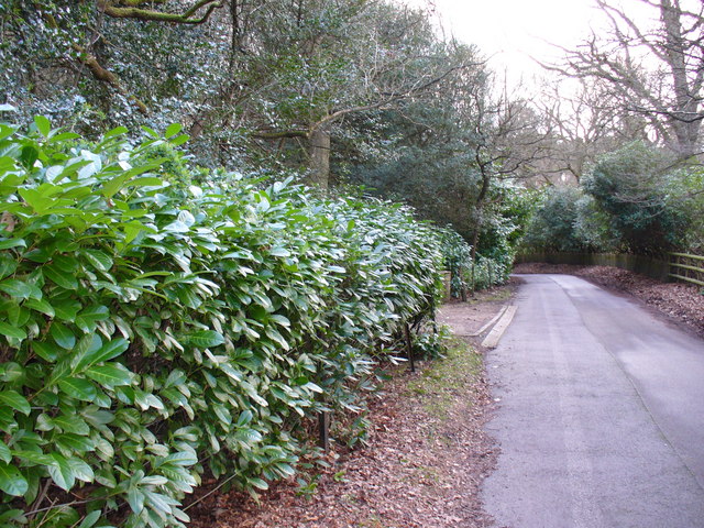
Show on map Photos Rhododendron-lined Lane, Wishanger
‹ ›
Weather for this location Next 14 days Nearby places Useful places within 5 km
All Historic
Own or manage this place?
Claim this listing to keep details accurate, add photos, and highlight what makes it special — free.
Claim this page→ How useful was the information on this page?
id: 00ef58c5-45fd-40d7-ae57-078e44c61dca
UK green spaces mapped from open public data — so anyone can find the woodland, trail, or nature reserve closest to them.
© 2026 Glade · Made with care for UK green spaces
Wildlife to spot
13,683 records · National Biodiversity Network
▾
Wildlife to spot 13,683 records · National Biodiversity Network Coot · Robin · Grey Heron · Mallard · Tufted Duck +41
Coot Fulica atra2025 Robin Erithacus rubecula2025 Grey Heron Ardea cinerea2025 Mallard Anas platyrhynchos2025 Tufted Duck Aythya fuligula Carrion Crow Corvus corone2025 Jackdaw Coloeus monedula2025 Long-tailed Tit Aegithalos caudatus2025 Moorhen Gallinula chloropus2025 Great Spotted Woodpecker Dendrocopos major2025 Blue Tit Cyanistes caeruleus2025 Great Tit Parus major2025 Woodpigeon Columba palumbus2025 Blackbird Turdus merula2025 Nuthatch Sitta europaea2025 Redwing Turdus iliacus2024 Song Thrush Turdus philomelos2025 Treecreeper Certhia familiaris2025 Goosander Mergus merganser2025 Jay Garrulus glandarius2024 Little Egret Egretta garzetta2024 Great Crested Grebe Podiceps cristatus2024 Canada Goose Branta canadensis2024 Egyptian Goose Alopochen aegyptiaca2025 Mute Swan Cygnus olor2025 Pheasant Phasianus colchicus2025 Coal Tit Periparus ater2025 Goldcrest Regulus regulus2025 Green Woodpecker Picus viridis2024 Chiffchaff Phylloscopus collybita2024 Chaffinch Fringilla coelebs2024 Cormorant Phalacrocorax carbo2024 Magpie Pica pica2024 Black-headed Gull Chroicocephalus ridibundus2024 Siskin Spinus spinus2024 Teal Anas crecca2025 Kestrel Falco tinnunculus2024 Stonechat Saxicola rubicola2024 Cetti's Warbler Cettia cetti2024 Wren Troglodytes troglodytes2024 Firecrest Regulus ignicapilla2024 Lesser Redpoll Acanthis flammea cabaret2024 Water Rail Rallus aquaticus2024 Goldfinch Carduelis carduelis2024 Marsh Tit Poecile palustris2024 Mandarin Duck Aix galericulata2023 Bank Vole
Bank Vole Myodes glareolus Common Lizard
Common Lizard Zootoca vivipara 🐸 Amphibians 1 species
spring
2025 ▾
Great Crested Newt
Great Crested Newt Triturus cristatus Red-legged Shieldbug · Marmalade Hoverfly · Stag Beetle · Dark-edged Bee-fly · Polietes +28
Red-legged Shieldbug Pentatoma rufipes Marmalade Hoverfly Episyrphus balteatus Stag Beetle Lucanus cervus Dark-edged Bee-fly Bombylius major Polietes Polietes Batman Hoverfly Myathropa florea Chrysolina banksii Chrysolina banksii Species observations from the last 10 years via NBN Atlas
Cabbage Bug Eurydema (Eurydema) oleracea
Cabbage Bug Eurydema (Eurydema) oleracea
Oak Bush-cricket Meconema thalassinum
Oak Bush-cricket Meconema thalassinum
Eupeodes corollae Eupeodes corollae
Eupeodes corollae Eupeodes corollae
Common Red Soldier Beetle Rhagonycha fulva
Common Red Soldier Beetle Rhagonycha fulva
Face Fly Musca autumnalis
Face Fly Musca autumnalis
Sphaerophoria Sphaerophoria
Sphaerophoria Sphaerophoria
Garden Chafer Phyllopertha horticola
Garden Chafer Phyllopertha horticola
Bronze Shieldbug Troilus luridus
Bronze Shieldbug Troilus luridus
Xylota segnis Xylota segnis
Xylota segnis Xylota segnis
Hawthorn Shieldbug Acanthosoma haemorrhoidale
Hawthorn Shieldbug Acanthosoma haemorrhoidale
Birch Catkin Bug Kleidocerys resedae
Birch Catkin Bug Kleidocerys resedae
Minotaur Beetle Typhaeus typhoeus2024
Minotaur Beetle Typhaeus typhoeus2024
Helophilus pendulus Helophilus pendulus2024
Helophilus pendulus Helophilus pendulus2024
Toxonevra muliebris Toxonevra muliebris2024
Toxonevra muliebris Toxonevra muliebris2024
Roesel's Bush-cricket Roeseliana roeselii2024
Roesel's Bush-cricket Roeseliana roeselii2024
Swollen-thighed Beetle Oedemera nobilis2024
Swollen-thighed Beetle Oedemera nobilis2024
Alder Wood-Wasp Xiphydria camelus2024
Alder Wood-Wasp Xiphydria camelus2024
Band-eyed Brown Horsefly Tabanus bromius2024
Band-eyed Brown Horsefly Tabanus bromius2024
Hairy Shieldbug Dolycoris baccarum2024
Hairy Shieldbug Dolycoris baccarum2024
Agrypnus murinus Agrypnus murinus2024
Agrypnus murinus Agrypnus murinus2024
Malachite Beetle Malachius bipustulatus2024
Malachite Beetle Malachius bipustulatus2024
Empis tessellata Empis tessellata2024
Empis tessellata Empis tessellata2024
Four-spotted Chaser Libellula quadrimaculata2024
Four-spotted Chaser Libellula quadrimaculata2024
Graptopeltus lynceus Graptopeltus lynceus2024
Graptopeltus lynceus Graptopeltus lynceus2024
7-spot Ladybird Coccinella septempunctata2024
7-spot Ladybird Coccinella septempunctata2024
Jet Ant Lasius fuliginosus2024
Jet Ant Lasius fuliginosus2024 Events & activities nearby Switch provider to compare local events, tours and bookable activities.
Bookable tours GetYourGuide Promote here