Plan your visit
🧺Picnic🦅Birds🦉Wildlife
Public accessFree entryDogs welcome204 ha
Getting here
50.89607, -2.64124
Open directionsv
Visiting this summer
Seasonal nature notes and what to look for now
- 🐦87+ species recorded in this area — summer evenings are best for activity; watch for Great Crested Grebe and Mallard
- 🧺Good picnic destination in summer — open space and facilities for a relaxed day out
- 🐕Dogs welcome — bring water in summer; the site has enough space to find shade on hot days
🌤️ Visiting this summer
- 🐦87+ species recorded in this area — summer evenings are best for activity; watch for Great Crested Grebe and Mallard
- 🧺Good picnic destination in summer — open space and facilities for a relaxed day out
- 🐕Dogs welcome — bring water in summer; the site has enough space to find shade on hot days
- £Free to visit — no entry charge
- 🐕Dogs welcome
🅿️Parking· Free🧺Picnic spot🚻Toilets
🧺Picnic day out
Very strong match
picnic area, toilets, car park; Reservoir — waterside day out
Free
🦅Bird watching
Very strong match
Birds — Great Crested Grebe, Mallard, Herring Gull +84 more · last seen 2025; Reservoir — wildfowl and wading birds
Free
Birds — Great Crested Grebe, Mallard, Herring Gull +84 more · last seen 2025; Deciduous woodland priority habitat
Free
🦋Insect spotting
Strong match
Insects — Beautiful Demoiselle, Emerald Damselfly, Black-tailed Skimmer +17 more · last seen 2025
Free
🛝Family friendly
Strong match
toilets, picnic area
Free
〰Waterside walks
Strong match
parking, toilets; Reservoir — waterside public access
Varies
Trails nearby
Within roughly 5 km2 signed routes nearby · 3 public paths nearby
Signed route nearbyPublic paths
Monarch's WayWalking route990 km▾
approximate route of Charles II's escape
Named routeRef MWLength 990 kmRegional walking route
Macmillan WayWalking route290 km▾
Named routeRef MWALength 290 kmListed length 461Regional walking route
24 signed routes nearby
Signed route nearby
Route 26Cycling route▾
Named routeRef 26National Cycle Network
South Somerset CyclewayCycling route▾
Named routeRegional cycle route
Main RouteCycling route20 m▾
Named routeRef 26Length 20 mNational Cycle NetworkOn-roadSurface asphalt
Main RouteCycling route1.7 km▾
Named routeRef 26Length 1.7 kmNational Cycle NetworkOn-roadSurface asphalt
Main RouteCycling route246 m▾
Named routeRef 26Length 246 mNational Cycle NetworkOn-roadSurface asphalt
Main RouteCycling route686 m▾
Named routeRef 26Length 686 mNational Cycle NetworkOn-roadSurface asphalt
3 public paths nearby
Public paths
Isles Lanebridleway · 1.1 km▾
Public pathbridlewayLength 1.1 kmPath type: track
Photos
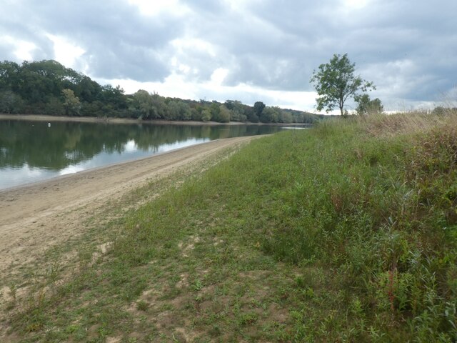
The western bank of Sutton Bingham Reservoir
Weather for this location
Next 14 daysNearby places
Useful places within 5 km
Wildlife to spot
7,149 records · National Biodiversity Network
Wildlife to spot
7,149 records · National Biodiversity Network🐦Birds33 species
autumnwinter
2025▾
Mallard · Herring Gull · Carrion Crow · Wren · Cormorant +28
- MallardAnas platyrhynchos
- Herring GullLarus argentatus
- Carrion CrowCorvus corone
- WrenTroglodytes troglodytes
- CormorantPhalacrocorax carbo
- WoodpigeonColumba palumbus
- Grey HeronArdea cinerea
- Black-headed GullChroicocephalus ridibundus
- JackdawColoeus monedula
- MagpiePica pica
- RobinErithacus rubecula
- RookCorvus frugilegus
- Great Crested GrebePodiceps cristatus
- MoorhenGallinula chloropus
- BlackbirdTurdus merula
- Common GullLarus canus
- PheasantPhasianus colchicus
- Blue TitCyanistes caeruleus
- StarlingSturnus vulgaris
- Pied WagtailMotacilla alba yarrellii
- Lesser Black-backed GullLarus fuscus
- Canada GooseBranta canadensis
- Little EgretEgretta garzetta
- Grey WagtailMotacilla cinerea
- Stock DoveColumba oenas
- Long-tailed TitAegithalos caudatus
- Little GrebeTachybaptus ruficollis
- Great TitParus major
- Great Spotted WoodpeckerDendrocopos major
- GoldfinchCarduelis carduelis
- TealAnas crecca
- JayGarrulus glandarius
- Mistle ThrushTurdus viscivorus
🦌Mammals1 species
autumnwinter
2025▾
Rabbit
- RabbitOryctolagus cuniculus
Hazel · Pendulous Sedge · Hedge Woundwort · Creeping Thistle · Greater Plantain +88
- HazelCorylus avellana
- Pendulous SedgeCarex pendula
- Hedge WoundwortStachys sylvatica
- Creeping ThistleCirsium arvense
- Greater PlantainPlantago major
- Prickly Sow-thistleSonchus asper
- Red GoosefootOxybasis rubra
Species observations from the last 10 years via NBN Atlas
Events & activities nearby
Switch provider to compare local events, tours and bookable activities.