Plan your visit
🦉 Wildlife🦅 Birds🌿 Foraging
Free entry Dogs welcome 39 ha
Places › England › South East › West Oxfordshire Getting here
51.80965, -1.40734
Open directionsv Visiting this summer
Seasonal nature notes and what to look for now
▾ ☀️ June — canopy now fully closed, creating cool dappled shade even on warm days 🌿 Foraging is at its best in summer here 🐕 Dogs welcome — bring water in summer; the site has enough space to find shade on hot days 🌤️ Visiting this summer
☀️ June — canopy now fully closed, creating cool dappled shade even on warm days 🌿 Foraging is at its best in summer here 🐕 Dogs welcome — bring water in summer; the site has enough space to find shade on hot days £ Free to visit — no entry charge🐕 Dogs welcome🦉 Wildlife
Very strong match
Multi-group wildlife — Amphibians, Birds, Mammals, Reptiles; Multi-group wildlife — Amphibians, Birds, Mammals, Reptiles
Free
🦅 Bird watching
Very strong match
Birds — Blue Tit, Woodpigeon, Robin +52 more · last seen 2025; Birds — Blue Tit, Woodpigeon, Robin +52 more · last seen 2025
Free
Plants — Bramble, Hawthorn, Elder +16 more foraging species; Deciduous woodland — fungi, berries and wild garlic
Varies
🦋 Insect spotting
Strong match
Insects — Small White, Large White, Meadow Brown +111 more · last seen 2026; Insects — Small White, Large White, Meadow Brown +111 more · last seen 2026
Free
🍂 Seasonal nature
Strong match
Plants — Bluebell, Bramble, Purple Moor-grass +167 more · last seen 2024; Plants — Bluebell, Bramble, Purple Moor-grass +167 more · last seen 2024
Free
🍄 Mushroom foraging
Good match
Fungi — Zoned Rosette, Oak Polypore, Jelly Ear · last seen 2017; Fungi — Zoned Rosette, Oak Polypore, Jelly Ear · last seen 2017
Varies
Trails nearby Within roughly 5 km 9 signed routes nearby · 4 public paths nearby
Signed route nearby Public paths
Oxford Green Belt Way Walking route 87 km ▾
Named route Length 87 km Regional walking route
Show on map Oxfordshire Way Walking route 110 km ▾
a traverse of Oxfordshire from the Cotswolds to the Chilterns
Named route Ref OW Length 110 km Regional walking route
Show on map Shakespeare's Way Walking route 235 km ▾
Named route Length 235 km Regional walking route
Show on map Wychwood Way Walking route 59.5 km ▾
Named route Length 59.5 km Regional walking route
Show on map The Roman Way Walking route 274.5 km ▾
Named route Length 274.5 km Regional walking route
Show on map 37 signed routes nearby
Signed route nearby
National Cycle Network Route 5 Cycling route ▾
Named route Ref 5 National Cycle Network
Show on map Cotswold Line Cycle Route (under development) Cycling route ▾
Named route Ref 442 National Cycle Network
Show on map A40 Cycle Path Cycling route ▾
Named route Local cycle route
Show on map Route 57 Cycling route ▾
Named route Ref 57 National Cycle Network
Show on map Blenheim Community Path Cycling route ▾
Named route Local cycle route
Show on map Cotswold Line Cycle Route Cycling route ▾
Named route Ref 442 National Cycle Network
Show on map 4 public paths nearby
Public paths
No named routes yet. Public paths are shown on the map.
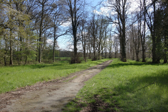
Photos Old Drive to Freeland House
‹ ›
Weather for this location Next 14 days Nearby places Useful places within 5 km
All Historic
How useful was the information on this page?
id: 47e312d9-e2da-4554-aa76-da09a2c5b496
UK green spaces mapped from open public data — so anyone can find the woodland, trail, or nature reserve closest to them.
© 2026 Glade · Made with care for UK green spaces
Wildlife to spot
7,244 records · National Biodiversity Network
▾
Wildlife to spot 7,244 records · National Biodiversity Network Woodpigeon · Blue Tit · Robin · Jay · Carrion Crow +32
Woodpigeon Columba palumbus Blue Tit Cyanistes caeruleus Robin Erithacus rubecula Jay Garrulus glandarius2024 Carrion Crow Corvus corone Wren Troglodytes troglodytes Blackbird Turdus merula Blackcap Sylvia atricapilla Marsh Tit Poecile palustris Great Tit Parus major Chiffchaff Phylloscopus collybita Jackdaw Coloeus monedula Long-tailed Tit Aegithalos caudatus2022 Goldcrest Regulus regulus Treecreeper Certhia familiaris Chaffinch Fringilla coelebs Dunnock Prunella modularis Green Woodpecker Picus viridis Rook Corvus frugilegus Song Thrush Turdus philomelos Pheasant Phasianus colchicus Great Spotted Woodpecker Dendrocopos major House Sparrow Passer domesticus2023 Starling Sturnus vulgaris2023 Mistle Thrush Turdus viscivorus Nuthatch Sitta europaea Cuckoo Cuculus canorus Yellowhammer Emberiza citrinella Stock Dove Columba oenas Willow Warbler Phylloscopus trochilus Greenfinch Chloris chloris2024 Bullfinch Pyrrhula pyrrhula2023 Grey Wagtail Motacilla cinerea2022 Erithacus rubecula melophilus Erithacus rubecula melophilus2022 Magpie Pica pica2022 Goldfinch Carduelis carduelis2022 Skylark Alauda arvensis2022 Hedgehog · Common Pipistrelle · Soprano Pipistrelle · Natterer's Bat · Badger
Hedgehog Erinaceus europaeus2023 Common Pipistrelle Pipistrellus pipistrellus Soprano Pipistrelle Pipistrellus pygmaeus Natterer's Bat Myotis nattereri Badger Meles meles2022 🦎 Reptiles 3 species
summer autumn
2025 ▾
Common Lizard · Slow-worm · Grass Snake
Common Lizard Zootoca vivipara2024 Slow-worm Anguis fragilis2024 Grass Snake Natrix helvetica 🐸 Amphibians 2 species
spring
2025 ▾
Great Crested Newt · Common Frog
Great Crested Newt Triturus cristatus Common Frog Rana temporaria2024 🐝 Insects 28 species
spring summer
2026 ▾
Red-headed Cardinal Beetle · Dark-edged Bee-fly · Glow-worm · Field Grasshopper · Dock Bug +23
Red-headed Cardinal Beetle Pyrochroa serraticornis2025 Dark-edged Bee-fly Bombylius major Glow-worm Lampyris noctiluca2025 Field Grasshopper Chorthippus brunneus2025 Dock Bug Coreus marginatus2023 🌿 Plants 3 species
summer autumn
2024 ▾
Purple Moor-grass · Heart-leaved Spear-moss · Silky Wall Feather-moss
Purple Moor-grass Molinia caerulea Heart-leaved Spear-moss Calliergon cordifolium Silky Wall Feather-moss Homalothecium sericeum2023 Species observations from the last 10 years via NBN Atlas
Corizus hyoscyami
Corizus hyoscyami
Corizus hyoscyami2023
Corizus hyoscyami2023
Meadow Grasshopper Pseudochorthippus parallelus2023
Meadow Grasshopper Pseudochorthippus parallelus2023
Dotted Bee-fly Bombylius discolor
Dotted Bee-fly Bombylius discolor
Speckled Bush-cricket Leptophyes punctatissima2025
Speckled Bush-cricket Leptophyes punctatissima2025
Minotaur Beetle Typhaeus typhoeus2025
Minotaur Beetle Typhaeus typhoeus2025
Swollen-thighed Beetle Oedemera nobilis2025
Swollen-thighed Beetle Oedemera nobilis2025
Common Cockchafer Melolontha melolontha2025
Common Cockchafer Melolontha melolontha2025
Rugged Oil-beetle Meloe rugosus2023
Rugged Oil-beetle Meloe rugosus2023
Ivy Bee Colletes hederae2023
Ivy Bee Colletes hederae2023
Green Shieldbug Palomena prasina2023
Green Shieldbug Palomena prasina2023
Roesel's Bush-cricket Roeseliana roeselii2023
Roesel's Bush-cricket Roeseliana roeselii2023
Common Darter Sympetrum striolatum2023
Common Darter Sympetrum striolatum2023
Long-winged Cone-head Conocephalus fuscus2023
Long-winged Cone-head Conocephalus fuscus2023
Tachina fera Tachina fera2023
Tachina fera Tachina fera2023
Common Red Soldier Beetle Rhagonycha fulva2023
Common Red Soldier Beetle Rhagonycha fulva2023
Eriothrix rufomaculata Eriothrix rufomaculata2023
Eriothrix rufomaculata Eriothrix rufomaculata2023
Stag Beetle Lucanus cervus2023
Stag Beetle Lucanus cervus2023
Marsham's Nomad Bee Nomada marshamella2023
Marsham's Nomad Bee Nomada marshamella2023
Epistrophe eligans Epistrophe eligans2023
Epistrophe eligans Epistrophe eligans2023
Pied Shieldbug Tritomegas bicolor2023
Pied Shieldbug Tritomegas bicolor2023
Cercopis vulnerata Cercopis vulnerata2023
Cercopis vulnerata Cercopis vulnerata2023
Xylota segnis Xylota segnis2023
Xylota segnis Xylota segnis2023
Turtle Bug Podops inuncta2023
Turtle Bug Podops inuncta2023 Events & activities nearby Switch provider to compare local events, tours and bookable activities.
Bookable tours