Plan your visit
🦉Wildlife🦅Birds🦋Insects
Free entryDogs welcome2 ha
Getting here
53.18374, -1.17609
Open directionsv
Visiting this summer
Seasonal nature notes and what to look for now
- ☀️June — canopy now fully closed, creating cool dappled shade even on warm days
- 🌿Foraging is at its best in summer here
- 🐕Dogs welcome — bring water in summer; the site has enough space to find shade on hot days
🌤️ Visiting this summer
- ☀️June — canopy now fully closed, creating cool dappled shade even on warm days
- 🌿Foraging is at its best in summer here
- 🐕Dogs welcome — bring water in summer; the site has enough space to find shade on hot days
- £Free to visit — no entry charge
- 🐕Dogs welcome
🦉Wildlife
Very strong match
Multi-group wildlife — Amphibians, Birds, Mammals; Multi-group wildlife — Amphibians, Birds, Mammals
Free
🦅Bird watching
Very strong match
Birds — Blackbird, Robin, Woodpigeon +58 more · last seen 2025; Birds — Blackbird, Robin, Woodpigeon +58 more · last seen 2025
Free
🦋Insect spotting
Strong match
Insects — Small White, Meadow Brown, Ringlet +123 more · last seen 2025; Insects — Small White, Meadow Brown, Ringlet +123 more · last seen 2025
Free
Deciduous woodland — fungi, berries and wild garlic
Varies
🍂Seasonal nature
Good match
Plants — Japanese Knotweed, Crescent-cup Liverwort · last seen 2022; Plants — Japanese Knotweed, Crescent-cup Liverwort · last seen 2022
Free
🌲Forest walks
Moderate match
Public woodland
Free
Trails nearby
Within roughly 5 km5 signed routes nearby
Signed route nearby
Archaeological Way (old route)Walking route▾
Dukeries TrailWalking route▾
Meden TrailWalking route▾
Robin Hood WayWalking route▾
Named routeRegional walking route
Maun Valley TrailWalking route▾
36 signed routes nearby
Signed route nearby
Route 645Cycling route▾
Named routeRef 645National Cycle Network
Route 6Cycling route▾
Named routeRef 6National Cycle Network
NCN National Route 648Cycling route▾
Named routeRef 648National Cycle Network
Main RouteCycling route984 m▾
Named routeRef 648Length 984 mNational Cycle NetworkOn-roadSurface asphalt
Main RouteCycling route661 m▾
Named routeRef 648Length 661 mNational Cycle NetworkTraffic-freeSurface unsealedfirm
Main RouteCycling route376 m▾
Named routeRef 6Length 376 mNational Cycle NetworkTraffic-freeSurface unsealedfirm
3 signed routes nearby
Signed route nearby
Outlaw TrailMountain bike route▾
Named routeRef Red Route
Viking TrailMountain bike route▾
Named routeRef Blue Route
Bike Park & Downhill RouteMountain bike route▾
1 public path nearby
Public paths
No named routes yet. Public paths are shown on the map.
Photos
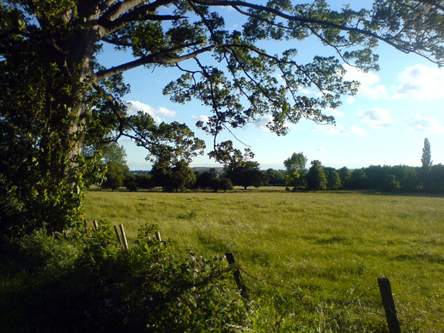
Field next to The Bottoms
Weather for this location
Next 14 daysNearby places
Useful places within 5 km
Own or manage this place?
Claim this listing to keep details accurate, add photos, and highlight what makes it special — free.
Claim this page→How useful was the information on this page?
id: ceac8770-f719-4a4b-b38b-6e9926aa42f2
Events & activities nearby
Switch provider to compare local events, tours and bookable activities.
Wildlife to spot
16,103 records · National Biodiversity Network
Wildlife to spot
16,103 records · National Biodiversity Network🐦Birds29 species
winterspring
2025▾
Blackbird · Robin · Woodpigeon · Great Tit · Raven +24
- BlackbirdTurdus merula
- RobinErithacus rubecula
- WoodpigeonColumba palumbus
- Great TitParus major
- RavenCorvus corax
- PeregrineFalco peregrinus
- Carrion CrowCorvus corone
- Song ThrushTurdus philomelos
- Blue TitCyanistes caeruleus
- SkylarkAlauda arvensis
- JackdawColoeus monedula
- MagpiePica pica
- GoldfinchCarduelis carduelis
- JayGarrulus glandarius
- WoodlarkLullula arborea
- WrenTroglodytes troglodytes
- GoldcrestRegulus regulus
- BlackcapSylvia atricapilla
- Coal TitPeriparus ater
- ChiffchaffPhylloscopus collybita
- WhitethroatCurruca communis
- Little Ringed PloverCharadrius dubius
- Willow WarblerPhylloscopus trochilus
- Dartford WarblerCurruca undata
- DunnockPrunella modularis
- Grey HeronArdea cinerea
- KestrelFalco tinnunculus
- Collared DoveStreptopelia decaocto
- Stock DoveColumba oenas
Muntjac
🐸Amphibians1 species
summerautumn
2025▾
Common Frog
- Common FrogRana temporaria
Helophilus pendulus · Hornet Hoverfly
- Helophilus pendulusHelophilus pendulus
- Hornet HoverflyVolucella zonaria
Bluebell · Lesser Celandine · Ramsons · Dog's Mercury · Wood Anemone +109
- BluebellHyacinthoides non-scripta
- Lesser CelandineFicaria verna
- RamsonsAllium ursinum
- Dog's MercuryMercurialis perennis
- Wood AnemoneAnemone nemorosa
- BroomCytisus scoparius
- BrackenPteridium aquilinum
Species observations from the last 10 years via NBN Atlas