Getting here
52.63468, 1.21673
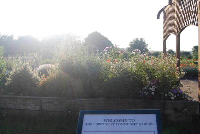
Visiting this summer
Seasonal nature notes and what to look for now
Visiting this summer
Seasonal nature notes and what to look for now
- 🌞Midsummer — early morning visits most comfortable; look for deer fawns in quieter clearings
- 🌿Foraging is at its best in summer here
- ☕Café on site — makes this an easy full-day family visit without needing to pack food
🌤️ Visiting this summer
- 🌞Midsummer — early morning visits most comfortable; look for deer fawns in quieter clearings
- 🌿Foraging is at its best in summer here
- ☕Café on site — makes this an easy full-day family visit without needing to pack food
Good to know
- £Free to visit — no entry charge
- 🐕Dogs welcome
Best for
Wildlife
Very strong match
Multi-group wildlife — Amphibians, Birds, Mammals; Multi-group wildlife — Amphibians, Birds, Mammals
Bird watching
Very strong match
Birds — Woodpigeon, Magpie, Teal +75 more · last seen 2026; Birds — Woodpigeon, Magpie, Teal +75 more · last seen 2026
Foraging
Strong match
Plants — Pedunculate Oak, Ground-elder, Hawthorn +10 more foraging species; Lowland meadows — wild flowers, berries and seasonal plants
Insect spotting
Strong match
Lowland meadows — marbled white, meadow brown and pollinating insects; Insects — 7-spot Ladybird, Meliscaeva auricollis, Adonis' Ladybird +42 more · last seen 2026
Seasonal nature
Strong match
Plants — Bee Orchid, Pedunculate Oak, Mistletoe +105 more · last seen 2026; Plants — Bee Orchid, Pedunculate Oak, Mistletoe +105 more · last seen 2026
Dog walks
Strong match
Dogs allowed with public access
Trails nearby
Within roughly 5 km🚶Walking
24 signed routes nearby · 3 public paths nearby
Signed route nearbyPublic paths
Walking
Marriott's WayWalking route42 km
Norwich to Aylsham via Reepham on disused railway
Kett's Country WalkWalking route18 km
Wymondham to Norwich
Tas Valley WayWalking route42 km
Norwich to Attleborough
Olympic Torch Relay (Norwich)Walking route
Countryside TrailWalking route
Norfolk County Council Circular Walks; Length: 180m
🚴Cycling
45 signed routes nearby
Signed route nearby
Cycling
Purple PedalwayCycling route
Blue PedalwayCycling route
Orange PedalwayCycling route
Edith Cavell PilgrimageCycling route22.5 km
NCN National Route 1Cycling route
Pink PedalwayCycling route
🐴Horse riding
7 public paths nearby
Public paths
Horse riding
Bowthorpe Hall Roadbridleway · 10 m
Cricket Waybridleway · 308 m
Bowthorpe Hall Roadbridleway · 6 m
Bowthorpe Hall Roadbridleway · 121 m
Cricket Waybridleway · 341 m
Wildlife to spot
Photos
Weather for this location
Loading local forecast…
Nearby places
Useful places within 5 km
Own or manage this place?
Claim this listing to keep details accurate, add photos, and highlight what makes it special — free.
Claim this pageHow was your visit?
How useful was the information on this page?
id: be3a69a6-e9b4-4fa1-ae02-41d5164ca827