Plan your visit
🧺Picnic🦅Birds🦉Wildlife
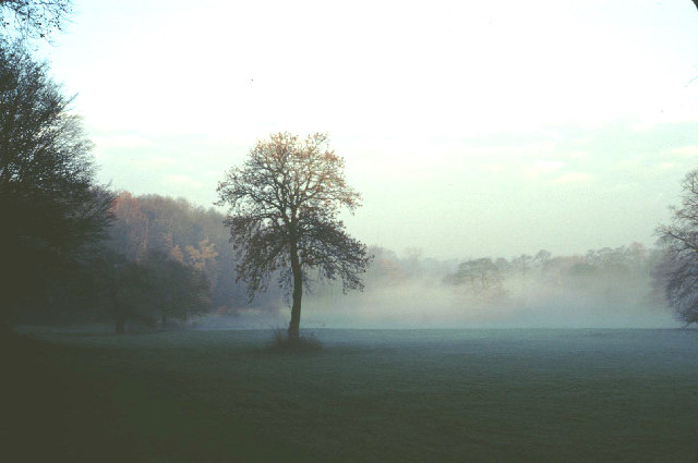
Public accessFree entryDogs welcome76 ha
Getting here
53.33268, -2.23816
Open directionsv
Visiting this summer
Seasonal nature notes and what to look for now
- 🐦69+ species recorded in this area — summer evenings are best for activity; watch for Woodpigeon and Magpie
- 🧺Good picnic destination in summer — open space and facilities for a relaxed day out
- 🐕Dogs welcome — bring water in summer; the site has enough space to find shade on hot days
🌤️ Visiting this summer
- 🐦69+ species recorded in this area — summer evenings are best for activity; watch for Woodpigeon and Magpie
- 🧺Good picnic destination in summer — open space and facilities for a relaxed day out
- 🐕Dogs welcome — bring water in summer; the site has enough space to find shade on hot days
- £Free to visit — no entry charge
- 🐕Dogs welcome
🅿️Parking· Paid🧺Picnic spot
🧺Picnic day out
Very strong match
picnic area, car park; Urban park — open green space
Free
🦅Bird watching
Very strong match
Birds — Woodpigeon, Magpie, Mallard +66 more · last seen 2026; Deciduous woodland — woodpeckers, warblers and woodland birds
Free
Birds — Woodpigeon, Magpie, Mallard +66 more · last seen 2026; Deciduous woodland priority habitat
Free
🦋Insect spotting
Strong match
Insects — 7-spot Ladybird, Marmalade Hoverfly, Green Shieldbug +67 more · last seen 2025
Free
🍂Seasonal nature
Strong match
Plants — Common Nettle, Cleavers, Hogweed +36 more · last seen 2025
Free
Dogs allowed with public access
Free
Trails nearby
Within roughly 5 km7 signed routes nearby · 39 public paths nearby
Signed route nearbyPublic paths
GM Ringway Stage 3Walking route11.7 km▾
Named routeLength 11.7 kmRegional walking route
Fred Perry WayWalking route▾
Ladybrook Valley Interest TrailWalking route▾
North Cheshire WayWalking route▾
Named routeListed length 114kmRegional walking route
Wizard WalkWalking route▾
Named routeLocal walking route
Gorsey Roadpublic footpath · 46 m▾
Public pathpublic footpathLength 46 mSurface asphaltPath type: residential
Mount Pleasantpublic footpath · 27 m▾
Public pathpublic footpathLength 27 mPath type: service
Dungeon Walkpublic footpath · 127 m▾
Public pathpublic footpathLength 127 mPath type: footway
46 signed routes nearby
Signed route nearby
Cheshire CyclewayCycling route▾
Named routeRef 70Regional cycle route
Airport Orbital CyclewayCycling route▾
Named routeLocal cycle route
Greater Manchester regional route 85Cycling route▾
Named routeRef 85Regional cycle route
Airport City CyclewayCycling route▾
Named routeLocal cycle route
Heritage LoopCycling route▾
Named routeRef Heritage LoopLocal cycle route
National Cycle Network 56Cycling route▾
Named routeRef 56National Cycle Network
15 public paths nearby
Public paths
Broad Walkrestricted byway · 45 m▾
Public pathrestricted bywayLength 45 mPath type: residential
Carrwood Roadrestricted byway · 59 m▾
Public pathrestricted bywayLength 59 mSurface unpavedPath type: residential
Kings Roadrestricted byway · 316 m▾
Public pathrestricted bywayLength 316 mPath type: residential
Weather for this location
Next 14 daysNearby places
Useful places within 5 km
Events & activities nearby
Switch provider to compare local events, tours and bookable activities.
Wildlife to spot
35,066 records · National Biodiversity Network
Wildlife to spot
35,066 records · National Biodiversity NetworkMagpie · Robin · Moorhen · Mallard · Woodpigeon +40
- MagpiePica pica
- RobinErithacus rubecula
- MoorhenGallinula chloropus
- MallardAnas platyrhynchos
- WoodpigeonColumba palumbus2025
- Carrion CrowCorvus corone2025
- Blue TitCyanistes caeruleus2025
- BlackbirdTurdus merula2025
- Black-headed GullChroicocephalus ridibundus
- Great TitParus major2025
- Grey WagtailMotacilla cinerea2025
- GoldcrestRegulus regulus2025
- CootFulica atra
- GoldfinchCarduelis carduelis2025
- NuthatchSitta europaea2025
- JackdawColoeus monedula2025
- JayGarrulus glandarius2025
- Coal TitPeriparus ater2025
- Great Crested GrebePodiceps cristatus
- StarlingSturnus vulgaris2025
- Great Spotted WoodpeckerDendrocopos major2025
- House SparrowPasser domesticus2025
- RedwingTurdus iliacus2025
- WrenTroglodytes troglodytes2025
- DunnockPrunella modularis2025
- Long-tailed TitAegithalos caudatus2025
- Grey HeronArdea cinerea
- Mistle ThrushTurdus viscivorus2025
- TreecreeperCerthia familiaris2025
- Pink-footed GooseAnser brachyrhynchus2025
- Rock DoveColumba livia2025
- Collared DoveStreptopelia decaocto2025
- Song ThrushTurdus philomelos2025
- Stock DoveColumba oenas2025
- Canada GooseBranta canadensis2025
- RookCorvus frugilegus2025
- KingfisherAlcedo atthis2025
- PheasantPhasianus colchicus2025
- ChaffinchFringilla coelebs2025
- BullfinchPyrrhula pyrrhula2025
- WoodcockScolopax rusticola2025
- RavenCorvus corax2025
- Pied WagtailMotacilla alba2025
- BlackcapSylvia atricapilla2025
- GoosanderMergus merganser2025
Grey Squirrel · Mole
- Grey SquirrelSciurus carolinensis
- MoleTalpa europaea
🐸Amphibians1 species
spring
2026▾
Common Frog
- Common FrogRana temporaria
7-spot Ladybird · Eristalis tenax · Anthocomus rufus · Scathophaga stercoraria · Marmalade Hoverfly +6
- 7-spot LadybirdCoccinella septempunctata
- Eristalis tenaxEristalis tenax
- Anthocomus rufusAnthocomus rufus
- Scathophaga stercorariaScathophaga stercoraria
- Marmalade HoverflyEpisyrphus balteatus
- Harlequin LadybirdHarmonia axyridis
- Willow Emerald Damselfly
Species observations from the last 10 years via NBN Atlas
Chalcolestes viridis
Chalcolestes viridis
Green ShieldbugPalomena prasinaGreen ShieldbugPalomena prasinaOrange LadybirdHalyzia sedecimguttataOrange LadybirdHalyzia sedecimguttataDock BugCoreus marginatusDock BugCoreus marginatusLarge Willow AphidTuberolachnus (Tuberolachnus) salignusLarge Willow AphidTuberolachnus (Tuberolachnus) salignus