Plan your visit
🦉 Wildlife🦅 Birds✦ Heritage
Dogs welcome
Places › England › North East › County Durham Getting here
54.69266, -1.84079
Open directionsv Visiting this summer
Seasonal nature notes and what to look for now
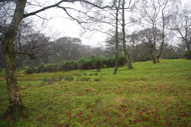
▾ 🌞 Midsummer — early morning visits most comfortable; look for deer fawns in quieter clearings ✦ Historic character is a year-round quality here — summer brings its own atmosphere to the setting 🐕 Dogs welcome — bring water in summer; the site has enough space to find shade on hot days 🌤️ Visiting this summer
🌞 Midsummer — early morning visits most comfortable; look for deer fawns in quieter clearings ✦ Historic character is a year-round quality here — summer brings its own atmosphere to the setting 🐕 Dogs welcome — bring water in summer; the site has enough space to find shade on hot days 🦉 Wildlife
Very strong match
Multi-group wildlife — Amphibians, Birds, Mammals, Reptiles; Multi-group wildlife — Amphibians, Birds, Mammals, Reptiles
Free
🦅 Bird watching
Very strong match
Birds — Chiffchaff, Robin, Blackbird +75 more · last seen 2026; Birds — Chiffchaff, Robin, Blackbird +75 more · last seen 2026
Free
🍂 Seasonal nature
Strong match
Plants — Viper's-bugloss, Musk-mallow, Common Centaury +14 more · last seen 2025; Plants — Viper's-bugloss, Musk-mallow, Common Centaury +14 more · last seen 2025
Free
🦋 Insect spotting
Good match
Insects — Common Carder Bee, Tachina ursina, Harlequin Ladybird +15 more · last seen 2025; Insects — Common Carder Bee, Tachina ursina, Harlequin Ladybird +15 more · last seen 2025
Free
Deciduous woodland — fungi, berries and wild garlic
Varies
Trails nearby Within roughly 5 km 9 signed routes nearby · 3 public paths nearby
Signed route nearby Public paths
Weardale Way Walking route 124 km ▾
Named route Length 124 km Regional walking route
Show on map Witon-le-Wear Circular Walk 2 Walking route ▾
Named route Local walking route
Show on map Witton-le-Wear Circular Walk 1 Walking route ▾
Named route Local walking route
Show on map Spurlswood Walk Walking route 7.2 km ▾
Named route Ref Spurlswood Length 7.2 km Round trip Local walking route
Show on map Tree Walk Walking route ▾
Named route Ref Tree Local walking route
Show on map 8 signed routes nearby
Signed route nearby
Walney to Wear Cycle Route Cycling route ▾
Named route Ref 70 National Cycle Network
Show on map National Byway (County Durham and Northumberland) Cycling route ▾
The National Byway route through County Durham and Northumberland
Named route Ref NB Regional cycle route
Show on map Main Route Cycling route 3.3 km ▾
Named route Ref 70 Length 3.3 km National Cycle Network Traffic-free Surface asphalt
Show on map Main Route Cycling route 2.9 km ▾
Named route Ref 70 Length 2.9 km National Cycle Network Traffic-free Surface unsealedfirm
Show on map Main Route Cycling route 3.1 km ▾
Named route Ref 70 Length 3.1 km National Cycle Network On-road Surface asphalt
Show on map Main Route Cycling route 60 m ▾
Named route Ref 70 Length 60 m National Cycle Network Traffic-free Surface asphalt
Show on map 5 signed routes nearby
Signed route nearby
Red route (difficult) Mountain bike route 23.5 km ▾
Named route Ref Red Length 23.5 km Round trip
Show on map Black (Severe) Mountain bike route 13 km ▾
Named route Ref Black Length 13 km Round trip
Show on map The Loop Mountain bike route ▾
Blue route (moderate) Mountain bike route 14.5 km ▾
Named route Ref Blue Length 14.5 km Round trip
Show on map Hamsterley Common Circuit Mountain bike route 38 km ▾
Named route Ref CDW13 Length 38 km Round trip Local cycle route
Show on map
Weather for this location Next 14 days Nearby places Useful places within 5 km
All Historic
Own or manage this place?
Claim this listing to keep details accurate, add photos, and highlight what makes it special — free.
Claim this page→ How useful was the information on this page?
id: b637a0c7-b3c5-49cc-9588-d8f2320692a5
UK green spaces mapped from open public data — so anyone can find the woodland, trail, or nature reserve closest to them.
© 2026 Glade · Made with care for UK green spaces
Wildlife to spot
3,542 records · National Biodiversity Network
▾
Wildlife to spot 3,542 records · National Biodiversity Network 🐦 Birds 2 species
winter autumn
2026 ▾
Woodcock · Moorhen
Woodcock Scolopax rusticola Moorhen Gallinula chloropus2025 Common Lizard
Common Lizard Zootoca vivipara Harlequin Ladybird
Harlequin Ladybird Harmonia axyridis Raspberry · Bramble · Spear Thistle · Sessile Oak · Tormentil +113
Raspberry Rubus idaeus Bramble Rubus fruticosus Spear Thistle Cirsium vulgare Sessile Oak Quercus petraea Tormentil Potentilla erecta Buckler-Fern Dryopteris affinis subsp. affinis Wood-sedge Carex sylvatica Species observations from the last 10 years via NBN Atlas
Creeping Thistle Cirsium arvense
Creeping Thistle Cirsium arvense
Holly Ilex aquifolium
Holly Ilex aquifolium
Red Bartsia Odontites vernus
Red Bartsia Odontites vernus
Sycamore Acer pseudoplatanus
Sycamore Acer pseudoplatanus
Soft-rush Juncus effusus
Soft-rush Juncus effusus
Selfheal Prunella vulgaris
Selfheal Prunella vulgaris
Ash Fraxinus excelsior
Ash Fraxinus excelsior
Tufted Vetch Vicia cracca
Tufted Vetch Vicia cracca
Wood Avens Geum urbanum
Wood Avens Geum urbanum
Lady-fern Athyrium filix-femina
Lady-fern Athyrium filix-femina
Lemon-scented Fern Oreopteris limbosperma
Lemon-scented Fern Oreopteris limbosperma
Common Nettle Urtica dioica
Common Nettle Urtica dioica
Bracken Pteridium aquilinum
Bracken Pteridium aquilinum
Great Willowherb Epilobium hirsutum
Great Willowherb Epilobium hirsutum
Greater Plantain Plantago major
Greater Plantain Plantago major
Devil's-bit Scabious Succisa pratensis
Devil's-bit Scabious Succisa pratensis
Wild Strawberry Fragaria vesca
Wild Strawberry Fragaria vesca
Goat Willow Salix caprea
Goat Willow Salix caprea
White Clover Trifolium repens
White Clover Trifolium repens
Mouse-ear-hawkweed Pilosella officinarum
Mouse-ear-hawkweed Pilosella officinarum
Creeping Bent Agrostis stolonifera
Creeping Bent Agrostis stolonifera
Wood Burdock Arctium nemorosum
Wood Burdock Arctium nemorosum
Heath Wood-rush Luzula multiflora
Heath Wood-rush Luzula multiflora
Common Bird's-foot-trefoil Lotus corniculatus
Common Bird's-foot-trefoil Lotus corniculatus
Male-fern Dryopteris filix-mas
Male-fern Dryopteris filix-mas
Broad Buckler-fern Dryopteris dilatata
Broad Buckler-fern Dryopteris dilatata
Herb-Robert Geranium robertianum
Herb-Robert Geranium robertianum
Autumn Hawkbit Scorzoneroides autumnalis
Autumn Hawkbit Scorzoneroides autumnalis
Rosebay Willowherb Chamaenerion angustifolium
Rosebay Willowherb Chamaenerion angustifolium
Centaurea nigra Centaurea nigra
Centaurea nigra Centaurea nigra
Rosa canina Rosa canina
Rosa canina Rosa canina
Common Dog-violet Viola riviniana
Common Dog-violet Viola riviniana
Annual Meadow-grass Poa annua
Annual Meadow-grass Poa annua
Rusty Willow Salix cinerea subsp. oleifolia
Rusty Willow Salix cinerea subsp. oleifolia
Tufted Hair-grass Deschampsia cespitosa
Tufted Hair-grass Deschampsia cespitosa
Blackthorn Prunus spinosa
Blackthorn Prunus spinosa
Common Chickweed Stellaria media
Common Chickweed Stellaria media
Purple Moor-grass Molinia caerulea
Purple Moor-grass Molinia caerulea
Heath Bedstraw Galium saxatile
Heath Bedstraw Galium saxatile
Gorse Ulex europaeus
Gorse Ulex europaeus
Scots Pine Pinus sylvestris
Scots Pine Pinus sylvestris
Rhododendron Rhododendron ponticum
Rhododendron Rhododendron ponticum
Viper's-bugloss Echium vulgare
Viper's-bugloss Echium vulgare
Hard-fern Blechnum spicant
Hard-fern Blechnum spicant
Heather Calluna vulgaris
Heather Calluna vulgaris
Austrian Pine Pinus nigra
Austrian Pine Pinus nigra
Lesser Burdock Arctium minus
Lesser Burdock Arctium minus
Broom Cytisus scoparius
Broom Cytisus scoparius
Common Figwort Scrophularia nodosa
Common Figwort Scrophularia nodosa
Germander Speedwell Veronica chamaedrys
Germander Speedwell Veronica chamaedrys
Walnut Juglans regia
Walnut Juglans regia
Fairy Flax Linum catharticum
Fairy Flax Linum catharticum
Common Milkwort Polygala vulgaris
Common Milkwort Polygala vulgaris
Meadow Buttercup Ranunculus acris
Meadow Buttercup Ranunculus acris
Dryopteris carthusiana x dilatata = D. x deweveri Dryopteris carthusiana x dilatata = D. x deweveri
Dryopteris carthusiana x dilatata = D. x deweveri Dryopteris carthusiana x dilatata = D. x deweveri
Heath Rush Juncus squarrosus
Heath Rush Juncus squarrosus
Hazel Corylus avellana
Hazel Corylus avellana
Downy Birch Betula pubescens
Downy Birch Betula pubescens
New Zealand Willowherb Epilobium brunnescens
New Zealand Willowherb Epilobium brunnescens
Zigzag Clover Trifolium medium
Zigzag Clover Trifolium medium
Rowan Sorbus aucuparia
Rowan Sorbus aucuparia
Toad Rush Juncus bufonius
Toad Rush Juncus bufonius
Sitka Spruce Picea sitchensis
Sitka Spruce Picea sitchensis
Common Vetch Vicia sativa
Common Vetch Vicia sativa
Crowberry agg. Empetrum nigrum
Crowberry agg. Empetrum nigrum
Beech Fagus sylvatica
Beech Fagus sylvatica
Silver Birch Betula pendula
Silver Birch Betula pendula
Hawthorn Crataegus monogyna
Hawthorn Crataegus monogyna
Broad-leaved Willowherb Epilobium montanum
Broad-leaved Willowherb Epilobium montanum
Lesser Spearwort Ranunculus flammula
Lesser Spearwort Ranunculus flammula
Marsh Cudweed Gnaphalium uliginosum
Marsh Cudweed Gnaphalium uliginosum
American Willowherb Epilobium ciliatum
American Willowherb Epilobium ciliatum
Field Wood-rush Luzula campestris
Field Wood-rush Luzula campestris
Velvet Bent Agrostis canina
Velvet Bent Agrostis canina
Great Wood-rush Luzula sylvatica
Great Wood-rush Luzula sylvatica
Wood-sorrel Oxalis acetosella
Wood-sorrel Oxalis acetosella
Dandelion Taraxacum
Dandelion Taraxacum
Cow Parsley Anthriscus sylvestris
Cow Parsley Anthriscus sylvestris
Daisy Bellis perennis
Daisy Bellis perennis
Russian Comfrey Symphytum asperum x officinale = S. x uplandicum
Russian Comfrey Symphytum asperum x officinale = S. x uplandicum
Perennial Rye-grass Lolium perenne
Perennial Rye-grass Lolium perenne
Greater Stitchwort Stellaria holostea
Greater Stitchwort Stellaria holostea
Field Horsetail Equisetum arvense
Field Horsetail Equisetum arvense
Garden Lady's-mantle Alchemilla mollis
Garden Lady's-mantle Alchemilla mollis
Wild Cherry Prunus avium
Wild Cherry Prunus avium
Eared Willow Salix aurita
Eared Willow Salix aurita
Common Orache Atriplex patula
Common Orache Atriplex patula
Crested Dog's-tail Cynosurus cristatus
Crested Dog's-tail Cynosurus cristatus
Dryopteris borreri Dryopteris borreri
Dryopteris borreri Dryopteris borreri
Common Sorrel Rumex acetosa
Common Sorrel Rumex acetosa
Hairy Bitter-cress Cardamine hirsuta
Hairy Bitter-cress Cardamine hirsuta
Narrow Buckler-fern Dryopteris carthusiana
Narrow Buckler-fern Dryopteris carthusiana
Yorkshire-fog Holcus lanatus
Yorkshire-fog Holcus lanatus
Smooth Sow-thistle Sonchus oleraceus
Smooth Sow-thistle Sonchus oleraceus
Ribwort Plantain Plantago lanceolata
Ribwort Plantain Plantago lanceolata
Common Ragwort Jacobaea vulgaris
Common Ragwort Jacobaea vulgaris
Japanese Larch Larix kaempferi
Japanese Larch Larix kaempferi
Bilberry Vaccinium myrtillus
Bilberry Vaccinium myrtillus
Jointed Rush Juncus articulatus
Jointed Rush Juncus articulatus
Silverweed Potentilla anserina
Silverweed Potentilla anserina
Meadow Crane's-bill Geranium pratense
Meadow Crane's-bill Geranium pratense
Marsh Thistle Cirsium palustre
Marsh Thistle Cirsium palustre
Wood Horsetail Equisetum sylvaticum
Wood Horsetail Equisetum sylvaticum
Rough Meadow-grass Poa trivialis
Rough Meadow-grass Poa trivialis
Cherry Laurel Prunus laurocerasus
Cherry Laurel Prunus laurocerasus
Bugle Ajuga reptans
Bugle Ajuga reptans
Wood Sage Teucrium scorodonia
Wood Sage Teucrium scorodonia
Cock's-foot Dactylis glomerata
Cock's-foot Dactylis glomerata
Common Valerian Valeriana officinalis
Common Valerian Valeriana officinalis
False Oat-grass Arrhenatherum elatius
False Oat-grass Arrhenatherum elatius
Norway Spruce Picea abies
Norway Spruce Picea abies Events & activities nearby Switch provider to compare local events, tours and bookable activities.
Bookable tours GetYourGuide Promote here