🐦70+ species recorded in this area — summer evenings are best for activity; watch for Robin and Blue Tit
☀️Summer family visits work well here — arrive early and plan for a longer stay
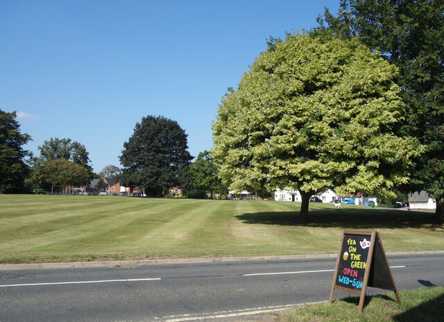
☕Tea on The Green — makes this an easy full-day family visit without needing to pack food
🌤️ Visiting this summer
🐦70+ species recorded in this area — summer evenings are best for activity; watch for Robin and Blue Tit
☀️Summer family visits work well here — arrive early and plan for a longer stay
☕Tea on The Green — makes this an easy full-day family visit without needing to pack food
Good to know
£Free to visit — no entry charge
🐕Dogs welcome
☕Café🛝Playground
Best for
10 activities
🦅
Bird watching
Very strong match
Birds — Robin, Blue Tit, Blackbird +67 more · last seen 2025
Free
🦉
Wildlife
Strong match
Mammals — Hedgehog, Grey Squirrel, Rabbit +13 more · last seen 2026
Free
🛝
Family friendly
Strong match
playground, café; Urban park — family destination
Free
🍄
Mushroom foraging
Strong match
Fungi — Diploicia canescens, Micarea denigrata, Athallia holocarpa s. lat. +18 more · last seen 2013
Varies
🎠
Playgrounds
Strong match
playground, café
Free
🦋
Insect spotting
Strong match
Insects — Small Tortoiseshell, Glow-worm, Meadow Brown +34 more · last seen 2025
Free
Trails nearby
Within roughly 5 km
🚶
Walking
▾
6 signed routes nearby · 25 public paths nearby
Signed route nearbyPublic paths
London to Walsingham - stage 04Walking route▾
Named routeRef LW04Local walking route
Windmill Hill Walk, Melford HallWalking route6 km▾
Easy walking along distinct dirt or grassy paths and fields, with a couple of stiles at the end. May be muddy after wet weather, so boots may be required. Special care is needed when crossing the busy A1092 and walking along the B1066.
Named routeLength 6 kmDuration 01:30Round tripLocal walking route
Wool Towns WalkWalking route50 km▾
Named routeLength 50 km
St Edmund WayWalking route▾
Named routeListed length 142kmRegional walking route
Stour Valley Path part 2Walking route▾
Named routeRegional walking route
Nether Roadpublic footpath · 128 m▾
Public pathpublic footpathLength 128 mPath type: residential
🚴
Cycling
▾
4 signed routes nearby
Signed route nearby
South Suffolk Cycle Route A1Cycling route▾
Named routeRef A1Regional cycle route
Wolf WayCycling route400 km▾
Named routeRef Wolf WayLength 400 kmRound tripLocal cycle route
Route 13Cycling route▾
Named routeRef 13National Cycle Network
Main RouteCycling route2.3 km▾
Named routeRef 13Length 2.3 kmNational Cycle NetworkOn-roadSurface asphalt
🐴
Horse riding
▾
1 public path nearby
Public paths
No named routes yet. Public paths are shown on the map.