🌞Midsummer — early morning visits most comfortable; look for deer fawns in quieter clearings
☀️Summer family visits work well here — arrive early and plan for a longer stay
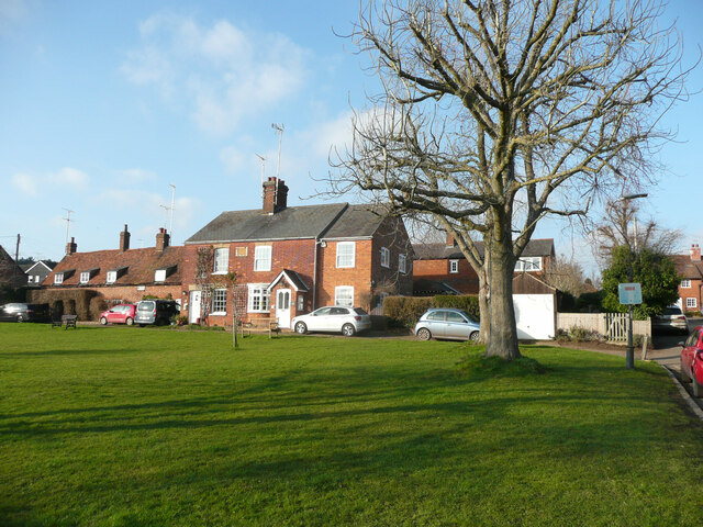
🛝Playground 103m away — built-in entertainment for younger visitors alongside the wider site
🌤️ Visiting this summer
🌞Midsummer — early morning visits most comfortable; look for deer fawns in quieter clearings
☀️Summer family visits work well here — arrive early and plan for a longer stay
🛝Playground 103m away — built-in entertainment for younger visitors alongside the wider site
Good to know
£Free to visit — no entry charge
🐕Dogs welcome
🅿️Parking· Free🛝Playground
Best for
4 activities
🎠
Playgrounds
Strong match
playground, parking
Free
🛝
Family friendly
Strong match
playground; Urban park — family destination
Free
🐶
Dog walks
Strong match
Dogs allowed with public access
Free
🧺
Picnic day out
Good match
Urban park — open green space
Free
Trails nearby
Within roughly 5 km
🚶
Walking
▾
18 signed routes nearby · 37 public paths nearby
Signed route nearbyPublic paths
The Chiltern WayWalking route275 km▾
A waymarked long-distance footpath in southern England
Named routeRef CWLength 275 kmRegional walking route
Lea Valley CircleWalking route4.3 km▾
Walk over the River Lea and gaze across its valley. One of the main rivers in Hertfordshire, it rises as a chalk stream – one of only 200 or so in the world.
Named routeLength 4.3 kmRound tripLocal walking route
Devil's Dyke & NomanslandWalking route4.6 km▾
Walk through the impressive Devil's Dyke, an ancient defensive earthworks from Celtic times. Stroll though the beautiful meadows of the Marshalls Heath nature reserve and the pretty woodlands bordering Nomansland Common.
Named routeLength 4.6 kmRound tripLocal walking route
The Romans & NomanslandWalking route7.8 km▾
Walk along ancient thoroughfares created by Romans and Saxons. Stroll through the picturesque and historic hamlets of Coleman Green, Cromer Hyde and Nomansland and finally enjoy stunning views across Wheathampstead and beyond.
Named routeLength 7.8 kmRound tripLocal walking route
Above the Lea ValleyWalking route6.5 km▾
From quiet woods to expansive views over the Lea valley, this walk includes Gustard Wood at the northern tip of Wheathampstead and the Grade I splendour of Mackerye End.
Named routeLength 6.5 kmRound tripLocal walking route
Butt End Pathpublic footpath · 157 m▾
Public pathpublic footpathLength 157 mSurface grassPath type: footway
Pam's Lanepublic footpath · 128 m▾
Public pathpublic footpathLength 128 mPath type: service
🚴
Cycling
▾
41 signed routes nearby
Signed route nearby
Route 12Cycling route▾
Named routeRef 12National Cycle Network
Route 6Cycling route▾
Named routeRef 6National Cycle Network
NCN National Route 57Cycling route▾
Named routeRef 57National Cycle Network
Recreational Cycle Route 16Cycling route▾
Local circular? cycle route
Named routeLocal cycle route
Chilterns CyclewayCycling route▾
Named routeRound tripRegional cycle route
Ayot GreenwayCycling route▾
Named route
🐴
Horse riding
▾
3 public paths nearby
Public paths
Hall Lanebridleway · 534 m▾
Public pathbridlewayLength 534 mSurface compactedPath type: track
Hall Lanebridleway · 129 m▾
Public pathbridlewayLength 129 mSurface asphaltPath type: service