Getting here
52.45415, -2.03220
Visiting this summer
Seasonal nature notes and what to look for now
Visiting this summer
Seasonal nature notes and what to look for now
- 🌞Midsummer — early morning visits most comfortable; look for deer fawns in quieter clearings
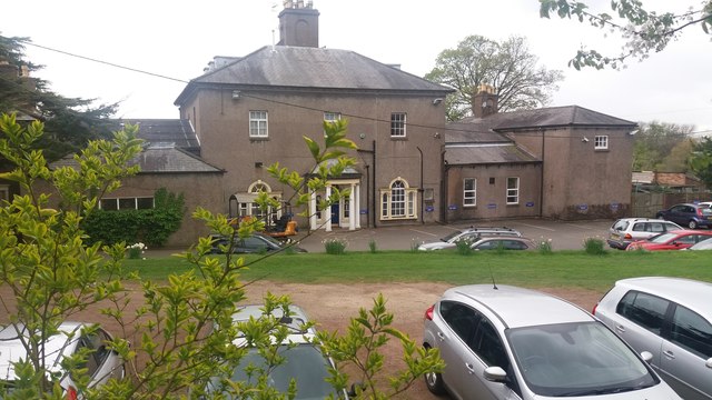
- ✦Historic character is a year-round quality here — summer brings its own atmosphere to the setting
- 🐕Dogs welcome — bring water in summer; the site has enough space to find shade on hot days
🌤️ Visiting this summer
- 🌞Midsummer — early morning visits most comfortable; look for deer fawns in quieter clearings
- ✦Historic character is a year-round quality here — summer brings its own atmosphere to the setting
- 🐕Dogs welcome — bring water in summer; the site has enough space to find shade on hot days
Good to know
- 🐕Dogs welcome
Best for
Wildlife
Very strong match
Multi-group wildlife — Amphibians, Birds, Mammals; Multi-group wildlife — Amphibians, Birds, Mammals
Heritage
Strong match
Historic site with public access
Bird watching
Strong match
Birds — Blue Tit, Carrion Crow, Magpie +46 more · last seen 2026; Birds — Blue Tit, Carrion Crow, Magpie +46 more · last seen 2026
Foraging
Strong match
Traditional orchard — seasonal fruit, fungi and wild plants
Insect spotting
Strong match
Traditional orchard — specialist orchard insects and lichens; Insects — Field Damsel Bug, Pine Ladybird, Juniper Shieldbug +1 more · last seen 2026
Dog walks
Good match
Dogs allowed with public access
Trails nearby
Within roughly 5 km🚶Walking
32 signed routes nearby · 23 public paths nearby
Signed route nearbyPublic paths
Walking
Monarch's WayWalking route990 km
approximate route of Charles II's escape
Sculpture Trail (Saltwells LNR)Walking route1 km
Sculpture trail around a bluebell covered Ancient Woodland and nationally important heritage urban nature reserve.
The Leasowes Red Walking TrailWalking route3.3 km
Red trail 3.3km – 1 hour 15 minutes. Moderate difficulty with some undulating ground and one short climb. Gravelled paths lead you around the woodland valleys & watercourses.
Down The Bumble Hole- Windmill End TrailWalking route3 km
Short trail exploring Windmill End- a tranquil Black Country spot. Today, featuring birdsong, cyclists and water voles. Yet in the 1700/1800s it was a noisy, dirty workshop lined with factories, boatyards, blast furnaces and collieries.
Doulton Trail (Saltwells LNR)Walking route1.5 km
Walking trail around a bluebell-covered Ancient Woodland and nationally important heritage urban nature reserve. Includes one long and steep flight of stairs but generally good surfaced paths and gentle gradients.
Sylvan Greenpublic footpath · 178 m
🚴Cycling
31 signed routes nearby
Signed route nearby
Cycling
Route 54Cycling route
Cycle Route Cradley Heath to Black HeathCycling route
Merrits Brook GreenwayCycling route
[PROPOSED]Starley Regional Cycle NetworkCycling route804 km
Starley (TfWM) Regional Cycle Network (Proposed route)
Bourn Brook WalkwayCycling route
cycle route Cradley Heath to Old HillCycling route
Wildlife to spot
Photos
Weather for this location
Loading local forecast…
Nearby places
Useful places within 5 km
Own or manage this place?
Claim this listing to keep details accurate, add photos, and highlight what makes it special — free.
Claim this pageHow was your visit?
How useful was the information on this page?
id: 844486c9-90e1-413e-a50a-0cf01b6609a7