Plan your visit
🦉 Wildlife🦅 Birds🦋 Insects
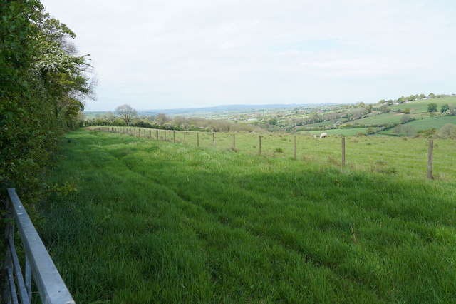
Public access Free entry Dogs welcome 7 ha
Places › England › East Midlands › Derbyshire Dales Getting here
53.02647, -1.66590
Open directionsv Visiting this summer
Seasonal nature notes and what to look for now
▾ 🌞 Midsummer — early morning visits most comfortable; look for deer fawns in quieter clearings 🐕 Early mornings are best for dog walks in summer — visit before 9am to avoid the heat and find quieter trails 📍 Open access throughout summer — no booking required 🌤️ Visiting this summer
🌞 Midsummer — early morning visits most comfortable; look for deer fawns in quieter clearings 🐕 Early mornings are best for dog walks in summer — visit before 9am to avoid the heat and find quieter trails 📍 Open access throughout summer — no booking required £ Free to visit — no entry charge🐕 Dogs welcome🦉 Wildlife
Very strong match
Multi-group wildlife — Amphibians, Birds, Mammals; Multi-group wildlife — Amphibians, Birds, Mammals
Free
🦅 Bird watching
Very strong match
Birds — Blackbird, Robin, Woodpigeon +61 more · last seen 2025; Birds — Blackbird, Robin, Woodpigeon +61 more · last seen 2025
Free
🦋 Insect spotting
Strong match
Insects — Small White, Large White, Small Tortoiseshell +51 more · last seen 2025; Insects — Small White, Large White, Small Tortoiseshell +51 more · last seen 2025
Free
🍂 Seasonal nature
Strong match
Plants — Common Pincushion, Lateral Cryphaea, Endive Pellia +102 more · last seen 2023; Plants — Common Pincushion, Lateral Cryphaea, Endive Pellia +102 more · last seen 2023
Free
Dogs allowed — public woodland
Free
Deciduous woodland — fungi, berries and wild garlic; Plants — Great Scented Liverwort, Common Threadwort, Ramsons +1 more foraging species
Varies
Trails nearby Within roughly 5 km 7 signed routes nearby · 12 public paths nearby
Signed route nearby Public paths
Limestone Way Walking route 74 km ▾
Castleton to Rocester
Named route Length 74 km Point-to-point Regional walking route
Show on map Centenary Way (Derbyshire) Walking route ▾
Amber Valley Routeway Walk 1 Walking route ▾
Named route Local walking route
Show on map Royal Shrovetide Challenge Walk (up'ards) Walking route ▾
Royal Shrovetide Challenge Walk (down'ards) Walking route ▾
29 signed routes nearby
Signed route nearby
Pennine Cycleway Cycling route ▾
Named route Ref 68 National Cycle Network
Show on map Route 547 Cycling route ▾
Named route Ref 547 National Cycle Network
Show on map Alternative Route Cycling route 3.3 km ▾
Named route Ref 547 Length 3.3 km National Cycle Network On-road Surface asphalt
Show on map Alternative Route Cycling route 809 m ▾
Named route Ref 547 Length 809 m National Cycle Network Traffic-free Surface unsealedfirm
Show on map Alternative Route Cycling route 2.3 km ▾
Named route Ref 547 Length 2.3 km National Cycle Network On-road Surface asphalt
Show on map Main Route Cycling route 450 m ▾
Named route Ref 68 Length 450 m National Cycle Network On-road Surface asphalt
Show on map 2 signed routes nearby
Signed route nearby
Tissington Trail Mountain bike route ▾
Named route Ref Tissington Trail Point-to-point Local cycle route
Show on map Carsington Water Cycle Route Mountain bike route ▾
Weather for this location Next 14 days Nearby places Useful places within 5 km
All Historic
Own or manage this place?
Claim this listing to keep details accurate, add photos, and highlight what makes it special — free.
Claim this page→ How useful was the information on this page?
id: 210df994-9f7b-4639-a11d-1bfd95078d81
UK green spaces mapped from open public data — so anyone can find the woodland, trail, or nature reserve closest to them.
© 2026 Glade · Made with care for UK green spaces
Wildlife to spot
2,325 records · National Biodiversity Network
▾
Wildlife to spot 2,325 records · National Biodiversity Network Starling · House Sparrow · Blackbird · Pheasant · Woodpigeon +7
Starling Sturnus vulgaris House Sparrow Passer domesticus Blackbird Turdus merula Pheasant Phasianus colchicus Woodpigeon Columba palumbus Great Tit Parus major Dunnock Prunella modularis Magpie Pica pica Robin Erithacus rubecula Wren Troglodytes troglodytes Carrion Crow Corvus corone Jackdaw Coloeus monedula Bat
🐸 Amphibians 1 species
summer
2023 ▾
Great Crested Newt
Great Crested Newt Triturus cristatus 🐝 Insects 2 species
winter summer
2025 ▾
Broad-bodied Chaser · Harlequin Ladybird
Broad-bodied Chaser Libellula depressa2023 Harlequin Ladybird Harmonia axyridis Goldilocks Buttercup · Meadow Crane's-bill · Lamiastrum galeobdolon subsp. montanum · Bearded Couch · Hairy-brome +130
Goldilocks Buttercup Ranunculus auricomus2024 Meadow Crane's-bill Geranium pratense2022 Lamiastrum galeobdolon subsp. montanum Lamiastrum galeobdolon subsp. montanum2024 Bearded Couch Elymus caninus2022 Hairy-brome Bromopsis ramosa2022 Species observations from the last 10 years via NBN Atlas
Sweet Chestnut
Sweet Chestnut
Castanea sativa
Castanea sativa
Ramsons Allium ursinum2023
Ramsons Allium ursinum2023
Hairy St John's-wort Hypericum hirsutum2022
Hairy St John's-wort Hypericum hirsutum2022
Black Bryony Tamus communis2022
Black Bryony Tamus communis2022
Red Campion Silene dioica
Red Campion Silene dioica
Herb-Robert Geranium robertianum
Herb-Robert Geranium robertianum
Great Willowherb Epilobium hirsutum
Great Willowherb Epilobium hirsutum
Hairy Bitter-cress Cardamine hirsuta
Hairy Bitter-cress Cardamine hirsuta
Common Couch Elymus repens
Common Couch Elymus repens
Hazel Corylus avellana
Hazel Corylus avellana
Woodruff Galium odoratum2024
Woodruff Galium odoratum2024
Cuckooflower Cardamine pratensis2023
Cuckooflower Cardamine pratensis2023
Agrimony Agrimonia eupatoria2022
Agrimony Agrimonia eupatoria2022
Raspberry Rubus idaeus
Raspberry Rubus idaeus
Dryopteris affinis Dryopteris affinis
Dryopteris affinis Dryopteris affinis
Marsh Thistle Cirsium palustre
Marsh Thistle Cirsium palustre
Hawthorn Crataegus monogyna
Hawthorn Crataegus monogyna
Foxglove Digitalis purpurea
Foxglove Digitalis purpurea
Common Orache Atriplex patula
Common Orache Atriplex patula
Wood Avens Geum urbanum
Wood Avens Geum urbanum
Hedge Woundwort Stachys sylvatica
Hedge Woundwort Stachys sylvatica
Timothy Phleum pratense
Timothy Phleum pratense
Greater Plantain Plantago major
Greater Plantain Plantago major
Holly Ilex aquifolium
Holly Ilex aquifolium
Creeping Thistle Cirsium arvense
Creeping Thistle Cirsium arvense
Smooth Hawk's-beard Crepis capillaris
Smooth Hawk's-beard Crepis capillaris
Broad-leaved Dock Rumex obtusifolius
Broad-leaved Dock Rumex obtusifolius
Pineappleweed Matricaria discoidea
Pineappleweed Matricaria discoidea
Creeping Buttercup Ranunculus repens
Creeping Buttercup Ranunculus repens
Rosebay Willowherb Chamaenerion angustifolium
Rosebay Willowherb Chamaenerion angustifolium
Cleavers Galium aparine
Cleavers Galium aparine
Oval Sedge Carex leporina
Oval Sedge Carex leporina
Dandelion Taraxacum
Dandelion Taraxacum
Small-leaved Lime Tilia cordata
Small-leaved Lime Tilia cordata
Malus sylvestris Malus sylvestris
Malus sylvestris Malus sylvestris
Wild Plum Prunus domestica
Wild Plum Prunus domestica
Yarrow Achillea millefolium
Yarrow Achillea millefolium
Goat Willow Salix caprea
Goat Willow Salix caprea
Meadow Vetchling Lathyrus pratensis
Meadow Vetchling Lathyrus pratensis
Bittersweet Solanum dulcamara var. marinum
Bittersweet Solanum dulcamara var. marinum
Nipplewort Lapsana communis
Nipplewort Lapsana communis
Selfheal Prunella vulgaris
Selfheal Prunella vulgaris
Procumbent Yellow-sorrel Oxalis corniculata
Procumbent Yellow-sorrel Oxalis corniculata
Horse-chestnut Aesculus hippocastanum
Horse-chestnut Aesculus hippocastanum
Chenopodium album Chenopodium album
Chenopodium album Chenopodium album
Wild Marjoram Origanum vulgare
Wild Marjoram Origanum vulgare
Common Mouse-ear Cerastium fontanum
Common Mouse-ear Cerastium fontanum
Bay Willow Salix pentandra
Bay Willow Salix pentandra
Meadow Foxtail Alopecurus pratensis
Meadow Foxtail Alopecurus pratensis
Cow Parsley Anthriscus sylvestris
Cow Parsley Anthriscus sylvestris
Curled Dock Rumex crispus
Curled Dock Rumex crispus
Wood Forget-me-not Myosotis sylvatica
Wood Forget-me-not Myosotis sylvatica
Wall Speedwell Veronica arvensis
Wall Speedwell Veronica arvensis
Perennial Rye-grass Lolium perenne
Perennial Rye-grass Lolium perenne
Sycamore Acer pseudoplatanus
Sycamore Acer pseudoplatanus
Common Bent Agrostis capillaris
Common Bent Agrostis capillaris
Hemlock Conium maculatum
Hemlock Conium maculatum
Rosa canina Rosa canina
Rosa canina Rosa canina
Elder Sambucus nigra
Elder Sambucus nigra
Shepherd's-purse Capsella bursa-pastoris
Shepherd's-purse Capsella bursa-pastoris
Red Clover Trifolium pratense
Red Clover Trifolium pratense
Wild Angelica Angelica sylvestris
Wild Angelica Angelica sylvestris
Hogweed Heracleum sphondylium
Hogweed Heracleum sphondylium
Ash Fraxinus excelsior
Ash Fraxinus excelsior
Rowan Sorbus aucuparia
Rowan Sorbus aucuparia
Silver Birch Betula pendula
Silver Birch Betula pendula
Cock's-foot Dactylis glomerata
Cock's-foot Dactylis glomerata
Guelder-rose Viburnum opulus
Guelder-rose Viburnum opulus
Festuca rubra Festuca rubra
Festuca rubra Festuca rubra
Soft-rush Juncus effusus
Soft-rush Juncus effusus
Gorse Ulex europaeus
Gorse Ulex europaeus
Broad-leaved Pondweed Potamogeton natans
Broad-leaved Pondweed Potamogeton natans
Blackthorn Prunus spinosa
Blackthorn Prunus spinosa
Broad-leaved Willowherb Epilobium montanum
Broad-leaved Willowherb Epilobium montanum
Creeping Cinquefoil Potentilla reptans
Creeping Cinquefoil Potentilla reptans
Equal-leaved Knotgrass Polygonum arenastrum
Equal-leaved Knotgrass Polygonum arenastrum
Spear Thistle Cirsium vulgare
Spear Thistle Cirsium vulgare
False Oat-grass Arrhenatherum elatius
False Oat-grass Arrhenatherum elatius
Ivy Hedera helix
Ivy Hedera helix
Prickly Sow-thistle Sonchus asper
Prickly Sow-thistle Sonchus asper
Compact Rush Juncus conglomeratus
Compact Rush Juncus conglomeratus
Round-leaved Crane's-bill Geranium rotundifolium
Round-leaved Crane's-bill Geranium rotundifolium
Greater Bird's-foot-trefoil Lotus pedunculatus
Greater Bird's-foot-trefoil Lotus pedunculatus
Common Nettle Urtica dioica
Common Nettle Urtica dioica
Wych Elm Ulmus glabra
Wych Elm Ulmus glabra
Redshank Persicaria maculosa
Redshank Persicaria maculosa
Ribwort Plantain Plantago lanceolata
Ribwort Plantain Plantago lanceolata
Garlic Mustard Alliaria petiolata
Garlic Mustard Alliaria petiolata
Sharp-flowered Rush Juncus acutiflorus
Sharp-flowered Rush Juncus acutiflorus
Common Sallow Salix cinerea
Common Sallow Salix cinerea
Common Hemp-nettle Galeopsis tetrahit
Common Hemp-nettle Galeopsis tetrahit
Common Sorrel Rumex acetosa
Common Sorrel Rumex acetosa
Beech Fagus sylvatica
Beech Fagus sylvatica
Common Ragwort Jacobaea vulgaris
Common Ragwort Jacobaea vulgaris
Italian Alder Alnus cordata
Italian Alder Alnus cordata
Groundsel Senecio vulgaris
Groundsel Senecio vulgaris
Meadowsweet Filipendula ulmaria
Meadowsweet Filipendula ulmaria
Meadow Buttercup Ranunculus acris
Meadow Buttercup Ranunculus acris
Bulrush Typha latifolia
Bulrush Typha latifolia
Alder Alnus glutinosa
Alder Alnus glutinosa
Bramble Rubus fruticosus
Bramble Rubus fruticosus
Tufted Vetch Vicia cracca
Tufted Vetch Vicia cracca
Autumn Hawkbit Scorzoneroides autumnalis
Autumn Hawkbit Scorzoneroides autumnalis
Bird's-Foot-Trefoil Lotus
Bird's-Foot-Trefoil Lotus
Procumbent Pearlwort Sagina procumbens
Procumbent Pearlwort Sagina procumbens
Tufted Hair-grass Deschampsia cespitosa
Tufted Hair-grass Deschampsia cespitosa
Common Valerian Valeriana officinalis
Common Valerian Valeriana officinalis
Centaurea nigra Centaurea nigra
Centaurea nigra Centaurea nigra
Annual Meadow-grass Poa annua
Annual Meadow-grass Poa annua
Salix fragilis Salix fragilis
Salix fragilis Salix fragilis
Creeping Soft-grass Holcus mollis
Creeping Soft-grass Holcus mollis
Reed Canary-grass Phalaris arundinacea
Reed Canary-grass Phalaris arundinacea
White Clover Trifolium repens
White Clover Trifolium repens
Pedunculate Oak Quercus robur
Pedunculate Oak Quercus robur
Crab Apple Malus sylvestris2024
Crab Apple Malus sylvestris2024
Butterbur Petasites hybridus2024
Butterbur Petasites hybridus2024
Common Whitlowgrass Erophila verna2024
Common Whitlowgrass Erophila verna2024
Cowslip Primula veris2024
Cowslip Primula veris2024
Moschatel Adoxa moschatellina2024
Moschatel Adoxa moschatellina2024
Rock Crane's-bill Geranium macrorrhizum2024
Rock Crane's-bill Geranium macrorrhizum2024
Bluebell Hyacinthoides non-scripta2024
Bluebell Hyacinthoides non-scripta2024
Three-nerved Sandwort Moehringia trinervia2024
Three-nerved Sandwort Moehringia trinervia2024
Fairy Flax Linum catharticum2022
Fairy Flax Linum catharticum2022
Dogwood Cornus sanguinea2022
Dogwood Cornus sanguinea2022
Bracken Pteridium aquilinum2022
Bracken Pteridium aquilinum2022
False-brome Brachypodium sylvaticum2022
False-brome Brachypodium sylvaticum2022
Greater Stitchwort Stellaria holostea2022
Greater Stitchwort Stellaria holostea2022
Heracleum sphondylium subsp. sphondylium f. angustifolium Heracleum sphondylium subsp. sphondylium f. angustifolium2022
Heracleum sphondylium subsp. sphondylium f. angustifolium Heracleum sphondylium subsp. sphondylium f. angustifolium2022
Large-leaved Lime Tilia platyphyllos2022
Large-leaved Lime Tilia platyphyllos2022
Lesser Trefoil Trifolium dubium2022
Lesser Trefoil Trifolium dubium2022 Events & activities nearby Switch provider to compare local events, tours and bookable activities.
Bookable tours GetYourGuide Promote here