Thundersley Christian Spiritualist Church 3 ha
Plan your visit
🦉 Wildlife🦅 Birds🦋 Insects
Public access Free entry Dogs welcome 3 ha
Places › England › Eastern › Castle Point Getting here
51.56256, 0.57042
Open directionsv Visiting this summer
Seasonal nature notes and what to look for now
▾ 🌞 Midsummer — early morning visits most comfortable; look for deer fawns in quieter clearings 🐕 Early mornings are best for dog walks in summer — visit before 9am to avoid the heat and find quieter trails 📍 Open access throughout summer — no booking required 🌤️ Visiting this summer
🌞 Midsummer — early morning visits most comfortable; look for deer fawns in quieter clearings 🐕 Early mornings are best for dog walks in summer — visit before 9am to avoid the heat and find quieter trails 📍 Open access throughout summer — no booking required £ Free to visit — no entry charge🐕 Dogs welcome🦉 Wildlife
Very strong match
Multi-group wildlife — Amphibians, Birds, Mammals, Reptiles; Multi-group wildlife — Amphibians, Birds, Mammals, Reptiles
Free
🦅 Bird watching
Very strong match
Birds — Woodpigeon, Swift, Magpie +61 more · last seen 2026; Birds — Woodpigeon, Swift, Magpie +61 more · last seen 2026
Free
🦋 Insect spotting
Strong match
Insects — Box Tree Moth, Lily Beetle, Holly Blue +138 more · last seen 2026; Insects — Box Tree Moth, Lily Beetle, Holly Blue +138 more · last seen 2026
Free
Dogs allowed — public woodland
Free
Deciduous woodland — fungi, berries and wild garlic; Plants — Oak, Bramble, Common Nettle +1 more foraging species
Varies
🍂 Seasonal nature
Good match
Plants — Bluebell, Oak, Rosebay Willowherb +12 more · last seen 2018; Plants — Bluebell, Oak, Rosebay Willowherb +12 more · last seen 2018
Free
Trails nearby Within roughly 5 km 6 signed routes nearby · 6 public paths nearby
Signed route nearby Public paths
Accessible Route, Rayleigh Mount Walking route 600 m ▾
Gravel path with inclines around Rayleigh Mount.
AccessAble: https://www.accessable.co.uk/national-trust/access-guides/rayleigh-mount-the-mount-national-trust
Named route Length 600 m Duration 00:30 Round trip Local walking route
Show on map Blue Walk Walking route ▾
Thames Estuary Path Walking route 46.6 km ▾
Named route Length 46.6 km National walking route
Show on map Roach Valley Walk Walking route ▾
Named route Local walking route
Show on map King Charles III England Coast Path: Tilbury to Southend-on-Sea Walking route ▾
Named route Ref ECP National walking route
Show on map 3 signed routes nearby
Signed route nearby
National Cycle Route 16 (proposed) Cycling route ▾
Named route Ref 16 National Cycle Network
Show on map National Cycle Route 16 Cycling route ▾
Named route Ref 16 National Cycle Network
Show on map Main Route Cycling route 441 m ▾
Named route Ref 16 Length 441 m National Cycle Network On-road Surface asphalt
Show on map 22 public paths nearby
Public paths
Lime Road bridleway · 42 m ▾
Public path bridleway Length 42 m Path type: service
Show on map Rhoda Road North bridleway · 109 m ▾
Public path bridleway Length 109 m Surface dirt Path type: track
Show on map Bowers Road bridleway · 51 m ▾
Public path bridleway Length 51 m Path type: service
Show on map Clarence Road bridleway · 64 m ▾
Public path bridleway Length 64 m Path type: service
Show on map Downer Road bridleway · 44 m ▾
Public path bridleway Length 44 m Surface unpaved Path type: service
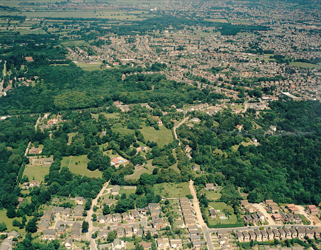
Show on map Photos Aerial view of Coombe Wood and Thundersley Glen
‹ ›
Weather for this location Next 14 days Nearby places Useful places within 5 km
All Historic
Own or manage this place?
Claim this listing to keep details accurate, add photos, and highlight what makes it special — free.
Claim this page→ How useful was the information on this page?
id: a8c7c234-e6b1-48bf-a049-65688753b043
UK green spaces mapped from open public data — so anyone can find the woodland, trail, or nature reserve closest to them.
© 2026 Glade · Made with care for UK green spaces
Wildlife to spot
9,607 records · National Biodiversity Network
▾
Wildlife to spot 9,607 records · National Biodiversity Network 🐦 Birds 42 species
winter spring summer
2026 ▾
Woodpigeon · Magpie · Blackbird · Robin · House Sparrow +37
Woodpigeon Columba palumbus2025 Magpie Pica pica2025 Blackbird Turdus merula2025 Robin Erithacus rubecula2025 House Sparrow Passer domesticus2025 Black-headed Gull Chroicocephalus ridibundus2025 Swift Apus apus2025 Carrion Crow Corvus corone2025 Blue Tit Cyanistes caeruleus2024 Jackdaw Coloeus monedula Starling Sturnus vulgaris2025 Great Tit Parus major2025 Chiffchaff Phylloscopus collybita2025 Herring Gull Larus argentatus2025 Great Spotted Woodpecker Dendrocopos major2024 Pied Wagtail Motacilla alba2025 Blackcap Sylvia atricapilla2025 Stock Dove Columba oenas2024 Green Woodpecker Picus viridis2024 Long-tailed Tit Aegithalos caudatus2024 Jay Garrulus glandarius2024 Chaffinch Fringilla coelebs2024 Wren Troglodytes troglodytes2024 Goldcrest Regulus regulus2025 Song Thrush Turdus philomelos2025 Collared Dove Streptopelia decaocto2025 Treecreeper Certhia familiaris2024 Nuthatch Sitta europaea2024 Dunnock Prunella modularis2024 Goldfinch Carduelis carduelis2024 Redwing Turdus iliacus2024 Woodcock Scolopax rusticola2024 Canada Goose Branta canadensis2023 Lesser Black-backed Gull Larus fuscus2025 Skylark Alauda arvensis2025 Kestrel Falco tinnunculus2025 Kingfisher Alcedo atthis2025 Tawny Owl Strix aluco2024 Greenfinch Chloris chloris2024 Rook Corvus frugilegus2024 House Martin Delichon urbicum2023 Rock Dove Columba livia2023 🦌 Mammals 3 species
winter spring
2026 ▾
Red Fox · Water Vole · Badger
Red Fox Vulpes vulpes Water Vole Arvicola amphibius2025 Badger Meles meles2024 🦎 Reptiles 2 species
spring summer
2026 ▾
Slow-worm · Adder
Slow-worm Anguis fragilis Adder Vipera berus 🐸 Amphibians 2 species
spring
2025 ▾
Smooth Newt · Common Frog
Smooth Newt Lissotriton vulgaris Common Frog Rana temporaria 🐝 Insects 29 species
spring summer autumn
2026 ▾
7-spot Ladybird · Hornet Hoverfly · Green Shieldbug · Nalassus laevioctostriatus · Leistus fulvibarbis +24
7-spot Ladybird Coccinella septempunctata2025 Hornet Hoverfly Volucella zonaria2025 Green Shieldbug Palomena prasina2025 Nalassus laevioctostriatus Nalassus laevioctostriatus Leistus fulvibarbis Leistus fulvibarbis Species observations from the last 10 years via NBN Atlas
2-spot Ladybird Adalia bipunctata2025
2-spot Ladybird Adalia bipunctata2025
Eristalis pertinax Eristalis pertinax2025
Eristalis pertinax Eristalis pertinax2025
Syrphus ribesii Syrphus ribesii2025
Syrphus ribesii Syrphus ribesii2025
Leopoldius signatus Leopoldius signatus2025
Leopoldius signatus Leopoldius signatus2025
Field Grasshopper Chorthippus brunneus2025
Field Grasshopper Chorthippus brunneus2025
Jersey Tiger Euplagia quadripunctaria2025
Jersey Tiger Euplagia quadripunctaria2025
Rosemary Beetle Chrysolina americana2025
Rosemary Beetle Chrysolina americana2025
Gatekeeper Pyronia tithonus2025
Gatekeeper Pyronia tithonus2025
Large White Pieris brassicae2025
Large White Pieris brassicae2025
Green-veined White Pieris napi2025
Green-veined White Pieris napi2025
Peacock Aglais io2025
Peacock Aglais io2025
Marbled White Melanargia galathea serena2025
Marbled White Melanargia galathea serena2025
Essex Skipper Thymelicus lineola2025
Essex Skipper Thymelicus lineola2025
Common Red Soldier Beetle Rhagonycha fulva2025
Common Red Soldier Beetle Rhagonycha fulva2025
Dock Bug Coreus marginatus2025
Dock Bug Coreus marginatus2025
Meadow Grasshopper Pseudochorthippus parallelus2025
Meadow Grasshopper Pseudochorthippus parallelus2025
Harlequin Ladybird Harmonia axyridis2025
Harlequin Ladybird Harmonia axyridis2025
Eupeodes Eupeodes2025
Eupeodes Eupeodes2025
Closterotomus trivialis Closterotomus trivialis2025
Closterotomus trivialis Closterotomus trivialis2025
Dark-edged Bee-fly Bombylius major2025
Dark-edged Bee-fly Bombylius major2025
Southern Oak Bush-cricket Meconema meridionale2024
Southern Oak Bush-cricket Meconema meridionale2024
Red-legged Shieldbug Pentatoma rufipes2024
Red-legged Shieldbug Pentatoma rufipes2024
Green Nettle Weevil Phyllobius pomaceus2024
Green Nettle Weevil Phyllobius pomaceus2024
Red-headed Cardinal Beetle Pyrochroa serraticornis2024
Red-headed Cardinal Beetle Pyrochroa serraticornis2024 Events & activities nearby Switch provider to compare local events, tours and bookable activities.
Bookable tours GetYourGuide Promote here