Tintock Wood ✦ Ancient woodland 6 ha
🦉 Wildlife🦅 Birds🍂 Seasonal
↑ Share
Public access Free entry Dogs welcome 6 ha
Places › England › South West › Stroud Getting here
51.70402, -2.45517
Open directionsv Visiting this summer
Seasonal nature notes and what to look for now
▾ 🌞 Midsummer — early morning visits most comfortable; look for deer fawns in quieter clearings 🐕 Early mornings are best for dog walks in summer — visit before 9am to avoid the heat and find quieter trails 📍 Open access throughout summer — no booking required 🌤️ Visiting this summer
🌞 Midsummer — early morning visits most comfortable; look for deer fawns in quieter clearings 🐕 Early mornings are best for dog walks in summer — visit before 9am to avoid the heat and find quieter trails 📍 Open access throughout summer — no booking required £ Free to visit — no entry charge🐕 Dogs welcome🌿 Ancient woodland — rare wildlife habitat🦉 Wildlife
Very strong match
Multi-group wildlife — Amphibians, Birds, Mammals, Reptiles; Multi-group wildlife — Amphibians, Birds, Mammals, Reptiles
Free
🦅 Bird watching
Very strong match
Birds — Lesser Black-backed Gull, Mallard, Black-headed Gull +84 more · last seen 2025; Birds — Lesser Black-backed Gull, Mallard, Black-headed Gull +84 more · last seen 2025
Free
🍂 Seasonal nature
Strong match
Ancient woodland — bluebells, fungi and autumn colour; Plants — Himalayan Balsam, Japanese Knotweed, Rubus ulmifolius · last seen 2023
Free
🦋 Insect spotting
Strong match
Insects — Common Cockchafer, Red Admiral, Small White +79 more · last seen 2026; Insects — Common Cockchafer, Red Admiral, Small White +79 more · last seen 2026
Free
Dogs allowed — public woodland
Free
Named cycling route nearby: Route 41
Varies
Trails nearby Within roughly 5 km 2 signed routes nearby · 2 public paths nearby
Signed route nearby Public paths
Cotswold Way Walking route 164 km ▾
Named route Ref CW Length 164 km National walking route
Show on map Severn Way (3) Worcester to Bristol Walking route 153 km ▾
Named route Ref SW (3) Length 153 km Regional walking route
Show on map 14 signed routes nearby
Signed route nearby
Route 41 Cycling route ▾
Named route Ref 41 National Cycle Network
Show on map Main Route Cycling route 2.7 km ▾
Named route Ref 41 Length 2.7 km National Cycle Network On-road Surface asphalt
Show on map Main Route Cycling route 20 m ▾
Named route Ref 41 Length 20 m National Cycle Network On-road Surface asphalt
Show on map Main Route Cycling route 5.2 km ▾
Named route Ref 41 Length 5.2 km National Cycle Network On-road Surface asphalt
Show on map Main Route Cycling route 679 m ▾
Named route Ref 41 Length 679 m National Cycle Network On-road Surface asphalt
Show on map Main Route Cycling route 477 m ▾
Named route Ref 41 Length 477 m National Cycle Network On-road Surface asphalt
Show on map ✦ Ancient woodland — continuously wooded since at least 1600 AD. A rare and irreplaceable habitat, rich in biodiversity and historical character.
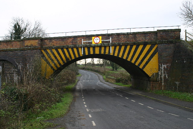
Photos Railway bridge near Berkeley
‹ ›
Weather for this location Next 14 days Nearby places Useful places within 5 km
All Historic
Own or manage this place?
Claim this listing to keep details accurate, add photos, and highlight what makes it special — free.
Claim this page→ How useful was the information on this page?
Something wrong on this page?
id: 604e7665-a3dc-44a0-8cff-30d57e2bdfd2
UK green spaces mapped from open public data — so anyone can find the woodland, trail, or nature reserve closest to them.
© 2026 Glade · Made with care for UK green spaces
Events & activities nearby Switch provider to compare local events, tours and bookable activities.
Bookable tours GetYourGuide Promote here
Wildlife to spot
25,746 records · National Biodiversity Network
▾
Wildlife to spot 25,746 records · National Biodiversity Network 🐦 Birds 60 species
spring summer autumn winter
2025 ▾
Mallard · Jackdaw · Starling · House Sparrow · Robin +55
Mallard Anas platyrhynchos Jackdaw Coloeus monedula Starling Sturnus vulgaris House Sparrow Passer domesticus Robin Erithacus rubecula Lesser Black-backed Gull Larus fuscus Magpie Pica pica Blue Tit Cyanistes caeruleus Great Tit Parus major Song Thrush Turdus philomelos Blackbird Turdus merula Carrion Crow Corvus corone Goldfinch Carduelis carduelis Wren Troglodytes troglodytes Herring Gull Larus argentatus Moorhen Gallinula chloropus Black-headed Gull Chroicocephalus ridibundus Woodpigeon Columba palumbus Dunnock Prunella modularis Shelduck Tadorna tadorna Common Gull Larus canus Grey Heron Ardea cinerea House Martin Delichon urbicum Swallow Hirundo rustica Chiffchaff Phylloscopus collybita Blackcap Sylvia atricapilla Oystercatcher Haematopus ostralegus2024 Chaffinch Fringilla coelebs Rook Corvus frugilegus Redwing Turdus iliacus Skylark Alauda arvensis Long-tailed Tit Aegithalos caudatus Snipe Gallinago gallinago Mistle Thrush Turdus viscivorus Green Sandpiper Tringa ochropus Kingfisher Alcedo atthis2024 Whitethroat Curruca communis2024 Reed Warbler Acrocephalus scirpaceus2024 Swift Apus apus2024 Cormorant Phalacrocorax carbo2024 Little Grebe Tachybaptus ruficollis Fieldfare Turdus pilaris Collared Dove Streptopelia decaocto Goldcrest Regulus regulus Little Egret Egretta garzetta Meadow Pipit Anthus pratensis Pied Wagtail Motacilla alba Grey Wagtail Motacilla cinerea Yellow Wagtail Motacilla flava Redshank Tringa totanus Spotted Flycatcher Muscicapa striata2024 Sedge Warbler Acrocephalus schoenobaenus2024 Mute Swan Cygnus olor2024 Kestrel Falco tinnunculus2024 Lesser Whitethroat Curruca curruca2024 Willow Warbler Phylloscopus trochilus2024 Greenfinch Chloris chloris2024 Greylag Goose Anser anser2024 Great Black-backed Gull Larus marinus2024 Jay Garrulus glandarius2024 Grey Squirrel
Grey Squirrel Sciurus carolinensis 🦎 Reptiles 1 species
summer autumn
2024 ▾
Grass Snake
Grass Snake Natrix helvetica 🐸 Amphibians 1 species
winter
2025 ▾
Common Frog
Common Frog Rana temporaria 🐝 Insects 16 species
spring summer
2026 ▾
Deraeocoris (Deraeocoris) ruber · Common Cockchafer · Eristalis tenax · Banded General · Beautiful Demoiselle +11
Deraeocoris (Deraeocoris) ruber Deraeocoris (Deraeocoris) ruber2025 Common Cockchafer Melolontha melolontha2025 Eristalis tenax Eristalis tenax Banded General Stratiomys potamida2025 Beautiful Demoiselle Calopteryx virgo2025 Species observations from the last 10 years via NBN Atlas
Carabus granulatus
Carabus granulatus
Carabus granulatus2025
Carabus granulatus2025
Dark-edged Bee-fly Bombylius major2025
Dark-edged Bee-fly Bombylius major2025
Yellow Meadow Ant Lasius flavus2024
Yellow Meadow Ant Lasius flavus2024
Orange Ladybird Halyzia sedecimguttata2024
Orange Ladybird Halyzia sedecimguttata2024
Swollen-thighed Beetle Oedemera nobilis2024
Swollen-thighed Beetle Oedemera nobilis2024
Timothy Grassbug Stenotus binotatus2024
Timothy Grassbug Stenotus binotatus2024
Common Red Soldier Beetle Rhagonycha fulva2024
Common Red Soldier Beetle Rhagonycha fulva2024
Alder Leaf Beetle Agelastica alni2024
Alder Leaf Beetle Agelastica alni2024
Splayed Deerfly Chrysops caecutiens2024
Splayed Deerfly Chrysops caecutiens2024
Hawthorn Shieldbug Acanthosoma haemorrhoidale2024
Hawthorn Shieldbug Acanthosoma haemorrhoidale2024
Clivina fossor Clivina fossor2024
Clivina fossor Clivina fossor2024