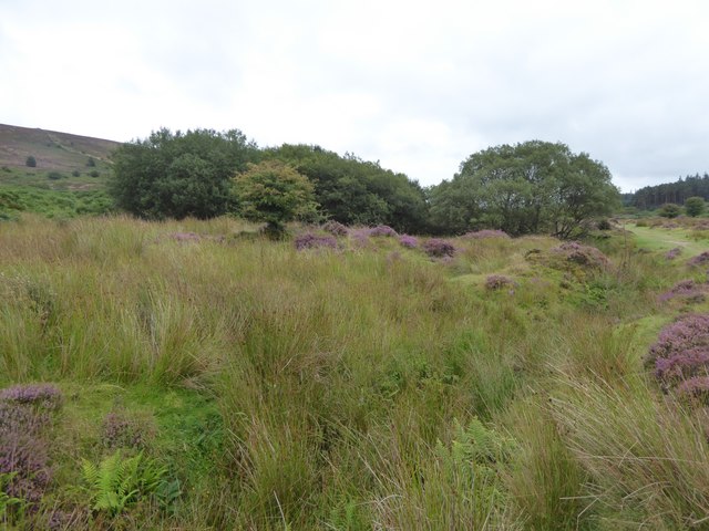
🐦67+ species recorded in this area — summer evenings are best for activity; watch for Willow Warbler and Stonechat
✦Historic character is a year-round quality here — summer brings its own atmosphere to the setting
🐕Dogs welcome — bring water in summer; the site has enough space to find shade on hot days
🌤️ Visiting this summer
🐦67+ species recorded in this area — summer evenings are best for activity; watch for Willow Warbler and Stonechat
✦Historic character is a year-round quality here — summer brings its own atmosphere to the setting
🐕Dogs welcome — bring water in summer; the site has enough space to find shade on hot days
Good to know
£Free to visit — no entry charge
🐕Dogs welcome
Best for
6 activities
🦅
Bird watching
Very strong match
Birds — Willow Warbler, Stonechat, Blackbird +64 more · last seen 2025; Lowland heathland — Dartford warblers, nightjars and stonechats
Free
🦉
Wildlife
Strong match
Birds — Willow Warbler, Stonechat, Blackbird +64 more · last seen 2025; Lowland heathland priority habitat
Free
✦
Heritage
Strong match
Historic site with public access
Free
🦋
Insect spotting
Strong match
Lowland heathland — silver-studded blue and heath fritillary butterflies; Insects — Large Red Damselfly, Eristalis intricaria, Broad-bodied Chaser +36 more · last seen 2025
Free
🐶
Dog walks
Good match
Dogs allowed with public access
Free
🏡
Historic gardens
Good match
Historic site with public access
Varies
Trails nearby
Within roughly 5 km
🚶
Walking
▾
4 signed routes nearby · 3 public paths nearby
Signed route nearbyPublic paths
Two Moors WayWalking route▾
Named routeRef MWListed length 166Regional walking route
The LichwayWalking route19 km▾
Also known as the 'Way of the Dead' as a route for carrying coffins to the graveyard at Lydford Church
Named routeRef LYWLength 19 kmLocal walking route
Bellever TrailWalking route▾
Named routeRef BTLocal walking route
Postbridge TrailWalking route▾
Named routeRef PTLocal walking route
🚴
Cycling
▾
3 signed routes nearby
Signed route nearby
Route 28Cycling route▾
Named routeRef 28National Cycle Network
Dartmoor Way (Cycle)Cycling route▾
Named routeLocal cycle route
Main RouteCycling route17.1 km▾
Named routeRef 28Length 17.1 kmNational Cycle NetworkOn-road
🐴
Horse riding
▾
37 public paths nearby
Public paths
No named routes yet. Public paths are shown on the map.