Plan your visit
Getting here
50.97626, -0.89102
Visiting this summer
Seasonal nature notes and what to look for now
Visiting this summer
Seasonal nature notes and what to look for now
- 🌞Midsummer — early morning visits most comfortable; look for deer fawns in quieter clearings
- 🌿Foraging is at its best in summer here
- 🐕Dogs welcome — bring water in summer; the site has enough space to find shade on hot days
🌤️ Visiting this summer
- 🌞Midsummer — early morning visits most comfortable; look for deer fawns in quieter clearings
- 🌿Foraging is at its best in summer here
- 🐕Dogs welcome — bring water in summer; the site has enough space to find shade on hot days
Good to know
- £Free to visit — no entry charge
- 🐕Dogs welcome
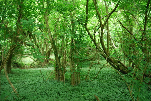
- 🌿Ancient woodland — rare wildlife habitat
Best for
Wildlife
Very strong match
Multi-group wildlife — Amphibians, Birds, Mammals, Reptiles; Multi-group wildlife — Amphibians, Birds, Mammals, Reptiles
Bird watching
Very strong match
Birds — Woodpigeon, Blackbird, Robin +62 more · last seen 2025; Birds — Woodpigeon, Blackbird, Robin +62 more · last seen 2025
Seasonal nature
Strong match
Ancient woodland — bluebells, fungi and autumn colour; Plants — Ramsons, Herb-Paris, Solomon's-seal +149 more · last seen 2025
Foraging
Strong match
Plants — Ramsons, Hazel, White Dead-nettle +19 more foraging species; Deciduous woodland — fungi, berries and wild garlic
Dog walks
Strong match
Dogs allowed — public woodland
Insect spotting
Strong match
Insects — Marmalade Hoverfly, Syrphus, Platycheirus albimanus +20 more · last seen 2025; Insects — Marmalade Hoverfly, Syrphus, Platycheirus albimanus +20 more · last seen 2025
Trails nearby
Within roughly 5 km🚶Walking
11 signed routes nearby · 9 public paths nearby
Signed route nearbyPublic paths
Walking
South Downs WayWalking route160 km
Staunton WayWalking route
Hangers WayWalking route
Long Woodland TrailWalking route8 km
Octagon WayWalking route29 km
🚴Cycling
44 signed routes nearby
Signed route nearby
Cycling
Route 222Cycling route
National Cycle Route 228 Pulborough to Petersfield (proposed)Cycling route
Route 22Cycling route
Discover the Hampshire South Downs by BikeCycling route
NCN 22/222 linkCycling route
Petersfield - QECP/SDWCycling route
🚵Mountain biking
6 signed routes nearby
Signed route nearby
Mountain biking
South Downs WayMountain bike route
Petersfield Off Road Cycle TrailMountain bike route
QECP Blue MTBMountain bike route
King Alfred's WayMountain bike route
King Alfreds Way is 350km (220 miles) off road route designed to be ridden clockwise. It starts & ends in Winchester. It is suitable for gravel or cross-country bikes.
Queen Elizabeth Off Road Cycle TrailMountain bike route
Shipwright's WayMountain bike route
🐴Horse riding
2 public paths nearby
Public paths
Horse riding
No named routes yet. Public paths are shown on the map.
Wildlife to spot
Photos
Weather for this location
Loading local forecast…
Nearby places
Useful places within 5 km
Own or manage this place?
Claim this listing to keep details accurate, add photos, and highlight what makes it special — free.
Claim this pageHow was your visit?
How useful was the information on this page?
id: bf9bd840-c153-46ae-bc8f-5ad20a3c0f26