🦉 Wildlife🦅 Birds🍂 Seasonal
↑ Share
Free entry Dogs welcome 26 ha
Places › England › North West › Westmorland and Furness Getting here
54.24144, -2.90372
Open directionsv Visiting this summer
Seasonal nature notes and what to look for now
▾ 🌞 Midsummer — early morning visits most comfortable; look for deer fawns in quieter clearings 🌿 Foraging is at its best in summer here 🐕 Dogs welcome — bring water in summer; the site has enough space to find shade on hot days 🌤️ Visiting this summer
🌞 Midsummer — early morning visits most comfortable; look for deer fawns in quieter clearings 🌿 Foraging is at its best in summer here 🐕 Dogs welcome — bring water in summer; the site has enough space to find shade on hot days £ Free to visit — no entry charge🐕 Dogs welcome🦉 Wildlife
Very strong match
Multi-group wildlife — Amphibians, Birds, Mammals; Multi-group wildlife — Amphibians, Birds, Mammals
Free
🦅 Bird watching
Very strong match
Birds — Carrion Crow, Blackbird, Chaffinch +68 more · last seen 2025; Birds — Carrion Crow, Blackbird, Chaffinch +68 more · last seen 2025
Free
🍂 Seasonal nature
Strong match
Plants — Broom Fork-moss, Fringed Bog-moss, Papillose Bog-moss +76 more · last seen 2026; Plants — Broom Fork-moss, Fringed Bog-moss, Papillose Bog-moss +76 more · last seen 2026
Free
🦋 Insect spotting
Strong match
Insects — Meadow Brown, Green-veined White, Small Heath +39 more · last seen 2025; Insects — Meadow Brown, Green-veined White, Small Heath +39 more · last seen 2025
Free
Deciduous woodland — fungi, berries and wild garlic; Plants — Forcipated Pincerwort, Common Threadwort, Two-horned Pincerwort
Varies
〰 Waterside walks
Good match
Grazing marsh and ditches — waterside walking
Varies
Trails nearby Within roughly 5 km 4 signed routes nearby
Signed route nearby
Cumbria Coastal Way Walking route 298 km ▾
Named route Length 298 km Regional walking route
Show on map Fell Foot Park Short Loop, Fell Foot Walking route 800 m ▾
An accessible, stile and step free circular route around the Fell Foot parkland, taking in Windermere lakeshore with views across the lake to Fairfield Horseshoe.
Named route Length 800 m Duration 00:30 Round trip Local walking route
Show on map Fell Foot circular heritage trail, Fell Foot Walking route 2.5 km ▾
Enjoy this circular Lake District walk exploring some of Fell Foot's heritage, including a complex of historic boathouses, a modern Active Base, and an 18th-century pleasure ground including a Pinetum. An easy walk on hard and grass paths.
Named route Length 2.5 km Duration 01:00 Round trip Local walking route
Show on map West Windermere Way (Walking Route) Walking route ▾
Named route Lhn
Show on map 27 signed routes nearby
Signed route nearby
Walney to Wear Cycle Route Cycling route ▾
Named route Ref 70 National Cycle Network
Show on map Lakes & Dales Loop Cycling route ▾
Named route Ref LDL Regional cycle route
Show on map Bay Cycle Way Cycling route 132 km ▾
Named route Ref 700 Length 132 km National Cycle Network
Show on map West Windermere Way (Cycle Route) Cycling route ▾
Named route Lhn
Show on map Main Route Cycling route 7.5 km ▾
Named route Ref 70 Length 7.5 km National Cycle Network On-road Surface asphalt
Show on map Main Route Cycling route 140 m ▾
Named route Ref 70 Length 140 m National Cycle Network On-road Surface asphalt
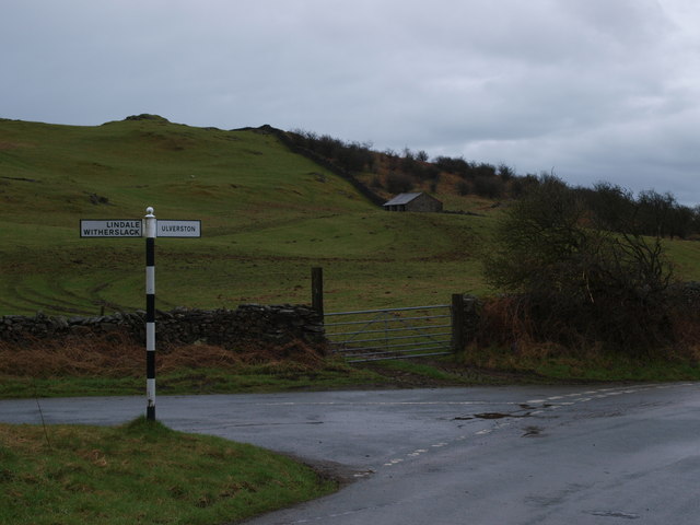
Show on map Photos Junction Height Road and Tow Top Road
‹ ›
Weather for this location Next 14 days Nearby places Useful places within 5 km
All Historic
Own or manage this place?
Claim this listing to keep details accurate, add photos, and highlight what makes it special — free.
Claim this page→ How useful was the information on this page?
Something wrong on this page?
id: f3c197df-e39b-4385-872d-f1dfcacc8b9a
UK green spaces mapped from open public data — so anyone can find the woodland, trail, or nature reserve closest to them.
© 2026 Glade · Made with care for UK green spaces
Events & activities nearby Switch provider to compare local events, tours and bookable activities.
Bookable tours GetYourGuide Promote here
Wildlife to spot
9,912 records · National Biodiversity Network
▾
Wildlife to spot 9,912 records · National Biodiversity Network Chaffinch · Mistle Thrush · Blackbird · Redwing · Goldfinch +34
Chaffinch Fringilla coelebs Mistle Thrush Turdus viscivorus Blackbird Turdus merula Redwing Turdus iliacus Goldfinch Carduelis carduelis Long-tailed Tit Aegithalos caudatus Jackdaw Coloeus monedula Woodpigeon Columba palumbus Nuthatch Sitta europaea Carrion Crow Corvus corone Robin Erithacus rubecula Great Spotted Woodpecker Dendrocopos major Bullfinch Pyrrhula pyrrhula Blue Tit Cyanistes caeruleus Dunnock Prunella modularis Coal Tit Periparus ater Green Woodpecker Picus viridis Goldcrest Regulus regulus Pheasant Phasianus colchicus Greenfinch Chloris chloris Marsh Tit Poecile palustris Meadow Pipit Anthus pratensis Siskin Spinus spinus Great Tit Parus major Jay Garrulus glandarius Stock Dove Columba oenas Raven Corvus corax Lesser Black-backed Gull Larus fuscus Magpie Pica pica Wren Troglodytes troglodytes Fieldfare Turdus pilaris Song Thrush Turdus philomelos Rook Corvus frugilegus Collared Dove Streptopelia decaocto Canada Goose Branta canadensis Pied Wagtail Motacilla alba yarrellii Starling Sturnus vulgaris Cormorant Phalacrocorax carbo Snipe Gallinago gallinago Badger
Common Pouchwort · Papillose Bog-moss · Flat-topped Bog-moss · Ulota crispa · Flat Neckera +96
Common Pouchwort Calypogeia fissa Papillose Bog-moss Sphagnum papillosum Flat-topped Bog-moss Sphagnum fallax Ulota crispa Ulota crispa Flat Neckera Neckera complanata Rusty Swan-neck Moss Campylopus flexuosus Dwarf Swan-neck Moss Species observations from the last 10 years via NBN Atlas
Campylopus pyriformis
Campylopus pyriformis
Bog Groove-moss Aulacomnium palustre
Bog Groove-moss Aulacomnium palustre
Hart's-tongue Thyme-moss Plagiomnium undulatum
Hart's-tongue Thyme-moss Plagiomnium undulatum
Soft Bog-moss Sphagnum tenellum
Soft Bog-moss Sphagnum tenellum
Bank Haircap Polytrichum formosum
Bank Haircap Polytrichum formosum
Lustrous Bog-moss Sphagnum subnitens
Lustrous Bog-moss Sphagnum subnitens
Lateral Cryphaea Cryphaea heteromalla
Lateral Cryphaea Cryphaea heteromalla
Chalk Comb-moss Ctenidium molluscum
Chalk Comb-moss Ctenidium molluscum
Jagged Germanderwort Riccardia chamedryfolia
Jagged Germanderwort Riccardia chamedryfolia
Floating Hook-moss Warnstorfia fluitans
Floating Hook-moss Warnstorfia fluitans
Rambling Tail-moss Anomodon viticulosus
Rambling Tail-moss Anomodon viticulosus
Even Scalewort Radula complanata
Even Scalewort Radula complanata
Forcipated Pincerwort Cephalozia connivens
Forcipated Pincerwort Cephalozia connivens
Common Threadwort Cephaloziella divaricata
Common Threadwort Cephaloziella divaricata
Feathery Bog-moss Sphagnum cuspidatum
Feathery Bog-moss Sphagnum cuspidatum
Red-stemmed Feather-moss Pleurozium schreberi
Red-stemmed Feather-moss Pleurozium schreberi
Bifid Crestwort Lophocolea bidentata
Bifid Crestwort Lophocolea bidentata
Silky Wall Feather-moss Homalothecium sericeum
Silky Wall Feather-moss Homalothecium sericeum
Common Tamarisk-moss Thuidium tamariscinum
Common Tamarisk-moss Thuidium tamariscinum
Rough-stalked Feather-moss Brachythecium rutabulum
Rough-stalked Feather-moss Brachythecium rutabulum
Frizzled Pincushion Plenogemma phyllantha
Frizzled Pincushion Plenogemma phyllantha
Slender Mouse-tail Moss Isothecium myosuroides
Slender Mouse-tail Moss Isothecium myosuroides
Strict Haircap Polytrichum strictum
Strict Haircap Polytrichum strictum
Tumid Notchwort Lophozia ventricosa
Tumid Notchwort Lophozia ventricosa
Polytrichum commune s.str. Polytrichum commune s.str.
Polytrichum commune s.str. Polytrichum commune s.str.
Thickpoint Grimmia Schistidium crassipilum
Thickpoint Grimmia Schistidium crassipilum
Lesser Yoke-moss Zygodon conoideus
Lesser Yoke-moss Zygodon conoideus
Bog-moss Flapwort Odontoschisma sphagni
Bog-moss Flapwort Odontoschisma sphagni
Elegant Bristle-moss Orthotrichum pulchellum
Elegant Bristle-moss Orthotrichum pulchellum
Hypnum cupressiforme var. cupressiforme Hypnum cupressiforme var. cupressiforme
Hypnum cupressiforme var. cupressiforme Hypnum cupressiforme var. cupressiforme
Velvet Feather-moss Brachytheciastrum velutinum
Velvet Feather-moss Brachytheciastrum velutinum
Wood Bristle-moss Lewinskya affinis
Wood Bristle-moss Lewinskya affinis
Minute Pouncewort Myriocoleopsis minutissima
Minute Pouncewort Myriocoleopsis minutissima
Blunt-leaved Bog-moss Sphagnum palustre
Blunt-leaved Bog-moss Sphagnum palustre
Red Bog-moss Sphagnum rubellum
Red Bog-moss Sphagnum rubellum
Barbilophozia Barbilophozia
Barbilophozia Barbilophozia
Swan's-neck Thyme-moss Mnium hornum
Swan's-neck Thyme-moss Mnium hornum
Dilated Scalewort Frullania dilatata
Dilated Scalewort Frullania dilatata
Fringed Bog-moss Sphagnum fimbriatum
Fringed Bog-moss Sphagnum fimbriatum
Neat Feather-moss Pseudoscleropodium purum
Neat Feather-moss Pseudoscleropodium purum
Juniper Haircap Polytrichum juniperinum
Juniper Haircap Polytrichum juniperinum
Forked Veilwort Metzgeria furcata
Forked Veilwort Metzgeria furcata
Lyell's Bristle-moss Pulvigera lyellii
Lyell's Bristle-moss Pulvigera lyellii
Heath Plait-moss Hypnum jutlandicum
Heath Plait-moss Hypnum jutlandicum
Broom Fork-moss Dicranum scoparium
Broom Fork-moss Dicranum scoparium
Dandelion Taraxacum2025
Dandelion Taraxacum2025
Common Ragwort Jacobaea vulgaris2025
Common Ragwort Jacobaea vulgaris2025
Sycamore Acer pseudoplatanus2025
Sycamore Acer pseudoplatanus2025
Soft-rush Juncus effusus2025
Soft-rush Juncus effusus2025
Rosebay Willowherb Chamaenerion angustifolium2025
Rosebay Willowherb Chamaenerion angustifolium2025
Daisy Bellis perennis2025
Daisy Bellis perennis2025
Common Nettle Urtica dioica2025
Common Nettle Urtica dioica2025
Ribwort Plantain Plantago lanceolata2025
Ribwort Plantain Plantago lanceolata2025
Petty Spurge Euphorbia peplus2025
Petty Spurge Euphorbia peplus2025
Red Campion Silene dioica2025
Red Campion Silene dioica2025
Shining Crane's-bill Geranium lucidum2025
Shining Crane's-bill Geranium lucidum2025
Ash Fraxinus excelsior2025
Ash Fraxinus excelsior2025
Ivy-leaved Toadflax Cymbalaria muralis2025
Ivy-leaved Toadflax Cymbalaria muralis2025
Cock's-foot Dactylis glomerata2025
Cock's-foot Dactylis glomerata2025
Common Sorrel Rumex acetosa2025
Common Sorrel Rumex acetosa2025
Elder Sambucus nigra2025
Elder Sambucus nigra2025
Common Knapweed Centaurea nigra2025
Common Knapweed Centaurea nigra2025
Foxglove Digitalis purpurea2025
Foxglove Digitalis purpurea2025
Bracken Pteridium aquilinum2025
Bracken Pteridium aquilinum2025
Beech Fagus sylvatica2025
Beech Fagus sylvatica2025
Dryopteris filix-mas Dryopteris filix-mas2025
Dryopteris filix-mas Dryopteris filix-mas2025
Polypody Polypodium vulgare2025
Polypody Polypodium vulgare2025
Herb-Robert Geranium robertianum2025
Herb-Robert Geranium robertianum2025
Hawthorn Crataegus monogyna2025
Hawthorn Crataegus monogyna2025
Dog's Mercury Mercurialis perennis2025
Dog's Mercury Mercurialis perennis2025
Cleavers Galium aparine2025
Cleavers Galium aparine2025
Maidenhair Spleenwort Asplenium trichomanes2025
Maidenhair Spleenwort Asplenium trichomanes2025
Hogweed Heracleum sphondylium2025
Hogweed Heracleum sphondylium2025
Spear Thistle Cirsium vulgare2025
Spear Thistle Cirsium vulgare2025
Sessile Oak Quercus petraea2025
Sessile Oak Quercus petraea2025
Broad Buckler-fern Dryopteris dilatata2025
Broad Buckler-fern Dryopteris dilatata2025
Common Bistort Bistorta officinalis2025
Common Bistort Bistorta officinalis2025
Bramble Rubus fruticosus2025
Bramble Rubus fruticosus2025
Sitka Spruce Picea sitchensis2025
Sitka Spruce Picea sitchensis2025
Smooth Sow-thistle Sonchus oleraceus2025
Smooth Sow-thistle Sonchus oleraceus2025
Cow Parsley Anthriscus sylvestris2025
Cow Parsley Anthriscus sylvestris2025
Yew Taxus baccata2025
Yew Taxus baccata2025
Ivy Hedera helix2025
Ivy Hedera helix2025
Hazel Corylus avellana2025
Hazel Corylus avellana2025
Creeping Bent Agrostis stolonifera2025
Creeping Bent Agrostis stolonifera2025
Holly Ilex aquifolium2025
Holly Ilex aquifolium2025
Broad-leaved Dock Rumex obtusifolius2025
Broad-leaved Dock Rumex obtusifolius2025
Downy Birch Betula pubescens2025
Downy Birch Betula pubescens2025
Wood Avens Geum urbanum2025
Wood Avens Geum urbanum2025
Wall-rue Asplenium ruta-muraria2025
Wall-rue Asplenium ruta-muraria2025
Hart's-Tongue Asplenium scolopendrium2025
Hart's-Tongue Asplenium scolopendrium2025
Blackthorn Prunus spinosa2025
Blackthorn Prunus spinosa2025
Gorse Ulex europaeus2025
Gorse Ulex europaeus2025
Creeping Buttercup Ranunculus repens2025
Creeping Buttercup Ranunculus repens2025
Cotoneaster Cotoneaster2025
Cotoneaster Cotoneaster2025