Plan your visit
Getting here
54.18366, -2.79298
Visiting this summer
Seasonal nature notes and what to look for now
Visiting this summer
Seasonal nature notes and what to look for now
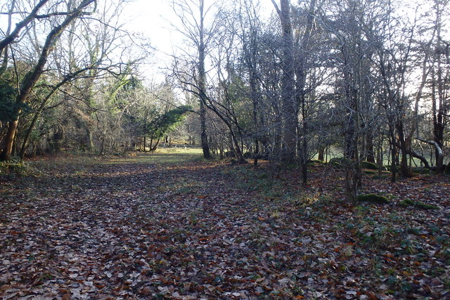
- ☀️June — canopy now fully closed, creating cool dappled shade even on warm days
- 🐕Early mornings are best for dog walks in summer — visit before 9am to avoid the heat and find quieter trails
- 🅿️Eaves Wood Car Park 474m away — 4 car parks within reach
🌤️ Visiting this summer
- ☀️June — canopy now fully closed, creating cool dappled shade even on warm days
- 🐕Early mornings are best for dog walks in summer — visit before 9am to avoid the heat and find quieter trails
- 🅿️Eaves Wood Car Park 474m away — 4 car parks within reach
Good to know
- £Free to visit — no entry charge
- 🐕Dogs welcome
- 🌿Ancient woodland — rare wildlife habitat
- 🌳Large woodland — room to roam
Best for
Bird watching
Very strong match
Reedbeds — bitterns, marsh harriers, bearded tits and reed warblers; Birds — Shoveler, Wigeon, Gadwall +80 more · last seen 2026
Wildlife
Very strong match
Multi-group wildlife — Amphibians, Birds, Mammals; Multi-group wildlife — Amphibians, Birds, Mammals
Seasonal nature
Strong match
Ancient woodland — bluebells, fungi and autumn colour; Plants — Maidenhair Spleenwort, Yellow Iris, Ground-elder +8 more · last seen 2026
Insect spotting
Strong match
Chalk and limestone grassland — chalkhill blue, adonis blue and rare moths; Insects — Eristalis pertinax, Carabus problematicus · last seen 2026
Dog walks
Strong match
Dogs allowed — public woodland
Waterside walks
Strong match
Lakeside priority habitat
Trails nearby
Within roughly 5 km🚶Walking
8 signed routes nearby · 47 public paths nearby
Signed route nearbyPublic paths
Walking
Cumbria Coastal WayWalking route298 km
Storth TrailWalking route
Arnside Knott Circular Walk, Arnside/SilverdaleWalking route2.7 km
Arnside Knott is renowned for its wildlife. Take this circular walk to admire views of the surrounding countryside and enjoy the sights and sounds along the route. Uneven terrain and loose path surfaces.
Arnside Knott Tramper Trail, Arnside/SilverdaleWalking route1.6 km
Short RouteWalking route1.1 km
Moss Lanepublic footpath · 64 m
Moss Lanepublic footpath · 9 m
Dogslack Wellpublic footpath · 334 m
🚴Cycling
41 signed routes nearby
Signed route nearby
Cycling
Walney to Wear Cycle RouteCycling route
Route 6Cycling route
Lancashire Cycleway (Northern Loop)Cycling route
Lakes & Dales LoopCycling route
Bay Cycle WayCycling route132 km
Main RouteCycling route596 m
🐴Horse riding
9 public paths nearby
Public paths
Horse riding
Dollywood Lanebyway open to all traffic · 785 m
Wildlife to spot
Photos
Weather for this location
Loading local forecast…
Nearby places
Useful places within 5 km
How was your visit?
How useful was the information on this page?
id: 1cfc6d14-3fb8-44eb-8a4a-093278b1e067