🦉 Wildlife🦅 Birds🧺 Picnic
↑ Share
Public access Free entry Dogs welcome
Places › England › South West › Bath and North East Somerset Getting here
51.37999, -2.38367
Open directionsv Visiting this summer
Seasonal nature notes and what to look for now
▾ 🌞 Midsummer — early morning visits most comfortable; look for deer fawns in quieter clearings 🧺 Good picnic destination in summer — open space and facilities for a relaxed day out 🐕 Dogs welcome — bring water in summer; the site has enough space to find shade on hot days 🌤️ Visiting this summer
🌞 Midsummer — early morning visits most comfortable; look for deer fawns in quieter clearings 🧺 Good picnic destination in summer — open space and facilities for a relaxed day out 🐕 Dogs welcome — bring water in summer; the site has enough space to find shade on hot days £ Free to visit — no entry charge🐕 Dogs welcome🚲 Bike parking🅿️ Parking· Paid 🧺 Picnic spot
🦉 Wildlife
Very strong match
Multi-group wildlife — Amphibians, Birds, Mammals, Reptiles; Multi-group wildlife — Amphibians, Birds, Mammals, Reptiles
Free
🦅 Bird watching
Very strong match
Birds — Robin, Blackcap, Woodpigeon +53 more · last seen 2026; Birds — Robin, Blackcap, Woodpigeon +53 more · last seen 2026
Free
🧺 Picnic day out
Strong match
picnic area, car park
Free
🦋 Insect spotting
Strong match
Insects — Dark-edged Bee-fly, 7-spot Ladybird, Marmalade Hoverfly +110 more · last seen 2026; Insects — Dark-edged Bee-fly, 7-spot Ladybird, Marmalade Hoverfly +110 more · last seen 2026
Free
Named cycling route nearby: Two Tunnels Greenway
Varies
Dogs allowed with public access
Free
Trails nearby Within roughly 5 km 6 signed routes nearby · 49 public paths nearby
Signed route nearby Public paths
Monarch's Way Walking route 990 km ▾
approximate route of Charles II's escape
Named route Ref MW Length 990 km Regional walking route
Show on map Bath Skyline Walk Walking route 9.6 km ▾
An elevated clockwise circular with panoramic views of the Bath landscape. The contrast of the city, so close to this rural haven, has earned the area World Heritage Site status. Roads, surfaced paths, steep hills, a rocky uneven section, steps & a stile.
Named route Ref BS Length 9.6 km Duration 03:30-04:00 Round trip Local walking route
Show on map Limestone Link Walking route 58 km ▾
Named route Ref LL Length 58 km Regional walking route
Show on map Kennet and Avon Canal Trail Walking route 140 km ▾
Rivers linked by a canal. The name refers to the entire navigable length. From Bristol the way is the Avon. The canal is from Bath to Newbury. From there to Reading the way is the Kennet. 53 locks to Summit Pound (150 m asl) and 54 down to Reading.
Named route Ref K&A Length 140 km Regional walking route
Show on map Cotswold Way Walking route 164 km ▾
Named route Ref CW Length 164 km National walking route
Show on map Claude Vale public footpath · 74 m ▾
Public path public footpath Length 74 m Surface gravel Path type: service
Show on map Bath-Bristol Cycle-track public footpath · 472 m ▾
Public path public footpath Length 472 m Surface asphalt Path type: cycleway
Show on map Rooksbridge Walk public footpath · 10 m ▾
Public path public footpath Length 10 m Surface asphalt Path type: footway
Show on map 127 signed routes nearby
Signed route nearby
Bath Two Tunnels Circuit Cycling route ▾
Named route Local cycle route
Show on map Avon Cycleway Cycling route ▾
Named route Regional cycle route
Show on map Route 24 Cycling route ▾
Named route Ref 24 National Cycle Network
Show on map Bristol & Bath Railway Path Cycling route ▾
Named route Ref B&BRP Local cycle route
Show on map EuroVelo 2 - Capitals Route - part United Kingdom 4 Cycling route ▾
Named route Ref EV2 International cycle route
Show on map Colliers Way Cycling route ▾
Named route Local cycle route
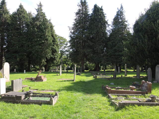
Show on map Photos Tall conifers in Twerton cemetery
‹ ›
Weather for this location Next 14 days Nearby places Useful places within 5 km
All Historic
Own or manage this place?
Claim this listing to keep details accurate, add photos, and highlight what makes it special — free.
Claim this page→ How useful was the information on this page?
Something wrong on this page?
id: 192d3532-5f11-4a4d-b550-a4d2f5742a4a
UK green spaces mapped from open public data — so anyone can find the woodland, trail, or nature reserve closest to them.
© 2026 Glade · Made with care for UK green spaces
Wildlife to spot
102,411 records · National Biodiversity Network
▾
Wildlife to spot 102,411 records · National Biodiversity Network 🐦 Birds 38 species
autumn winter
2026 ▾
Robin · Woodpigeon · Magpie · Great Tit · Blue Tit +33
Robin Erithacus rubecula Woodpigeon Columba palumbus Magpie Pica pica2025 Great Tit Parus major Blue Tit Cyanistes caeruleus2025 Dunnock Prunella modularis Jackdaw Coloeus monedula Blackbird Turdus merula2025 Goldfinch Carduelis carduelis2025 Jay Garrulus glandarius Pied Wagtail Motacilla alba2025 Herring Gull Larus argentatus2025 Rock Dove Columba livia2025 Carrion Crow Corvus corone2025 Mute Swan Cygnus olor Collared Dove Streptopelia decaocto2025 Blackcap Sylvia atricapilla2025 House Sparrow Passer domesticus Black-headed Gull Chroicocephalus ridibundus2025 Lesser Black-backed Gull Larus fuscus2025 Chaffinch Fringilla coelebs2025 Long-tailed Tit Aegithalos caudatus2025 Goldcrest Regulus regulus2025 Wren Troglodytes troglodytes2025 Cormorant Phalacrocorax carbo2025 Chiffchaff Phylloscopus collybita2025 Grey Wagtail Motacilla cinerea2025 Starling Sturnus vulgaris2025 Mallard Anas platyrhynchos Great Spotted Woodpecker Dendrocopos major2025 Woodcock Scolopax rusticola2025 Tawny Owl Strix aluco2025 Sylvia atricapilla atricapilla Sylvia atricapilla atricapilla2025 Peregrine Falco peregrinus2025 Raven Corvus corax2025 Greenfinch Chloris chloris2025 Grey Heron Ardea cinerea2025 Moorhen Gallinula chloropus2025 Feral Cat · Grey Squirrel
Feral Cat Felis catus Grey Squirrel Sciurus carolinensis Dark-edged Bee-fly · Hawthorn Shieldbug · Southern Green Shieldbug · Dark Bush-cricket · Scathophaga stercoraria +21
Dark-edged Bee-fly Bombylius major Hawthorn Shieldbug Acanthosoma haemorrhoidale2025 Southern Green Shieldbug Nezara viridula2025 Dark Bush-cricket Pholidoptera griseoaptera2025 Scathophaga stercoraria Scathophaga stercoraria Dotted Bee-fly Bombylius discolor Common Feather-moss
Common Feather-moss Kindbergia praelonga Species observations from the last 10 years via NBN Atlas
Meliscaeva auricollis Meliscaeva auricollis
Meliscaeva auricollis Meliscaeva auricollis
Mocydia crocea Mocydia crocea
Mocydia crocea Mocydia crocea
Stenagostus rhombeus Stenagostus rhombeus
Stenagostus rhombeus Stenagostus rhombeus
Large Willow Aphid Tuberolachnus (Tuberolachnus) salignus2025
Large Willow Aphid Tuberolachnus (Tuberolachnus) salignus2025
Brown Marmorated Stink Bug Halyomorpha halys2025
Brown Marmorated Stink Bug Halyomorpha halys2025
Spotted-winged Drosophila Drosophila suzukii2025
Spotted-winged Drosophila Drosophila suzukii2025
Southern Oak Bush-cricket Meconema meridionale2025
Southern Oak Bush-cricket Meconema meridionale2025
Valenzuela flavidus Valenzuela flavidus2025
Valenzuela flavidus Valenzuela flavidus2025
Western Conifer Seed Bug Leptoglossus occidentalis2025
Western Conifer Seed Bug Leptoglossus occidentalis2025
Oedemera femoralis Oedemera femoralis2025
Oedemera femoralis Oedemera femoralis2025
Sitona suturalis Sitona suturalis2025
Sitona suturalis Sitona suturalis2025
Hairy Shieldbug Dolycoris baccarum2025
Hairy Shieldbug Dolycoris baccarum2025
Parent Bug Elasmucha grisea2025
Parent Bug Elasmucha grisea2025
Batman Hoverfly Myathropa florea2025
Batman Hoverfly Myathropa florea2025
Green Shieldbug Palomena prasina2025
Green Shieldbug Palomena prasina2025
Marmalade Hoverfly Episyrphus balteatus2025
Marmalade Hoverfly Episyrphus balteatus2025
Rugged Oil-beetle Meloe rugosus2025
Rugged Oil-beetle Meloe rugosus2025
Woundwort Shieldbug Eysarcoris venustissimus2025
Woundwort Shieldbug Eysarcoris venustissimus2025
7-spot Ladybird Coccinella septempunctata2025
7-spot Ladybird Coccinella septempunctata2025
Helophilus pendulus Helophilus pendulus2025
Helophilus pendulus Helophilus pendulus2025 Events & activities nearby Switch provider to compare local events, tours and bookable activities.
Bookable tours GetYourGuide Promote here