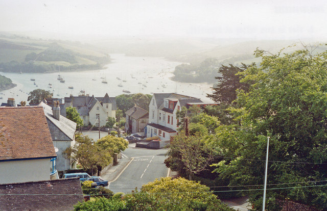
Twomeads
Getting here
50.23657, -3.77509
Visiting this summer
Seasonal nature notes and what to look for now
Visiting this summer
Seasonal nature notes and what to look for now
- 🌞Midsummer — early morning visits most comfortable; look for deer fawns in quieter clearings
- ⚽Playing fields is at its best in summer here
- 🛝Playground 226m away — built-in entertainment for younger visitors alongside the wider site
🌤️ Visiting this summer
- 🌞Midsummer — early morning visits most comfortable; look for deer fawns in quieter clearings
- ⚽Playing fields is at its best in summer here
- 🛝Playground 226m away — built-in entertainment for younger visitors alongside the wider site
Good to know
- 🐕Dogs welcome
Best for
Wildlife
Very strong match
Multi-group wildlife — Birds, Mammals, Reptiles; Multi-group wildlife — Birds, Mammals, Reptiles
Bird watching
Very strong match
Birds — Herring Gull, Great Black-backed Gull, Grey Heron +75 more · last seen 2025; Birds — Herring Gull, Great Black-backed Gull, Grey Heron +75 more · last seen 2025
Playing fields
Very strong match
Playing field
Insect spotting
Strong match
Insects — 7-spot Ladybird, Dock Bug, Green Shieldbug +82 more · last seen 2026; Insects — 7-spot Ladybird, Dock Bug, Green Shieldbug +82 more · last seen 2026
Playgrounds
Strong match
playground, parking
Family friendly
Strong match
playground; Playing field
Trails nearby
Within roughly 5 km🚶Walking
2 signed routes nearby · 16 public paths nearby
Signed route nearbyPublic paths
Walking
South West Coast Path (Section 38: Bigbury on Sea to Salcombe)Walking route
South West Coast Path (Section 39: Salcombe to Torcross)Walking route
Kingsale Roadpublic footpath · 63 m
Fortescue Roadpublic footpath · 68 m
Penny's Hillpublic footpath · 84 m
🚴Cycling
32 signed routes nearby
Signed route nearby
Cycling
Route 28Cycling route
Alternative RouteCycling route17 m
Main RouteCycling route165 m
Main RouteCycling route11 m
Main RouteCycling route90 m
Main RouteCycling route841 m
🐴Horse riding
2 public paths nearby
Public paths
Horse riding
No named routes yet. Public paths are shown on the map.
Wildlife to spot
Photos
Weather for this location
Loading local forecast…
Nearby places
Useful places within 5 km
Own or manage this place?
Claim this listing to keep details accurate, add photos, and highlight what makes it special — free.
Claim this pageHow was your visit?
How useful was the information on this page?
id: 61e919f1-45bb-4380-b1fb-3454a2f82de8