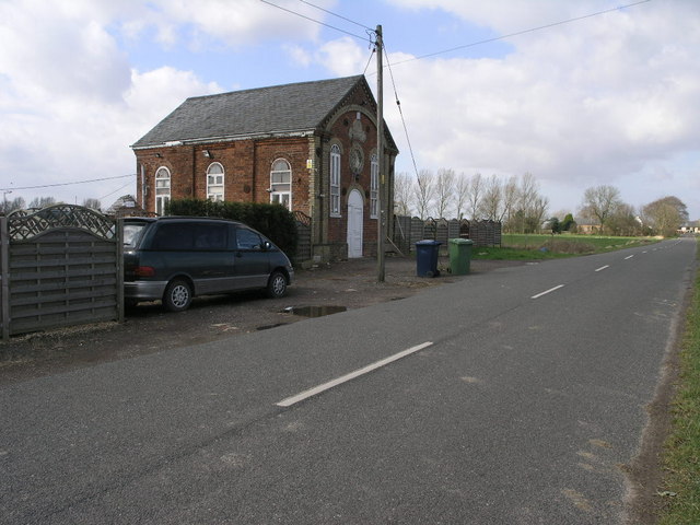
Tydd Fen Methodist Church
Plan your visit
🦅 Birds🦉 Wildlife🦋 Insects
Public access Free entry Dogs welcome
Places › England › Eastern › Fenland Getting here
52.71948, 0.05687
Open directionsv Visiting this summer
Seasonal nature notes and what to look for now
▾ 🐦 61+ species recorded in this area — summer evenings are best for activity; watch for House Sparrow and Blackbird 🐕 Early mornings are best for dog walks in summer — visit before 9am to avoid the heat and find quieter trails 📍 Open access throughout summer — no booking required 🌤️ Visiting this summer
🐦 61+ species recorded in this area — summer evenings are best for activity; watch for House Sparrow and Blackbird 🐕 Early mornings are best for dog walks in summer — visit before 9am to avoid the heat and find quieter trails 📍 Open access throughout summer — no booking required £ Free to visit — no entry charge🐕 Dogs welcome🦅 Bird watching
Very strong match
Birds — House Sparrow, Blackbird, Chaffinch +58 more · last seen 2025; Birds — House Sparrow, Blackbird, Chaffinch +58 more · last seen 2025
Free
🦉 Wildlife
Very strong match
Multi-group wildlife — Birds, Mammals; Multi-group wildlife — Birds, Mammals
Free
🦋 Insect spotting
Strong match
Insects — Large White, Small Tortoiseshell, Pea-leaf Weevil +22 more · last seen 2019; Insects — Large White, Small Tortoiseshell, Pea-leaf Weevil +22 more · last seen 2019
Free
Dogs allowed with public access
Free
🍂 Seasonal nature
Good match
Plants — Dilated Scalewort, Marchantia polymorpha subsp. ruderalis · last seen 2017; Plants — Dilated Scalewort, Marchantia polymorpha subsp. ruderalis · last seen 2017
Free
Religious grounds — local heritage
Free
Trails nearby Within roughly 5 km 1 signed route nearby
Signed route nearby
Greenwich Meridian Trail Walking route 440 km ▾
A long-distance walk that follows the line of the Prime Meridian. Inaugurated in 2009, to coincide with the 125th anniversary of the Greenwich Meridian.
Named route Ref GMT Length 440 km Regional walking route
Show on map 12 signed routes nearby
Signed route nearby
EuroVelo 12 - North Sea Cycle Route - part United Kingdom 2 Cycling route ▾
Norwich - Lincoln
Named route Ref EV12 International cycle route
Show on map Route 1 Cycling route ▾
NCN 1 King's Lynn to Boston
Named route Ref 1 National Cycle Network
Show on map Main Route Cycling route 516 m ▾
Named route Ref 1 Length 516 m National Cycle Network On-road Surface asphalt
Show on map Main Route Cycling route 956 m ▾
Named route Ref 1 Length 956 m National Cycle Network On-road Surface asphalt
Show on map Main Route Cycling route 1.3 km ▾
Named route Ref 1 Length 1.3 km National Cycle Network On-road Surface asphalt
Show on map Main Route Cycling route 862 m ▾
Named route Ref 1 Length 862 m National Cycle Network On-road Surface asphalt
Show on map 1 public path nearby
Public paths
Bottle Lane byway open to all traffic · 514 m ▾
Public path byway open to all traffic Length 514 m Surface compacted Path type: track
Show on map
Weather for this location Next 14 days Nearby places Useful places within 5 km
All Historic
Own or manage this place?
Claim this listing to keep details accurate, add photos, and highlight what makes it special — free.
Claim this page→ How useful was the information on this page?
id: d9401ade-f0c8-400e-b7cf-3fdd6ff882d2
UK green spaces mapped from open public data — so anyone can find the woodland, trail, or nature reserve closest to them.
© 2026 Glade · Made with care for UK green spaces
Wildlife to spot
1,462 records · National Biodiversity Network
▾
Wildlife to spot 1,462 records · National Biodiversity Network 🐦 Birds 4 species
spring summer winter
2025 ▾
Barn Owl · Kestrel · Avocet · Swift
Barn Owl Tyto alba Kestrel Falco tinnunculus2024 Avocet Recurvirostra avosetta2023 Swift Apus apus2022 Roe Deer · Hedgehog
Roe Deer Capreolus capreolus Hedgehog Erinaceus europaeus2020 🐝 Insects 20 species
spring summer
2019 ▾
Pea-leaf Weevil · Atheta longicornis · Sepedophilus marshami · Nehemitropia lividipennis · Aleochara lanuginosa +15
Pea-leaf Weevil Sitona lineatus Atheta longicornis Atheta longicornis Sepedophilus marshami Sepedophilus marshami Nehemitropia lividipennis Nehemitropia lividipennis Aleochara lanuginosa Aleochara lanuginosa Tachyporus hypnorum Tachyporus hypnorum Silverweed · Square-stalked Willowherb · Dilated Scalewort · Creeping Buttercup · Red Dead-nettle +143
Silverweed Potentilla anserina2016 Square-stalked Willowherb Epilobium tetragonum2016 Dilated Scalewort Frullania dilatata Creeping Buttercup Ranunculus repens2016 Red Dead-nettle Lamium purpureum2016 Broad-leaved Dock Rumex obtusifolius Species observations from the last 10 years via NBN Atlas
Gyrohypnus fracticornis Gyrohypnus fracticornis
Gyrohypnus fracticornis Gyrohypnus fracticornis
Philonthus albipes Philonthus albipes
Philonthus albipes Philonthus albipes
Rugilus orbiculatus Rugilus orbiculatus
Rugilus orbiculatus Rugilus orbiculatus
Omalium rivulare Omalium rivulare
Omalium rivulare Omalium rivulare
Cercyon haemorrhoidalis Cercyon haemorrhoidalis
Cercyon haemorrhoidalis Cercyon haemorrhoidalis
Quedius cruentus Quedius cruentus
Quedius cruentus Quedius cruentus
Common Blue Polyommatus icarus2017
Common Blue Polyommatus icarus2017
Meadow Brown Maniola jurtina2017
Meadow Brown Maniola jurtina2017
Large Skipper Ochlodes sylvanus2017
Large Skipper Ochlodes sylvanus2017
Large White Pieris brassicae2017
Large White Pieris brassicae2017
Speckled Wood Pararge aegeria2017
Speckled Wood Pararge aegeria2017
Gatekeeper Pyronia tithonus2017
Gatekeeper Pyronia tithonus2017
Small White Pieris rapae2017
Small White Pieris rapae2017
Small Tortoiseshell Aglais urticae2017
Small Tortoiseshell Aglais urticae2017 2016
2016
White Clover Trifolium repens2016
White Clover Trifolium repens2016
Ribwort Plantain Plantago lanceolata2016
Ribwort Plantain Plantago lanceolata2016
Thyme-leaved Speedwell Veronica serpyllifolia2016
Thyme-leaved Speedwell Veronica serpyllifolia2016
Upright Hedge-parsley Torilis japonica2016
Upright Hedge-parsley Torilis japonica2016
Field Horsetail Equisetum arvense2016
Field Horsetail Equisetum arvense2016
Hoary Ragwort Jacobaea erucifolia2016
Hoary Ragwort Jacobaea erucifolia2016
Greater Pond-sedge Carex riparia2016
Greater Pond-sedge Carex riparia2016
Pale Persicaria Persicaria lapathifolia2016
Pale Persicaria Persicaria lapathifolia2016
Hoary Willowherb Epilobium parviflorum2016
Hoary Willowherb Epilobium parviflorum2016
Common Couch Elymus repens2016
Common Couch Elymus repens2016
Black-bindweed Fallopia convolvulus2016
Black-bindweed Fallopia convolvulus2016
Dandelion Taraxacum2016
Dandelion Taraxacum2016
Cut-leaved Dead-nettle Lamium hybridum2016
Cut-leaved Dead-nettle Lamium hybridum2016
Smooth Sow-thistle Sonchus oleraceus2016
Smooth Sow-thistle Sonchus oleraceus2016
Small-flowered Crane's-bill Geranium pusillum2016
Small-flowered Crane's-bill Geranium pusillum2016
Field Maple Acer campestre2016
Field Maple Acer campestre2016
Cut-leaved Crane's-bill Geranium dissectum2016
Cut-leaved Crane's-bill Geranium dissectum2016
Cornus sanguinea subsp. australis Cornus sanguinea subsp. australis2016
Cornus sanguinea subsp. australis Cornus sanguinea subsp. australis2016
Hedge Woundwort Stachys sylvatica2016
Hedge Woundwort Stachys sylvatica2016
Autumn Hawkbit Scorzoneroides autumnalis2016
Autumn Hawkbit Scorzoneroides autumnalis2016
Crataegus monogyna x rhipidophylla = C. x subsphaerica Crataegus monogyna x rhipidophylla = C. x subsphaerica2016
Crataegus monogyna x rhipidophylla = C. x subsphaerica Crataegus monogyna x rhipidophylla = C. x subsphaerica2016
Common Field-speedwell Veronica persica2016
Common Field-speedwell Veronica persica2016
Horned Pondweed Zannichellia palustris2016
Horned Pondweed Zannichellia palustris2016
Amphibious Bistort Persicaria amphibia2016
Amphibious Bistort Persicaria amphibia2016
Columbine Aquilegia vulgaris2016
Columbine Aquilegia vulgaris2016
Common Orache Atriplex patula2016
Common Orache Atriplex patula2016
Elder Sambucus nigra2016
Elder Sambucus nigra2016
Scentless Mayweed Tripleurospermum inodorum2016
Scentless Mayweed Tripleurospermum inodorum2016
Wild-oat Avena fatua2016
Wild-oat Avena fatua2016
Lotus corniculatus var. sativus Lotus corniculatus var. sativus2016
Lotus corniculatus var. sativus Lotus corniculatus var. sativus2016
Selfheal Prunella vulgaris2016
Selfheal Prunella vulgaris2016
Stinking Iris Iris foetidissima2016
Stinking Iris Iris foetidissima2016
Alder Alnus glutinosa2016
Alder Alnus glutinosa2016
Reflexed Saltmarsh-Grass Puccinellia distans2016
Reflexed Saltmarsh-Grass Puccinellia distans2016
Black Mustard Brassica nigra2016
Black Mustard Brassica nigra2016
Apple Malus domestica2016
Apple Malus domestica2016
Hawthorn Crataegus monogyna2016
Hawthorn Crataegus monogyna2016
Calystegia sepium subsp. sepium f. colorata Calystegia sepium subsp. sepium f. colorata2016
Calystegia sepium subsp. sepium f. colorata Calystegia sepium subsp. sepium f. colorata2016
Common Chickweed Stellaria media2016
Common Chickweed Stellaria media2016
Polygonum aviculare Polygonum aviculare2016
Polygonum aviculare Polygonum aviculare2016
White Dead-nettle Lamium album2016
White Dead-nettle Lamium album2016
Common Poppy Papaver rhoeas2016
Common Poppy Papaver rhoeas2016
Cornfield Knotgrass Polygonum rurivagum2016
Cornfield Knotgrass Polygonum rurivagum2016
Grey Willow Salix cinerea subsp. cinerea2016
Grey Willow Salix cinerea subsp. cinerea2016
White Willow Salix alba2016
White Willow Salix alba2016
Herb-Robert Geranium robertianum2016
Herb-Robert Geranium robertianum2016
Fat-hen Chenopodium album2016
Fat-hen Chenopodium album2016
Sun Spurge Euphorbia helioscopia2016
Sun Spurge Euphorbia helioscopia2016
Small Nettle Urtica urens2016
Small Nettle Urtica urens2016
Purple-loosestrife Lythrum salicaria2016
Purple-loosestrife Lythrum salicaria2016
Rape Brassica napus2016
Rape Brassica napus2016
Black Nightshade Solanum nigrum2016
Black Nightshade Solanum nigrum2016
Broad Bean Vicia faba2016
Broad Bean Vicia faba2016
Redshank Persicaria maculosa2016
Redshank Persicaria maculosa2016
Charlock Sinapis arvensis2016
Charlock Sinapis arvensis2016
Guelder-rose Viburnum opulus2016
Guelder-rose Viburnum opulus2016
Hoary Cress Lepidium draba2016
Hoary Cress Lepidium draba2016
Great Mullein Verbascum thapsus2016
Great Mullein Verbascum thapsus2016
Cornus sanguinea subsp. sanguinea Cornus sanguinea subsp. sanguinea2016
Cornus sanguinea subsp. sanguinea Cornus sanguinea subsp. sanguinea2016
Pedunculate Oak Quercus robur2016
Pedunculate Oak Quercus robur2016
Nipplewort Lapsana communis2016
Nipplewort Lapsana communis2016
Swine-cress Lepidium coronopus2016
Swine-cress Lepidium coronopus2016
Holly Ilex aquifolium2016
Holly Ilex aquifolium2016
Tall Fescue Schedonorus arundinaceus2016
Tall Fescue Schedonorus arundinaceus2016
Fat Duckweed Lemna gibba2016
Fat Duckweed Lemna gibba2016
Chicory Cichorium intybus2016
Chicory Cichorium intybus2016
Crataegus laevigata x monogyna = C. x media Crataegus laevigata x monogyna = C. x media2016
Crataegus laevigata x monogyna = C. x media Crataegus laevigata x monogyna = C. x media2016
Sycamore Acer pseudoplatanus2016
Sycamore Acer pseudoplatanus2016
Groundsel Senecio vulgaris2016
Groundsel Senecio vulgaris2016
Ivy-leaved Duckweed Lemna trisulca2016
Ivy-leaved Duckweed Lemna trisulca2016
Fig-leaved Goosefoot Chenopodium ficifolium2016
Fig-leaved Goosefoot Chenopodium ficifolium2016
Common Reed Phragmites australis2016
Common Reed Phragmites australis2016
Salix caprea x cinerea = S. x reichardtii Salix caprea x cinerea = S. x reichardtii2016
Salix caprea x cinerea = S. x reichardtii Salix caprea x cinerea = S. x reichardtii2016
Duke of Argyll's Teaplant Lycium barbarum2016
Duke of Argyll's Teaplant Lycium barbarum2016
Hemlock Conium maculatum2016
Hemlock Conium maculatum2016
Germander Speedwell Veronica chamaedrys2016
Germander Speedwell Veronica chamaedrys2016
Dog-rose Rosa canina2016
Dog-rose Rosa canina2016
Scented Mayweed Matricaria chamomilla2016
Scented Mayweed Matricaria chamomilla2016
Reed Canary-grass Phalaris arundinacea2016
Reed Canary-grass Phalaris arundinacea2016
Ivy Hedera helix2016
Ivy Hedera helix2016
Giant Blackberry Rubus armeniacus2016
Giant Blackberry Rubus armeniacus2016
Lesser Trefoil Trifolium dubium2016
Lesser Trefoil Trifolium dubium2016
Hard Rush Juncus inflexus2016
Hard Rush Juncus inflexus2016
Raspberry Rubus idaeus2016
Raspberry Rubus idaeus2016
Broad-leaved Osier Salix viminalis x caprea = S. x smithiana2016
Broad-leaved Osier Salix viminalis x caprea = S. x smithiana2016
Rubus conjungens Rubus conjungens2016
Rubus conjungens Rubus conjungens2016
Lesser Sea-spurrey Spergularia marina2016
Lesser Sea-spurrey Spergularia marina2016
Goat Willow Salix caprea2016
Goat Willow Salix caprea2016
Beet Beta vulgaris2016
Beet Beta vulgaris2016
Garlic Mustard Alliaria petiolata2016
Garlic Mustard Alliaria petiolata2016
Bristly Oxtongue Helminthotheca echioides2016
Bristly Oxtongue Helminthotheca echioides2016
Greater Periwinkle Vinca major2016
Greater Periwinkle Vinca major2016
Creeping Comfrey Symphytum grandiflorum2016
Creeping Comfrey Symphytum grandiflorum2016
Garden Honeysuckle Lonicera caprifolium x etrusca = L. x italica2016
Garden Honeysuckle Lonicera caprifolium x etrusca = L. x italica2016
Yew Taxus baccata2016
Yew Taxus baccata2016
Creeping Bent Agrostis stolonifera2016
Creeping Bent Agrostis stolonifera2016
Goat's-beard Tragopogon pratensis2016
Goat's-beard Tragopogon pratensis2016
Toad Rush Juncus bufonius2016
Toad Rush Juncus bufonius2016
Great Bindweed Calystegia sepium subsp. sepium2016
Great Bindweed Calystegia sepium subsp. sepium2016
Calystegia sepium subsp. roseata Calystegia sepium subsp. roseata2016
Calystegia sepium subsp. roseata Calystegia sepium subsp. roseata2016
Rough Hawkbit Leontodon hispidus2016
Rough Hawkbit Leontodon hispidus2016
Large Bindweed Calystegia silvatica2016
Large Bindweed Calystegia silvatica2016
Procumbent Pearlwort Sagina procumbens2016
Procumbent Pearlwort Sagina procumbens2016
Hogweed Heracleum sphondylium2016
Hogweed Heracleum sphondylium2016
Horse-radish Armoracia rusticana2016
Horse-radish Armoracia rusticana2016
Greater Celandine Chelidonium majus2016
Greater Celandine Chelidonium majus2016
Mugwort Artemisia vulgaris2016
Mugwort Artemisia vulgaris2016
American Willowherb Epilobium ciliatum2016
American Willowherb Epilobium ciliatum2016
Ash Fraxinus excelsior2016
Ash Fraxinus excelsior2016
False Oat-grass Arrhenatherum elatius2016
False Oat-grass Arrhenatherum elatius2016
Slender Speedwell Veronica filiformis2016
Slender Speedwell Veronica filiformis2016
Yellow Iris Iris pseudacorus2016
Yellow Iris Iris pseudacorus2016
Hybrid Campion Silene dioica x latifolia = S. x hampeana2016
Hybrid Campion Silene dioica x latifolia = S. x hampeana2016
Broad-leaved Willowherb Epilobium montanum2016
Broad-leaved Willowherb Epilobium montanum2016
White Campion Silene latifolia2016
White Campion Silene latifolia2016
Green Alkanet Pentaglottis sempervirens2016
Green Alkanet Pentaglottis sempervirens2016
Winter Heliotrope Petasites pyrenaicus2016
Winter Heliotrope Petasites pyrenaicus2016
Osier Salix viminalis2016
Osier Salix viminalis2016
Timothy Phleum pratense2016
Timothy Phleum pratense2016
Curled Dock Rumex crispus2016
Curled Dock Rumex crispus2016
Great Willowherb Epilobium hirsutum2016
Great Willowherb Epilobium hirsutum2016
Rosebay Willowherb Chamaenerion angustifolium2016
Rosebay Willowherb Chamaenerion angustifolium2016
Norway Spruce Picea abies2016
Norway Spruce Picea abies2016
Dwarf Mallow Malva neglecta2016
Dwarf Mallow Malva neglecta2016
Perennial Rye-grass Lolium perenne2016
Perennial Rye-grass Lolium perenne2016
Common Mouse-ear Cerastium fontanum2016
Common Mouse-ear Cerastium fontanum2016
Bramble Rubus fruticosus2016
Bramble Rubus fruticosus2016
English Elm Ulmus procera2016
English Elm Ulmus procera2016
Reed Sweet-grass Glyceria maxima2016
Reed Sweet-grass Glyceria maxima2016
Lucerne Medicago sativa subsp. sativa2016
Lucerne Medicago sativa subsp. sativa2016
Common Mallow Malva sylvestris2016
Common Mallow Malva sylvestris2016
Sharp-stipuled Willow Salix triandra x viminalis = S. x mollissima2016
Sharp-stipuled Willow Salix triandra x viminalis = S. x mollissima2016
Common Sorrel Rumex acetosa2016
Common Sorrel Rumex acetosa2016
Fennel Pondweed Stuckenia pectinata2016
Fennel Pondweed Stuckenia pectinata2016
Spear Thistle Cirsium vulgare2016
Spear Thistle Cirsium vulgare2016
Perennial Sow-thistle Sonchus arvensis2016
Perennial Sow-thistle Sonchus arvensis2016
Annual Meadow-grass Poa annua2016
Annual Meadow-grass Poa annua2016
Balm-of-Gilead Populus balsamifera x deltoides = P. x jackii2016
Balm-of-Gilead Populus balsamifera x deltoides = P. x jackii2016
Creeping Thistle Cirsium arvense2016
Creeping Thistle Cirsium arvense2016
Black Horehound Ballota nigra2016
Black Horehound Ballota nigra2016
Henbit Dead-nettle Lamium amplexicaule2016
Henbit Dead-nettle Lamium amplexicaule2016
Cleavers Galium aparine2016
Cleavers Galium aparine2016 Events & activities nearby Switch provider to compare local events, tours and bookable activities.
Bookable tours GetYourGuide Promote here