Plan your visit
🦅Birds🦉Wildlife🎠Play
Public accessPaid entryDogs welcome
Getting here
54.97913, -2.10612
Open directionsv
Visiting this summer
Seasonal nature notes and what to look for now
- 🐦58+ species recorded in this area — summer evenings are best for activity; watch for Blue Tit and Woodpigeon
- ☀️Summer family visits work well here — arrive early and plan for a longer stay
- ☕Cafe Enna — makes this an easy full-day family visit without needing to pack food
🌤️ Visiting this summer
- 🐦58+ species recorded in this area — summer evenings are best for activity; watch for Blue Tit and Woodpigeon
- ☀️Summer family visits work well here — arrive early and plan for a longer stay
- ☕Cafe Enna — makes this an easy full-day family visit without needing to pack food
☕Café🅿️Parking· Free🛝Playground
🦅Bird watching
Very strong match
Birds — Blue Tit, Woodpigeon, Coal Tit +55 more · last seen 2025; Deciduous woodland — woodpeckers, warblers and woodland birds
Free
Birds — Blue Tit, Woodpigeon, Coal Tit +55 more · last seen 2025; Deciduous woodland priority habitat
Free
playground, café, parking
Free
🛝Family friendly
Strong match
playground, café
Free
Dogs allowed with public access
Free
Named cycling route nearby: Hadrian's Cycleway
Varies
Trails nearby
Within roughly 5 km4 signed routes nearby
Signed route nearby
Way of LightWalking route▾
Named routeRegional walking route
Historic Fortifications TrailWalking route▾
Named routeLocal walking route
Historic Dilston TrailWalking route▾
Named routeLocal walking route
Hadrian's Wall PathWalking route134.5 km▾
Named routeLength 134.5 kmNational walking route
20 signed routes nearby
Signed route nearby
Hadrian's CyclewayCycling route▾
Named routeRef 72National Cycle Network
National Byway (County Durham and Northumberland)Cycling route▾
The National Byway route through County Durham and Northumberland
Named routeRef NBRegional cycle route
National Byway Hexham LoopCycling route▾
Named routeRef NBRegional cycle route
Main RouteCycling route20 m▾
Named routeRef 72Length 20 mNational Cycle NetworkOn-roadSurface asphalt
Main RouteCycling route452 m▾
Named routeRef 72Length 452 mNational Cycle NetworkOn-roadSurface asphalt
Main RouteCycling route71 m▾
Named routeRef 72Length 71 mNational Cycle NetworkTraffic-freeSurface asphalt
2 public paths nearby
Public paths
Spital Lanebridleway · 319 m▾
Public pathbridlewayLength 319 mSurface asphaltPath type: service
Spital Lanebridleway · 316 m▾
Public pathbridlewayLength 316 mSurface dirtIncline downPath type: track
Photos
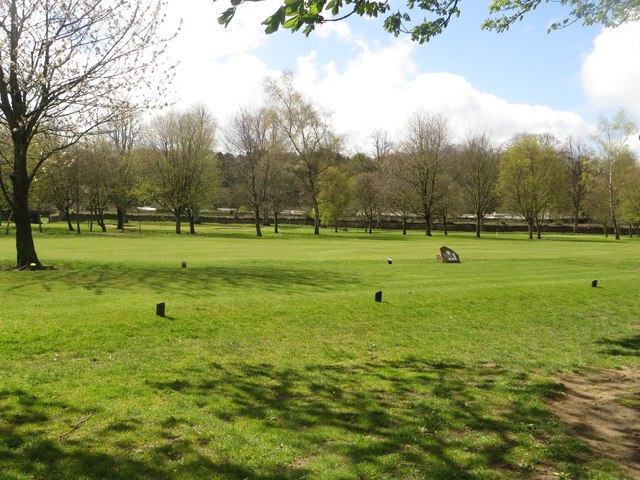
Tee on Tyne Green Golf Course
Weather for this location
Next 14 daysNearby places
Useful places within 5 km
Wildlife to spot
38,942 records · National Biodiversity Network
Wildlife to spot
38,942 records · National Biodiversity NetworkWoodpigeon · Blue Tit · Coal Tit · Blackbird · Chaffinch +38
- WoodpigeonColumba palumbus
- Blue TitCyanistes caeruleus
- Coal TitPeriparus ater
- BlackbirdTurdus merula
- ChaffinchFringilla coelebs
- RobinErithacus rubecula
- JackdawColoeus monedula
- GreenfinchChloris chloris
- DunnockPrunella modularis
- Tree SparrowPasser montanus
- StarlingSturnus vulgaris
- BlackcapSylvia atricapilla
- MagpiePica pica
- House SparrowPasser domesticus
- NuthatchSitta europaea
- MallardAnas platyrhynchos
- Black-headed GullChroicocephalus ridibundus
- Carrion CrowCorvus corone
- DipperCinclus cinclus
- Long-tailed TitAegithalos caudatus
- Herring GullLarus argentatus
- TreecreeperCerthia familiaris
- Reed BuntingEmberiza schoeniclus
- BramblingFringilla montifringilla
- BullfinchPyrrhula pyrrhula
- PheasantPhasianus colchicus
- Common GullLarus canus
- MoorhenGallinula chloropus
- Great TitParus major
- Grey HeronArdea cinerea
- Little EgretEgretta garzetta
- GoldfinchCarduelis carduelis
- Mistle ThrushTurdus viscivorus
- CormorantPhalacrocorax carbo
- WrenTroglodytes troglodytes
- ChiffchaffPhylloscopus collybita
- TealAnas crecca
- European White-fronted GooseAnser albifrons albifrons
- Rock DoveColumba livia
- Greylag GooseAnser anser
- RookCorvus frugilegus
- Song ThrushTurdus philomelos
- Grey WagtailMotacilla cinerea
Harlequin Ladybird
- Harlequin LadybirdHarmonia axyridis
Sweet Violet · Hard Shield-fern · Opposite-leaved Golden-saxifrage · Ivy-leaved Speedwell · Alternate-leaved Golden-saxifrage +4
- Sweet VioletViola odorata
- Hard Shield-fernPolystichum aculeatum
- Opposite-leaved Golden-saxifrageChrysosplenium oppositifolium
- Ivy-leaved SpeedwellVeronica hederifolia
- Alternate-leaved Golden-saxifrageChrysosplenium alternifolium
- Yellow Star-of-BethlehemGagea lutea
Species observations from the last 10 years via NBN Atlas
Wood Anemone
Wood Anemone
Anemone nemorosa
Anemone nemorosa
Meadow SaxifrageSaxifraga granulataMeadow SaxifrageSaxifraga granulataHart's-TongueAsplenium scolopendriumHart's-TongueAsplenium scolopendriumEvents & activities nearby
Switch provider to compare local events, tours and bookable activities.