Tyne Riverside Country Park
🦉 Wildlife🦅 Birds🌿 Foraging
↑ Share
Public access Free entry Dogs welcome
Places › England › North East › Newcastle upon Tyne Getting here
54.98631, -1.76379
Open directionsv Visiting this summer
Seasonal nature notes and what to look for now
▾ 🌞 Midsummer — early morning visits most comfortable; look for deer fawns in quieter clearings 🌿 Foraging is at its best in summer here 🐕 Dogs welcome — bring water in summer; the site has enough space to find shade on hot days 🌤️ Visiting this summer
🌞 Midsummer — early morning visits most comfortable; look for deer fawns in quieter clearings 🌿 Foraging is at its best in summer here 🐕 Dogs welcome — bring water in summer; the site has enough space to find shade on hot days £ Free to visit — no entry charge🐕 Dogs welcome🚲 Bike parking🅿️ Parking· Free
🦉 Wildlife
Very strong match
Multi-group wildlife — Amphibians, Birds, Mammals; Multi-group wildlife — Amphibians, Birds, Mammals
Free
🦅 Bird watching
Very strong match
Birds — Woodpigeon, Blackbird, Magpie +71 more · last seen 2026; Birds — Woodpigeon, Blackbird, Magpie +71 more · last seen 2026
Free
Plants — Ground-elder, Beech, Sessile Oak +21 more foraging species; Deciduous woodland — fungi, berries and wild garlic
Varies
🦋 Insect spotting
Strong match
Lowland meadows — marbled white, meadow brown and pollinating insects; Insects — 7-spot Ladybird, Orange Ladybird, Buff-tailed Bumblebee +21 more · last seen 2026
Free
🍂 Seasonal nature
Strong match
Plants — American Willowherb, Snowdrop, Lesser Celandine +233 more · last seen 2026; Plants — American Willowherb, Snowdrop, Lesser Celandine +233 more · last seen 2026
Free
Dogs allowed with public access
Free
Trails nearby Within roughly 5 km 2 signed routes nearby · 5 public paths nearby
Signed route nearby Public paths
Red Kite Trail Walking route 18 km ▾
Named route Length 18 km Round trip Local walking route
Show on map Hadrian's Wall Path Walking route 134.5 km ▾
Named route Length 134.5 km National walking route
Show on map Church Dene footpath public footpath · 356 m ▾
Public path public footpath Length 356 m Surface unpaved Path type: footway
Show on map 76 signed routes nearby
Signed route nearby
Route 14 Cycling route ▾
Named route Ref 14 National Cycle Network
Show on map Hadrian's Cycleway Cycling route ▾
Named route Ref 72 National Cycle Network
Show on map National Cycle Network Link Route Cycling route ▾
Named route Ref (14) / (141) / (72) National Cycle Network
Show on map National Cycle Network Link Route Cycling route ▾
Named route Ref (141) / (72) National Cycle Network
Show on map National Cycle Network Link Route Cycling route ▾
Named route Ref (72) National Cycle Network
Show on map Keelman's Way Cycling route ▾
Named route Ref 141 National Cycle Network
Show on map 10 public paths nearby
Public paths
Blayney Row restricted byway · 32 m ▾
Public path restricted byway Length 32 m Path type: residential
Show on map Moore Court restricted byway · 116 m ▾
Public path restricted byway Length 116 m Surface asphalt Path type: track
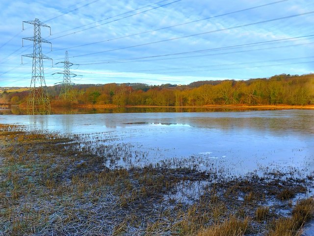
Show on map Photos Flooded farmland near Blayney Row
‹ ›
Weather for this location Next 14 days Nearby places Useful places within 5 km
Own or manage this place?
Claim this listing to keep details accurate, add photos, and highlight what makes it special — free.
Claim this page→ How useful was the information on this page?
Something wrong on this page?
id: b500c932-f37a-426c-be85-d45fd1e62210
UK green spaces mapped from open public data — so anyone can find the woodland, trail, or nature reserve closest to them.
© 2026 Glade · Made with care for UK green spaces
Wildlife to spot
20,204 records · National Biodiversity Network
▾
Wildlife to spot 20,204 records · National Biodiversity Network 🐦 Birds 38 species
summer autumn
2026 ▾
Carrion Crow · Woodpigeon · Jackdaw · Magpie · Mallard +33
Carrion Crow Corvus corone2025 Woodpigeon Columba palumbus2025 Jackdaw Coloeus monedula2025 Magpie Pica pica2025 Mallard Anas platyrhynchos2025 Black-headed Gull Chroicocephalus ridibundus Wren Troglodytes troglodytes2025 Lapwing Vanellus vanellus2025 Cormorant Phalacrocorax carbo2025 Moorhen Gallinula chloropus2025 Blackbird Turdus merula2025 Grey Heron Ardea cinerea2025 Blue Tit Cyanistes caeruleus2025 Robin Erithacus rubecula2025 Great Tit Parus major2025 Greylag Goose Anser anser Rock Dove Columba livia2025 Goosander Mergus merganser2025 Canada Goose Branta canadensis2025 Goldfinch Carduelis carduelis2025 Great Spotted Woodpecker Dendrocopos major2025 Teal Anas crecca2025 Dunnock Prunella modularis2025 Goldcrest Regulus regulus2025 Coal Tit Periparus ater2025 Kingfisher Alcedo atthis2025 Jay Garrulus glandarius2025 Long-tailed Tit Aegithalos caudatus2025 Nuthatch Sitta europaea2025 Siskin Spinus spinus2025 Peregrine Falco peregrinus2025 Hobby Falco subbuteo2025 Herring Gull Larus argentatus2025 Lesser Black-backed Gull Larus fuscus2025 Common Gull Larus canus2025 Little Egret Egretta garzetta2025 Swallow Hirundo rustica2025 Great Black-backed Gull Larus marinus2025 Roe Deer · Grey Squirrel
Roe Deer Capreolus capreolus Grey Squirrel Sciurus carolinensis 🐝 Insects 14 species
spring summer
2026 ▾
Buff-tailed Bumblebee · 7-spot Ladybird · Western Conifer Seed Bug · Green Shieldbug · Western Honey Bee +9
Buff-tailed Bumblebee Bombus terrestris 7-spot Ladybird Coccinella septempunctata Western Conifer Seed Bug Leptoglossus occidentalis2025 Green Shieldbug Palomena prasina2025 Western Honey Bee Apis mellifera Harlequin Ladybird Snowdrop · Cherry Plum · Holly · Galanthus nivalis f. pleniflorus · Tall Fescue +81
Snowdrop Galanthus nivalis Cherry Plum Prunus cerasifera Holly Ilex aquifolium Galanthus nivalis f. pleniflorus Galanthus nivalis f. pleniflorus Tall Fescue Schedonorus arundinaceus2025 Perennial Sow-thistle Sonchus arvensis2025 Species observations from the last 10 years via NBN Atlas
Harmonia axyridis
Harmonia axyridis
Syrphus ribesii Syrphus ribesii2025
Syrphus ribesii Syrphus ribesii2025
Hairy Shieldbug Dolycoris baccarum2025
Hairy Shieldbug Dolycoris baccarum2025
Pemphigus (Pemphigus) populinigrae Pemphigus (Pemphigus) populinigrae2025
Pemphigus (Pemphigus) populinigrae Pemphigus (Pemphigus) populinigrae2025
Thecabius (Thecabius) affinis Thecabius (Thecabius) affinis2025
Thecabius (Thecabius) affinis Thecabius (Thecabius) affinis2025
Poplar-lettuce Aphid Pemphigus (Pemphigus) bursarius2025
Poplar-lettuce Aphid Pemphigus (Pemphigus) bursarius2025
Common Darter Sympetrum striolatum2025
Common Darter Sympetrum striolatum2025
Broad-bodied Chaser Libellula depressa2025
Broad-bodied Chaser Libellula depressa2025
Emperor Dragonfly Anax imperator2025
Emperor Dragonfly Anax imperator2025 Rush Aster
Rush Aster
Symphyotrichum novi-belgii2025
Symphyotrichum novi-belgii2025
Common Toadflax Linaria vulgaris2025
Common Toadflax Linaria vulgaris2025
Sea Aster Tripolium pannonicum2025
Sea Aster Tripolium pannonicum2025
Dewberry Rubus caesius2025
Dewberry Rubus caesius2025
Common Chickweed Stellaria media
Common Chickweed Stellaria media
Narcissus agg. Narcissus agg.
Narcissus agg. Narcissus agg.
Beech Fagus sylvatica
Beech Fagus sylvatica
Daisy Bellis perennis
Daisy Bellis perennis
Red Dead-nettle Lamium purpureum
Red Dead-nettle Lamium purpureum
Sessile Oak Quercus petraea
Sessile Oak Quercus petraea
Ash Fraxinus excelsior
Ash Fraxinus excelsior
Dog's Mercury Mercurialis perennis
Dog's Mercury Mercurialis perennis
Lesser Celandine Ficaria verna
Lesser Celandine Ficaria verna
Crocus Crocus
Crocus Crocus
Yew Taxus baccata
Yew Taxus baccata
Intermediate Polypody Polypodium interjectum
Intermediate Polypody Polypodium interjectum
Greater Bird's-foot-trefoil Lotus pedunculatus2025
Greater Bird's-foot-trefoil Lotus pedunculatus2025
Scentless Mayweed Tripleurospermum inodorum2025
Scentless Mayweed Tripleurospermum inodorum2025
Harebell Campanula rotundifolia2025
Harebell Campanula rotundifolia2025
Prickly Sow-thistle Sonchus asper2025
Prickly Sow-thistle Sonchus asper2025
Dryopteris borreri Dryopteris borreri2025
Dryopteris borreri Dryopteris borreri2025
Common Saltmarsh-grass Puccinellia maritima2025
Common Saltmarsh-grass Puccinellia maritima2025
Clustered Dock Rumex conglomeratus2025
Clustered Dock Rumex conglomeratus2025
Common Bent Agrostis capillaris2025
Common Bent Agrostis capillaris2025
Italian Rye-grass Lolium multiflorum2025
Italian Rye-grass Lolium multiflorum2025
Crack-willow Salix alba x euxina = S. x fragilis2025
Crack-willow Salix alba x euxina = S. x fragilis2025
Fat-hen Chenopodium album2025
Fat-hen Chenopodium album2025
Crosswort Cruciata laevipes2025
Crosswort Cruciata laevipes2025
Hawkweed Hieracium2025
Hawkweed Hieracium2025
Stone Parsley Sison amomum2025
Stone Parsley Sison amomum2025
Small Pondweed Potamogeton berchtoldii2025
Small Pondweed Potamogeton berchtoldii2025
Broad-leaved Pondweed Potamogeton natans2025
Broad-leaved Pondweed Potamogeton natans2025
Rusty Willow Salix cinerea subsp. oleifolia2025
Rusty Willow Salix cinerea subsp. oleifolia2025
Ground-elder Aegopodium podagraria2025
Ground-elder Aegopodium podagraria2025
Broad-leaved Helleborine Epipactis helleborine2025
Broad-leaved Helleborine Epipactis helleborine2025
False-brome Brachypodium sylvaticum2025
False-brome Brachypodium sylvaticum2025
Meadow Vetchling Lathyrus pratensis2025
Meadow Vetchling Lathyrus pratensis2025
Broad-leaved Willowherb Epilobium montanum2025
Broad-leaved Willowherb Epilobium montanum2025
Meadowsweet Filipendula ulmaria2025
Meadowsweet Filipendula ulmaria2025
Wild Cherry Prunus avium2025
Wild Cherry Prunus avium2025
Field Forget-me-not Myosotis arvensis2025
Field Forget-me-not Myosotis arvensis2025
Sweet Vernal-grass Anthoxanthum odoratum2025
Sweet Vernal-grass Anthoxanthum odoratum2025
Common Mallow Malva sylvestris2025
Common Mallow Malva sylvestris2025
Dove's-foot Crane's-bill Geranium molle2025
Dove's-foot Crane's-bill Geranium molle2025
Soft-brome Bromus hordeaceus2025
Soft-brome Bromus hordeaceus2025
Wild Celery Apium graveolens2025
Wild Celery Apium graveolens2025
Knotgrass Polygonum aviculare2025
Knotgrass Polygonum aviculare2025
Purple Toadflax Linaria purpurea2025
Purple Toadflax Linaria purpurea2025
Upright Hedge-parsley Torilis japonica2025
Upright Hedge-parsley Torilis japonica2025
Bladder Campion Silene vulgaris2025
Bladder Campion Silene vulgaris2025
Spear-leaved Orache Atriplex prostrata2025
Spear-leaved Orache Atriplex prostrata2025
Wild Privet Ligustrum vulgare2025
Wild Privet Ligustrum vulgare2025
Lesser Sea-spurrey Spergularia marina2025
Lesser Sea-spurrey Spergularia marina2025
Large Bindweed Calystegia silvatica2025
Large Bindweed Calystegia silvatica2025
Reed Canary-grass Phalaris arundinacea2025
Reed Canary-grass Phalaris arundinacea2025
Autumn Hawkbit Scorzoneroides autumnalis2025
Autumn Hawkbit Scorzoneroides autumnalis2025
Common Spike-rush Eleocharis palustris2025
Common Spike-rush Eleocharis palustris2025
Garden Privet Ligustrum ovalifolium2025
Garden Privet Ligustrum ovalifolium2025
Field Horsetail Equisetum arvense2025
Field Horsetail Equisetum arvense2025
Procumbent Pearlwort Sagina procumbens2025
Procumbent Pearlwort Sagina procumbens2025
Amphibious Bistort Persicaria amphibia2025
Amphibious Bistort Persicaria amphibia2025
Common Hemp-nettle Galeopsis tetrahit2025
Common Hemp-nettle Galeopsis tetrahit2025
Ivy-leaved Toadflax Cymbalaria muralis2025
Ivy-leaved Toadflax Cymbalaria muralis2025
Creeping Bent Agrostis stolonifera2025
Creeping Bent Agrostis stolonifera2025
Foxglove Digitalis purpurea2025
Foxglove Digitalis purpurea2025
Welted Thistle Carduus crispus2025
Welted Thistle Carduus crispus2025
Hairy Bitter-cress Cardamine hirsuta2025
Hairy Bitter-cress Cardamine hirsuta2025
Bristly Oxtongue Helminthotheca echioides2025
Bristly Oxtongue Helminthotheca echioides2025
Chicory Cichorium intybus2025
Chicory Cichorium intybus2025
Marsh Horsetail Equisetum palustre2025
Marsh Horsetail Equisetum palustre2025
False Fox-sedge Carex otrubae2025
False Fox-sedge Carex otrubae2025
Weld Reseda luteola2025
Weld Reseda luteola2025
Common Duckweed Lemna minor2025
Common Duckweed Lemna minor2025
Snow-in-summer Cerastium tomentosum2025
Snow-in-summer Cerastium tomentosum2025
American Willowherb Epilobium ciliatum2025
American Willowherb Epilobium ciliatum2025
Common Bird's-foot-trefoil Lotus corniculatus2025
Common Bird's-foot-trefoil Lotus corniculatus2025
Wood Dock Rumex sanguineus2025
Wood Dock Rumex sanguineus2025
Marsh Thistle Cirsium palustre2025
Marsh Thistle Cirsium palustre2025
Common Scurvygrass Cochlearia officinalis2025
Common Scurvygrass Cochlearia officinalis2025
Keeled Garlic Allium carinatum2025
Keeled Garlic Allium carinatum2025 Events & activities nearby Switch provider to compare local events, tours and bookable activities.
Bookable tours GetYourGuide Promote here