Plan your visit
🦉 Wildlife🦅 Birds⚽ Pitches
Public access Dogs welcome
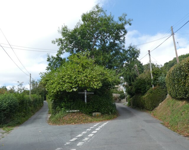
Places › England › South West › East Devon Getting here
50.73500, -2.96066
Open directionsv Visiting this summer
Seasonal nature notes and what to look for now
▾ 🌞 Midsummer — early morning visits most comfortable; look for deer fawns in quieter clearings ⚽ Playing fields is at its best in summer here ⛺ Camping available here — summer nights at this site are worth planning around 🌤️ Visiting this summer
🌞 Midsummer — early morning visits most comfortable; look for deer fawns in quieter clearings ⚽ Playing fields is at its best in summer here ⛺ Camping available here — summer nights at this site are worth planning around ⛺ Campsite🅿️ Parking🛝 Playground
🦉 Wildlife
Very strong match
Multi-group wildlife — Amphibians, Birds, Mammals, Reptiles; Multi-group wildlife — Amphibians, Birds, Mammals, Reptiles
Free
🦅 Bird watching
Very strong match
Birds — Robin, Woodpigeon, Blackbird +66 more · last seen 2026; Birds — Robin, Woodpigeon, Blackbird +66 more · last seen 2026
Free
⚽ Playing fields
Very strong match
Playing field
Free
🦋 Insect spotting
Strong match
Insects — Glow-worm, Eristalis pertinax, Dark-edged Bee-fly +83 more · last seen 2026; Insects — Glow-worm, Eristalis pertinax, Dark-edged Bee-fly +83 more · last seen 2026
Free
🛝 Family friendly
Strong match
playground; Playing field
Free
Trails nearby Within roughly 5 km 7 signed routes nearby · 23 public paths nearby
Signed route nearby Public paths
Monarch's Way Walking route 990 km ▾
approximate route of Charles II's escape
Named route Ref MW Length 990 km Regional walking route
Show on map East Devon Way Walking route ▾
Named route Ref EDW Listed length 61km Regional walking route
Show on map Wessex Ridgeway Walking route ▾
Named route Ref WR Regional walking route
Show on map South West Coast Path (Section 46: Seaton to Seatown) Walking route ▾
Named route Ref SWCP National walking route
Show on map Liberty Trail Walking route ▾
Named route Ref LIB Regional walking route
Show on map Barnes Meadow public footpath · 21 m ▾
Public path public footpath Length 21 m Path type: residential
Show on map Barber's Lane public footpath · 86 m ▾
Public path public footpath Length 86 m Path type: residential
Show on map Hook Farm Way public footpath · 37 m ▾
Public path public footpath Length 37 m Path type: residential
Show on map 22 signed routes nearby
Signed route nearby
Route 2 Cycling route ▾
National Cycle Route 2 Christchurch to Axminster
Named route Ref 2 National Cycle Network
Show on map National Cycle Route 2 Axminster to Dawlish Cycling route ▾
Named route Ref 2 National Cycle Network
Show on map Main Route Cycling route 148 m ▾
Named route Ref 2 Length 148 m National Cycle Network Traffic-free Surface asphalt
Show on map Main Route Cycling route 40 m ▾
Named route Ref 2 Length 40 m National Cycle Network Traffic-free Surface asphalt
Show on map Main Route Cycling route 3 km ▾
Named route Ref 2 Length 3 km National Cycle Network On-road Surface asphalt
Show on map Main Route Cycling route 610 m ▾
Named route Ref 2 Length 610 m National Cycle Network On-road Surface asphalt
Show on map 1 signed route nearby
Signed route nearby
Wessex Ridgeway Trail Mountain bike route ▾
Named route Listed length 207km
Show on map 4 public paths nearby
Public paths
Woodhouse Fields bridleway · 584 m ▾
Public path bridleway Length 584 m Path type: unclassified
Show on map Cuckoo Lane bridleway · 154 m ▾
Public path bridleway Length 154 m Path type: service
Show on map Mill Lane bridleway · 242 m ▾
Public path bridleway Length 242 m Path type: residential
Show on map
Weather for this location Next 14 days Nearby places Useful places within 5 km
All Historic
Own or manage this place?
Claim this listing to keep details accurate, add photos, and highlight what makes it special — free.
Claim this page→ How useful was the information on this page?
id: 02bb76a8-93ef-4d53-abec-ff891452d2f4
UK green spaces mapped from open public data — so anyone can find the woodland, trail, or nature reserve closest to them.
© 2026 Glade · Made with care for UK green spaces
Wildlife to spot
37,375 records · National Biodiversity Network
▾
Wildlife to spot 37,375 records · National Biodiversity Network 🐦 Birds 47 species
winter spring summer autumn
2026 ▾
Robin · Blackbird · Goldcrest · Woodpigeon · Wren +42
Robin Erithacus rubecula Blackbird Turdus merula Goldcrest Regulus regulus2025 Woodpigeon Columba palumbus2025 Wren Troglodytes troglodytes2025 Great Tit Parus major Dunnock Prunella modularis Green Woodpecker Picus viridis Coal Tit Periparus ater2025 House Sparrow Passer domesticus Nuthatch Sitta europaea Dipper Cinclus cinclus2025 Grey Wagtail Motacilla cinerea2025 Carrion Crow Corvus corone2025 Kingfisher Alcedo atthis2025 Goldfinch Carduelis carduelis2025 Rook Corvus frugilegus2025 Blue Tit Cyanistes caeruleus2025 Chiffchaff Phylloscopus collybita2025 Great Spotted Woodpecker Dendrocopos major2025 Linnet Linaria cannabina2025 Blackcap Sylvia atricapilla2025 Mallard Anas platyrhynchos2025 Magpie Pica pica2025 Jackdaw Coloeus monedula2025 Herring Gull Larus argentatus2024 House Martin Delichon urbicum2024 Kestrel Falco tinnunculus2025 Greenfinch Chloris chloris2025 Pheasant Phasianus colchicus2025 Fieldfare Turdus pilaris2025 Chaffinch Fringilla coelebs2025 Pied Wagtail Motacilla alba2025 Tawny Owl Strix aluco2025 Treecreeper Certhia familiaris2025 Yellowhammer Emberiza citrinella2025 Bullfinch Pyrrhula pyrrhula2025 Redwing Turdus iliacus2025 Marsh Tit Poecile palustris2025 Oystercatcher Haematopus ostralegus2024 Little Egret Egretta garzetta2024 Rock Pipit Anthus petrosus2024 Turnstone Arenaria interpres2024 Rock Dove Columba livia2024 Grey Heron Ardea cinerea2024 Swallow Hirundo rustica2024 Swift Apus apus2024 🦌 Mammals 4 species
spring summer autumn
2025 ▾
Grey Squirrel · Roe Deer · Eurasian Serotine · Badger
Grey Squirrel Sciurus carolinensis2024 Roe Deer Capreolus capreolus Eurasian Serotine Cnephaeus serotinus2024 Badger Meles meles2024 🦎 Reptiles 2 species
spring autumn
2025 ▾
Slow-worm · Common Lizard
Slow-worm Anguis fragilis Common Lizard Zootoca vivipara Glow-worm · Oil Beetle · Dark-edged Bee-fly · Chrysolina banksii · Southern Hawker +33
Glow-worm Lampyris noctiluca2025 Oil Beetle Meloe Dark-edged Bee-fly Bombylius major Chrysolina banksii Chrysolina banksii2025 Southern Hawker Aeshna cyanea2025 Beautiful Demoiselle Calopteryx virgo2025 Species observations from the last 10 years via NBN Atlas
Rose Chafer Cetonia aurata2024
Rose Chafer Cetonia aurata2024
Bloody-nosed Beetle Timarcha tenebricosa2024
Bloody-nosed Beetle Timarcha tenebricosa2024
Baccha elongata Baccha elongata2024
Baccha elongata Baccha elongata2024
Tortoise Bug Eurygaster testudinaria2025
Tortoise Bug Eurygaster testudinaria2025
Alder Leaf Beetle Agelastica alni2025
Alder Leaf Beetle Agelastica alni2025
Dark Bush-cricket Pholidoptera griseoaptera2025
Dark Bush-cricket Pholidoptera griseoaptera2025
Golden-ringed Dragonfly Cordulegaster boltonii2025
Golden-ringed Dragonfly Cordulegaster boltonii2025
River Skater Aquarius najas2025
River Skater Aquarius najas2025
Eristalis tenax Eristalis tenax2025
Eristalis tenax Eristalis tenax2025
Common Red Soldier Beetle Rhagonycha fulva2025
Common Red Soldier Beetle Rhagonycha fulva2025
Scaeva pyrastri Scaeva pyrastri2025
Scaeva pyrastri Scaeva pyrastri2025
Lesser Stag Beetle Dorcus parallelipipedus2025
Lesser Stag Beetle Dorcus parallelipipedus2025
Emperor Dragonfly Anax imperator2025
Emperor Dragonfly Anax imperator2025
Abax parallelepipedus Abax parallelepipedus2025
Abax parallelepipedus Abax parallelepipedus2025
Azure Damselfly Coenagrion puella2025
Azure Damselfly Coenagrion puella2025
Red-headed Cardinal Beetle Pyrochroa serraticornis2025
Red-headed Cardinal Beetle Pyrochroa serraticornis2025
Common Cockchafer Melolontha melolontha2025
Common Cockchafer Melolontha melolontha2025
Cramp-Ball Fungus Weevil Platyrhinus resinosus2025
Cramp-Ball Fungus Weevil Platyrhinus resinosus2025
Black Oil-beetle Meloe proscarabaeus2025
Black Oil-beetle Meloe proscarabaeus2025
Oedemera femoralis Oedemera femoralis2025
Oedemera femoralis Oedemera femoralis2025
Silver Fish Lepisma saccharinum2024
Silver Fish Lepisma saccharinum2024
Field Grasshopper Chorthippus brunneus2024
Field Grasshopper Chorthippus brunneus2024
Snail Hunter Cychrus caraboides2024
Snail Hunter Cychrus caraboides2024
Common Blue Damselfly Enallagma cyathigerum2024
Common Blue Damselfly Enallagma cyathigerum2024
Wasp Beetle Clytus arietis2024
Wasp Beetle Clytus arietis2024
Rutpela maculata Rutpela maculata2024
Rutpela maculata Rutpela maculata2024
Sonronius dahlbomi Sonronius dahlbomi2024
Sonronius dahlbomi Sonronius dahlbomi2024
Grypocoris (Lophyromiris) stysi Grypocoris (Lophyromiris) stysi2024
Grypocoris (Lophyromiris) stysi Grypocoris (Lophyromiris) stysi2024
Cheilosia illustrata Cheilosia illustrata2024
Cheilosia illustrata Cheilosia illustrata2024
Xylota segnis Xylota segnis2024
Xylota segnis Xylota segnis2024
Meadow Plant Bug Leptopterna dolabrata2024
Meadow Plant Bug Leptopterna dolabrata2024
Norellisoma spinimanum Norellisoma spinimanum2024
Norellisoma spinimanum Norellisoma spinimanum2024 Events & activities nearby Switch provider to compare local events, tours and bookable activities.
Bookable tours GetYourGuide Promote here