Walshaw Wood
✦ Ancient woodland11 ha
🦉Wildlife🦅Birds🍂Seasonal
Public accessFree entryDogs welcome11 ha
Getting here
53.77261, -2.04185
Open directionsv
Visiting this summer
Seasonal nature notes and what to look for now
- 🌞Midsummer — early morning visits most comfortable; look for deer fawns in quieter clearings
- 🐕Early mornings are best for dog walks in summer — visit before 9am to avoid the heat and find quieter trails
- ⛺Camping available here — summer nights at this site are worth planning around
🌤️ Visiting this summer
- 🌞Midsummer — early morning visits most comfortable; look for deer fawns in quieter clearings
- 🐕Early mornings are best for dog walks in summer — visit before 9am to avoid the heat and find quieter trails
- ⛺Camping available here — summer nights at this site are worth planning around
- £Free to visit — no entry charge
- 🐕Dogs welcome
- 🌿Ancient woodland — rare wildlife habitat
🦉Wildlife
Very strong match
Multi-group wildlife — Amphibians, Birds, Mammals; Multi-group wildlife — Amphibians, Birds, Mammals
Free
🦅Bird watching
Very strong match
Birds — Wren, Robin, Blackbird +62 more · last seen 2026; Birds — Wren, Robin, Blackbird +62 more · last seen 2026
Free
🍂Seasonal nature
Strong match
Ancient woodland — bluebells, fungi and autumn colour; Plants — Fairy Foxglove, Bifid Crestwort, Bilberry +58 more · last seen 2026
Free
Dogs allowed — public woodland
Free
🦋Insect spotting
Strong match
Insects — Meadow Brown, Ringlet, Small White +44 more · last seen 2026; Insects — Meadow Brown, Ringlet, Small White +44 more · last seen 2026
Free
Plants — Bilberry, Wood-sorrel, Common Hemp-nettle +5 more foraging species; Deciduous woodland — fungi, berries and wild garlic
Varies
Trails nearby
Within roughly 5 km18 signed routes nearby · 44 public paths nearby
Signed route nearbyPublic paths
Mary Towneley LoopWalking route▾
Forms part of Pennine Bridleway National Trail
Named routeRegional walking route
Todmorden Centenary WayWalking route▾
Named routeLocal walking route
Pennine Way (Warland Reservoir to Calder Valley)Walking route▾
Named routeNational walking route
Todmorden Centenary Way LinkWalking route▾
Named routeLocal walking route
Crags Walk, Hardcastle CragsWalking route1.3 km▾
Named routeLength 1.3 kmDuration 00:45Round tripLocal walking route
Estate Trackpublic footpath · 105 m▾
Public pathpublic footpathLength 105 mSurface compactedPath type: service
50 signed routes nearby
Signed route nearby
Pennine CyclewayCycling route▾
Named routeRef 68National Cycle Network
Route 66Cycling route▾
Named routeRef 66National Cycle Network
West Yorkshire Cycle RouteCycling route▾
Named routeRef WYCRRegional cycle route
Route 68Cycling route▾
Named routeRef 68National Cycle Network
Main RouteCycling route113 m▾
Named routeRef 68Length 113 mNational Cycle NetworkOn-roadSurface asphalt
Main RouteCycling route27 m▾
Named routeRef 66Length 27 mNational Cycle NetworkOn-roadSurface asphalt
3 signed routes nearby
Signed route nearby
Calder Aire LinkMountain bike route▾
Great North Trail (Yorkshire Dales)Mountain bike route172.2 km▾
Named routeLength 172.2 km
Great North Trail (Peak District and South Pennines)Mountain bike route130.4 km▾
Named routeLength 130.4 kmNational Cycle Network
8 public paths nearby
Public paths
Cow Hey Lanebridleway · 265 m▾
Public pathbridlewayLength 265 mSurface unpavedPath type: service
Kiln Lanebridleway · 227 m▾
Public pathbridlewayLength 227 mSurface unpavedPath type: service
Kiln Lanebridleway · 28 m▾
Public pathbridlewayLength 28 mSurface unpavedPath type: service
Cow Hey Lanebridleway · 9 m▾
Public pathbridlewayLength 9 mSurface unpavedPath type: service
Photos
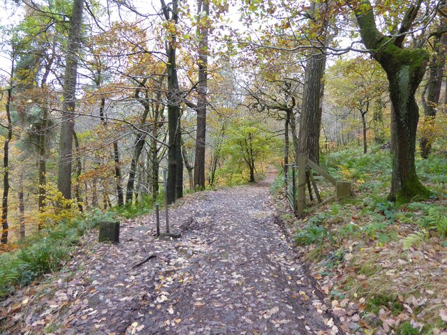
Leaving National Trust Walshaw Wood
Weather for this location
Next 14 daysNearby places
Useful places within 5 km
Own or manage this place?
Claim this listing to keep details accurate, add photos, and highlight what makes it special — free.
Claim this page→How useful was the information on this page?
id: bdca705f-b800-439a-aad2-a9baaf6ab451
Wildlife to spot
7,704 records · National Biodiversity Network
Wildlife to spot
7,704 records · National Biodiversity Network🐦Birds47 species
summerautumn
2026▾
Wren · Blackbird · Blue Tit · Woodpigeon · Nuthatch +42
- WrenTroglodytes troglodytes2025
- BlackbirdTurdus merula2025
- Blue TitCyanistes caeruleus2025
- WoodpigeonColumba palumbus2025
- NuthatchSitta europaea2025
- RobinErithacus rubecula2025
- Great TitParus major2025
- Coal TitPeriparus ater2025
- DipperCinclus cinclus
- KestrelFalco tinnunculus2025
- Long-tailed TitAegithalos caudatus2025
- ChaffinchFringilla coelebs2025
- MagpiePica pica2025
- JackdawColoeus monedula2025
- Carrion CrowCorvus corone2025
- ChiffchaffPhylloscopus collybita2025
- MallardAnas platyrhynchos2025
- JayGarrulus glandarius2025
- PheasantPhasianus colchicus2025
- GoldcrestRegulus regulus2025
- Grey WagtailMotacilla cinerea2025
- Red Grouse (scotica)Lagopus scotica2025
- LapwingVanellus vanellus2025
- Mistle ThrushTurdus viscivorus2025
- DunnockPrunella modularis2025
- GoldfinchCarduelis carduelis2025
- SwallowHirundo rustica2025
- CurlewNumenius arquata2025
- BlackcapSylvia atricapilla2025
- Golden PloverPluvialis apricaria2025
- FieldfareTurdus pilaris2025
- Great Spotted WoodpeckerDendrocopos major2025
- Stock DoveColumba oenas2025
- StonechatSaxicola rubicola2025
- Meadow PipitAnthus pratensis2025
- SiskinSpinus spinus2025
- WhitethroatCurruca communis2025
- Lesser Black-backed GullLarus fuscus2025
- Willow WarblerPhylloscopus trochilus2025
- Green WoodpeckerPicus viridis2025
- OystercatcherHaematopus ostralegus2025
- Pied WagtailMotacilla alba yarrellii2025
- Canada GooseBranta canadensis2025
- Spotted FlycatcherMuscicapa striata2025
- LinnetLinaria cannabina2025
- Little OwlAthene noctua2025
- TreecreeperCerthia familiaris2025
🦌Mammals2 species
summerautumn
2025▾
Grey Squirrel · Rabbit
- Grey SquirrelSciurus carolinensis
- RabbitOryctolagus cuniculus
Leucozona glaucia · Cheilosia illustrata · Common Darter · Xylota segnis · Scathophaga stercoraria +17
- Leucozona glauciaLeucozona glaucia2025
- Cheilosia illustrataCheilosia illustrata2025
- Common DarterSympetrum striolatum2025
- Xylota segnisXylota segnis2025
- Scathophaga stercorariaScathophaga stercoraria
- Empoasca vitisEmpoasca vitis
Waved Silk-moss · Fairy Foxglove · Springy Turf-moss · Fringed Bog-moss · Common Hemp-nettle +15
- Waved Silk-mossPlagiothecium undulatum
- Fairy FoxgloveErinus alpinus2025
- Springy Turf-mossRhytidiadelphus squarrosus
- Fringed Bog-mossSphagnum fimbriatum
- Common Hemp-nettleGaleopsis tetrahit2025
- Upright Hedge-parsleyTorilis japonica2025
Species observations from the last 10 years via NBN Atlas
Events & activities nearby
Switch provider to compare local events, tours and bookable activities.