Plan your visit
Getting here
51.38886, -1.79765
Visiting this summer
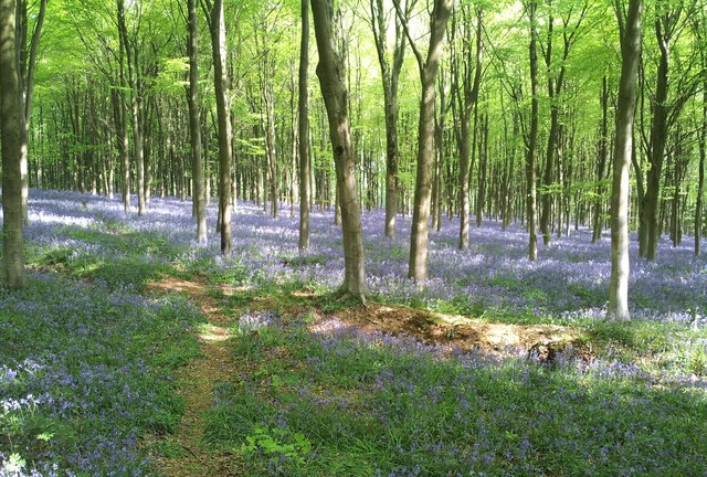
Seasonal nature notes and what to look for now
Visiting this summer
Seasonal nature notes and what to look for now
- 🐦77+ species recorded in this area — summer evenings are best for activity; watch for Wren and Goldfinch
- ✦Historic character is a year-round quality here — summer brings its own atmosphere to the setting
- 🐕Dogs welcome — bring water in summer; the site has enough space to find shade on hot days
🌤️ Visiting this summer
- 🐦77+ species recorded in this area — summer evenings are best for activity; watch for Wren and Goldfinch
- ✦Historic character is a year-round quality here — summer brings its own atmosphere to the setting
- 🐕Dogs welcome — bring water in summer; the site has enough space to find shade on hot days
Good to know
- £Free to visit — no entry charge
- 🐕Dogs welcome
Best for
Bird watching
Very strong match
Birds — Wren, Goldfinch, Great Tit +74 more · last seen 2025; Deciduous woodland — woodpeckers, warblers and woodland birds
Wildlife
Strong match
Birds — Wren, Goldfinch, Great Tit +74 more · last seen 2025; Deciduous woodland priority habitat
Heritage
Strong match
Historic site with public access
Insect spotting
Strong match
Chalk and limestone grassland — chalkhill blue, adonis blue and rare moths; Insects — Anoplotrupes stercorosus, Glow-worm, Abax parallelepipedus +10 more · last seen 2026
Seasonal nature
Strong match
Plants — Daffodil, Holly, Beech +45 more · last seen 2026
Dog walks
Good match
Dogs allowed with public access
Trails nearby
Within roughly 5 km🚶Walking
9 signed routes nearby · 2 public paths nearby
Signed route nearbyPublic paths
Walking
The RidgewayWalking route140 km
Avebury Ridgeway WalkWalking route8 km
Starting at the heart of the Avebury World Heritage Site, this walk takes you through the remains of the largest stone circle in the world and along the West Kennet Avenue into beautiful, rolling chalk downland.
Wessex RidgewayWalking route
White Horse TrailWalking route
Kennet and Avon Canal TrailWalking route140 km
Rivers linked by a canal. The name refers to the entire navigable length. From Bristol the way is the Avon. The canal is from Bath to Newbury. From there to Reading the way is the Kennet. 53 locks to Summit Pound (150 m asl) and 54 down to Reading.
Tancoat Lanepublic footpath · 1.6 km
🚴Cycling
36 signed routes nearby
Signed route nearby
Cycling
Mercian WayCycling route
Wiltshire CyclewayCycling route155 km
Route 403Cycling route
Route 482Cycling route
EuroVelo 2 - Capitals Route - part United Kingdom 4Cycling route
National Cycle Network Route 4Cycling route
🚵Mountain biking
2 signed routes nearby
Signed route nearby
Mountain biking
Wessex Ridgeway TrailMountain bike route
King Alfred's WayMountain bike route
King Alfreds Way is 350km (220 miles) off road route designed to be ridden clockwise. It starts & ends in Winchester. It is suitable for gravel or cross-country bikes.
🐴Horse riding
11 public paths nearby
Public paths
Horse riding
The Ridgewaybyway open to all traffic · 173 m
Workway Drovebridleway · 5 m
The Ridgewaybyway open to all traffic · 589 m
The Ridgewaybyway open to all traffic · 764 m
Workway Drovebridleway · 1.2 km
Wildlife to spot
Photos
Weather for this location
Loading local forecast…
Nearby places
Useful places within 5 km