Waterman's Lodge bowl barrow, one of a pair of Bronze Age barrows on the western edge of Wychwood Forest 0 ha
🦉 Wildlife🦅 Birds🌿 Foraging
↑ Share
Free entry Dogs welcome 0 ha
Places › England › South East › West Oxfordshire Getting here
51.86037, -1.51859
Open directionsv ✦ Scheduled Ancient Monument — Nationally protected archaeological site on the National Heritage List for England (NHLE). Scheduled monuments represent the best surviving examples of England's irreplaceable archaeological heritage.
Bowl barrow scheduled monument
Visiting this summer
Seasonal nature notes and what to look for now
▾ 🌞 Midsummer — early morning visits most comfortable; look for deer fawns in quieter clearings 🌿 Foraging is at its best in summer here 🐕 Dogs welcome — bring water in summer; the site has enough space to find shade on hot days 🌤️ Visiting this summer
🌞 Midsummer — early morning visits most comfortable; look for deer fawns in quieter clearings 🌿 Foraging is at its best in summer here 🐕 Dogs welcome — bring water in summer; the site has enough space to find shade on hot days £ Free to visit — no entry charge🐕 Dogs welcome🦉 Wildlife
Very strong match
Multi-group wildlife — Birds, Mammals, Reptiles; Multi-group wildlife — Birds, Mammals, Reptiles
Free
🦅 Bird watching
Very strong match
Birds — Woodpigeon, Nuthatch, Blackbird +67 more · last seen 2025; Birds — Woodpigeon, Nuthatch, Blackbird +67 more · last seen 2025
Free
Plants — Bramble, Hogweed, Hawthorn +20 more foraging species; Deciduous woodland — fungi, berries and wild garlic
Varies
🦋 Insect spotting
Strong match
Insects — Small White, Large White, Gatekeeper +76 more · last seen 2026; Insects — Small White, Large White, Gatekeeper +76 more · last seen 2026
Free
🍂 Seasonal nature
Strong match
Plants — Creeping Buttercup, Broad-leaved Dock, White Clover +169 more · last seen 2022; Plants — Creeping Buttercup, Broad-leaved Dock, White Clover +169 more · last seen 2022
Free
Trails nearby Within roughly 5 km 5 signed routes nearby · 2 public paths nearby
Signed route nearby Public paths
Oxfordshire Way Walking route 110 km ▾
a traverse of Oxfordshire from the Cotswolds to the Chilterns
Named route Ref OW Length 110 km Regional walking route
Show on map Wychwood Way Walking route 59.5 km ▾
Named route Length 59.5 km Regional walking route
Show on map D'Arcy Dalton Way Walking route 107 km ▾
Follows roughly the western boundary of Oxfordshire in unspoilt countryside.
Named route Length 107 km Regional walking route
Show on map The Roman Way Walking route 274.5 km ▾
Named route Length 274.5 km Regional walking route
Show on map European walking route E2 west, UK, South East England Walking route ▾
Westroute: Stranraer (UK) - Birminhgham (UK) - Calais (FR) - Zoersel (BE) / Eastroute: Stranraer (UK) - Harwich (UK) - Rotterdam (NL) - Zoersel (BE) / Both Routes: Zoersel (BE) - Maastrich (NL) - Luxembourg (LUX) - Lake Geneva (CH) - Nice (FR)
Named route Ref E2 International walking route
Show on map Patch Riding public footpath · 3.3 km ▾
Public path public footpath Length 3.3 km Path type: footway
Show on map 36 signed routes nearby
Signed route nearby
Cotswold Line Cycle Route Cycling route ▾
Named route Ref 442 National Cycle Network
Show on map National Byway (Oxon and Glos) Cycling route ▾
Named route Ref NB Regional cycle route
Show on map Main Route Cycling route 756 m ▾
Named route Ref 442 Length 756 m National Cycle Network On-road Surface asphalt
Show on map Main Route Cycling route 449 m ▾
Named route Ref 442 Length 449 m National Cycle Network On-road Surface asphalt
Show on map Main Route Cycling route 2.5 km ▾
Named route Ref 442 Length 2.5 km National Cycle Network On-road Surface asphalt
Show on map Main Route Cycling route 430 m ▾
Named route Ref 442 Length 430 m National Cycle Network On-road Surface asphalt
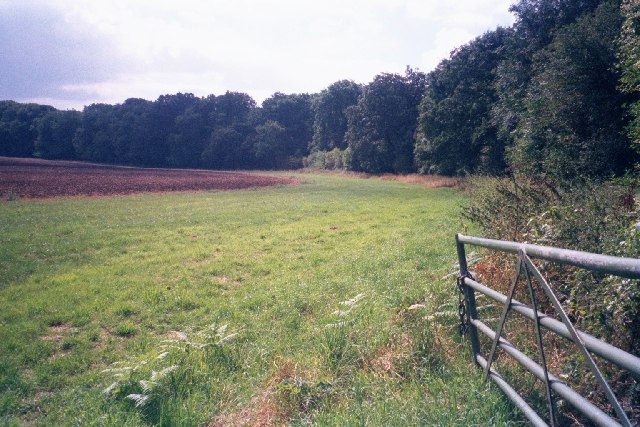
Show on map Photos Edge of field within Wychwood Forest
‹ ›
Weather for this location Next 14 days Nearby places Useful places within 5 km
All Historic
Own or manage this place?
Claim this listing to keep details accurate, add photos, and highlight what makes it special — free.
Claim this page→ How useful was the information on this page?
Something wrong on this page?
id: 3e859d15-b43d-4667-9638-5176910a6be5
UK green spaces mapped from open public data — so anyone can find the woodland, trail, or nature reserve closest to them.
© 2026 Glade · Made with care for UK green spaces
Wildlife to spot
2,883 records · National Biodiversity Network
▾
Wildlife to spot 2,883 records · National Biodiversity Network 🐦 Birds 46 species
winter spring
2025 ▾
Woodpigeon · Carrion Crow · Skylark · Blackbird · Blue Tit +41
Woodpigeon Columba palumbus Carrion Crow Corvus corone Skylark Alauda arvensis Blackbird Turdus merula Blue Tit Cyanistes caeruleus Pheasant Phasianus colchicus Nuthatch Sitta europaea Great Tit Parus major Goldfinch Carduelis carduelis Chaffinch Fringilla coelebs Dunnock Prunella modularis Mistle Thrush Turdus viscivorus Stock Dove Columba oenas Marsh Tit Poecile palustris2024 Wren Troglodytes troglodytes Green Woodpecker Picus viridis Robin Erithacus rubecula Jackdaw Coloeus monedula Coal Tit Periparus ater Yellowhammer Emberiza citrinella2024 Linnet Linaria cannabina2024 Kestrel Falco tinnunculus2024 Chiffchaff Phylloscopus collybita Long-tailed Tit Aegithalos caudatus Goldcrest Regulus regulus Great Spotted Woodpecker Dendrocopos major Fieldfare Turdus pilaris2024 Song Thrush Turdus philomelos2024 Jay Garrulus glandarius2023 House Sparrow Passer domesticus Mallard Anas platyrhynchos Collared Dove Streptopelia decaocto Blackcap Sylvia atricapilla Greenfinch Chloris chloris House Martin Delichon urbicum Swift Apus apus Magpie Pica pica Rook Corvus frugilegus Raven Corvus corax2024 Stonechat Saxicola rubicola2024 Starling Sturnus vulgaris2024 Red-legged Partridge Alectoris rufa2024 Lapwing Vanellus vanellus2023 Barn Owl Tyto alba2023 Woodcock Scolopax rusticola2023 Redwing Turdus iliacus2023 Grey Squirrel · Fallow Deer · Brown Hare · Roe Deer · Badger +1
Grey Squirrel Sciurus carolinensis Fallow Deer Dama dama Brown Hare Lepus europaeus Roe Deer Capreolus capreolus Badger Meles meles2023 Muntjac Muntiacus reevesi2023 Non-biting midges · Common Blue Damselfly · Aquarius paludum · Sigara (Sigara) dorsalis · Azure Damselfly +24
Non-biting midges Chironomidae2025 Common Blue Damselfly Enallagma cyathigerum2025 Aquarius paludum Aquarius paludum2025 Sigara (Sigara) dorsalis Sigara (Sigara) dorsalis2025 Azure Damselfly Coenagrion puella2025 Toothed Pondskater Species observations from the last 10 years via NBN Atlas
Gerris (Gerris) odontogaster2025
Gerris (Gerris) odontogaster2025
Athous bicolor Athous bicolor2025
Athous bicolor Athous bicolor2025
Oak Bush-cricket Meconema thalassinum2024
Oak Bush-cricket Meconema thalassinum2024
Cream-spot Ladybird Calvia quattuordecimguttata
Cream-spot Ladybird Calvia quattuordecimguttata
Abax parallelepipedus Abax parallelepipedus
Abax parallelepipedus Abax parallelepipedus
Plea minutissima Plea minutissima2025
Plea minutissima Plea minutissima2025
Sigara (Subsigara) falleni Sigara (Subsigara) falleni2025
Sigara (Subsigara) falleni Sigara (Subsigara) falleni2025
Water Measurer Hydrometra stagnorum2025
Water Measurer Hydrometra stagnorum2025
Microvelia (Microvelia) reticulata Microvelia (Microvelia) reticulata2025
Microvelia (Microvelia) reticulata Microvelia (Microvelia) reticulata2025
Saucer Bug Ilyocoris cimicoides2025
Saucer Bug Ilyocoris cimicoides2025
Emperor Dragonfly Anax imperator2025
Emperor Dragonfly Anax imperator2025
Common Pondskater Gerris (Gerris) lacustris2025
Common Pondskater Gerris (Gerris) lacustris2025
Pondweed Bug Mesovelia furcata2025
Pondweed Bug Mesovelia furcata2025
Common Water-Boatman Notonecta (Notonecta) glauca2025
Common Water-Boatman Notonecta (Notonecta) glauca2025
Phryganeidae Phryganeidae2025
Phryganeidae Phryganeidae2025
Blue-tailed Damselfly Ischnura elegans2025
Blue-tailed Damselfly Ischnura elegans2025
Hawthorn Shieldbug Acanthosoma haemorrhoidale2025
Hawthorn Shieldbug Acanthosoma haemorrhoidale2025
Cantharis rustica Cantharis rustica2025
Cantharis rustica Cantharis rustica2025
Red-headed Cardinal Beetle Pyrochroa serraticornis2025
Red-headed Cardinal Beetle Pyrochroa serraticornis2025
Harlequin Ladybird Harmonia axyridis2025
Harlequin Ladybird Harmonia axyridis2025
Cantharis decipiens Cantharis decipiens2025
Cantharis decipiens Cantharis decipiens2025
Orange Ladybird Halyzia sedecimguttata2025
Orange Ladybird Halyzia sedecimguttata2025
16-spot Ladybird Tytthaspis sedecimpunctata2025
16-spot Ladybird Tytthaspis sedecimpunctata2025
Athous haemorrhoidalis Athous haemorrhoidalis2025
Athous haemorrhoidalis Athous haemorrhoidalis2025 Events & activities nearby Switch provider to compare local events, tours and bookable activities.
Bookable tours GetYourGuide Promote here