Plan your visit
🦉 Wildlife🌿 Foraging🦋 Insects
Public access Free entry Dogs welcome
Places › England › Yorkshire and the Humber › Sheffield Getting here
53.47826, -1.58698
Open directionsv Visiting this summer
Seasonal nature notes and what to look for now
▾ 🌞 Midsummer — early morning visits most comfortable; look for deer fawns in quieter clearings 🌿 Foraging is at its best in summer here 🐕 Dogs welcome — bring water in summer; the site has enough space to find shade on hot days 🌤️ Visiting this summer
🌞 Midsummer — early morning visits most comfortable; look for deer fawns in quieter clearings 🌿 Foraging is at its best in summer here 🐕 Dogs welcome — bring water in summer; the site has enough space to find shade on hot days £ Free to visit — no entry charge🐕 Dogs welcome🦉 Wildlife
Very strong match
Multi-group wildlife — Amphibians, Birds, Mammals; Multi-group wildlife — Amphibians, Birds, Mammals
Free
Plants — Bramble, Hogweed, Common Bistort +19 more foraging species; Deciduous woodland — fungi, berries and wild garlic
Varies
🦋 Insect spotting
Strong match
Insects — Swollen-thighed Beetle, Dark-edged Bee-fly, Poecilus versicolor +221 more · last seen 2026; Insects — Swollen-thighed Beetle, Dark-edged Bee-fly, Poecilus versicolor +221 more · last seen 2026
Free
🦅 Bird watching
Strong match
Birds — Kestrel, Lapwing, Goldcrest +31 more · last seen 2026; Birds — Kestrel, Lapwing, Goldcrest +31 more · last seen 2026
Free
🍂 Seasonal nature
Strong match
Plants — Japanese Knotweed, Ploughman's-spikenard, Southern Marsh-orchid +148 more · last seen 2026; Plants — Japanese Knotweed, Ploughman's-spikenard, Southern Marsh-orchid +148 more · last seen 2026
Free
Dogs allowed with public access
Free
Trails nearby Within roughly 5 km 6 signed routes nearby · 22 public paths nearby
Signed route nearby Public paths
Sheffield Country Walk Walking route 85 km ▾
Named route Length 85 km Regional walking route
Show on map Barnsley Boundary Walk Walking route ▾
Named route Regional walking route
Show on map Trans-Pennine Trail (Stockport to Silkstone Common) Walking route ▾
Named route Regional walking route
Show on map Penistone Boundary Walk Walking route ▾
Named route Local walking route
Show on map Old Salt Road Walking route ▾
Upper Don Trail public footpath · 117 m ▾
Public path public footpath Length 117 m Surface paving_stones Path type: cycleway
Show on map Upper Don Trail public footpath · 230 m ▾
Public path public footpath Length 230 m Surface asphalt Path type: cycleway
Show on map Upper Don Trail public footpath · 66 m ▾
Public path public footpath Length 66 m Surface asphalt Path type: cycleway
Show on map 30 signed routes nearby
Signed route nearby
Route 627 Cycling route ▾
Named route Ref 627 National Cycle Network
Show on map Route 67 Cycling route ▾
Named route Ref 67 National Cycle Network
Show on map Sheffield Local Cycle Network Cycling route ▾
Sheffield Local Cycle Network
Named route Local cycle route
Show on map Trans Pennine Trail Cycling route ▾
Named route Ref 62 National Cycle Network
Show on map Main Route Cycling route 31 m ▾
Named route Ref 62 Length 31 m National Cycle Network Traffic-free Surface asphalt
Show on map Main Route Cycling route 762 m ▾
Named route Ref 627 Length 762 m National Cycle Network Traffic-free Surface asphalt
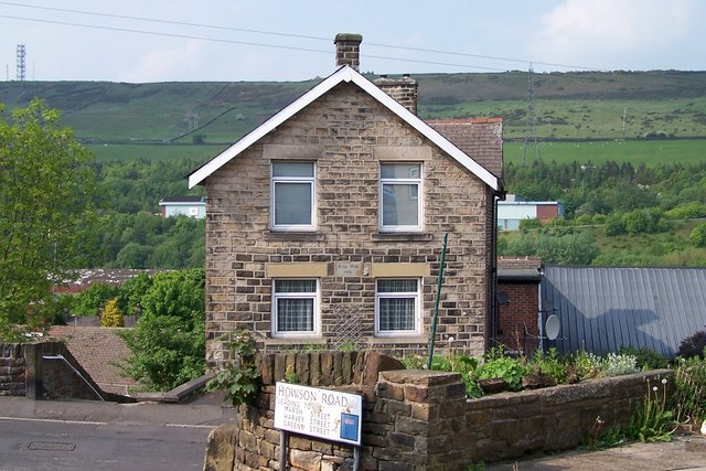
Show on map Photos Crag View House, Stocksbridge
‹ ›
Weather for this location Next 14 days Nearby places Useful places within 5 km
All Historic
Own or manage this place?
Claim this listing to keep details accurate, add photos, and highlight what makes it special — free.
Claim this page→ How useful was the information on this page?
id: 11f420c6-779f-4426-bf86-5b2647772da2
UK green spaces mapped from open public data — so anyone can find the woodland, trail, or nature reserve closest to them.
© 2026 Glade · Made with care for UK green spaces
Wildlife to spot
12,250 records · National Biodiversity Network
▾
Wildlife to spot 12,250 records · National Biodiversity Network Lapwing · Kestrel · Chaffinch · Goldcrest · Bullfinch +18
Lapwing Vanellus vanellus Kestrel Falco tinnunculus Chaffinch Fringilla coelebs Goldcrest Regulus regulus Bullfinch Pyrrhula pyrrhula Blackbird Turdus merula Robin Erithacus rubecula House Sparrow Passer domesticus Blue Tit Cyanistes caeruleus Woodpigeon Columba palumbus Dunnock Prunella modularis Jackdaw Coloeus monedula Goldfinch Carduelis carduelis Greenfinch Chloris chloris Dipper Cinclus cinclus2025 Wren Troglodytes troglodytes Magpie Pica pica Coal Tit Periparus ater Starling Sturnus vulgaris Mallard Anas platyrhynchos Green Woodpecker Picus viridis2025 Long-tailed Tit Aegithalos caudatus2025 Barn Owl Tyto alba2025 Hedgehog
Hedgehog Erinaceus europaeus 🐸 Amphibians 2 species
spring autumn
2025 ▾
Common Toad · Common Frog
Common Toad Bufo bufo Common Frog Rana temporaria Dark-edged Bee-fly · Harlequin Ladybird · Swollen-thighed Beetle · Common Earwig · Field Grasshopper +9
Dark-edged Bee-fly Bombylius major Harlequin Ladybird Harmonia axyridis2025 Swollen-thighed Beetle Oedemera nobilis2025 Common Earwig Forficula auricularia/dentata agg.2025 Field Grasshopper Chorthippus brunneus2025 Roesel's Bush-cricket Ploughman's-spikenard · Wood Anemone · Common Bistort · Lesser Celandine · Wood Avens +70
Ploughman's-spikenard Inula conyzae2025 Wood Anemone Anemone nemorosa2025 Common Bistort Bistorta officinalis2025 Lesser Celandine Ficaria verna2025 Wood Avens Geum urbanum2025 Great Wood-rush Luzula sylvatica Species observations from the last 10 years via NBN Atlas
Roeseliana roeselii2025
Roeseliana roeselii2025
Melanostoma scalare Melanostoma scalare2025
Melanostoma scalare Melanostoma scalare2025
Agapanthia villosoviridescens Agapanthia villosoviridescens2025
Agapanthia villosoviridescens Agapanthia villosoviridescens2025
Hawthorn Shieldbug Acanthosoma haemorrhoidale2025
Hawthorn Shieldbug Acanthosoma haemorrhoidale2025
Orange Ladybird Halyzia sedecimguttata2025
Orange Ladybird Halyzia sedecimguttata2025
7-spot Ladybird Coccinella septempunctata2024
7-spot Ladybird Coccinella septempunctata2024
Lily Beetle Lilioceris lilii2024
Lily Beetle Lilioceris lilii2024
Common Darter Sympetrum striolatum2024
Common Darter Sympetrum striolatum2024
Southern Hawker Aeshna cyanea2024
Southern Hawker Aeshna cyanea2024 2025
2025
Sweet Cicely Myrrhis odorata2025
Sweet Cicely Myrrhis odorata2025
Wall Screw-moss Tortula muralis
Wall Screw-moss Tortula muralis
Springy Turf-moss Rhytidiadelphus squarrosus
Springy Turf-moss Rhytidiadelphus squarrosus
Bristly Oxtongue Helminthotheca echioides2025
Bristly Oxtongue Helminthotheca echioides2025
Bramble Rubus2025
Bramble Rubus2025
Bracken Pteridium aquilinum2025
Bracken Pteridium aquilinum2025
Southern Marsh-orchid Dactylorhiza praetermissa2025
Southern Marsh-orchid Dactylorhiza praetermissa2025
Greater Stitchwort Stellaria holostea2025
Greater Stitchwort Stellaria holostea2025
Red Campion Silene dioica2025
Red Campion Silene dioica2025
Ground-elder Aegopodium podagraria2025
Ground-elder Aegopodium podagraria2025
Opposite-leaved Golden-saxifrage Chrysosplenium oppositifolium2025
Opposite-leaved Golden-saxifrage Chrysosplenium oppositifolium2025
Hyacinthoides Hyacinthoides2025
Hyacinthoides Hyacinthoides2025
Ramsons Allium ursinum2025
Ramsons Allium ursinum2025
Dog's Mercury Mercurialis perennis2025
Dog's Mercury Mercurialis perennis2025
Common Pincushion Dicranoweisia cirrata
Common Pincushion Dicranoweisia cirrata
Common Feather-moss Kindbergia praelonga
Common Feather-moss Kindbergia praelonga
Cypress-leaved Plait-moss Hypnum cupressiforme
Cypress-leaved Plait-moss Hypnum cupressiforme
Wood Bristle-moss Lewinskya affinis
Wood Bristle-moss Lewinskya affinis
Blueish Veilwort Metzgeria violacea
Blueish Veilwort Metzgeria violacea
Broom Fork-moss Dicranum scoparium
Broom Fork-moss Dicranum scoparium
Heath Star Moss Campylopus introflexus
Heath Star Moss Campylopus introflexus
Polytrichum Polytrichum
Polytrichum Polytrichum
Rough-stalked Feather-moss Brachythecium rutabulum
Rough-stalked Feather-moss Brachythecium rutabulum
Anomalous Bristle-moss Orthotrichum anomalum
Anomalous Bristle-moss Orthotrichum anomalum
Grey-cushioned Grimmia Grimmia pulvinata
Grey-cushioned Grimmia Grimmia pulvinata
Heath Plait-moss Hypnum jutlandicum
Heath Plait-moss Hypnum jutlandicum
Lucerne Medicago sativa subsp. sativa2025
Lucerne Medicago sativa subsp. sativa2025
Broad-leaved Helleborine Epipactis helleborine2025
Broad-leaved Helleborine Epipactis helleborine2025
Goldenrod Solidago virgaurea2025
Goldenrod Solidago virgaurea2025
Reflexed Stonecrop Petrosedum rupestre2025
Reflexed Stonecrop Petrosedum rupestre2025
Goat's-rue Galega officinalis2025
Goat's-rue Galega officinalis2025
Meadowsweet Filipendula ulmaria2025
Meadowsweet Filipendula ulmaria2025
Hedge Woundwort Stachys sylvatica2025
Hedge Woundwort Stachys sylvatica2025
Heath Bedstraw Galium saxatile2025
Heath Bedstraw Galium saxatile2025
Dog-rose Rosa canina2025
Dog-rose Rosa canina2025
Foxglove Digitalis purpurea2025
Foxglove Digitalis purpurea2025
Broad-leaved Willowherb Epilobium montanum2025
Broad-leaved Willowherb Epilobium montanum2025
Poppy Papaver2025
Poppy Papaver2025
Broom Cytisus scoparius2025
Broom Cytisus scoparius2025
Common Nettle Urtica dioica2025
Common Nettle Urtica dioica2025
Hoary Mustard Hirschfeldia incana2025
Hoary Mustard Hirschfeldia incana2025
Germander Speedwell Veronica chamaedrys2025
Germander Speedwell Veronica chamaedrys2025
Bush Vetch Vicia sepium2025
Bush Vetch Vicia sepium2025
Barren Strawberry Potentilla sterilis2025
Barren Strawberry Potentilla sterilis2025
Wood-sorrel Oxalis acetosella2025
Wood-sorrel Oxalis acetosella2025
Herb-Robert Geranium robertianum2025
Herb-Robert Geranium robertianum2025
Wild Angelica Angelica sylvestris2025
Wild Angelica Angelica sylvestris2025
Tutsan Hypericum androsaemum2025
Tutsan Hypericum androsaemum2025
Hogweed Heracleum sphondylium2025
Hogweed Heracleum sphondylium2025
Himalayan Balsam Impatiens glandulifera2025
Himalayan Balsam Impatiens glandulifera2025
Garlic Mustard Alliaria petiolata2025
Garlic Mustard Alliaria petiolata2025
Hard Shield-fern Polystichum aculeatum2025
Hard Shield-fern Polystichum aculeatum2025
Dame's-violet Hesperis matronalis2025
Dame's-violet Hesperis matronalis2025
Pick-a-back-plant Tolmiea menziesii2025
Pick-a-back-plant Tolmiea menziesii2025
Pendulous Sedge Carex pendula2025
Pendulous Sedge Carex pendula2025
Hart's-Tongue Asplenium scolopendrium2025
Hart's-Tongue Asplenium scolopendrium2025
Creeping Soft-grass Holcus mollis2025
Creeping Soft-grass Holcus mollis2025
Cow Parsley Anthriscus sylvestris2025
Cow Parsley Anthriscus sylvestris2025
Scaly Male-fern Dryopteris affinis2025
Scaly Male-fern Dryopteris affinis2025
Field-rose Rosa arvensis2025
Field-rose Rosa arvensis2025
Cherry Plum Prunus cerasifera2025
Cherry Plum Prunus cerasifera2025
Stinking Hellebore Helleborus foetidus2025
Stinking Hellebore Helleborus foetidus2025
Hazel Corylus avellana2025
Hazel Corylus avellana2025
Soft Shield-fern Polystichum setiferum2024
Soft Shield-fern Polystichum setiferum2024
Narrow-leaved Ragwort Senecio inaequidens2024
Narrow-leaved Ragwort Senecio inaequidens2024
Apple Malus domestica2024
Apple Malus domestica2024
Grey Alder Alnus incana2024
Grey Alder Alnus incana2024
Male-fern Dryopteris filix-mas2024
Male-fern Dryopteris filix-mas2024
Hard Rush Juncus inflexus2024
Hard Rush Juncus inflexus2024 Events & activities nearby Switch provider to compare local events, tours and bookable activities.
Bookable tours GetYourGuide Promote here