🦉 Wildlife🦅 Birds🌿 Foraging
↑ Share
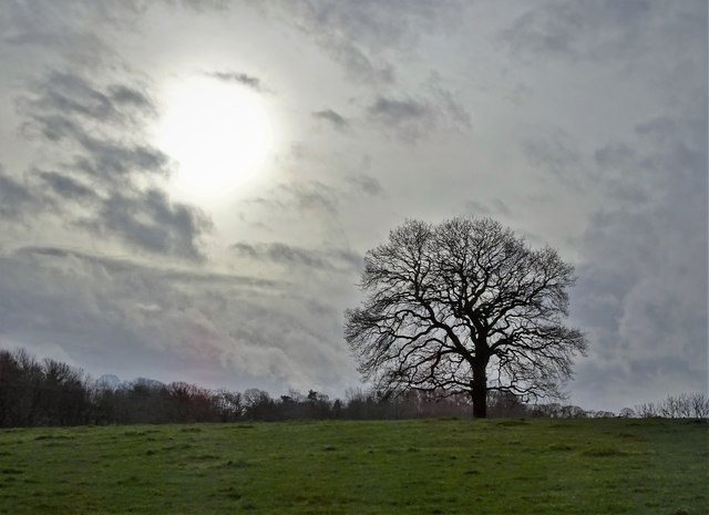
Public access Free entry Dogs welcome 2 ha
Places › England › East Midlands › North East Derbyshire Getting here
53.23245, -1.50122
Open directionsv Visiting this summer
Seasonal nature notes and what to look for now
▾ 🌞 Midsummer — early morning visits most comfortable; look for deer fawns in quieter clearings 🌿 Foraging is at its best in summer here 🐕 Dogs welcome — bring water in summer; the site has enough space to find shade on hot days 🌤️ Visiting this summer
🌞 Midsummer — early morning visits most comfortable; look for deer fawns in quieter clearings 🌿 Foraging is at its best in summer here 🐕 Dogs welcome — bring water in summer; the site has enough space to find shade on hot days £ Free to visit — no entry charge🐕 Dogs welcome🦉 Wildlife
Very strong match
Multi-group wildlife — Amphibians, Birds, Mammals, Reptiles; Multi-group wildlife — Amphibians, Birds, Mammals, Reptiles
Free
🦅 Bird watching
Very strong match
Birds — Great Tit, Blue Tit, Robin +77 more · last seen 2026; Birds — Great Tit, Blue Tit, Robin +77 more · last seen 2026
Free
Plants — Ramsons, Wood-sorrel, Corn Mint +12 more foraging species; Deciduous woodland — fungi, berries and wild garlic
Varies
🍂 Seasonal nature
Strong match
Plants — Rosebay Willowherb, Brooklime, Yellow Pimpernel +68 more · last seen 2025; Plants — Rosebay Willowherb, Brooklime, Yellow Pimpernel +68 more · last seen 2025
Free
Dogs allowed — public woodland
Free
🦋 Insect spotting
Strong match
Insects — Marmalade Hoverfly, Syrphus, Common Blue Damselfly +39 more · last seen 2025; Insects — Marmalade Hoverfly, Syrphus, Common Blue Damselfly +39 more · last seen 2025
Free
Trails nearby Within roughly 5 km 6 signed routes nearby · 31 public paths nearby
Signed route nearby Public paths
Chesterfield Round Walk Walking route ▾
Named route Round trip Local walking route
Show on map South Chesterfield Way Walking route ▾
Named route Local walking route
Show on map Peak District Boundary Walk Stage 11 Walking route 17 km ▾
Named route Length 17 km Regional walking route
Show on map North Chesterfield Way Walking route ▾
Named route Local walking route
Show on map Round Holmesfield Walk Walking route ▾
2 signed routes nearby
Signed route nearby
Route 5 Cycling route ▾
Named route Ref 5 Local cycle route
Show on map LCN 3 Cycling route ▾
Named route Ref 3 Local cycle route
Show on map 10 public paths nearby
Public paths
Westwick Lane bridleway · 249 m ▾
Public path bridleway Length 249 m Surface gravel Path type: track
Show on map Frithhall Lane bridleway · 146 m ▾
Public path bridleway Length 146 m Surface concrete Path type: track
Show on map Frithhall Lane bridleway · 141 m ▾
Public path bridleway Length 141 m Surface concrete Path type: track
Show on map Westwick Lane bridleway · 18 m ▾
Public path bridleway Length 18 m Path type: service
Show on map Frithhall Lane bridleway · 5 m ▾
Public path bridleway Length 5 m Surface concrete Path type: track
Show on map
Weather for this location Next 14 days Nearby places Useful places within 5 km
All Historic
Own or manage this place?
Claim this listing to keep details accurate, add photos, and highlight what makes it special — free.
Claim this page→ How useful was the information on this page?
Something wrong on this page?
id: ea1e66f0-d56c-4c04-9258-cd56d0a5066d
UK green spaces mapped from open public data — so anyone can find the woodland, trail, or nature reserve closest to them.
© 2026 Glade · Made with care for UK green spaces
Events & activities nearby Switch provider to compare local events, tours and bookable activities.
Bookable tours GetYourGuide Promote here
Wildlife to spot
19,004 records · National Biodiversity Network
▾
Wildlife to spot 19,004 records · National Biodiversity Network 🐦 Birds 41 species
spring winter
2026 ▾
Coot · Tufted Duck · Moorhen · Mallard · Great Crested Grebe +36
Coot Fulica atra2025 Tufted Duck Aythya fuligula2025 Moorhen Gallinula chloropus2025 Mallard Anas platyrhynchos2025 Great Crested Grebe Podiceps cristatus Black-headed Gull Chroicocephalus ridibundus2025 Chaffinch Fringilla coelebs2025 Wren Troglodytes troglodytes2025 Long-tailed Tit Aegithalos caudatus2025 Great Tit Parus major2025 Nuthatch Sitta europaea2025 Coal Tit Periparus ater2025 Cormorant Phalacrocorax carbo2025 Mandarin Duck Aix galericulata2025 Carrion Crow Corvus corone2025 Jackdaw Coloeus monedula2025 Dunnock Prunella modularis2025 Robin Erithacus rubecula2025 Song Thrush Turdus philomelos2025 Goldfinch Carduelis carduelis2025 Magpie Pica pica2025 Blackbird Turdus merula2025 Jay Garrulus glandarius Tawny Owl Strix aluco2025 Bullfinch Pyrrhula pyrrhula2025 Chiffchaff Phylloscopus collybita2025 Pheasant Phasianus colchicus2025 Stock Dove Columba oenas2025 Lesser Black-backed Gull Larus fuscus2025 Yellowhammer Emberiza citrinella2025 Kestrel Falco tinnunculus2025 Woodpigeon Columba palumbus2025 House Sparrow Passer domesticus2025 Blue Tit Cyanistes caeruleus2025 Redwing Turdus iliacus2025 Barn Owl Tyto alba2025 Great Spotted Woodpecker Dendrocopos major2024 Goosander Mergus merganser2024 Treecreeper Certhia familiaris2024 Grey Heron Ardea cinerea2024 Little Grebe Tachybaptus ruficollis2024 Badger
Grass Snake
Grass Snake Natrix helvetica 🐝 Insects 10 species
spring summer
2025 ▾
Syrphus · Marmalade Hoverfly · Common Blue Damselfly · Sphaerophoria · Volucella pellucens +5
Syrphus Syrphus Marmalade Hoverfly Episyrphus balteatus Common Blue Damselfly Enallagma cyathigerum Sphaerophoria Sphaerophoria Volucella pellucens Volucella pellucens Dolichovespula media Dolichovespula media Rosebay Willowherb · Bluebell · Gorse · Chicory · Wood-sorrel +94
Rosebay Willowherb Chamaenerion angustifolium Bluebell Hyacinthoides non-scripta Gorse Ulex europaeus Chicory Cichorium intybus Wood-sorrel Oxalis acetosella Bullace Prunus domestica subsp. insititia Bittersweet Solanum dulcamara Species observations from the last 10 years via NBN Atlas
Brown Hawker
Brown Hawker
Aeshna grandis
Aeshna grandis
Portevinia maculata Portevinia maculata
Portevinia maculata Portevinia maculata
Cantharis nigricans Cantharis nigricans
Cantharis nigricans Cantharis nigricans
Black-headed Cardinal Beetle Pyrochroa coccinea
Black-headed Cardinal Beetle Pyrochroa coccinea
Corn Mint Mentha arvensis
Corn Mint Mentha arvensis
Brooklime Veronica beccabunga
Brooklime Veronica beccabunga
Amphibious Bistort Persicaria amphibia
Amphibious Bistort Persicaria amphibia
Common Bistort Bistorta officinalis
Common Bistort Bistorta officinalis
daffodils Narcissus
daffodils Narcissus
Creeping Thistle Cirsium arvense
Creeping Thistle Cirsium arvense
Coltsfoot Tussilago farfara
Coltsfoot Tussilago farfara
Meadow Foxtail Alopecurus pratensis
Meadow Foxtail Alopecurus pratensis
Radish Raphanus raphanistrum
Radish Raphanus raphanistrum
Great Willowherb Epilobium hirsutum
Great Willowherb Epilobium hirsutum
Foxglove Digitalis purpurea
Foxglove Digitalis purpurea
Wavy Bitter-cress Cardamine flexuosa
Wavy Bitter-cress Cardamine flexuosa
Hogweed Heracleum sphondylium
Hogweed Heracleum sphondylium
Creeping Buttercup Ranunculus repens
Creeping Buttercup Ranunculus repens
White Mustard Sinapis alba
White Mustard Sinapis alba
Corn Spurrey Spergula arvensis
Corn Spurrey Spergula arvensis
Cleavers Galium aparine
Cleavers Galium aparine
Raspberry Rubus idaeus
Raspberry Rubus idaeus
Bramble Rubus fruticosus
Bramble Rubus fruticosus
Oxeye Daisy Leucanthemum vulgare
Oxeye Daisy Leucanthemum vulgare
Wych Elm Ulmus glabra
Wych Elm Ulmus glabra
Viola arvensis x tricolor = V. x contempta Viola arvensis x tricolor = V. x contempta
Viola arvensis x tricolor = V. x contempta Viola arvensis x tricolor = V. x contempta
Great Burnet Sanguisorba officinalis
Great Burnet Sanguisorba officinalis
Greater Plantain Plantago major
Greater Plantain Plantago major
Garlic Mustard Alliaria petiolata
Garlic Mustard Alliaria petiolata
Wild Pansy Viola tricolor
Wild Pansy Viola tricolor
Hairy Bitter-cress Cardamine hirsuta
Hairy Bitter-cress Cardamine hirsuta
Ribwort Plantain Plantago lanceolata
Ribwort Plantain Plantago lanceolata
White Dead-nettle Lamium album
White Dead-nettle Lamium album
Elder Sambucus nigra
Elder Sambucus nigra
Common Nettle Urtica dioica
Common Nettle Urtica dioica
Mouse-ear-hawkweed Pilosella officinarum
Mouse-ear-hawkweed Pilosella officinarum
Common Bird's-foot-trefoil Lotus corniculatus
Common Bird's-foot-trefoil Lotus corniculatus
Danish Scurvygrass Cochlearia danica
Danish Scurvygrass Cochlearia danica
Centaurea nigra Centaurea nigra
Centaurea nigra Centaurea nigra
American Winter-cress Barbarea verna
American Winter-cress Barbarea verna
Cat's-ear Hypochaeris radicata
Cat's-ear Hypochaeris radicata
Lesser Burdock Arctium minus
Lesser Burdock Arctium minus
Dandelion Taraxacum
Dandelion Taraxacum
Perennial Cornflower Centaurea montana
Perennial Cornflower Centaurea montana
Cow Parsley Anthriscus sylvestris
Cow Parsley Anthriscus sylvestris
Yarrow Achillea millefolium
Yarrow Achillea millefolium
Bush Vetch Vicia sepium
Bush Vetch Vicia sepium
Red Valerian Centranthus ruber
Red Valerian Centranthus ruber
Field Forget-me-not Myosotis arvensis
Field Forget-me-not Myosotis arvensis
Broad-leaved Dock Rumex obtusifolius
Broad-leaved Dock Rumex obtusifolius
Wall Speedwell Veronica arvensis
Wall Speedwell Veronica arvensis
Cuckooflower Cardamine pratensis
Cuckooflower Cardamine pratensis
Sweet Vernal-grass Anthoxanthum odoratum
Sweet Vernal-grass Anthoxanthum odoratum
White Clover Trifolium repens
White Clover Trifolium repens
Meadow Crane's-bill Geranium pratense
Meadow Crane's-bill Geranium pratense
Germander Speedwell Veronica chamaedrys
Germander Speedwell Veronica chamaedrys
Ground-ivy Glechoma hederacea
Ground-ivy Glechoma hederacea
Sticky Mouse-ear Cerastium glomeratum
Sticky Mouse-ear Cerastium glomeratum
Snowdrop Galanthus nivalis
Snowdrop Galanthus nivalis
Bilberry Vaccinium myrtillus
Bilberry Vaccinium myrtillus
Holly Ilex aquifolium
Holly Ilex aquifolium
Ash Fraxinus excelsior
Ash Fraxinus excelsior
Cock's-foot Dactylis glomerata
Cock's-foot Dactylis glomerata
Sweet Cicely Myrrhis odorata
Sweet Cicely Myrrhis odorata
Prickly Sow-thistle Sonchus asper
Prickly Sow-thistle Sonchus asper
Tufted Vetch Vicia cracca
Tufted Vetch Vicia cracca
Field Wood-rush Luzula campestris
Field Wood-rush Luzula campestris
Myosotis discolor subsp. dubia Myosotis discolor subsp. dubia
Myosotis discolor subsp. dubia Myosotis discolor subsp. dubia
Curled Dock Rumex crispus
Curled Dock Rumex crispus
Common Field-speedwell Veronica persica
Common Field-speedwell Veronica persica
Spear Thistle Cirsium vulgare
Spear Thistle Cirsium vulgare
Common Ragwort Jacobaea vulgaris
Common Ragwort Jacobaea vulgaris
Bulbous Buttercup Ranunculus bulbosus
Bulbous Buttercup Ranunculus bulbosus
Creeping Cinquefoil Potentilla reptans
Creeping Cinquefoil Potentilla reptans
Common Vetch Vicia sativa
Common Vetch Vicia sativa
Common Chickweed Stellaria media
Common Chickweed Stellaria media
Hedera helix Hedera helix
Hedera helix Hedera helix
Rowan Sorbus aucuparia
Rowan Sorbus aucuparia
Sycamore Acer pseudoplatanus
Sycamore Acer pseudoplatanus
Annual Meadow-grass Poa annua
Annual Meadow-grass Poa annua
Lesser Celandine Ficaria verna
Lesser Celandine Ficaria verna
Daisy Bellis perennis
Daisy Bellis perennis
Wood Anemone Anemone nemorosa
Wood Anemone Anemone nemorosa
Groundsel Senecio vulgaris
Groundsel Senecio vulgaris
Field Pansy Viola arvensis
Field Pansy Viola arvensis
Black Medick Medicago lupulina
Black Medick Medicago lupulina
Shepherd's-purse Capsella bursa-pastoris
Shepherd's-purse Capsella bursa-pastoris
Meadow Vetchling Lathyrus pratensis
Meadow Vetchling Lathyrus pratensis
Greater Stitchwort Stellaria holostea
Greater Stitchwort Stellaria holostea
Festuca rubra Festuca rubra
Festuca rubra Festuca rubra
Common Mouse-ear Cerastium fontanum
Common Mouse-ear Cerastium fontanum
Charlock Sinapis arvensis
Charlock Sinapis arvensis
Creeping Comfrey Symphytum grandiflorum
Creeping Comfrey Symphytum grandiflorum
Hawthorn Crataegus monogyna
Hawthorn Crataegus monogyna
Toothwort Lathraea squamaria
Toothwort Lathraea squamaria
Opposite-leaved Golden-saxifrage Chrysosplenium oppositifolium
Opposite-leaved Golden-saxifrage Chrysosplenium oppositifolium