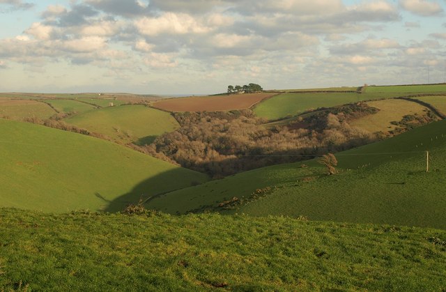
West Prawle Wood
✦ Ancient woodland16 ha
Plan your visit
🦅Birds🦉Wildlife🍂Seasonal
Public accessFree entryDogs welcome16 ha
Getting here
50.23344, -3.71905
Open directionsv
Visiting this summer
Seasonal nature notes and what to look for now
- 🐦66+ species recorded in this area — summer evenings are best for activity; watch for Mallard and Herring Gull
- 🐕Early mornings are best for dog walks in summer — visit before 9am to avoid the heat and find quieter trails
- 📍Open access throughout summer — no booking required
🌤️ Visiting this summer
- 🐦66+ species recorded in this area — summer evenings are best for activity; watch for Mallard and Herring Gull
- 🐕Early mornings are best for dog walks in summer — visit before 9am to avoid the heat and find quieter trails
- 📍Open access throughout summer — no booking required
- £Free to visit — no entry charge
- 🐕Dogs welcome
- 🌿Ancient woodland — rare wildlife habitat
🦅Bird watching
Very strong match
Birds — Mallard, Herring Gull, Little Egret +63 more · last seen 2026; Birds — Mallard, Herring Gull, Little Egret +63 more · last seen 2026
Free
🦉Wildlife
Very strong match
Multi-group wildlife — Birds, Mammals; Multi-group wildlife — Birds, Mammals
Free
🍂Seasonal nature
Strong match
Ancient woodland — bluebells, fungi and autumn colour; Plants — Parrot's-feather · last seen 2023
Free
Dogs allowed — public woodland
Free
🦋Insect spotting
Strong match
Acid grassland — heathland butterflies and rare invertebrates; Insects — Vagrant Emperor, Glow-worm, Portevinia maculata +13 more · last seen 2025
Free
Deciduous woodland — fungi, berries and wild garlic
Varies
Trails nearby
Within roughly 5 km3 signed routes nearby · 3 public paths nearby
Signed route nearbyPublic paths
South West Coast Path (Section 38: Bigbury on Sea to Salcombe)Walking route▾
Named routeRef SWCPNational walking route
South West Coast Path (Section 39: Salcombe to Torcross)Walking route▾
Named routeRef SWCPNational walking route
South West Coast Path (Section 40: Torcross to Dartmouth)Walking route▾
Named routeRef SWCPNational walking route
26 signed routes nearby
Signed route nearby
Route 28Cycling route▾
Named routeRef 28National Cycle Network
Alternative RouteCycling route17 m▾
Named routeRef 28Length 17 mNational Cycle NetworkTraffic-freeSurface asphalt
Main RouteCycling route165 m▾
Named routeRef 28Length 165 mNational Cycle NetworkOn-roadSurface asphalt
Main RouteCycling route90 m▾
Named routeRef 28Length 90 mNational Cycle NetworkTraffic-freeSurface bareearth
Main RouteCycling route3.4 km▾
Named routeRef 28Length 3.4 kmNational Cycle NetworkOn-roadSurface asphalt
Main RouteCycling route143 m▾
Named routeRef 28Length 143 mNational Cycle NetworkOn-roadSurface asphalt
2 public paths nearby
Public paths
Woodlanebridleway · 879 m▾
Public pathbridlewayLength 879 mPath type: track
Weather for this location
Next 14 daysNearby places
Useful places within 5 km
Own or manage this place?
Claim this listing to keep details accurate, add photos, and highlight what makes it special — free.
Claim this page→How useful was the information on this page?
id: 1e6c45fd-0534-4e21-9569-34960bb78b61
Events & activities nearby
Switch provider to compare local events, tours and bookable activities.
Wildlife to spot
6,688 records · National Biodiversity Network
Wildlife to spot
6,688 records · National Biodiversity Network🐦Birds31 species
winterspringsummerautumn
2026▾
Herring Gull · Mallard · Little Egret · Greenshank · Mute Swan +26
- Herring GullLarus argentatus2025
- MallardAnas platyrhynchos2025
- Little EgretEgretta garzetta2025
- GreenshankTringa nebularia2025
- Mute SwanCygnus olor2025
- Grey HeronArdea cinerea2025
- RedshankTringa totanus2025
- Black-headed GullChroicocephalus ridibundus2025
- MoorhenGallinula chloropus2025
- Great Black-backed GullLarus marinus2025
- CurlewNumenius arquata2025
- ShelduckTadorna tadorna2025
- Pied WagtailMotacilla alba yarrellii2025
- OystercatcherHaematopus ostralegus2025
- Canada GooseBranta canadensis2025
- ChaffinchFringilla coelebs
- CormorantPhalacrocorax carbo2025
- Collared DoveStreptopelia decaocto2025
- Grey WagtailMotacilla cinerea2025
- SwallowHirundo rustica2025
- JayGarrulus glandarius2025
- TealAnas crecca2025
- WhimbrelNumenius phaeopus2024
- Greylag GooseAnser anser2024
- StarlingSturnus vulgaris2025
- Common SandpiperActitis hypoleucos2025
- Long-tailed TitAegithalos caudatus2025
- KingfisherAlcedo atthis2024
- Larus argentatus argenteusLarus argentatus argenteus2024
- CuckooCuculus canorus2024
- House MartinDelichon urbicum2024
Vagrant Emperor · Portevinia maculata · Glow-worm · Platycheirus · Melanostoma +8
- Vagrant EmperorAnax ephippiger
- Portevinia maculataPortevinia maculata
- Glow-wormLampyris noctiluca
- PlatycheirusPlatycheirus
- MelanostomaMelanostoma
- Dock BugCoreus marginatus
- Rhingia rostrataRhingia rostrata
Species observations from the last 10 years via NBN Atlas