Getting here
54.91043, -2.01351
Visiting this summer
Seasonal nature notes and what to look for now
Visiting this summer
Seasonal nature notes and what to look for now
- 🌞Midsummer — early morning visits most comfortable; look for deer fawns in quieter clearings
- 🍄Mushroom foraging is at its best in summer here
- 🐕Dogs welcome — bring water in summer; the site has enough space to find shade on hot days
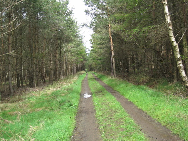
🌤️ Visiting this summer
- 🌞Midsummer — early morning visits most comfortable; look for deer fawns in quieter clearings
- 🍄Mushroom foraging is at its best in summer here
- 🐕Dogs welcome — bring water in summer; the site has enough space to find shade on hot days
Good to know
- £Free to visit — no entry charge
- 🐕Dogs welcome
- 🌿Ancient woodland — rare wildlife habitat
Best for
Wildlife
Very strong match
Multi-group wildlife — Birds, Mammals, Reptiles; Multi-group wildlife — Birds, Mammals, Reptiles
Bird watching
Very strong match
Birds — Wigeon, Blue Tit, Siskin +83 more · last seen 2025; Birds — Wigeon, Blue Tit, Siskin +83 more · last seen 2025
Mushroom foraging
Strong match
Fungi — Usnea subfloridana, Tongues Of Fire, Mollisia fallax +77 more · last seen 2025; Fungi — Usnea subfloridana, Tongues Of Fire, Mollisia fallax +77 more · last seen 2025
Seasonal nature
Strong match
Ancient woodland — bluebells, fungi and autumn colour; Plants — Twinflower · last seen 2024
Horse riding
Strong match
Horse riding listed as facility
Foraging
Good match
Deciduous woodland — fungi, berries and wild garlic
Trails nearby
Within roughly 5 km🚶Walking
2 signed routes nearby
Signed route nearby
Walking
Way of LightWalking route
Stocksfields Community Woodland TrailsWalking route
🚴Cycling
5 signed routes nearby
Signed route nearby
Cycling
Hadrian's CyclewayCycling route
National Byway (County Durham and Northumberland)Cycling route
The National Byway route through County Durham and Northumberland
Main RouteCycling route2.6 km
Main RouteCycling route20 m
Main RouteCycling route1.9 km
🐴Horse riding
2 public paths nearby
Public paths
Horse riding
Coal Roadbyway open to all traffic · 532 m
Wildlife to spot
Photos
Weather for this location
Loading local forecast…
Nearby places
Useful places within 5 km
Own or manage this place?
Claim this listing to keep details accurate, add photos, and highlight what makes it special — free.
Claim this pageHow was your visit?
How useful was the information on this page?
id: f50bd35a-0463-4dad-93c6-d1e4551e011f