Plan your visit
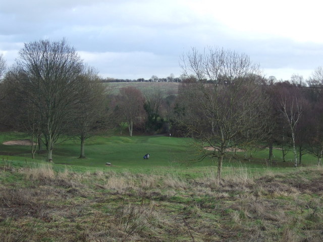
⛳ Golf🦉 Wildlife🦅 Birds
Public access Paid entry Dogs welcome
Places › England › Yorkshire and the Humber › Leeds Getting here
53.91911, -1.40175
Open directionsv Visiting this summer
Seasonal nature notes and what to look for now
▾ 🌞 Midsummer — early morning visits most comfortable; look for deer fawns in quieter clearings ⛳ Golf is at its best in summer here 🐕 Dogs welcome — bring water in summer; the site has enough space to find shade on hot days 🌤️ Visiting this summer
🌞 Midsummer — early morning visits most comfortable; look for deer fawns in quieter clearings ⛳ Golf is at its best in summer here 🐕 Dogs welcome — bring water in summer; the site has enough space to find shade on hot days 🦉 Wildlife
Very strong match
Multi-group wildlife — Amphibians, Birds, Mammals; Multi-group wildlife — Amphibians, Birds, Mammals
Free
🦅 Bird watching
Very strong match
Birds — Mallard, Woodpigeon, Blackbird +63 more · last seen 2026; Birds — Mallard, Woodpigeon, Blackbird +63 more · last seen 2026
Free
🦋 Insect spotting
Strong match
Insects — Eristalis tenax, Platycheirus albimanus, Hairy-footed Flower Bee +185 more · last seen 2026; Insects — Eristalis tenax, Platycheirus albimanus, Hairy-footed Flower Bee +185 more · last seen 2026
Free
Dogs allowed with public access
Free
〰 Waterside walks
Good match
Grazing marsh and ditches — waterside walking
Varies
Trails nearby Within roughly 5 km 3 signed routes nearby · 25 public paths nearby
Signed route nearby Public paths
Ebor Way Walking route ▾
Named route Regional walking route
Show on map East Keskick And Hetchell Wood 6.25 miles 3.5 hours Walking route ▾
Named route Local walking route
Show on map Leeds Country Way Walking route ▾
Named route Local walking route
Show on map Wharfe Grove public footpath · 206 m ▾
Public path public footpath Length 206 m Surface asphalt Path type: residential
Show on map Linton Common public footpath · 322 m ▾
Public path public footpath Length 322 m Surface asphalt Path type: residential
Show on map 49 signed routes nearby
Signed route nearby
NCN National Route 665 Cycling route ▾
Named route Ref 665 National Cycle Network
Show on map Route 67 Cycling route ▾
Named route Ref 67 National Cycle Network
Show on map West Yorkshire Cycle Route Cycling route ▾
Named route Ref WYCR Regional cycle route
Show on map Elmet Greenway Cycling route ▾
Named route National Cycle Network
Show on map Main Route Cycling route 15 m ▾
Named route Ref 67 Length 15 m National Cycle Network On-road Surface asphalt
Show on map Main Route Cycling route 2.2 km ▾
Named route Ref 66 Length 2.2 km National Cycle Network Traffic-free Surface asphalt
Show on map 3 signed routes nearby
Signed route nearby
The Owl Mountain bike route ▾
The Starling Mountain bike route ▾
Red Kite Trail Mountain bike route ▾
6 public paths nearby
Public paths
Trip Lane bridleway · 301 m ▾
Public path bridleway Length 301 m Surface asphalt Path type: residential
Show on map Trip Lane bridleway · 907 m ▾
Public path bridleway Length 907 m Surface asphalt Path type: service
Show on map
Weather for this location Next 14 days Nearby places Useful places within 5 km
All Historic
Own or manage this place?
Claim this listing to keep details accurate, add photos, and highlight what makes it special — free.
Claim this page→ How useful was the information on this page?
id: 7250a121-ab47-41ab-bf54-7c38e8b9de50
UK green spaces mapped from open public data — so anyone can find the woodland, trail, or nature reserve closest to them.
© 2026 Glade · Made with care for UK green spaces
Wildlife to spot
12,891 records · National Biodiversity Network
▾
Wildlife to spot 12,891 records · National Biodiversity Network Mallard · Black-headed Gull · Goosander · Blackbird · Wren +29
Mallard Anas platyrhynchos Black-headed Gull Chroicocephalus ridibundus Goosander Mergus merganser2025 Blackbird Turdus merula Wren Troglodytes troglodytes2025 Carrion Crow Corvus corone2025 Magpie Pica pica2025 Woodpigeon Columba palumbus2025 Grey Heron Ardea cinerea2025 Robin Erithacus rubecula2025 Goldfinch Carduelis carduelis2025 Kingfisher Alcedo atthis2025 Blue Tit Cyanistes caeruleus2025 Redwing Turdus iliacus2025 Long-tailed Tit Aegithalos caudatus2025 Great Tit Parus major2025 Jackdaw Coloeus monedula2025 Little Egret Egretta garzetta2025 Chaffinch Fringilla coelebs2025 Starling Sturnus vulgaris2025 Song Thrush Turdus philomelos2025 Jay Garrulus glandarius2025 Goldcrest Regulus regulus2025 Mistle Thrush Turdus viscivorus2025 Great Spotted Woodpecker Dendrocopos major2025 Pied Wagtail Motacilla alba yarrellii2025 Moorhen Gallinula chloropus2025 Dunnock Prunella modularis2025 Coal Tit Periparus ater2025 Greenfinch Chloris chloris2025 Skylark Alauda arvensis2025 Swift Apus apus2025 Rock Dove Columba livia2025 Grey Wagtail Motacilla cinerea2025 Eristalis tenax · Syrphus torvus · Meliscaeva auricollis · Empis livida · Scaeva selenitica +86
Eristalis tenax Eristalis tenax Syrphus torvus Syrphus torvus Meliscaeva auricollis Meliscaeva auricollis Empis livida Empis livida2025 Scaeva selenitica Scaeva selenitica2025 Swollen-thighed Beetle Oedemera nobilis2025 Pyramidal Orchid · Himalayan Balsam
Pyramidal Orchid Anacamptis pyramidalis Himalayan Balsam Impatiens glandulifera Species observations from the last 10 years via NBN Atlas
Cheilosia albitarsis
Cheilosia albitarsis
Cheilosia albitarsis2025
Cheilosia albitarsis2025
Hairy-footed Flower Bee Anthophora plumipes
Hairy-footed Flower Bee Anthophora plumipes
Marmalade Hoverfly Episyrphus balteatus
Marmalade Hoverfly Episyrphus balteatus
Bombus terrestris subsp. audax Bombus terrestris subsp. audax2025
Bombus terrestris subsp. audax Bombus terrestris subsp. audax2025
Ivy Bee Colletes hederae2025
Ivy Bee Colletes hederae2025
Broad Centurion Chloromyia formosa2025
Broad Centurion Chloromyia formosa2025
Banded Demoiselle Calopteryx splendens2025
Banded Demoiselle Calopteryx splendens2025
Scaeva pyrastri Scaeva pyrastri2025
Scaeva pyrastri Scaeva pyrastri2025
Volucella inanis Volucella inanis2025
Volucella inanis Volucella inanis2025
Eupeodes corollae Eupeodes corollae2025
Eupeodes corollae Eupeodes corollae2025
Cheilosia illustrata Cheilosia illustrata2025
Cheilosia illustrata Cheilosia illustrata2025
Volucella pellucens Volucella pellucens2025
Volucella pellucens Volucella pellucens2025
Greater Bulb-Fly Merodon equestris2025
Greater Bulb-Fly Merodon equestris2025
Tree Bumblebee Bombus hypnorum2025
Tree Bumblebee Bombus hypnorum2025
Platycheirus rosarum Platycheirus rosarum2025
Platycheirus rosarum Platycheirus rosarum2025
Platycheirus Platycheirus
Platycheirus Platycheirus
Buffish Mining Bee Andrena nigroaenea
Buffish Mining Bee Andrena nigroaenea
Hairy Shieldbug Dolycoris baccarum
Hairy Shieldbug Dolycoris baccarum
Green Shieldbug Palomena prasina
Green Shieldbug Palomena prasina
Dark-edged Bee-fly Bombylius major
Dark-edged Bee-fly Bombylius major
Early Bumblebee Bombus pratorum
Early Bumblebee Bombus pratorum
7-spot Ladybird Coccinella septempunctata
7-spot Ladybird Coccinella septempunctata
Orange Ladybird Halyzia sedecimguttata
Orange Ladybird Halyzia sedecimguttata
10-spot Ladybird Adalia decempunctata
10-spot Ladybird Adalia decempunctata
22-spot Ladybird Psyllobora vigintiduopunctata2025
22-spot Ladybird Psyllobora vigintiduopunctata2025
Eupeodes luniger Eupeodes luniger2025
Eupeodes luniger Eupeodes luniger2025
Common Earwig Forficula auricularia/dentata agg.2025
Common Earwig Forficula auricularia/dentata agg.2025
Cheilosia caerulescens Cheilosia caerulescens2025
Cheilosia caerulescens Cheilosia caerulescens2025
Box Bug Gonocerus acuteangulatus2025
Box Bug Gonocerus acuteangulatus2025
Cuckoo-Spit Insect Philaenus spumarius2025
Cuckoo-Spit Insect Philaenus spumarius2025
Notonecta (Notonecta) maculata Notonecta (Notonecta) maculata2025
Notonecta (Notonecta) maculata Notonecta (Notonecta) maculata2025
Coriomeris denticulatus Coriomeris denticulatus2025
Coriomeris denticulatus Coriomeris denticulatus2025
Platycheirus manicatus Platycheirus manicatus2025
Platycheirus manicatus Platycheirus manicatus2025
Figwort Sawfly Tenthredo scrophulariae2025
Figwort Sawfly Tenthredo scrophulariae2025
Platycheirus clypeatus agg. Platycheirus clypeatus agg.2025
Platycheirus clypeatus agg. Platycheirus clypeatus agg.2025
Platycheirus granditarsus Platycheirus granditarsus2025
Platycheirus granditarsus Platycheirus granditarsus2025
Platycheirus albimanus Platycheirus albimanus2025
Platycheirus albimanus Platycheirus albimanus2025
Sphaerophoria scripta Sphaerophoria scripta2025
Sphaerophoria scripta Sphaerophoria scripta2025
Helophilus pendulus Helophilus pendulus2025
Helophilus pendulus Helophilus pendulus2025
Blue-tailed Damselfly Ischnura elegans2025
Blue-tailed Damselfly Ischnura elegans2025
Turnip Tigress Athalia rosae2025
Turnip Tigress Athalia rosae2025
Common Blue Damselfly Enallagma cyathigerum2025
Common Blue Damselfly Enallagma cyathigerum2025
Corizus hyoscyami Corizus hyoscyami2025
Corizus hyoscyami Corizus hyoscyami2025
Cicadella viridis Cicadella viridis2025
Cicadella viridis Cicadella viridis2025
Chrysotoxum bicinctum Chrysotoxum bicinctum2025
Chrysotoxum bicinctum Chrysotoxum bicinctum2025
Pine Ladybird Exochomus quadripustulatus2025
Pine Ladybird Exochomus quadripustulatus2025
Long-winged Cone-head Conocephalus fuscus2025
Long-winged Cone-head Conocephalus fuscus2025
Conops quadrifasciatus Conops quadrifasciatus2025
Conops quadrifasciatus Conops quadrifasciatus2025
Helophilus hybridus Helophilus hybridus2025
Helophilus hybridus Helophilus hybridus2025
Batman Hoverfly Myathropa florea2025
Batman Hoverfly Myathropa florea2025
Hornet Hoverfly Volucella zonaria2025
Hornet Hoverfly Volucella zonaria2025
Common Green Grasshopper Omocestus viridulus2025
Common Green Grasshopper Omocestus viridulus2025
Deraeocoris (Deraeocoris) ruber Deraeocoris (Deraeocoris) ruber2025
Deraeocoris (Deraeocoris) ruber Deraeocoris (Deraeocoris) ruber2025
Marsh Snipefly Rhagio tringarius2025
Marsh Snipefly Rhagio tringarius2025
Cionus tuberculosus Cionus tuberculosus2025
Cionus tuberculosus Cionus tuberculosus2025
Cheilosia pagana Cheilosia pagana2025
Cheilosia pagana Cheilosia pagana2025
Liocoris tripustulatus Liocoris tripustulatus2025
Liocoris tripustulatus Liocoris tripustulatus2025
Common Red Soldier Beetle Rhagonycha fulva2025
Common Red Soldier Beetle Rhagonycha fulva2025
Anthidium manicatum subsp. nigrithorax Anthidium manicatum subsp. nigrithorax2025
Anthidium manicatum subsp. nigrithorax Anthidium manicatum subsp. nigrithorax2025
14-spot Ladybird Propylea quattuordecimpunctata2025
14-spot Ladybird Propylea quattuordecimpunctata2025
Leucozona laternaria Leucozona laternaria2025
Leucozona laternaria Leucozona laternaria2025
Common Carder Bee Bombus pascuorum2025
Common Carder Bee Bombus pascuorum2025
Common Wasp Vespula vulgaris2025
Common Wasp Vespula vulgaris2025
Pleasant Sawfly Tenthredo amoena2025
Pleasant Sawfly Tenthredo amoena2025
Willughby's Leafcutter Bee Megachile willughbiella2025
Willughby's Leafcutter Bee Megachile willughbiella2025
Dasysyrphus albostriatus Dasysyrphus albostriatus2025
Dasysyrphus albostriatus Dasysyrphus albostriatus2025
Chrysotoxum festivum Chrysotoxum festivum2025
Chrysotoxum festivum Chrysotoxum festivum2025
Melangyna compositarum/labiatarum Melangyna compositarum/labiatarum2025
Melangyna compositarum/labiatarum Melangyna compositarum/labiatarum2025
Epistrophe grossulariae Epistrophe grossulariae2025
Epistrophe grossulariae Epistrophe grossulariae2025
Small Garden Bumblebee Bombus hortorum2025
Small Garden Bumblebee Bombus hortorum2025
Field Grasshopper Chorthippus brunneus2025
Field Grasshopper Chorthippus brunneus2025
Slender Bodied Digger Wasp Crabro cribrarius2025
Slender Bodied Digger Wasp Crabro cribrarius2025
Melanostoma scalare Melanostoma scalare2025
Melanostoma scalare Melanostoma scalare2025
Eumerus Eumerus2025
Eumerus Eumerus2025
Eristalis arbustorum Eristalis arbustorum2025
Eristalis arbustorum Eristalis arbustorum2025
Grypocoris (Lophyromiris) stysi Grypocoris (Lophyromiris) stysi2025
Grypocoris (Lophyromiris) stysi Grypocoris (Lophyromiris) stysi2025
Red-tailed Bumblebee Bombus lapidarius2025
Red-tailed Bumblebee Bombus lapidarius2025
Orange-tailed Mining Bee Andrena haemorrhoa2025
Orange-tailed Mining Bee Andrena haemorrhoa2025
Dasysyrphus venustus Dasysyrphus venustus2025
Dasysyrphus venustus Dasysyrphus venustus2025
Chrysogaster solstitialis Chrysogaster solstitialis2025
Chrysogaster solstitialis Chrysogaster solstitialis2025
Patchwork Leafcutter Bee Megachile centuncularis2025
Patchwork Leafcutter Bee Megachile centuncularis2025
Common Green Sawfly Tenthredo mesomela2025
Common Green Sawfly Tenthredo mesomela2025
Vestal Cuckoo Bee Bombus vestalis2025
Vestal Cuckoo Bee Bombus vestalis2025
Red-legged Shieldbug Pentatoma rufipes2025
Red-legged Shieldbug Pentatoma rufipes2025
Pachyrhinus lethierryi Pachyrhinus lethierryi2025
Pachyrhinus lethierryi Pachyrhinus lethierryi2025 Events & activities nearby Switch provider to compare local events, tours and bookable activities.
Bookable tours GetYourGuide Promote here