Getting here
54.62633, -3.26439
Visiting this summer
Seasonal nature notes and what to look for now
Visiting this summer
Seasonal nature notes and what to look for now
- 🌞Midsummer — early morning visits most comfortable; look for deer fawns in quieter clearings
- 🐕Early mornings are best for dog walks in summer — visit before 9am to avoid the heat and find quieter trails
- 🅿️Spout Force Waterfall 263m away — 4 car parks within reach
🌤️ Visiting this summer
- 🌞Midsummer — early morning visits most comfortable; look for deer fawns in quieter clearings
- 🐕Early mornings are best for dog walks in summer — visit before 9am to avoid the heat and find quieter trails
- 🅿️Spout Force Waterfall 263m away — 4 car parks within reach
Good to know
- £Free to visit — no entry charge
- 🐕Dogs welcome
Best for
Dog walks
Very strong match
Dogs allowed — woodland with marked walking trails
Forest walks
Very strong match
4 marked walking trail(s)
Hiking
Strong match
4 marked walking trails
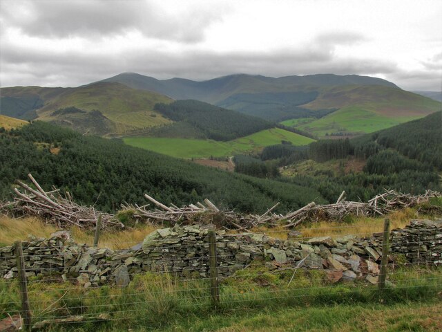
Bird watching
Good match
Moorland — golden plover, curlew and short-eared owl
Wildlife
Good match
Grass moorland priority habitat
Trails nearby
Within roughly 5 km🚶Walking
6 signed routes nearby · 1 public path nearby
Signed route nearbyPublic paths
Walking
Seat How Summit TrailWalking route
Comb Beck TrailWalking route
Two Gills TrailWalking route
Lanthwaite Wood and Crummock Water Walk, North Lakes OutdoorsWalking route6.4 km
This walk passes through the hills & woodlands on the eastern side of Crummock Water. The route is dominated by two sweeping views: the famous vista of the Buttermere fells, and the dramatic rocky buttress of Grasmoor End looming over its northern tip.
Allerdale RambleWalking route
🚴Cycling
20 signed routes nearby
Signed route nearby
Cycling
Route 38Cycling route
Route 7Cycling route
Lakes & Dales LoopCycling route
Route C2CCycling route
C2C off-road sections - no longer NCN
Route 7Cycling route
NCN 7 Workington link
Main RouteCycling route556 m
🚵Mountain biking
4 signed routes nearby
Signed route nearby
Mountain biking
Cyclewise Coaching TrailMountain bike route
Quercus TrailMountain bike route7.4 km
Altura North TrailMountain bike route
Altura South TrailMountain bike route
Wildlife to spot
Photos
Weather for this location
Loading local forecast…
Nearby places
Useful places within 5 km
Own or manage this place?
Claim this listing to keep details accurate, add photos, and highlight what makes it special — free.
Claim this pageHow was your visit?
How useful was the information on this page?
id: fde89ab5-4f4f-490f-aa40-7361c7cf6707