Woodhouse West End Bowling Club
Plan your visit
🦉 Wildlife🎳 Bowls🦅 Birds
Public access Dogs welcome
Places › England › Yorkshire and the Humber › Sheffield Getting here
53.35609, -1.38259
Open directionsv Visiting this summer
Seasonal nature notes and what to look for now
▾ 🌞 Midsummer — early morning visits most comfortable; look for deer fawns in quieter clearings 🎳 Bowling greens is at its best in summer here 🐕 Dogs welcome — bring water in summer; the site has enough space to find shade on hot days 🌤️ Visiting this summer
🌞 Midsummer — early morning visits most comfortable; look for deer fawns in quieter clearings 🎳 Bowling greens is at its best in summer here 🐕 Dogs welcome — bring water in summer; the site has enough space to find shade on hot days 🦉 Wildlife
Very strong match
Multi-group wildlife — Amphibians, Birds, Mammals, Reptiles; Multi-group wildlife — Amphibians, Birds, Mammals, Reptiles
Free
🎳 Bowling greens
Very strong match
Bowling green
Paid
🦅 Bird watching
Very strong match
Birds — Great Tit, Blackbird, Robin +49 more · last seen 2026; Birds — Great Tit, Blackbird, Robin +49 more · last seen 2026
Free
🦋 Insect spotting
Strong match
Insects — 7-spot Ladybird, Syrphus, Marmalade Hoverfly +104 more · last seen 2026; Insects — 7-spot Ladybird, Syrphus, Marmalade Hoverfly +104 more · last seen 2026
Free
🍂 Seasonal nature
Strong match
Plants — Lesser Celandine, Pedunculate Oak, Great Willowherb +173 more · last seen 2026; Plants — Lesser Celandine, Pedunculate Oak, Great Willowherb +173 more · last seen 2026
Free
Plants — Pedunculate Oak, Elder, Hogweed +21 more foraging species
Varies
Trails nearby Within roughly 5 km 9 signed routes nearby · 28 public paths nearby
Signed route nearby Public paths
Cuckoo Way Walking route ▾
Sheffield Round Walk Walking route ▾
Named route Ref SRW
Show on map Norfolk Heritage Walk Walking route ▾
Named route Ref NHW
Show on map Five Weirs Walk Walking route ▾
Named route Ref Five
Show on map Sheffield Canal Walking route ▾
Named route Ref Canal
Show on map 113 signed routes nearby
Signed route nearby
Norfolk Park Cycling Route Cycling route ▾
Named route Ref Norfolk Park Local cycle route
Show on map Route 6 Cycling route ▾
Named route Ref 6 National Cycle Network
Show on map Route 67 Cycling route ▾
Named route Ref 67 National Cycle Network
Show on map Sheffield Local Cycle Network Cycling route ▾
Sheffield Local Cycle Network
Named route Local cycle route
Show on map Rotherham Local Cycle Network Cycling route ▾
Named route Local cycle route
Show on map Route 6 Cycling route ▾
Temporary redirection of NCN 6 due to storm damage
Named route Ref 6 National Cycle Network
Show on map 9 public paths nearby
Public paths
Stone Lane bridleway · 433 m ▾
Public path bridleway Length 433 m Surface asphalt Path type: service
Show on map Water Slacks Lane bridleway · 453 m ▾
Public path bridleway Length 453 m Surface paved Path type: footway
Show on map Stone Lane bridleway · 700 m ▾
Public path bridleway Length 700 m Surface asphalt Path type: service
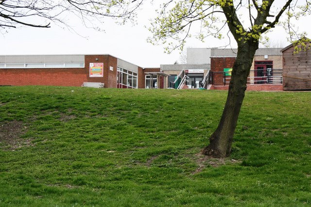
Show on map Photos Woodhouse West Primary School
‹ ›
Weather for this location Next 14 days Nearby places Useful places within 5 km
Own or manage this place?
Claim this listing to keep details accurate, add photos, and highlight what makes it special — free.
Claim this page→ How useful was the information on this page?
id: 02f1cc19-0d04-472b-a7f0-f7b4f50d1c40
UK green spaces mapped from open public data — so anyone can find the woodland, trail, or nature reserve closest to them.
© 2026 Glade · Made with care for UK green spaces
Events & activities nearby Switch provider to compare local events, tours and bookable activities.
Bookable tours GetYourGuide Promote here
Wildlife to spot
19,292 records · National Biodiversity Network
▾
Wildlife to spot 19,292 records · National Biodiversity Network 🐦 Birds 32 species
winter spring autumn
2026 ▾
Great Tit · Robin · Blue Tit · Nuthatch · Great Spotted Woodpecker +27
Great Tit Parus major Robin Erithacus rubecula Blue Tit Cyanistes caeruleus Nuthatch Sitta europaea Great Spotted Woodpecker Dendrocopos major Blackbird Turdus merula Long-tailed Tit Aegithalos caudatus Treecreeper Certhia familiaris House Sparrow Passer domesticus Dunnock Prunella modularis Pheasant Phasianus colchicus Redwing Turdus iliacus Mallard Anas platyrhynchos Woodpigeon Columba palumbus Wren Troglodytes troglodytes Bullfinch Pyrrhula pyrrhula Jay Garrulus glandarius Kestrel Falco tinnunculus Song Thrush Turdus philomelos2025 Goldfinch Carduelis carduelis2025 Grey Heron Ardea cinerea2025 Skylark Alauda arvensis Chaffinch Fringilla coelebs Pied Wagtail Motacilla alba Linnet Linaria cannabina2025 Coal Tit Periparus ater2025 Magpie Pica pica2025 Carrion Crow Corvus corone2025 Goldcrest Regulus regulus2025 Pink-footed Goose Anser brachyrhynchus2025 Kingfisher Alcedo atthis2025 Moorhen Gallinula chloropus2025 Red Fox · Squirrel · Roe Deer · Grey Squirrel · Common Shrew +3
Red Fox Vulpes vulpes Squirrel Sciurus2025 Roe Deer Capreolus capreolus2025 Grey Squirrel Sciurus carolinensis Common Shrew Sorex araneus2025 Brown Rat Rattus norvegicus2025 Grass Snake
Grass Snake Natrix helvetica 🐸 Amphibians 2 species
spring summer
2026 ▾
Smooth Newt · Common Frog
Smooth Newt Lissotriton vulgaris2025 Common Frog Rana temporaria 🐝 Insects 20 species
summer autumn
2026 ▾
7-spot Ladybird · Hawthorn Shieldbug · Common Darter · Gatekeeper · Cinnabar +15
7-spot Ladybird Coccinella septempunctata Hawthorn Shieldbug Acanthosoma haemorrhoidale2025 Common Darter Sympetrum striolatum2025 Gatekeeper Pyronia tithonus2025 Cinnabar Tyria jacobaeae2025 🌿 Plants 45 species
spring summer autumn
2026 ▾
Bearded Couch · Lesser Celandine · Yew · Early Dog-violet · Lords-and-Ladies +40
Bearded Couch Elymus caninus2025 Lesser Celandine Ficaria verna Yew Taxus baccata Early Dog-violet Viola reichenbachiana Lords-and-Ladies Arum maculatum Bee Orchid Species observations from the last 10 years via NBN Atlas
Bat
Bat
Chiroptera2025
Chiroptera2025
Badger Meles meles2025
Badger Meles meles2025 16-spot Ladybird
16-spot Ladybird
Tytthaspis sedecimpunctata2025
Tytthaspis sedecimpunctata2025
Hairy-footed Flower Bee Anthophora plumipes
Hairy-footed Flower Bee Anthophora plumipes
Pine Ladybird Exochomus quadripustulatus
Pine Ladybird Exochomus quadripustulatus
Meliscaeva auricollis Meliscaeva auricollis
Meliscaeva auricollis Meliscaeva auricollis
Comma Polygonia c-album2025
Comma Polygonia c-album2025
Parent Bug Elasmucha grisea2025
Parent Bug Elasmucha grisea2025
Birch Shieldbug Elasmostethus interstinctus2025
Birch Shieldbug Elasmostethus interstinctus2025
Dasysyrphus tricinctus Dasysyrphus tricinctus2025
Dasysyrphus tricinctus Dasysyrphus tricinctus2025
Speckled Wood Pararge aegeria2025
Speckled Wood Pararge aegeria2025
Large Skipper Ochlodes sylvanus2025
Large Skipper Ochlodes sylvanus2025
Ringlet Aphantopus hyperantus2025
Ringlet Aphantopus hyperantus2025
Syrphus Syrphus2025
Syrphus Syrphus2025
Gorse Shieldbug Piezodorus lituratus2025
Gorse Shieldbug Piezodorus lituratus2025
Harmonia axyridis form spectabilis Harmonia axyridis form spectabilis2025
Harmonia axyridis form spectabilis Harmonia axyridis form spectabilis2025
Eurygaster maura Eurygaster maura2025
Eurygaster maura Eurygaster maura2025 Ophrys apifera
Ophrys apifera
Himalayan Balsam Impatiens glandulifera2025
Himalayan Balsam Impatiens glandulifera2025
Wild Teasel Dipsacus fullonum2025
Wild Teasel Dipsacus fullonum2025
Devil's-bit Scabious Succisa pratensis2025
Devil's-bit Scabious Succisa pratensis2025
Ribwort Plantain Plantago lanceolata
Ribwort Plantain Plantago lanceolata
Creeping Comfrey Symphytum grandiflorum
Creeping Comfrey Symphytum grandiflorum
Colorado Spruce Picea pungens
Colorado Spruce Picea pungens
Primrose Primula vulgaris
Primrose Primula vulgaris
Hard Shield-fern Polystichum aculeatum
Hard Shield-fern Polystichum aculeatum
Italian Lords-and-Ladies Arum italicum
Italian Lords-and-Ladies Arum italicum
White Campion Silene latifolia2025
White Campion Silene latifolia2025
Red Campion Silene dioica2025
Red Campion Silene dioica2025
Hazel Corylus avellana2025
Hazel Corylus avellana2025
Pear Pyrus communis2025
Pear Pyrus communis2025
Bulrush Typha latifolia2025
Bulrush Typha latifolia2025
Hare's-foot Clover Trifolium arvense2025
Hare's-foot Clover Trifolium arvense2025
Pale Galingale Cyperus eragrostis2025
Pale Galingale Cyperus eragrostis2025
Marsh Cudweed Gnaphalium uliginosum2025
Marsh Cudweed Gnaphalium uliginosum2025
Slender Rush Juncus tenuis2025
Slender Rush Juncus tenuis2025
Wormwood Artemisia absinthium2025
Wormwood Artemisia absinthium2025
Bilberry Vaccinium myrtillus2025
Bilberry Vaccinium myrtillus2025
Hard-fern Blechnum spicant2025
Hard-fern Blechnum spicant2025
Figwort Scrophularia2025
Figwort Scrophularia2025
Musk-mallow Malva moschata2025
Musk-mallow Malva moschata2025
Black Nightshade Solanum nigrum2025
Black Nightshade Solanum nigrum2025
Scorpion Weed Phacelia tanacetifolia2025
Scorpion Weed Phacelia tanacetifolia2025
Flax Linum usitatissimum2025
Flax Linum usitatissimum2025
Radish Raphanus raphanistrum2025
Radish Raphanus raphanistrum2025
Elder Sambucus nigra2025
Elder Sambucus nigra2025
White Dead-nettle Lamium album2025
White Dead-nettle Lamium album2025
Wild Angelica Angelica sylvestris2025
Wild Angelica Angelica sylvestris2025
Selfheal Prunella vulgaris2025
Selfheal Prunella vulgaris2025
Great Willowherb Epilobium hirsutum2025
Great Willowherb Epilobium hirsutum2025
Spear-leaved Orache Atriplex prostrata2025
Spear-leaved Orache Atriplex prostrata2025
Common Toadflax Linaria vulgaris2025
Common Toadflax Linaria vulgaris2025
Broom Cytisus scoparius2025
Broom Cytisus scoparius2025
Rosebay Willowherb Chamaenerion angustifolium2025
Rosebay Willowherb Chamaenerion angustifolium2025
Common Sorrel Rumex acetosa2025
Common Sorrel Rumex acetosa2025
Cinquefoil Potentilla2025
Cinquefoil Potentilla2025
Field Scabious Knautia arvensis2025
Field Scabious Knautia arvensis2025