🐦62+ species recorded in this area — summer evenings are best for activity; watch for Shoveler and Wigeon
☀️Summer family visits work well here — arrive early and plan for a longer stay
☕The Orchard Cafe — makes this an easy full-day family visit without needing to pack food
🌤️ Visiting this summer
🐦62+ species recorded in this area — summer evenings are best for activity; watch for Shoveler and Wigeon
☀️Summer family visits work well here — arrive early and plan for a longer stay
☕The Orchard Cafe — makes this an easy full-day family visit without needing to pack food
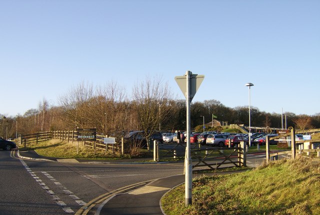
Good to know
£Free to visit — no entry charge
🐕Dogs welcome
☕Café🅿️Parking· Paid🛝Playground🚻Toilets
Best for
12 activities
🛝
Family friendly
Very strong match
playground, café, toilets; Urban park — family destination
Free
🦅
Bird watching
Very strong match
Birds — Shoveler, Wigeon, Pochard +59 more · last seen 2026; Deciduous woodland — woodpeckers, warblers and woodland birds
Free
🎠
Playgrounds
Very strong match
playground, toilets, café, parking
Free
🦉
Wildlife
Strong match
Birds — Shoveler, Wigeon, Pochard +59 more · last seen 2026; Deciduous woodland priority habitat
Free
🧺
Picnic day out
Strong match
café, toilets, car park; Urban park — open green space
Free
🦋
Insect spotting
Strong match
Insects — Emperor Dragonfly, Common Darter, Large Red Damselfly +49 more · last seen 2026; Lowland meadows — marbled white, meadow brown and pollinating insects
Free
Trails nearby
Within roughly 5 km
🚶
Walking
▾
10 signed routes nearby · 29 public paths nearby
Signed route nearbyPublic paths
Monarch's WayWalking route990 km▾
approximate route of Charles II's escape
Named routeRef MWLength 990 kmRegional walking route
Millennium Way (Warks)Walking route100 km▾
A 100 mile long distance footpath, across the centre of England from Pershore to Chipping Warden via Meriden.
Named routeLength 100 kmRegional walking route
Severn Way (3) Worcester to BristolWalking route153 km▾
Named routeRef SW (3)Length 153 kmRegional walking route
Worcester Woods Meadows TrailWalking route▾
Named routeLocal walking route
Worcester Woods Woodland TrailWalking route▾
Named routeLocal walking route
Dalziel Drivepublic footpath · 89 m▾
Public pathpublic footpathLength 89 mPath type: residential
Augusta Drivepublic footpath · 50 m▾
Public pathpublic footpathLength 50 mPath type: residential
🚴
Cycling
▾
184 signed routes nearby
Signed route nearby
Mercian WayCycling route▾
Named routeRef 45National Cycle Network
Kempsey Norton LoopCycling route13.5 km▾
Named routeLength 13.5 kmRound tripLocal cycle route
Starting at Worcester University and heading out to Broardheath and Hallow. A 14 mile circular route with alternatives to shorten it to 7.5 miles. The route covers a mixture of quiet lanes and bridleways.
Named routeRef BroHaLength 14 kmRound tripLocal cycle route
Starting at Worcester Woods Countryside Centre and heading out to Kempsey. A 12 mile route with alternatives to shorten it to 8 miles. The route covers a mixture of quiet lanes and bridleways.
Named routeLength 12 kmRound tripLocal cycle route
Circular route starting at the Pump House Environment Centre and covering a mixture of quiet lanes and residential streets.The route is 10.5 miles with a short cut that reduces it to 6.5 miles.
Named routeLength 10.5 kmRound tripLocal cycle route
Local cycle route 7Cycling route▾
Named routeRef 7Local cycle route
🐴
Horse riding
▾
10 public paths nearby
Public paths
Oakmount Drivebridleway · 145 m▾
Public pathbridlewayLength 145 mSurface pavedPath type: residential