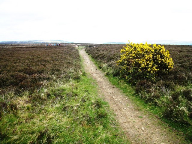
World War II bombing decoy, 500m north west of John Cross
11 ha
Plan your visit
🦅Birds🦉Wildlife✦Heritage
Public accessFree entryDogs welcome11 ha
Getting here
54.41389, -0.60793
Open directionsv
Visiting this summer
Seasonal nature notes and what to look for now
- 🐦89+ species recorded in this area — summer evenings are best for activity; watch for Wigeon and Chaffinch
- ✦Historic character is a year-round quality here — summer brings its own atmosphere to the setting
- 🐕Dogs welcome — bring water in summer; the site has enough space to find shade on hot days
🌤️ Visiting this summer
- 🐦89+ species recorded in this area — summer evenings are best for activity; watch for Wigeon and Chaffinch
- ✦Historic character is a year-round quality here — summer brings its own atmosphere to the setting
- 🐕Dogs welcome — bring water in summer; the site has enough space to find shade on hot days
- £Free to visit — no entry charge
- 🐕Dogs welcome
🦅Bird watching
Very strong match
Birds — Wigeon, Chaffinch, Blackbird +86 more · last seen 2025; Upland heathland — red grouse, merlin and short-eared owl
Free
Birds — Wigeon, Chaffinch, Blackbird +86 more · last seen 2025; Upland heathland priority habitat
Free
Historic site with public access
Free
🦋Insect spotting
Strong match
Insects — Eristalis pertinax, Volucella pellucens, November Moth agg. +123 more · last seen 2025
Free
🍂Seasonal nature
Strong match
Plants — Broad-leaved Helleborine, Marsh Pennywort, Heath Spotted-orchid +62 more · last seen 2026
Free
Dogs allowed with public access
Free
Trails nearby
Within roughly 5 km6 signed routes nearby · 13 public paths nearby
Signed route nearbyPublic paths
Cleveland WayWalking route▾
Named routePoint-to-pointNational walking route
Lyke Wake WalkWalking route▾
Named routeRegional walking route
Esk Valley WalkWalking route▾
Named routeRef EVRegional walking route
King Charles III England Coast Path: Filey Brigg to North GareWalking route▾
Named routeRef ECPNational walking route
Coast to Coast Walk (Richmond to Robin Hood’s Bay)Walking route▾
Named routeRef C2CRegional walking route
15 signed routes nearby
Signed route nearby
EuroVelo 12 - North Sea Cycle Route - part United Kingdom 3Cycling route▾
Lincoln - Whitby
Named routeRef EV12International cycle route
NCN 1 Humber to TeesCycling route▾
Named routeRef 1National Cycle Network
Main RouteCycling route63 m▾
Named routeRef 1Length 63 mNational Cycle NetworkOn-roadSurface asphalt
Main RouteCycling route1.1 km▾
Named routeRef 1Length 1.1 kmNational Cycle NetworkTraffic-freeSurface asphalt
Main RouteCycling route106 m▾
Named routeRef 1Length 106 mNational Cycle NetworkOn-roadSurface asphalt
Main RouteCycling route27 m▾
Named routeRef 1Length 27 mNational Cycle NetworkOn-roadSurface asphalt
1 signed route nearby
Signed route nearby
Moors to SeaMountain bike route▾
2 public paths nearby
Public paths
Robin Hood's Bay Roadbridleway · 724 m▾
Public pathbridlewayLength 724 mSurface dirtPath type: bridleway
Robin Hood's Bay Roadbridleway · 285 m▾
Public pathbridlewayLength 285 mSurface dirtPath type: track
Weather for this location
Next 14 daysNearby places
Useful places within 5 km
Events & activities nearby
Switch provider to compare local events, tours and bookable activities.
Wildlife to spot
3,126 records · National Biodiversity Network
Wildlife to spot
3,126 records · National Biodiversity NetworkWigeon · Merlin · Chaffinch · Cuckoo · Blackcap +33
- WigeonMareca penelope
- MerlinFalco columbarius
- ChaffinchFringilla coelebs
- CuckooCuculus canorus
- BlackcapSylvia atricapilla
- SwallowHirundo rustica
- WoodcockScolopax rusticola
- Spotted FlycatcherMuscicapa striata
- Song ThrushTurdus philomelos
- WoodpigeonColumba palumbus
- TwiteLinaria flavirostris
- Fringilla coelebs gengleriFringilla coelebs gengleri
- Troglodytes troglodytes indigenusTroglodytes troglodytes indigenus
- Sitta europaea caesiaSitta europaea caesia
- Erithacus rubecula melophilusErithacus rubecula melophilus
- Turdus philomelos clarkeiTurdus philomelos clarkei
- RedstartPhoenicurus phoenicurus
- Garden WarblerSylvia borin
- Tawny OwlStrix aluco
- WrenTroglodytes troglodytes
- RobinErithacus rubecula
- Mistle ThrushTurdus viscivorus
- Blue TitCyanistes caeruleus
- GoldfinchCarduelis carduelis
- ChiffchaffPhylloscopus collybita
- BlackbirdTurdus merula
- LapwingVanellus vanellus
- Ring OuzelTurdus torquatus
- KestrelFalco tinnunculus
- StonechatSaxicola rubicola
- Meadow PipitAnthus pratensis
- WheatearOenanthe oenanthe
- SkylarkAlauda arvensis
- Grey WagtailMotacilla cinerea
- CrossbillLoxia curvirostra
- Great Spotted WoodpeckerDendrocopos major
- SiskinSpinus spinus
- Black RedstartPhoenicurus ochruros2024
🦌Mammals6 species
springsummerautumnwinter
2025▾
Minke Whale · Bottle-nosed Dolphin · Red Fox · Brown Hare · Badger +1
- Minke WhaleBalaenoptera acutorostrata
- Bottle-nosed DolphinTursiops truncatus
- Red FoxVulpes vulpes
- Brown HareLepus europaeus
- BadgerMeles meles
🦎Reptiles2 species
springsummer
2025▾
Common Lizard · Slow-worm
- Common LizardZootoca vivipara
- Slow-wormAnguis fragilis
🐸Amphibians3 species
spring
2026▾
Common Frog · Palmate Newt · Common Toad
- Common FrogRana temporaria2025
- Palmate NewtLissotriton helveticus
- Common ToadBufo bufo2025
Eristalis pertinax · Green Tiger Beetle · Agapanthia villosoviridescens · Bog Bush-cricket · Batman Hoverfly +17
- Eristalis pertinaxEristalis pertinax
- Green Tiger BeetleCicindela campestris
- Agapanthia villosoviridescensAgapanthia villosoviridescens
- Bog Bush-cricketMetrioptera brachyptera
- Batman HoverflyMyathropa florea
- DasysyrphusDasysyrphus
- Syrphus
🌿Plants35 species
summerautumn
2026▾
Broad-leaved Helleborine · Heath Spotted-orchid · Marsh Pennywort · Mat-grass · Bifid Crestwort +30
- Broad-leaved HelleborineEpipactis helleborine2025
- Heath Spotted-orchidDactylorhiza maculata2025
- Marsh PennywortHydrocotyle vulgaris2025
- Mat-grassNardus stricta2025
- Bifid CrestwortLophocolea bidentata2025
Species observations from the last 10 years via NBN Atlas
Harbour Seal
Harbour Seal
Phoca vitulina2024
Phoca vitulina2024
Syrphus
Syrphus
Common Red Soldier BeetleRhagonycha fulvaCommon Red Soldier BeetleRhagonycha fulvaMelanostomaMelanostomaMelanostomaMelanostomaLarge Red DamselflyPyrrhosoma nymphulaLarge Red DamselflyPyrrhosoma nymphulaMottled GrasshopperMyrmeleotettix maculatusMottled GrasshopperMyrmeleotettix maculatusGreen ShieldbugPalomena prasinaGreen ShieldbugPalomena prasinaDownlooker SnipeflyRhagio scolopaceusDownlooker SnipeflyRhagio scolopaceusMeadow GrasshopperPseudochorthippus parallelusMeadow GrasshopperPseudochorthippus parallelusCommon Green GrasshopperOmocestus viridulusCommon Green GrasshopperOmocestus viridulusVolucella bombylansVolucella bombylansVolucella bombylansVolucella bombylansGreen HairstreakCallophrys rubiGreen HairstreakCallophrys rubiVolucella pellucensVolucella pellucens2024Volucella pellucensVolucella pellucens2024Eristalis nemorumEristalis nemorum2024Eristalis nemorumEristalis nemorum2024Sericomyia silentisSericomyia silentis2024Sericomyia silentisSericomyia silentis2024Leucozona glauciaLeucozona glaucia2024Leucozona glauciaLeucozona glaucia2024Common HawkerAeshna juncea2024Common HawkerAeshna juncea2024Greater FeatherwortPlagiochila asplenioides2025Greater FeatherwortPlagiochila asplenioides2025White EarwortDiplophyllum albicans2025White EarwortDiplophyllum albicans2025RaspberryRubus idaeus2025RaspberryRubus idaeus2025Small-white OrchidPseudorchis albida2025Small-white OrchidPseudorchis albida2025Lesser SpearwortRanunculus flammula2025Lesser SpearwortRanunculus flammula2025Round-leaved SundewDrosera rotundifolia2025Round-leaved SundewDrosera rotundifolia2025Heath BedstrawGalium saxatile2025Heath BedstrawGalium saxatile2025Sheep's SorrelRumex acetosella2025Sheep's SorrelRumex acetosella2025Common LiverwortMarchantia polymorphaCommon LiverwortMarchantia polymorphaLateral CryphaeaCryphaea heteromalla2025Lateral CryphaeaCryphaea heteromalla2025Swan's-neck Thyme-mossMnium hornum2025Swan's-neck Thyme-mossMnium hornum2025Shining HookeriaHookeria lucens2025Shining HookeriaHookeria lucens2025Wood SpeedwellVeronica montana2025Wood SpeedwellVeronica montana2025Yellow Fringe-mossRacomitrium aciculare2025Yellow Fringe-mossRacomitrium aciculare2025Waved Silk-mossPlagiothecium undulatum2025Waved Silk-mossPlagiothecium undulatum2025Hart's-tongue Thyme-mossPlagiomnium undulatum2025Hart's-tongue Thyme-mossPlagiomnium undulatum2025Water EarwortScapania undulata2025Water EarwortScapania undulata2025Plagiochila porelloidesPlagiochila porelloides2025Plagiochila porelloidesPlagiochila porelloides2025Blueish VeilwortMetzgeria violacea2025Blueish VeilwortMetzgeria violacea2025Common SmoothcapAtrichum undulatum2025Common SmoothcapAtrichum undulatum2025Enchanter's-nightshadeCircaea lutetiana2025Enchanter's-nightshadeCircaea lutetiana2025FoxgloveDigitalis purpurea2025FoxgloveDigitalis purpurea2025TormentilPotentilla erecta2025TormentilPotentilla erecta2025Bell HeatherErica cinerea2025Bell HeatherErica cinerea2025IvyHedera helix2025IvyHedera helix2025Hard-fernBlechnum spicant2025Hard-fernBlechnum spicant2025HollyIlex aquifolium2025HollyIlex aquifolium2025Hart's-TongueAsplenium scolopendrium2025Hart's-TongueAsplenium scolopendrium2025Common Cow-wheatMelampyrum pratense2024Common Cow-wheatMelampyrum pratense2024Yellow LoosestrifeLysimachia vulgaris2024Yellow LoosestrifeLysimachia vulgaris2024