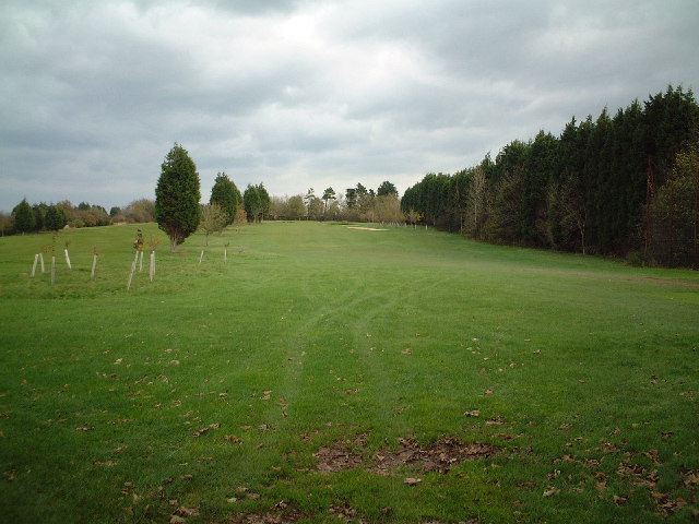
Worlebury Golf Course 20 ha
Plan your visit
🦉 Wildlife🦅 Birds🦋 Insects
Public access Free entry Dogs welcome 20 ha
Places › England › South West › North Somerset Getting here
51.36223, -2.94123
Open directionsv Visiting this summer
Seasonal nature notes and what to look for now
▾ 🌞 Midsummer — early morning visits most comfortable; look for deer fawns in quieter clearings 🐕 Early mornings are best for dog walks in summer — visit before 9am to avoid the heat and find quieter trails 🅿️ Hill Road East Car Park 12m away — 20 car parks within reach 🌤️ Visiting this summer
🌞 Midsummer — early morning visits most comfortable; look for deer fawns in quieter clearings 🐕 Early mornings are best for dog walks in summer — visit before 9am to avoid the heat and find quieter trails 🅿️ Hill Road East Car Park 12m away — 20 car parks within reach £ Free to visit — no entry charge🐕 Dogs welcome🦉 Wildlife
Very strong match
Multi-group wildlife — Amphibians, Birds, Mammals, Reptiles; Multi-group wildlife — Amphibians, Birds, Mammals, Reptiles
Free
🦅 Bird watching
Very strong match
Birds — Blackbird, Magpie, Rock Dove +76 more · last seen 2025; Birds — Blackbird, Magpie, Rock Dove +76 more · last seen 2025
Free
🦋 Insect spotting
Strong match
Chalk and limestone grassland — chalkhill blue, adonis blue and rare moths; Insects — Green Shieldbug, Common Carder Bee, Buff-tailed Bumblebee +110 more · last seen 2026
Free
Dogs allowed — public woodland
Free
Deciduous woodland — fungi, berries and wild garlic
Varies
Trails nearby Within roughly 5 km 7 signed routes nearby · 100 public paths nearby
Signed route nearby Public paths
The Butcombe Trail Walking route 74 km ▾
Named route Ref BUT Length 74 km Regional walking route
Show on map The Mendip Trail Walking route ▾
Named route Ref MT Regional walking route
Show on map King Charles III England Coast Path: Brean Down to Minehead Walking route ▾
Named route Ref ECP National walking route
Show on map Round Yatton Walk Walking route ▾
Named route Ref RYW Local walking route
Show on map West Mendip Way Walking route 48 km ▾
Named route Ref WMW Length 48 km Regional walking route
Show on map Worlebury Hill Road public footpath · 362 m ▾
Public path public footpath Length 362 m Path type: track
Show on map Pleshey Close public footpath · 12 m ▾
Public path public footpath Length 12 m Path type: residential
Show on map Rossendale Close public footpath · 8 m ▾
Public path public footpath Length 8 m Surface asphalt Path type: residential
Show on map 65 signed routes nearby
Signed route nearby
Route 33 Cycling route ▾
Named route Ref 33 National Cycle Network
Show on map Weston to NCN Link Cycling route ▾
Named route Regional cycle route
Show on map Pier to Pier Way Cycling route ▾
Named route Regional cycle route
Show on map Weston-super-Mare Cycle Cycling route ▾
Named route Local cycle route
Show on map Main Route Cycling route 856 m ▾
Named route Ref 33 Length 856 m National Cycle Network Traffic-free Surface asphalt
Show on map Main Route Cycling route 117 m ▾
Named route Ref 33 Length 117 m National Cycle Network Traffic-free Surface asphalt
Show on map 10 public paths nearby
Public paths
Worlebury Hill Road bridleway · 149 m ▾
Public path bridleway Length 149 m Path type: track
Show on map Worlebury Hill Road restricted byway · 310 m ▾
Public path restricted byway Length 310 m Path type: residential
Show on map Worlebury Hill Road bridleway · 80 m ▾
Public path bridleway Length 80 m Path type: unclassified
Show on map
Weather for this location Next 14 days Nearby places Useful places within 5 km
Own or manage this place?
Claim this listing to keep details accurate, add photos, and highlight what makes it special — free.
Claim this page→ How useful was the information on this page?
id: 78b25674-12b7-4943-b3f7-30f026a99a63
UK green spaces mapped from open public data — so anyone can find the woodland, trail, or nature reserve closest to them.
© 2026 Glade · Made with care for UK green spaces
Wildlife to spot
37,038 records · National Biodiversity Network
▾
Wildlife to spot 37,038 records · National Biodiversity Network 🐦 Birds 35 species
winter spring
2025 ▾
Snow Bunting · Pied Wagtail · Robin · Blackbird · Magpie +30
Snow Bunting Plectrophenax nivalis Pied Wagtail Motacilla alba yarrellii Robin Erithacus rubecula Blackbird Turdus merula Magpie Pica pica Carrion Crow Corvus corone Goldfinch Carduelis carduelis Greenfinch Chloris chloris Blue Tit Cyanistes caeruleus Blackcap Sylvia atricapilla Rock Dove Columba livia Woodpigeon Columba palumbus Jackdaw Coloeus monedula House Sparrow Passer domesticus Herring Gull Larus argentatus Starling Sturnus vulgaris Swallow Hirundo rustica Long-tailed Tit Aegithalos caudatus Coal Tit Periparus ater Firecrest Regulus ignicapilla Oystercatcher Haematopus ostralegus Black-headed Gull Chroicocephalus ridibundus Curlew Numenius arquata Shelduck Tadorna tadorna Moorhen Gallinula chloropus Chiffchaff Phylloscopus collybita Wren Troglodytes troglodytes Lesser Black-backed Gull Larus fuscus Swift Apus apus Willow Warbler Phylloscopus trochilus Raven Corvus corax Collared Dove Streptopelia decaocto Great Tit Parus major Song Thrush Turdus philomelos Dunnock Prunella modularis Red Fox
Slow-worm
🐸 Amphibians 1 species
summer autumn
2025 ▾
Common Frog
Common Frog Rana temporaria 🐝 Insects 69 species
spring summer
2026 ▾
Green Shieldbug · Red-legged Shieldbug · Spotted-winged Drosophila · Hawthorn Shieldbug · Helophilus pendulus +64
Green Shieldbug Palomena prasina2025 Red-legged Shieldbug Pentatoma rufipes2025 Spotted-winged Drosophila Drosophila suzukii Hawthorn Shieldbug Acanthosoma haemorrhoidale2025 Helophilus pendulus Helophilus pendulus2025 🌿 Plants 2 species
winter spring
2025 ▾
Henbit Dead-nettle · Silver-moss
Henbit Dead-nettle Lamium amplexicaule Silver-moss Bryum argenteum Species observations from the last 10 years via NBN Atlas
Broad Centurion
Broad Centurion
Chloromyia formosa2025
Chloromyia formosa2025
Oedemera femoralis Oedemera femoralis
Oedemera femoralis Oedemera femoralis
7-spot Ladybird Coccinella septempunctata2025
7-spot Ladybird Coccinella septempunctata2025
Harlequin Ladybird Harmonia axyridis2025
Harlequin Ladybird Harmonia axyridis2025
Eristalis pertinax Eristalis pertinax2025
Eristalis pertinax Eristalis pertinax2025
Ribautiana tenerrima Ribautiana tenerrima2025
Ribautiana tenerrima Ribautiana tenerrima2025
Marmalade Hoverfly Episyrphus balteatus2025
Marmalade Hoverfly Episyrphus balteatus2025
Speckled Bush-cricket Leptophyes punctatissima2025
Speckled Bush-cricket Leptophyes punctatissima2025
Minettia longipennis Minettia longipennis2025
Minettia longipennis Minettia longipennis2025
Hornet Hoverfly Volucella zonaria2025
Hornet Hoverfly Volucella zonaria2025
Scaeva pyrastri Scaeva pyrastri2025
Scaeva pyrastri Scaeva pyrastri2025
Sicus ferrugineus Sicus ferrugineus2025
Sicus ferrugineus Sicus ferrugineus2025
14-spot Ladybird Propylea quattuordecimpunctata2025
14-spot Ladybird Propylea quattuordecimpunctata2025
Syrphus Syrphus2025
Syrphus Syrphus2025
Greater Bulb-Fly Merodon equestris2025
Greater Bulb-Fly Merodon equestris2025
Green Dock Beetle Gastrophysa viridula2025
Green Dock Beetle Gastrophysa viridula2025
Neria cibaria Neria cibaria2025
Neria cibaria Neria cibaria2025
Scatopse notata Scatopse notata2025
Scatopse notata Scatopse notata2025
Tephrochlamys tarsalis Tephrochlamys tarsalis2025
Tephrochlamys tarsalis Tephrochlamys tarsalis2025
Dock Bug Coreus marginatus2025
Dock Bug Coreus marginatus2025
White Clover Seed Weevil Protapion fulvipes2025
White Clover Seed Weevil Protapion fulvipes2025
Eristalis tenax Eristalis tenax2025
Eristalis tenax Eristalis tenax2025
Aphis (Aphis) hederae Aphis (Aphis) hederae2025
Aphis (Aphis) hederae Aphis (Aphis) hederae2025
Coenosia tigrina Coenosia tigrina2025
Coenosia tigrina Coenosia tigrina2025
Volucella inanis Volucella inanis2025
Volucella inanis Volucella inanis2025
Viridicerus ustulatus Viridicerus ustulatus2025
Viridicerus ustulatus Viridicerus ustulatus2025
Southern Oak Bush-cricket Meconema meridionale2025
Southern Oak Bush-cricket Meconema meridionale2025
Syritta pipiens Syritta pipiens2025
Syritta pipiens Syritta pipiens2025
Corizus hyoscyami Corizus hyoscyami2025
Corizus hyoscyami Corizus hyoscyami2025
Common Red Soldier Beetle Rhagonycha fulva2025
Common Red Soldier Beetle Rhagonycha fulva2025
Sphaerophoria Sphaerophoria2025
Sphaerophoria Sphaerophoria2025
Volucella pellucens Volucella pellucens2025
Volucella pellucens Volucella pellucens2025
Athous campyloides Athous campyloides2025
Athous campyloides Athous campyloides2025
Cantharis livida Cantharis livida2025
Cantharis livida Cantharis livida2025
Yellow-legged Black Pachygaster leachii2025
Yellow-legged Black Pachygaster leachii2025
Cuckoo-Spit Insect Philaenus spumarius2025
Cuckoo-Spit Insect Philaenus spumarius2025
Eupteryx urticae Eupteryx urticae2025
Eupteryx urticae Eupteryx urticae2025
Parent Bug Elasmucha grisea2025
Parent Bug Elasmucha grisea2025
Strawberry-blossom Weevil Anthonomus rubi2025
Strawberry-blossom Weevil Anthonomus rubi2025
Bronze Shieldbug Troilus luridus2025
Bronze Shieldbug Troilus luridus2025
Scarce Chaser Libellula fulva2025
Scarce Chaser Libellula fulva2025
Woolly Vine Scale Insect Pulvinaria vitis2025
Woolly Vine Scale Insect Pulvinaria vitis2025
Meliscaeva auricollis Meliscaeva auricollis2025
Meliscaeva auricollis Meliscaeva auricollis2025
Pipizella Pipizella2025
Pipizella Pipizella2025
Cheilosia Cheilosia2025
Cheilosia Cheilosia2025
Batman Hoverfly Myathropa florea2025
Batman Hoverfly Myathropa florea2025
Swollen-thighed Beetle Oedemera nobilis2025
Swollen-thighed Beetle Oedemera nobilis2025
Alder Leaf Beetle Agelastica alni2025
Alder Leaf Beetle Agelastica alni2025
Epistrophe nitidicollis Epistrophe nitidicollis2025
Epistrophe nitidicollis Epistrophe nitidicollis2025
Cantharis fusca Cantharis fusca2025
Cantharis fusca Cantharis fusca2025
Oncopsis flavicollis Oncopsis flavicollis2025
Oncopsis flavicollis Oncopsis flavicollis2025
Cercopis vulnerata Cercopis vulnerata2025
Cercopis vulnerata Cercopis vulnerata2025
Dark Bush-cricket Pholidoptera griseoaptera2025
Dark Bush-cricket Pholidoptera griseoaptera2025
Red-headed Cardinal Beetle Pyrochroa serraticornis2025
Red-headed Cardinal Beetle Pyrochroa serraticornis2025
Trichopsocus brincki Trichopsocus brincki2025
Trichopsocus brincki Trichopsocus brincki2025
Box Bug Gonocerus acuteangulatus2025
Box Bug Gonocerus acuteangulatus2025
Rhyparochromus pini Rhyparochromus pini2025
Rhyparochromus pini Rhyparochromus pini2025
Liophloeus tessulatus Liophloeus tessulatus2025
Liophloeus tessulatus Liophloeus tessulatus2025
Dark-edged Bee-fly Bombylius major2025
Dark-edged Bee-fly Bombylius major2025
Chilenocaecilius ornatipennis Chilenocaecilius ornatipennis2025
Chilenocaecilius ornatipennis Chilenocaecilius ornatipennis2025
Rhinoceros Beetle Sinodendron cylindricum2025
Rhinoceros Beetle Sinodendron cylindricum2025
Abax parallelepipedus Abax parallelepipedus2025
Abax parallelepipedus Abax parallelepipedus2025
Black Clock Pterostichus madidus2025
Black Clock Pterostichus madidus2025
Helina evecta Helina evecta2025
Helina evecta Helina evecta2025 Events & activities nearby Switch provider to compare local events, tours and bookable activities.
Bookable tours GetYourGuide Promote here