Kingston Copse - Woodland plantation
✦ Ancient woodland9 ha
Plan your visit
🦉Wildlife🐶Dogs🍂Seasonal
Public accessFree entryDogs welcome9 ha
Getting here
50.62642, -1.32522
Open directionsv
Visiting this summer
Seasonal nature notes and what to look for now
- 🌞Midsummer — early morning visits most comfortable; look for deer fawns in quieter clearings
- 🐕Early mornings are best for dog walks in summer — visit before 9am to avoid the heat and find quieter trails
- 📍Open access throughout summer — no booking required
🌤️ Visiting this summer
- 🌞Midsummer — early morning visits most comfortable; look for deer fawns in quieter clearings
- 🐕Early mornings are best for dog walks in summer — visit before 9am to avoid the heat and find quieter trails
- 📍Open access throughout summer — no booking required
- £Free to visit — no entry charge
- 🐕Dogs welcome
- 🌿Ancient woodland — rare wildlife habitat
Deciduous woodland priority habitat; Ancient woodland
Free
Dogs allowed — public woodland
Free
🍂Seasonal nature
Strong match
Ancient woodland — bluebells, fungi and autumn colour
Free
🦅Bird watching
Strong match
Deciduous woodland — woodpeckers, warblers and woodland birds
Free
Deciduous woodland — fungi, berries and wild garlic
Varies
Ancient woodland — historic landscape
Free
Trails nearby
Within roughly 5 km11 signed routes nearby · 10 public paths nearby
Signed route nearbyPublic paths
Yar River TrailWalking route▾
Named routeLocal walking route
Isle of Wight Coastal PathWalking route113 km▾
Named routeLength 113 kmRound tripRegional walking route
Worsley TrailWalking route▾
Named routeLocal walking route
Tennyson TrailWalking route▾
Named routeLocal walking route
The Stenbury TrailWalking route▾
Named routeLocal walking route
14 signed routes nearby
Signed route nearby
Round the Island RouteCycling route▾
Named routeRef 67Regional cycle route
Red Squirrel TrailCycling route▾
Named routeLocal cycle route
National Cycle Route 23Cycling route▾
Named routeRef 23National Cycle Network
Manors and Mills: Brighstone to Shorwell Quieter Lanes Cycle RouteCycling route▾
Named routeRef Manors and MillsLocal cycle route
Main RouteCycling route506 m▾
Named routeRef 23Length 506 mNational Cycle NetworkTraffic-freeSurface unsealedfirm
Main RouteCycling route155 m▾
Named routeRef 23Length 155 mNational Cycle NetworkTraffic-freeSurface asphalt
2 signed routes nearby
Signed route nearby
Chalk Ridge ExtremeMountain bike route▾
Chevy ChaseMountain bike route▾
17 public paths nearby
Public paths
Ashbridge Lanebyway open to all traffic · 300 m▾
Public pathbyway open to all trafficLength 300 mSurface asphaltPath type: service
Dungewood Lanebyway open to all traffic · 51 m▾
Public pathbyway open to all trafficLength 51 mSurface compactedIncline upPath type: track
Dungewood Lanebyway open to all traffic · 173 m▾
Public pathbyway open to all trafficLength 173 mSurface dirtIncline downPath type: track
Dungewood Lanebyway open to all traffic · 78 m▾
Public pathbyway open to all trafficLength 78 mSurface dirtIncline upPath type: track
Dungewood Lanebyway open to all traffic · 415 m▾
Public pathbyway open to all trafficLength 415 mSurface dirtIncline upPath type: track
Photos
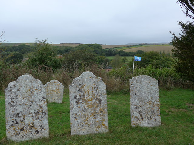
St James, Kingston: churchyard (a)
Weather for this location
Next 14 daysNearby places
Useful places within 5 km
Own or manage this place?
Claim this listing to keep details accurate, add photos, and highlight what makes it special — free.
Claim this page→How useful was the information on this page?
id: ce813b72-8fac-46e0-89e0-862cb2a30b97
Events & activities nearby
Switch provider to compare local events, tours and bookable activities.
Wildlife to spot
9,767 records · National Biodiversity Network
Wildlife to spot
9,767 records · National Biodiversity NetworkGoldfinch · Blue Tit · Dunnock · Great Tit · Blackbird +33
- GoldfinchCarduelis carduelis
- Blue TitCyanistes caeruleus
- DunnockPrunella modularis
- Great TitParus major
- BlackbirdTurdus merula
- RobinErithacus rubecula
- WrenTroglodytes troglodytes2024
- Long-tailed TitAegithalos caudatus
- GoldcrestRegulus regulus2024
- GreenfinchChloris chloris
- FirecrestRegulus ignicapilla2024
- MagpiePica pica
- ChaffinchFringilla coelebs
- Coal TitPeriparus ater
- ChiffchaffPhylloscopus collybita2024
- LapwingVanellus vanellus
- Great Spotted WoodpeckerDendrocopos major
- Song ThrushTurdus philomelos
- JackdawColoeus monedula
- KestrelFalco tinnunculus
- House SparrowPasser domesticus
- Collared DoveStreptopelia decaocto
- RavenCorvus corax
- PheasantPhasianus colchicus
- RedwingTurdus iliacus2024
- BullfinchPyrrhula pyrrhula2024
- BlackcapSylvia atricapilla2024
- Dark-bellied Brent GooseBranta bernicla bernicla
- StarlingSturnus vulgaris
- Grey WagtailMotacilla cinerea
- SwallowHirundo rustica
- House MartinDelichon urbicum
- Carrion CrowCorvus corone2024
- FieldfareTurdus pilaris2024
- Meadow PipitAnthus pratensis2024
- Barn OwlTyto alba2024
- LinnetLinaria cannabina2024
- WhitethroatCurruca communis2024
Red Squirrel
- Red SquirrelSciurus vulgaris
🐸Amphibians1 species
winter
2026▾
Common Toad
14-spot Ladybird · Cantharis flavilabris (=nigra auctt.) · Swollen-thighed Beetle · Potato Capsid · Cantharis +44
- 14-spot LadybirdPropylea quattuordecimpunctata2025
- Cantharis flavilabris (=nigra auctt.)Cantharis flavilabris (=nigra auctt.)2025
- Swollen-thighed BeetleOedemera nobilis2025
- Potato CapsidClosterotomus norwegicus2025
- CantharisCantharis2025
Species observations from the last 10 years via NBN Atlas
Dotted Bee-fly
Dotted Bee-fly
Bombylius discolor
Bombylius discolor
Sericomyia silentisSericomyia silentis2025Sericomyia silentisSericomyia silentis2025Conops ceriaeformisConops ceriaeformis2025Conops ceriaeformisConops ceriaeformis2025Four-barred MajorOxycera rara2025Four-barred MajorOxycera rara2025Migrant HawkerAeshna mixta2025Migrant HawkerAeshna mixta2025Hornet HoverflyVolucella zonaria2025Hornet HoverflyVolucella zonaria2025Chrysotoxum bicinctumChrysotoxum bicinctum2025Chrysotoxum bicinctumChrysotoxum bicinctum2025Woolly Alder SawflyEriocampa ovata2025Woolly Alder SawflyEriocampa ovata2025Figwort SawflyTenthredo scrophulariae2025Figwort SawflyTenthredo scrophulariae20257-spot LadybirdCoccinella septempunctata20257-spot LadybirdCoccinella septempunctata2025Green ShieldbugPalomena prasina2025Green ShieldbugPalomena prasina2025Common Flower BugAnthocoris nemorum2025Common Flower BugAnthocoris nemorum2025Striped Slender RobberflyLeptogaster cylindrica2025Striped Slender RobberflyLeptogaster cylindrica2025Meadow Plant BugLeptopterna dolabrata2025Meadow Plant BugLeptopterna dolabrata2025Malachite BeetleMalachius bipustulatus2025Malachite BeetleMalachius bipustulatus2025Broad CenturionChloromyia formosa2025Broad CenturionChloromyia formosa202516-spot LadybirdTytthaspis sedecimpunctata202516-spot LadybirdTytthaspis sedecimpunctata2025Speckled Bush-cricketLeptophyes punctatissima2025Speckled Bush-cricketLeptophyes punctatissima2025Field GrasshopperChorthippus brunneus2025Field GrasshopperChorthippus brunneus2025EupeodesEupeodes2025EupeodesEupeodes2025SyrphusSyrphus2025SyrphusSyrphus2025Banded DemoiselleCalopteryx splendens2025Banded DemoiselleCalopteryx splendens2025Golden-ringed DragonflyCordulegaster boltonii2025Golden-ringed DragonflyCordulegaster boltonii2025PhalacridaePhalacridae2025PhalacridaePhalacridae2025Anthicus antherinusAnthicus antherinus2025Anthicus antherinusAnthicus antherinus2025Syntomus foveatusSyntomus foveatus2025Syntomus foveatusSyntomus foveatus2025Marsh SnipeflyRhagio tringarius2025Marsh SnipeflyRhagio tringarius2025Xanthogramma pedissequumXanthogramma pedissequum2025Xanthogramma pedissequumXanthogramma pedissequum2025Xylota segnisXylota segnis2025Xylota segnisXylota segnis2025Helophilus pendulusHelophilus pendulus2025Helophilus pendulusHelophilus pendulus2025Riponnensia splendensRiponnensia splendens2025Riponnensia splendensRiponnensia splendens2025Epistrophe diaphanaEpistrophe diaphana2025Epistrophe diaphanaEpistrophe diaphana2025Rhopalus (Rhopalus) subrufusRhopalus (Rhopalus) subrufus2025Rhopalus (Rhopalus) subrufusRhopalus (Rhopalus) subrufus2025Asparagus BeetleCrioceris asparagi2025Asparagus BeetleCrioceris asparagi2025Elder AphidAphis (Aphis) sambuci2025Elder AphidAphis (Aphis) sambuci2025Rhingia rostrataRhingia rostrata2025Rhingia rostrataRhingia rostrata2025Dolichovespula mediaDolichovespula media2025Dolichovespula mediaDolichovespula media2025Meliscaeva auricollisMeliscaeva auricollis2025Meliscaeva auricollisMeliscaeva auricollis2025Oedemera femoralisOedemera femoralis2024Oedemera femoralisOedemera femoralis2024Dasysyrphus tricinctusDasysyrphus tricinctus2024Dasysyrphus tricinctusDasysyrphus tricinctus2024Hawthorn ShieldbugAcanthosoma haemorrhoidale2024Hawthorn ShieldbugAcanthosoma haemorrhoidale2024Mint Leaf BeetleChrysolina herbacea2024Mint Leaf BeetleChrysolina herbacea2024Chrysogaster solstitialisChrysogaster solstitialis2024Chrysogaster solstitialisChrysogaster solstitialis202424-spot LadybirdSubcoccinella vigintiquattuorpunctata202424-spot LadybirdSubcoccinella vigintiquattuorpunctata2024