Getting here
52.41154, -2.08766
Visiting this summer
Seasonal nature notes and what to look for now
Visiting this summer
Seasonal nature notes and what to look for now
- 🌞Midsummer — early morning visits most comfortable; look for deer fawns in quieter clearings
- 🐕Early mornings are best for dog walks in summer — visit before 9am to avoid the heat and find quieter trails
- 📍Open access throughout summer — no booking required
🌤️ Visiting this summer
- 🌞Midsummer — early morning visits most comfortable; look for deer fawns in quieter clearings
- 🐕Early mornings are best for dog walks in summer — visit before 9am to avoid the heat and find quieter trails
- 📍Open access throughout summer — no booking required
Good to know
- £Free to visit — no entry charge
- 🐕Dogs welcome
Best for
Dog walks
Strong match
Dogs allowed — public woodland
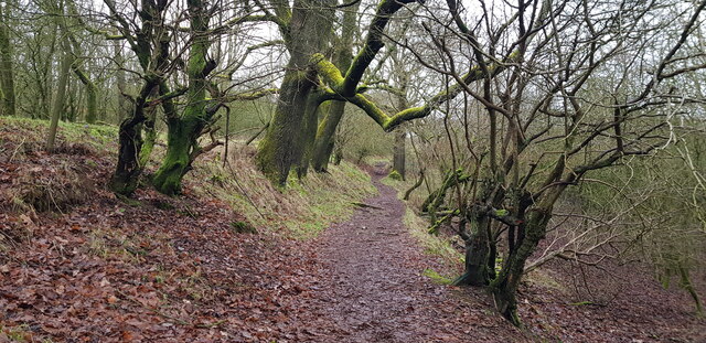
Forest walks
Good match
Public woodland
Hiking
Good match
Named hiking route nearby: North Worcestershire Path
Wildlife
Weak signal
Conifer plantation — limited but present wildlife
Trails nearby
Within roughly 5 km🚶Walking
19 signed routes nearby · 1 public path nearby
Signed route nearbyPublic paths
Walking
Monarch's WayWalking route990 km
approximate route of Charles II's escape
Lye Town History TrailWalking route
Discover the hidden history and architecture of Lye High Street along this clockwise circular trail. Duration: 54 mins
The Lye & Wollescote Cemetery TrailWalking route
Take a stroll around the tranquil surroundings of The Lye & Wollescote Cemetery to discover the fascinating stories of some of those who shaped the town’s history. Duration: 45 mins
The Leasowes Red Walking TrailWalking route3.3 km
Red trail 3.3km – 1 hour 15 minutes. Moderate difficulty with some undulating ground and one short climb. Gravelled paths lead you around the woodland valleys & watercourses.
North Worcestershire PathWalking route
🚴Cycling
20 signed routes nearby
Signed route nearby
Cycling
National Cycle Network Route 5Cycling route
Rea Valley RouteCycling route
NCN 5 section of Rea Valley Route
[PROPOSED]Starley Regional Cycle NetworkCycling route804 km
Starley (TfWM) Regional Cycle Network (Proposed route)
Rea Valley RouteCycling route
[PROPOSED]Birmingham Local Cycle NetworkCycling route
Birmingham Local Cycle Network (Proposed)
Main RouteCycling route674 m
🐴Horse riding
14 public paths nearby
Public paths
Horse riding
No named routes yet. Public paths are shown on the map.
Wildlife to spot
Photos
Weather for this location
Loading local forecast…
Nearby places
Useful places within 5 km
Own or manage this place?
Claim this listing to keep details accurate, add photos, and highlight what makes it special — free.
Claim this pageHow was your visit?
How useful was the information on this page?
id: 3a64c9df-881a-4f89-804a-31dc147c3251