Getting here
51.98414, 0.81453
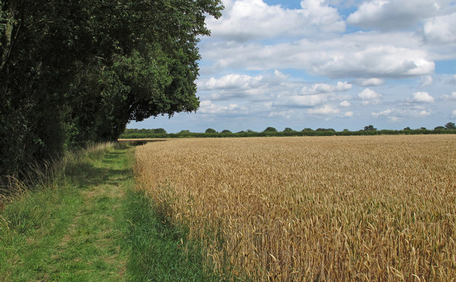
Visiting this summer
Seasonal nature notes and what to look for now
Visiting this summer
Seasonal nature notes and what to look for now
- 🌞Midsummer — early morning visits most comfortable; look for deer fawns in quieter clearings
- 🌿Foraging is at its best in summer here
- 🐕Dogs welcome — bring water in summer; the site has enough space to find shade on hot days
🌤️ Visiting this summer
- 🌞Midsummer — early morning visits most comfortable; look for deer fawns in quieter clearings
- 🌿Foraging is at its best in summer here
- 🐕Dogs welcome — bring water in summer; the site has enough space to find shade on hot days
Good to know
- £Free to visit — no entry charge
- 🐕Dogs welcome
- 🌿Ancient woodland — rare wildlife habitat
Best for
Wildlife
Very strong match
Multi-group wildlife — Amphibians, Birds, Mammals; Multi-group wildlife — Amphibians, Birds, Mammals
Bird watching
Very strong match
Birds — Blue Tit, Robin, Chiffchaff +61 more · last seen 2025; Birds — Blue Tit, Robin, Chiffchaff +61 more · last seen 2025
Seasonal nature
Strong match
Ancient woodland — bluebells, fungi and autumn colour; Plants — Wood Anemone, Hedge Woundwort, Goat Willow +65 more · last seen 2026
Foraging
Strong match
Plants — Wood-sorrel, Nettle-leaved Bellflower, Hazel +9 more foraging species; Deciduous woodland — fungi, berries and wild garlic
Dog walks
Strong match
Dogs allowed — public woodland
Insect spotting
Strong match
Lowland fens — fen dragonflies and rare invertebrates; Insects — 7-spot Ladybird, Dark-edged Bee-fly, Mecinus pascuorum +45 more · last seen 2025
Trails nearby
Within roughly 5 km🚶Walking
4 signed routes nearby · 26 public paths nearby
Signed route nearbyPublic paths
Walking
Gainsborough Trail Great Cornard WalkWalking route
St Edmund WayWalking route
Stour Valley Path part 2Walking route
Essex Way (Epping to Stratford St Mary)Walking route
Wemsey's Lanepublic footpath · 251 m
Wemsey's Lanepublic footpath · 195 m
🚴Cycling
16 signed routes nearby
Signed route nearby
Cycling
South Suffolk Cycle Route A2 (Bures Loop)Cycling route
South Suffolk Cycle Route A3 (Boxford Link)Cycling route
Route 13Cycling route
Wolf WayCycling route400 km
Main RouteCycling route144 m
Main RouteCycling route17 m
🐴Horse riding
4 public paths nearby
Public paths
Horse riding
Dead Lanebyway open to all traffic · 207 m
Dead Lanebyway open to all traffic · 235 m
Wildlife to spot
Photos
Weather for this location
Loading local forecast…
Nearby places
Useful places within 5 km
Own or manage this place?
Claim this listing to keep details accurate, add photos, and highlight what makes it special — free.
Claim this pageHow was your visit?
How useful was the information on this page?
id: 303c0eb5-3ca8-44de-9075-d5c6eb22726d