☀️June — long evenings and clear skies; one of the most rewarding months for a late visit
☀️Summer family visits work well here — arrive early and plan for a longer stay
🛝Playground on site — built-in entertainment for younger visitors alongside the wider site
🌤️ Visiting this summer
☀️June — long evenings and clear skies; one of the most rewarding months for a late visit
☀️Summer family visits work well here — arrive early and plan for a longer stay
🛝Playground on site — built-in entertainment for younger visitors alongside the wider site
Good to know
£Free to visit — no entry charge
🐕Dogs welcome
🅿️Parking· Free🛝Playground
Best for
8 activities
🦅
Bird watching
Strong match
Nature reserve
Free
🦉
Wildlife
Strong match
Nature reserve
Free
🎠
Playgrounds
Strong match
playground, parking
Free
🛝
Family friendly
Strong match
playground
Free
🐶
Dog walks
Strong match
Dogs allowed — nature reserve
Free
🌲
Forest walks
Strong match
Nature reserve
Free
Trails nearby
Within roughly 5 km
🚶
Walking
▾
4 signed routes nearby · 4 public paths nearby
Signed route nearbyPublic paths
The Tame Way- Canal RouteWalking route19 km▾
Explore the views, history and wildlife of the Tame Valley Wetlands. Stretching between Birmingham and Tamworth is an extraordinary hidden landscape on the doorstep of over 1 million people.
Sister walk to a river walk also ending at Hopwas.
Duration ~5h
Named routeRef TW-CLength 19 kmPoint-to-pointLocal walking route
Rail Trail: Birmingham International > Marston GreenWalking route6.4 km▾
A 4-mile walk discovering wildflower meadows, oak woodland and parkland along Low Brook on an easy route to Marston Green. Plane spotting optional!
Duration: 1.5 hours
Distance: 4 miles
Named routeRef rtBIALength 6.4 kmPoint-to-pointLocal walking route
Colebridge WayWalking route▾
Named routeLocal walking route
Rail Trail: Marston Green Circular via ElmdonWalking route8.8 km▾
A 5.5-mile walk to discover a different side of suburban life, with a trail packed with plane spotting, heritage and a surprising amount of green space!
Duration: 2.5 hours
Distance: 5.5 miles
Named routeRef rtMGLength 8.8 kmRound tripLocal walking route
🚴
Cycling
▾
65 signed routes nearby
Signed route nearby
National Cycle Network Route 533Cycling route▾
Named routeRef 533National Cycle Network
Cole Valley RouteCycling route▾
Named routeLocal cycle route
Ward End RouteCycling route▾
Named routeLocal cycle route
3 Parks Cycle Route- Silver Route (Airport Viewing Area to Meriden Park)Cycling route2.7 km▾
The all-weather route follows the valley of the Hatchford, Westley and Kingshurst Brooks whilst passing through an attractive mixture of formal parkland, wooded areas and open grassland.
Named routeRef 3PSLength 2.7 kmPoint-to-pointLocal cycle route
Ward End RouteCycling route▾
Signposted as 'Ward End Route'.
Named routeLocal cycle route
A45 Pop Up Cycle RouteCycling route▾
Named routeRef Pop UpLocal cycle route
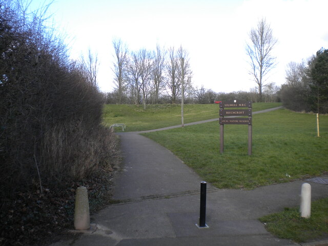
About this nature reserve
Beechcroft is a 4-hectare local nature reserve located in Solihull, West Midlands, England. It offers a semi-natural area with diverse flora and fauna, and is primarily used for quiet walks and wildlife observation.