Getting here
53.33265, -2.24082
Visiting this summer
Seasonal nature notes and what to look for now
Visiting this summer
Seasonal nature notes and what to look for now
- 🌞Midsummer — early morning visits most comfortable; look for deer fawns in quieter clearings
- 🧺Good picnic destination in summer — open space and facilities for a relaxed day out
- 🐕Dogs welcome — bring water in summer; the site has enough space to find shade on hot days
🌤️ Visiting this summer
- 🌞Midsummer — early morning visits most comfortable; look for deer fawns in quieter clearings
- 🧺Good picnic destination in summer — open space and facilities for a relaxed day out
- 🐕Dogs welcome — bring water in summer; the site has enough space to find shade on hot days
Good to know
- £Free to visit — no entry charge
- 🐕Dogs welcome
Best for
Picnic day out
Strong match
picnic area, car park
Dog walks
Strong match
Dogs allowed — public woodland
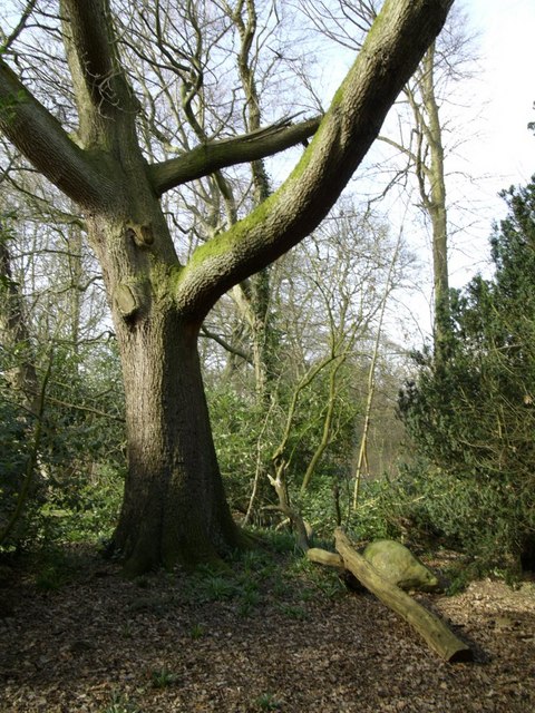
Wildlife
Strong match
Deciduous woodland priority habitat
Bird watching
Strong match
Deciduous woodland — woodpeckers, warblers and woodland birds
Foraging
Good match
Deciduous woodland — fungi, berries and wild garlic
Family friendly
Good match
picnic area
Trails nearby
Within roughly 5 km🚶Walking
7 signed routes nearby · 37 public paths nearby
Signed route nearbyPublic paths
Walking
GM Ringway Stage 3Walking route11.7 km
Fred Perry WayWalking route
Ladybrook Valley Interest TrailWalking route
North Cheshire WayWalking route
Wizard WalkWalking route
Dungeon Walkpublic footpath · 127 m
Dungeon Walkpublic footpath · 109 m
Marbury Roadpublic footpath · 101 m
🚴Cycling
46 signed routes nearby
Signed route nearby
Cycling
Cheshire CyclewayCycling route
Airport Orbital CyclewayCycling route
Greater Manchester regional route 85Cycling route
Airport City CyclewayCycling route
Heritage LoopCycling route
National Cycle Network 56Cycling route
🐴Horse riding
15 public paths nearby
Public paths
Horse riding
Broad Walkrestricted byway · 45 m
Carrwood Roadrestricted byway · 59 m
Kings Roadrestricted byway · 316 m
Wildlife to spot
Photos
Weather for this location
Loading local forecast…
Nearby places
Useful places within 5 km
Own or manage this place?
Claim this listing to keep details accurate, add photos, and highlight what makes it special — free.
Claim this pageHow was your visit?
How useful was the information on this page?
id: fc0279b3-6c4e-41ff-9548-9da20941bab7