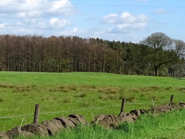
Bowl barrow 110m south-west of Threelows Cottages
0 ha
🦉Wildlife✦Heritage🦅Birds
Public accessFree entryDogs welcome0 ha
Getting here
53.01436, -1.88943
Open directionsv
Visiting this summer
Seasonal nature notes and what to look for now
- 🌞Midsummer — early morning visits most comfortable; look for deer fawns in quieter clearings
- ✦Historic character is a year-round quality here — summer brings its own atmosphere to the setting
- 🐕Dogs welcome — bring water in summer; the site has enough space to find shade on hot days
🌤️ Visiting this summer
- 🌞Midsummer — early morning visits most comfortable; look for deer fawns in quieter clearings
- ✦Historic character is a year-round quality here — summer brings its own atmosphere to the setting
- 🐕Dogs welcome — bring water in summer; the site has enough space to find shade on hot days
- £Free to visit — no entry charge
- 🐕Dogs welcome
🦉Wildlife
Very strong match
Multi-group wildlife — Amphibians, Birds, Mammals; Multi-group wildlife — Amphibians, Birds, Mammals
Free
Historic site with public access
Free
🦅Bird watching
Strong match
Birds — Blackbird, Robin, Wren +27 more · last seen 2025; Birds — Blackbird, Robin, Wren +27 more · last seen 2025
Free
🍂Seasonal nature
Strong match
Plants — Cuckooflower, Hogweed, Common Nettle +76 more · last seen 2025; Plants — Cuckooflower, Hogweed, Common Nettle +76 more · last seen 2025
Free
Plants — Hogweed, Common Nettle, Wood-sorrel +13 more foraging species
Varies
Dogs allowed with public access
Free
Trails nearby
Within roughly 5 km8 signed routes nearby · 6 public paths nearby
Signed route nearbyPublic paths
Limestone WayWalking route74 km▾
Castleton to Rocester
Named routeLength 74 kmPoint-to-pointRegional walking route
Weaver WalkWalking route▾
Named routeLocal walking route
Hamps WayWalking route23 km▾
Named routeLength 23 kmLocal walking route
Manifold Valley Circular WalkWalking route▾
Named routeLocal walking route
Friends of the Peak District Boundary WalkWalking route▾
Named routeLocal walking route
Farley 19public footpath · 477 m▾
Public pathpublic footpathLength 477 mSurface unpavedPath type: footway
Cotton 40public footpath · 288 m▾
Public pathpublic footpathLength 288 mPath type: footway
Farley 47public footpath · 504 m▾
Public pathpublic footpathLength 504 mSurface unpavedPath type: footway
11 signed routes nearby
Signed route nearby
National Route 550Cycling route▾
Named routeRef 550National Cycle Network
Churnet Valley CyclewayCycling route▾
Named routeLocal cycle route
Route 549Cycling route▾
Named routeRef 549National Cycle Network
Main RouteCycling route13.8 km▾
Named routeRef 550Length 13.8 kmNational Cycle NetworkTraffic-freeSurface unsealedfirm
Main RouteCycling route140 m▾
Named routeRef 549Length 140 mNational Cycle NetworkTraffic-freeSurface asphalt
Main RouteCycling route321 m▾
Named routeRef 549Length 321 mNational Cycle NetworkTraffic-freeSurface asphalt
Weather for this location
Next 14 daysNearby places
Useful places within 5 km
Own or manage this place?
Claim this listing to keep details accurate, add photos, and highlight what makes it special — free.
Claim this page→How useful was the information on this page?
id: f3b5b6f1-8c93-4fbb-bd61-92ee81e9e2e9
Wildlife to spot
4,170 records · National Biodiversity Network
Wildlife to spot
4,170 records · National Biodiversity Network🐦Birds17 species
summerautumn
2025▾
Robin · Great Tit · Wren · Woodpigeon · Blue Tit +12
- RobinErithacus rubecula
- Great TitParus major
- WrenTroglodytes troglodytes
- WoodpigeonColumba palumbus
- Blue TitCyanistes caeruleus
- NuthatchSitta europaea
- BlackbirdTurdus merula
- WoodcockScolopax rusticola
- RedwingTurdus iliacus
- WigeonMareca penelope
- Grey HeronArdea cinerea
- Red-legged PartridgeAlectoris rufa
- PochardAythya ferina
- Mediterranean GullIchthyaetus melanocephalus
- ShovelerSpatula clypeata
- LinnetLinaria cannabina
- WheatearOenanthe oenanthe
🦌Mammals17 species
summerautumn
2026▾
Grey Squirrel · Red Fox · Muntjac · Wood Mouse · Dog +12
- Grey SquirrelSciurus carolinensis2025
- Red FoxVulpes vulpes2025
- MuntjacMuntiacus reevesi2025
- Wood MouseApodemus sylvaticus2025
- DogCanis2025
- Badger
Species observations from the last 10 years via NBN Atlas
Meles meles2025
Meles meles2025
Roe DeerCapreolus capreolus2025Roe DeerCapreolus capreolus2025Brown HareLepus europaeus2025Brown HareLepus europaeus2025ShrewSoricidae2025ShrewSoricidae2025Red DeerCervus elaphus2025Red DeerCervus elaphus2025Brown RatRattus norvegicus2025Brown RatRattus norvegicus2025WeaselMustela nivalis2025WeaselMustela nivalis2025BatChiroptera2025BatChiroptera2025Natterer's BatMyotis nattereriNatterer's BatMyotis nattereriDaubenton's BatMyotis daubentoniiDaubenton's BatMyotis daubentoniiOtterLutra lutra2025OtterLutra lutra2025Feral CatFelis catus2025Feral CatFelis catus2025Events & activities nearby
Switch provider to compare local events, tours and bookable activities.