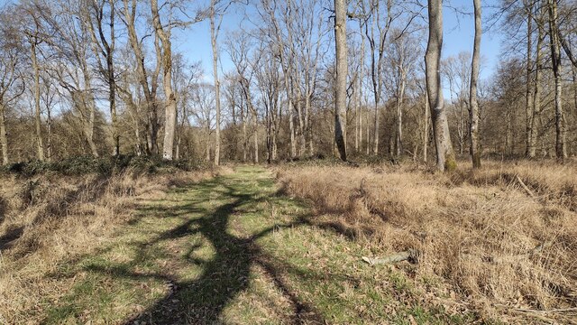
Bowl barrow 200m west of Hawksnest Copse in Wychwood Forest 0 ha
🦉 Wildlife🦅 Birds🦋 Insects
↑ Share
Free entry Dogs welcome 0 ha
Places › England › South East › West Oxfordshire Getting here
51.84703, -1.50932
Open directionsv ✦ Scheduled Ancient Monument — Nationally protected archaeological site on the National Heritage List for England (NHLE). Scheduled monuments represent the best surviving examples of England's irreplaceable archaeological heritage.
Bowl barrow scheduled monument
Visiting this summer
Seasonal nature notes and what to look for now
▾ 🌞 Midsummer — early morning visits most comfortable; look for deer fawns in quieter clearings ✦ Historic character is a year-round quality here — summer brings its own atmosphere to the setting 🐕 Dogs welcome — bring water in summer; the site has enough space to find shade on hot days 🌤️ Visiting this summer
🌞 Midsummer — early morning visits most comfortable; look for deer fawns in quieter clearings ✦ Historic character is a year-round quality here — summer brings its own atmosphere to the setting 🐕 Dogs welcome — bring water in summer; the site has enough space to find shade on hot days £ Free to visit — no entry charge🐕 Dogs welcome🦉 Wildlife
Very strong match
Multi-group wildlife — Birds, Mammals, Reptiles; Multi-group wildlife — Birds, Mammals, Reptiles
Free
🦅 Bird watching
Very strong match
Birds — Raven, Woodpigeon, Carrion Crow +60 more · last seen 2025; Birds — Raven, Woodpigeon, Carrion Crow +60 more · last seen 2025
Free
🦋 Insect spotting
Strong match
Insects — Non-biting midges, Red-headed Cardinal Beetle, Harlequin Ladybird +53 more · last seen 2026; Insects — Non-biting midges, Red-headed Cardinal Beetle, Harlequin Ladybird +53 more · last seen 2026
Free
Deciduous woodland — fungi, berries and wild garlic
Varies
🍂 Seasonal nature
Good match
Plants — Dilated Scalewort, Fox-tail Feather-moss, Broom Fork-moss +2 more · last seen 2022; Plants — Dilated Scalewort, Fox-tail Feather-moss, Broom Fork-moss +2 more · last seen 2022
Free
Trails nearby Within roughly 5 km 5 signed routes nearby
Signed route nearby
Oxfordshire Way Walking route 110 km ▾
a traverse of Oxfordshire from the Cotswolds to the Chilterns
Named route Ref OW Length 110 km Regional walking route
Show on map Wychwood Way Walking route 59.5 km ▾
Named route Length 59.5 km Regional walking route
Show on map D'Arcy Dalton Way Walking route 107 km ▾
Follows roughly the western boundary of Oxfordshire in unspoilt countryside.
Named route Length 107 km Regional walking route
Show on map The Roman Way Walking route 274.5 km ▾
Named route Length 274.5 km Regional walking route
Show on map European walking route E2 west, UK, South East England Walking route ▾
Westroute: Stranraer (UK) - Birminhgham (UK) - Calais (FR) - Zoersel (BE) / Eastroute: Stranraer (UK) - Harwich (UK) - Rotterdam (NL) - Zoersel (BE) / Both Routes: Zoersel (BE) - Maastrich (NL) - Luxembourg (LUX) - Lake Geneva (CH) - Nice (FR)
Named route Ref E2 International walking route
Show on map 38 signed routes nearby
Signed route nearby
Cotswold Line Cycle Route Cycling route ▾
Named route Ref 442 National Cycle Network
Show on map NCN National Route 57 Cycling route ▾
Named route Ref 57 National Cycle Network
Show on map National Byway (Oxon and Glos) Cycling route ▾
Named route Ref NB Regional cycle route
Show on map Witney to Long Hanborough Cycle Path Cycling route ▾
Named route Local cycle route
Show on map Main Route Cycling route 2.1 km ▾
Named route Ref 57 Length 2.1 km National Cycle Network On-road Surface asphalt
Show on map Main Route Cycling route 756 m ▾
Named route Ref 442 Length 756 m National Cycle Network On-road Surface asphalt
Show on map
Weather for this location Next 14 days Nearby places Useful places within 5 km
All Historic
Own or manage this place?
Claim this listing to keep details accurate, add photos, and highlight what makes it special — free.
Claim this page→ How useful was the information on this page?
Something wrong on this page?
id: beca5873-61d9-4795-8b2a-32d924c5a729
UK green spaces mapped from open public data — so anyone can find the woodland, trail, or nature reserve closest to them.
© 2026 Glade · Made with care for UK green spaces
Events & activities nearby Switch provider to compare local events, tours and bookable activities.
Bookable tours GetYourGuide Promote here
Wildlife to spot
12,348 records · National Biodiversity Network
▾
Wildlife to spot 12,348 records · National Biodiversity Network 🐦 Birds 43 species
autumn winter
2025 ▾
Blackbird · Woodpigeon · Carrion Crow · Jackdaw · Collared Dove +38
Blackbird Turdus merula Woodpigeon Columba palumbus Carrion Crow Corvus corone Jackdaw Coloeus monedula Collared Dove Streptopelia decaocto Wren Troglodytes troglodytes House Sparrow Passer domesticus Blue Tit Cyanistes caeruleus Goldfinch Carduelis carduelis Pheasant Phasianus colchicus Great Tit Parus major Raven Corvus corax Robin Erithacus rubecula Starling Sturnus vulgaris Jay Garrulus glandarius Skylark Alauda arvensis Great Spotted Woodpecker Dendrocopos major Mistle Thrush Turdus viscivorus Nuthatch Sitta europaea Magpie Pica pica Stock Dove Columba oenas Linnet Linaria cannabina Chaffinch Fringilla coelebs Meadow Pipit Anthus pratensis Rook Corvus frugilegus Yellowhammer Emberiza citrinella Dunnock Prunella modularis House Martin Delichon urbicum Redwing Turdus iliacus Bullfinch Pyrrhula pyrrhula Kestrel Falco tinnunculus Song Thrush Turdus philomelos Rock Dove Columba livia Greenfinch Chloris chloris Moorhen Gallinula chloropus Pied Wagtail Motacilla alba Marsh Tit Poecile palustris Long-tailed Tit Aegithalos caudatus Swift Apus apus Whooper Swan Cygnus cygnus Barn Owl Tyto alba Peregrine Falco peregrinus Coal Tit Periparus ater 🦌 Mammals 3 species
autumn winter
2025 ▾
Grey Squirrel · Brown Hare · Muntjac
Grey Squirrel Sciurus carolinensis Brown Hare Lepus europaeus Muntjac Muntiacus reevesi Slow-worm
Non-biting midges · Common Blue Damselfly · Sigara (Subsigara) fossarum · Blue-tailed Damselfly · Sigara (Subsigara) falleni +30
Non-biting midges Chironomidae2025 Common Blue Damselfly Enallagma cyathigerum2025 Sigara (Subsigara) fossarum Sigara (Subsigara) fossarum2025 Blue-tailed Damselfly Ischnura elegans2025 Sigara (Subsigara) falleni Sigara (Subsigara) falleni2025 Species observations from the last 10 years via NBN Atlas
Azure Damselfly
Azure Damselfly
Coenagrion puella2025
Coenagrion puella2025
Common Pondskater Gerris (Gerris) lacustris2025
Common Pondskater Gerris (Gerris) lacustris2025
Cymatia coleoptrata Cymatia coleoptrata2025
Cymatia coleoptrata Cymatia coleoptrata2025
Leptocerus tineiformis Leptocerus tineiformis2025
Leptocerus tineiformis Leptocerus tineiformis2025
Red-eyed Damselfly Erythromma najas2025
Red-eyed Damselfly Erythromma najas2025
Aquarius paludum Aquarius paludum2025
Aquarius paludum Aquarius paludum2025
Sigara (Sigara) dorsalis Sigara (Sigara) dorsalis2025
Sigara (Sigara) dorsalis Sigara (Sigara) dorsalis2025
Toothed Pondskater Gerris (Gerris) odontogaster2025
Toothed Pondskater Gerris (Gerris) odontogaster2025
Athous bicolor Athous bicolor2025
Athous bicolor Athous bicolor2025
Dark-edged Bee-fly Bombylius major
Dark-edged Bee-fly Bombylius major
Cream-spot Ladybird Calvia quattuordecimguttata
Cream-spot Ladybird Calvia quattuordecimguttata
Abax parallelepipedus Abax parallelepipedus
Abax parallelepipedus Abax parallelepipedus
Plea minutissima Plea minutissima2025
Plea minutissima Plea minutissima2025
Water Measurer Hydrometra stagnorum2025
Water Measurer Hydrometra stagnorum2025
Microvelia (Microvelia) reticulata Microvelia (Microvelia) reticulata2025
Microvelia (Microvelia) reticulata Microvelia (Microvelia) reticulata2025
Saucer Bug Ilyocoris cimicoides2025
Saucer Bug Ilyocoris cimicoides2025
Emperor Dragonfly Anax imperator2025
Emperor Dragonfly Anax imperator2025
Pondweed Bug Mesovelia furcata2025
Pondweed Bug Mesovelia furcata2025
Common Water-Boatman Notonecta (Notonecta) glauca2025
Common Water-Boatman Notonecta (Notonecta) glauca2025
Phryganeidae Phryganeidae2025
Phryganeidae Phryganeidae2025
Ephemera vulgata Ephemera vulgata2025
Ephemera vulgata Ephemera vulgata2025
Field Grasshopper Chorthippus brunneus2025
Field Grasshopper Chorthippus brunneus2025
Hawthorn Shieldbug Acanthosoma haemorrhoidale2025
Hawthorn Shieldbug Acanthosoma haemorrhoidale2025
Cantharis rustica Cantharis rustica2025
Cantharis rustica Cantharis rustica2025
Red-headed Cardinal Beetle Pyrochroa serraticornis2025
Red-headed Cardinal Beetle Pyrochroa serraticornis2025
Harlequin Ladybird Harmonia axyridis2025
Harlequin Ladybird Harmonia axyridis2025
Cantharis decipiens Cantharis decipiens2025
Cantharis decipiens Cantharis decipiens2025
Orange Ladybird Halyzia sedecimguttata2025
Orange Ladybird Halyzia sedecimguttata2025
16-spot Ladybird Tytthaspis sedecimpunctata2025
16-spot Ladybird Tytthaspis sedecimpunctata2025
Athous haemorrhoidalis Athous haemorrhoidalis2025
Athous haemorrhoidalis Athous haemorrhoidalis2025