🌞Midsummer — early morning visits most comfortable; look for deer fawns in quieter clearings
🌿Foraging is at its best in summer here
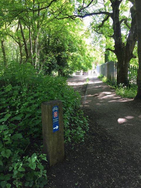
🐕Dogs welcome — bring water in summer; the site has enough space to find shade on hot days
🌤️ Visiting this summer
🌞Midsummer — early morning visits most comfortable; look for deer fawns in quieter clearings
🌿Foraging is at its best in summer here
🐕Dogs welcome — bring water in summer; the site has enough space to find shade on hot days
Good to know
£Free to visit — no entry charge
🐕Dogs welcome
Best for
5 activities
🦉
Wildlife
Strong match
Deciduous woodland priority habitat
Free
🦅
Bird watching
Strong match
Deciduous woodland — woodpeckers, warblers and woodland birds
Free
🌿
Foraging
Good match
Deciduous woodland — fungi, berries and wild garlic
Varies
🦋
Insect spotting
Good match
Semi-improved grassland — butterflies and wildflowers
Free
🌲
Forest walks
Moderate match
Public woodland
Free
Trails nearby
Within roughly 5 km
🚶
Walking
▾
9 signed routes nearby
Signed route nearby
Monarch's WayWalking route990 km▾
approximate route of Charles II's escape
Named routeRef MWLength 990 kmRegional walking route
Heart of England WayWalking route▾
Named routeListed length 161kmRegional walking route
E2 hiking trail BirminghamWalking route▾
Named routeNational walking route
Four Commons WalkWalking route9.5 km▾
Circular route following the Wyrley & Essington Canal to Clayhanger Common – one of Walsall’s much-loved areas of green, open space.
Distance: 6 miles/9.5 km(approx)
Duration: 120 mins(approx)
Named routeLength 9.5 kmRound tripLocal walking route
Clayhanger Common WalkWalking route9.5 km▾
Short, circular route following the Wyrley & Essington Canal to Clayhanger Common – one of Walsall’s much-loved areas of green, open space.
Distance: 6 miles/9.5 km(approx)
Duration: 120 mins(approx)
Named routeLength 9.5 kmRound tripLocal walking route
🚴
Cycling
▾
62 signed routes nearby
Signed route nearby
Sneyd Junction to Pudding Green JunctionCycling route16 km▾
Canalside route passing through the heartlands of the industrial Black Country. Decends using the Walsall locks then rises at Ryders Green Locks.
Distance: 10 miles/16 km (approx)
Duration: 90 min (approx)
Named routeLength 16 kmPoint-to-pointLocal cycle route
Route 54Cycling route▾
Named routeRef 54National Cycle Network
McClean WayCycling route▾
Named routeLocal cycle route
Sneyd Junction to Cannock Extension CanalCycling route8.8 km▾
A semi-rural route following the curves of the canal, until it opens out into parkland at the Cannock Extension.
Distance: 5.5 miles/8.8 km (approx)
Duration: 45 min (approx)
Named routeLength 8.8 kmPoint-to-pointLocal cycle route
Cannock Extension Canal to Longwood JunctionCycling route11.2 km▾
Canalside route leading past Clayhanger Common and through Rushall, with a pub along the way.
Distance: 7 miles/11.2 km (approx)
Duration: 60 min (approx)
Named routeLength 11.2 kmPoint-to-pointLocal cycle route
Sneyd Junction to Horseley Fields JunctionCycling route9.6 km▾
Canalside route following the Wyrley & Essington, taking New Cross Bridge, where the towpath changes to the other side of the canal.
Distance: 6 miles/9.6 km (approx)
Duration: 60 min (approx)
Named routeLength 9.6 kmPoint-to-pointLocal cycle route