Lightfoot Green - Broadleaved woodland
2 ha
🐶Dogs🦉Wildlife🎠Play
Public accessFree entryDogs welcome2 ha
Getting here
53.79518, -2.73068
Open directionsv
Visiting this summer
Seasonal nature notes and what to look for now
- 🌞Midsummer — early morning visits most comfortable; look for deer fawns in quieter clearings
- 🐕Early mornings are best for dog walks in summer — visit before 9am to avoid the heat and find quieter trails
- 🛝Playground 257m away — built-in entertainment for younger visitors alongside the wider site
🌤️ Visiting this summer
- 🌞Midsummer — early morning visits most comfortable; look for deer fawns in quieter clearings
- 🐕Early mornings are best for dog walks in summer — visit before 9am to avoid the heat and find quieter trails
- 🛝Playground 257m away — built-in entertainment for younger visitors alongside the wider site
- £Free to visit — no entry charge
- 🐕Dogs welcome
Dogs allowed — public woodland
Free
Deciduous woodland priority habitat
Free
🦅Bird watching
Strong match
Deciduous woodland — woodpeckers, warblers and woodland birds
Free
🛝Family friendly
Good match
playground
Free
Named cycling route nearby: NCN 622 Preston Guild Wheel
Varies
Trails nearby
Within roughly 5 km2 signed routes nearby · 14 public paths nearby
Signed route nearbyPublic paths
Ribble WayWalking route114 km▾
The Ribble Way follows the valley of the River Ribble from the mouth to the source near to the Pennine Way National Trail on Gayle Moor.
Named routeLength 114 kmRegional walking route
Preston Guild WheelWalking route▾
Relation for walking route. The Cycling relation is separately mapped as NCN 622
Named routeRound tripLocal walking route
Eastwaypublic footpath · 117 m▾
Public pathpublic footpathLength 117 mSurface asphaltPath type: secondary
194 signed routes nearby
Signed route nearby
NCN 622 Preston Guild WheelCycling route▾
Named routeRef 622National Cycle Network
Route 62Cycling route▾
Named routeRef 62National Cycle Network
NCN 622 (Low gradient route avoiding steep slope)Cycling route▾
Named routeRef 622National Cycle Network
NCN 622 (Steep gradient route)Cycling route▾
Named routeRef 622National Cycle Network
Route 6Cycling route▾
Named routeRef 6National Cycle Network
Lancashire Cycleway (Northern Loop)Cycling route▾
Named routeRef 90Regional cycle route
4 public paths nearby
Public paths
Sandyforth Lanebridleway · 219 m▾
Public pathbridlewayLength 219 mSurface asphaltPath type: unclassified
Sandyforth Lanebridleway · 299 m▾
Public pathbridlewayLength 299 mSurface asphaltPath type: bridleway
Sandyforth Lanebridleway · 23 m▾
Public pathbridlewayLength 23 mSurface asphaltPath type: bridleway
Sandyforth Lanebridleway · 20 m▾
Public pathbridlewayLength 20 mSurface asphaltPath type: bridleway
Photos
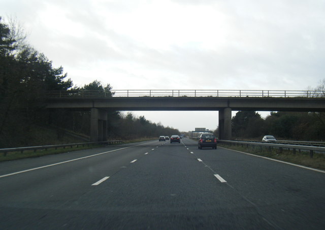
M55 passes under Lightfoot Green Lane
Weather for this location
Next 14 daysNearby places
Useful places within 5 km
Own or manage this place?
Claim this listing to keep details accurate, add photos, and highlight what makes it special — free.
Claim this page→How useful was the information on this page?
id: dae4f202-592d-4f54-b47a-4448532be00a
Wildlife to spot
38,672 records · National Biodiversity Network
Wildlife to spot
38,672 records · National Biodiversity Network🐦Birds41 species
springsummerautumn
2026▾
Woodpigeon · Carrion Crow · Jackdaw · Magpie · Blackbird +36
- WoodpigeonColumba palumbus2025
- Carrion CrowCorvus corone2025
- JackdawColoeus monedula2025
- MagpiePica pica2025
- BlackbirdTurdus merula2025
- Pied WagtailMotacilla alba2025
- Rock DoveColumba livia2025
- Herring GullLarus argentatus2025
- ChaffinchFringilla coelebs2025
- Collared DoveStreptopelia decaocto2025
- Lesser Black-backed GullLarus fuscus2025
- RedwingTurdus iliacus2025
- House SparrowPasser domesticus2025
- GoldfinchCarduelis carduelis2025
- Canada GooseBranta canadensis2025
- Blue TitCyanistes caeruleus2025
- Great TitParus major2025
- StarlingSturnus vulgaris2025
- RookCorvus frugilegus2025
- Erithacus rubecula melophilusErithacus rubecula melophilus2025
- Cyanistes caeruleus obscurusCyanistes caeruleus obscurus2025
- BlackcapSylvia atricapilla2025
- MallardAnas platyrhynchos2025
- WrenTroglodytes troglodytes
- DunnockPrunella modularis2025
- GreenfinchChloris chloris2025
- RobinErithacus rubecula2025
- Tree SparrowPasser montanus2025
- Coal TitPeriparus ater2025
- Mistle ThrushTurdus viscivorus2025
- Black-headed GullChroicocephalus ridibundus2025
- MoorhenGallinula chloropus2025
- Grey HeronArdea cinerea2025
- Coloeus monedula spermologusColoeus monedula spermologus2025
- Turdus merula merulaTurdus merula merula2025
- Columba palumbus palumbusColumba palumbus palumbus2025
- Pica pica picaPica pica pica2025
- ChiffchaffPhylloscopus collybita2025
- Song ThrushTurdus philomelos2025
- JayGarrulus glandarius2025
- LapwingVanellus vanellus2025
🦌Mammals3 species
summerwinter
2025▾
Red Fox · Grey Squirrel · Hedgehog
- Red FoxVulpes vulpes
- Grey SquirrelSciurus carolinensis
- HedgehogErinaceus europaeus
🐸Amphibians1 species
springsummer
2025▾
Common Frog
- Common FrogRana temporaria
🐝Insects14 species
springsummer
2025▾
Syrphus · 14-spot Ladybird · Water Ladybird · Alder Leaf Beetle · Coenosia tigrina +9
- SyrphusSyrphus
- 14-spot LadybirdPropylea quattuordecimpunctata
- Water LadybirdAnisosticta novemdecimpunctata
- Alder Leaf BeetleAgelastica alni
- Coenosia tigrinaCoenosia tigrina
- Western Honey BeeApis mellifera
🌿Plants36 species
winterspringsummer
2026▾
Ground-elder · Common Dog-violet · Prunus cerasifera var. cerasifera · Broad Buckler-fern · Groundsel +31
- Ground-elderAegopodium podagraria
- Common Dog-violetViola riviniana
- Prunus cerasifera var. cerasiferaPrunus cerasifera var. cerasifera
- Broad Buckler-fernDryopteris dilatata
- GroundselSenecio vulgaris
- Garlic Mustard
Species observations from the last 10 years via NBN Atlas
Orange Ladybird
Orange Ladybird
Halyzia sedecimguttata
Halyzia sedecimguttata
Common WaspVespula vulgarisCommon WaspVespula vulgarisPterostichus nigerPterostichus nigerPterostichus nigerPterostichus nigerLarge Red DamselflyPyrrhosoma nymphulaLarge Red DamselflyPyrrhosoma nymphulaGreater Bulb-FlyMerodon equestrisGreater Bulb-FlyMerodon equestrisEristalis pertinaxEristalis pertinaxEristalis pertinaxEristalis pertinaxPolydrusus formosusPolydrusus formosusPolydrusus formosusPolydrusus formosusWater ScorpionNepa cinereaWater ScorpionNepa cinereaAlliaria petiolata
Alliaria petiolata
HogweedHeracleum sphondyliumHogweedHeracleum sphondyliumMeadow ButtercupRanunculus acrisMeadow ButtercupRanunculus acrisRibwort PlantainPlantago lanceolataRibwort PlantainPlantago lanceolataDaisyBellis perennisDaisyBellis perennisHard RushJuncus inflexusHard RushJuncus inflexusItalian Lords-and-LadiesArum italicumItalian Lords-and-LadiesArum italicumBlackthornPrunus spinosaBlackthornPrunus spinosaWall-rueAsplenium ruta-murariaWall-rueAsplenium ruta-murariaFringecupsTellima grandifloraFringecupsTellima grandifloraMaidenhair SpleenwortAsplenium trichomanesMaidenhair SpleenwortAsplenium trichomanesHerb-RobertGeranium robertianumHerb-RobertGeranium robertianumLesser CelandineFicaria vernaLesser CelandineFicaria vernaLamiastrum galeobdolon subsp. argentatumLamiastrum galeobdolon subsp. argentatumLamiastrum galeobdolon subsp. argentatumLamiastrum galeobdolon subsp. argentatumStag's-horn SumachRhus typhina2025Stag's-horn SumachRhus typhina2025Betula utilisBetula utilis2025Betula utilisBetula utilis2025WalnutJuglans regia2025WalnutJuglans regia2025Copper BeechFagus sylvatica group 'Atropurpurea'2025Copper BeechFagus sylvatica group 'Atropurpurea'2025Red BistortBistorta amplexicaulis2025Red BistortBistorta amplexicaulis2025LaburnhamLaburnum anagyroides2025LaburnhamLaburnum anagyroides2025SycamoreAcer pseudoplatanus2025SycamoreAcer pseudoplatanus2025Monkey-puzzleAraucaria araucana2025Monkey-puzzleAraucaria araucana2025Wild CherryPrunus avium2025Wild CherryPrunus avium2025Tufted VetchVicia cracca2025Tufted VetchVicia cracca2025Fox-and-cubsPilosella aurantiaca2025Fox-and-cubsPilosella aurantiaca2025Large BindweedCalystegia silvatica2025Large BindweedCalystegia silvatica2025FennelFoeniculum vulgare2025FennelFoeniculum vulgare2025Lesser SpearwortRanunculus flammula2025Lesser SpearwortRanunculus flammula2025Water BentPolypogon viridis2025Water BentPolypogon viridis2025Remote SedgeCarex remota2025Remote SedgeCarex remota2025Field MapleAcer campestre2025Field MapleAcer campestre2025Events & activities nearby
Switch provider to compare local events, tours and bookable activities.