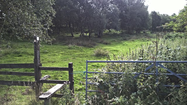
Ramshorn Common - Broadleaved woodland
37 ha
Plan your visit
🐶Dogs🦉Wildlife🦅Birds
Public accessFree entryDogs welcome37 ha
Getting here
53.00982, -1.88992
Open directionsv
Visiting this summer
Seasonal nature notes and what to look for now
- 🌞Midsummer — early morning visits most comfortable; look for deer fawns in quieter clearings
- 🐕Early mornings are best for dog walks in summer — visit before 9am to avoid the heat and find quieter trails
- 📍Open access throughout summer — no booking required
🌤️ Visiting this summer
- 🌞Midsummer — early morning visits most comfortable; look for deer fawns in quieter clearings
- 🐕Early mornings are best for dog walks in summer — visit before 9am to avoid the heat and find quieter trails
- 📍Open access throughout summer — no booking required
- £Free to visit — no entry charge
- 🐕Dogs welcome
Dogs allowed — public woodland
Free
Deciduous woodland priority habitat
Free
🦅Bird watching
Strong match
Deciduous woodland — woodpeckers, warblers and woodland birds
Free
Deciduous woodland — fungi, berries and wild garlic
Varies
🍂Seasonal nature
Good match
Broadleaved woodland — spring blossom and autumn colour
Free
Trails nearby
Within roughly 5 km8 signed routes nearby · 16 public paths nearby
Signed route nearbyPublic paths
Limestone WayWalking route74 km▾
Castleton to Rocester
Named routeLength 74 kmPoint-to-pointRegional walking route
Weaver WalkWalking route▾
Named routeLocal walking route
Hamps WayWalking route23 km▾
Named routeLength 23 kmLocal walking route
Manifold Valley Circular WalkWalking route▾
Named routeLocal walking route
Friends of the Peak District Boundary WalkWalking route▾
Named routeLocal walking route
Farley 47public footpath · 504 m▾
Public pathpublic footpathLength 504 mSurface unpavedPath type: footway
Cotton 40public footpath · 288 m▾
Public pathpublic footpathLength 288 mPath type: footway
Farley 2public footpath · 163 m▾
Public pathpublic footpathLength 163 mPath type: footway
9 signed routes nearby
Signed route nearby
National Route 550Cycling route▾
Named routeRef 550National Cycle Network
Churnet Valley CyclewayCycling route▾
Named routeLocal cycle route
Route 549Cycling route▾
Named routeRef 549National Cycle Network
Main RouteCycling route13.8 km▾
Named routeRef 550Length 13.8 kmNational Cycle NetworkTraffic-freeSurface unsealedfirm
Main RouteCycling route140 m▾
Named routeRef 549Length 140 mNational Cycle NetworkTraffic-freeSurface asphalt
Main RouteCycling route321 m▾
Named routeRef 549Length 321 mNational Cycle NetworkTraffic-freeSurface asphalt
6 public paths nearby
Public paths
Green Lanebridleway · 475 m▾
Public pathbridlewayLength 475 mSurface unpavedPath type: track
Weather for this location
Next 14 daysNearby places
Useful places within 5 km
Own or manage this place?
Claim this listing to keep details accurate, add photos, and highlight what makes it special — free.
Claim this page→How useful was the information on this page?
id: 2b434f8c-eadd-41db-841c-8b9e0d52d418
Wildlife to spot
4,445 records · National Biodiversity Network
Wildlife to spot
4,445 records · National Biodiversity Network🐦Birds15 species
summerautumn
2025▾
Robin · Great Tit · Wren · Woodpigeon · Blue Tit +10
- RobinErithacus rubecula
- Great TitParus major
- WrenTroglodytes troglodytes
- WoodpigeonColumba palumbus
- Blue TitCyanistes caeruleus
- NuthatchSitta europaea
- BlackbirdTurdus merula
- WoodcockScolopax rusticola
- RedwingTurdus iliacus
- WigeonMareca penelope
- Grey HeronArdea cinerea
- Red-legged PartridgeAlectoris rufa
- PochardAythya ferina
- Mediterranean GullIchthyaetus melanocephalus
- ShovelerSpatula clypeata
🦌Mammals15 species
summerautumn
2025▾
Grey Squirrel · Muntjac · Red Fox · Wood Mouse · Badger +10
- Grey SquirrelSciurus carolinensis
- MuntjacMuntiacus reevesi
- Red FoxVulpes vulpes
- Wood MouseApodemus sylvaticus
- BadgerMeles meles
- Roe DeerCapreolus capreolus
- Dog
🐸Amphibians1 species
summer
2025▾
Common Frog
- Common FrogRana temporaria
Red-legged Shieldbug
- Red-legged ShieldbugPentatoma rufipes
Sneezewort · Common Bird's-foot-trefoil
- SneezewortAchillea ptarmica
- Common Bird's-foot-trefoilLotus corniculatus
Species observations from the last 10 years via NBN Atlas
Canis
Canis
ShrewSoricidaeShrewSoricidaeBrown HareLepus europaeusBrown HareLepus europaeusRed DeerCervus elaphusRed DeerCervus elaphusBrown RatRattus norvegicusBrown RatRattus norvegicusWeaselMustela nivalisWeaselMustela nivalisBatChiropteraBatChiropteraOtterLutra lutraOtterLutra lutraFeral CatFelis catusFeral CatFelis catusEvents & activities nearby
Switch provider to compare local events, tours and bookable activities.