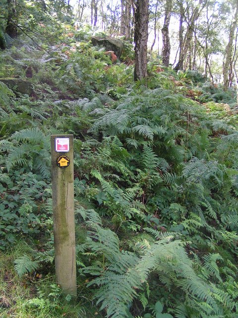
Broadmoor Wood ✦ Ancient woodland 16 ha
Plan your visit
🦉 Wildlife🍂 Seasonal🦅 Birds
Public access Free entry Dogs welcome 16 ha
Places › England › West Midlands › Staffordshire Moorlands Getting here
52.95318, -1.92335
Open directionsv Visiting this summer
Seasonal nature notes and what to look for now
▾ 🌞 Midsummer — early morning visits most comfortable; look for deer fawns in quieter clearings 🐕 Early mornings are best for dog walks in summer — visit before 9am to avoid the heat and find quieter trails ⛺ Camping available here — summer nights at this site are worth planning around 🌤️ Visiting this summer
🌞 Midsummer — early morning visits most comfortable; look for deer fawns in quieter clearings 🐕 Early mornings are best for dog walks in summer — visit before 9am to avoid the heat and find quieter trails ⛺ Camping available here — summer nights at this site are worth planning around £ Free to visit — no entry charge🐕 Dogs welcome🌿 Ancient woodland — rare wildlife habitat🦉 Wildlife
Very strong match
Multi-group wildlife — Amphibians, Birds, Mammals; Multi-group wildlife — Amphibians, Birds, Mammals
Free
🍂 Seasonal nature
Strong match
Ancient woodland — bluebells, fungi and autumn colour; Plants — Bulrush, Polypody, Himalayan Balsam +3 more · last seen 2025
Free
🦅 Bird watching
Strong match
Birds — Tawny Owl, Wren, Yellowhammer +33 more · last seen 2025; Birds — Tawny Owl, Wren, Yellowhammer +33 more · last seen 2025
Free
Dogs allowed — public woodland
Free
🦋 Insect spotting
Strong match
Insects — Agapetus fuscipes, Sericostoma personatum, Large White +40 more · last seen 2025; Insects — Agapetus fuscipes, Sericostoma personatum, Large White +40 more · last seen 2025
Free
Deciduous woodland — fungi, berries and wild garlic
Varies
Trails nearby Within roughly 5 km 3 signed routes nearby · 13 public paths nearby
Signed route nearby Public paths
Churnet Way Walking route ▾
Staffordshire Way (Rushton Spencer - Cannock Chase) Walking route 76 km ▾
Staffordshire Way, part Rushton Spencer - Cannock Chase
Named route Length 76 km Regional walking route
Show on map Weaver Walk Walking route ▾
Named route Local walking route
Show on map 5 signed routes nearby
Signed route nearby
Route 549 Cycling route ▾
Named route Ref 549 National Cycle Network
Show on map Churnet Valley Cycleway Cycling route ▾
Named route Local cycle route
Show on map N/A Cycling route 911 m ▾
Named route Length 911 m National Cycle Network Traffic-free Surface asphalt
Show on map N/A Cycling route 112 m ▾
Named route Length 112 m National Cycle Network Traffic-free Surface asphalt
Show on map N/A Cycling route 375 m ▾
Named route Length 375 m National Cycle Network Traffic-free Surface asphalt
Show on map 1 public path nearby
Public paths
No named routes yet. Public paths are shown on the map.
✦ Ancient woodland — continuously wooded since at least 1600 AD. A rare and irreplaceable habitat, rich in biodiversity and historical character.
Weather for this location Next 14 days Nearby places Useful places within 5 km
All Historic
Own or manage this place?
Claim this listing to keep details accurate, add photos, and highlight what makes it special — free.
Claim this page→ How useful was the information on this page?
id: 59982e72-3290-425f-b8c9-85df4d068966
UK green spaces mapped from open public data — so anyone can find the woodland, trail, or nature reserve closest to them.
© 2026 Glade · Made with care for UK green spaces
Wildlife to spot
869 records · National Biodiversity Network
▾
Wildlife to spot 869 records · National Biodiversity Network 🐦 Birds 10 species
spring summer autumn
2025 ▾
Willow Tit · Wren · Great Spotted Woodpecker · Little Owl · Blackbird +5
Willow Tit Poecile montanus Wren Troglodytes troglodytes2024 Great Spotted Woodpecker Dendrocopos major Little Owl Athene noctua2023 Blackbird Turdus merula2022 Tawny Owl Strix aluco2021 Brambling Fringilla montifringilla2021 Siskin Spinus spinus2021 Chaffinch Fringilla coelebs2021 Yellowhammer Emberiza citrinella2021 🦌 Mammals 11 species
winter spring summer
2025 ▾
Rabbit · Mole · Grey Squirrel · Badger · Field Vole +6
Rabbit Oryctolagus cuniculus2023 Mole Talpa europaea Grey Squirrel Sciurus carolinensis2022 Badger Meles meles Field Vole Microtus agrestis2022 Agapetus fuscipes · Sericostoma personatum · Silo pallipes · Cramp-Ball Fungus Weevil · Varied Carpet Beetle +11
Agapetus fuscipes Agapetus fuscipes2019 Sericostoma personatum Sericostoma personatum2019 Silo pallipes Silo pallipes2019 Cramp-Ball Fungus Weevil Platyrhinus resinosus Varied Carpet Beetle Anthrenus verbasci Agapanthia villosoviridescens Agapanthia villosoviridescens Himalayan Balsam · Scented Mayweed · Pineappleweed · Hairy Bitter-cress · Pedunculate Oak +94
Himalayan Balsam Impatiens glandulifera Scented Mayweed Matricaria chamomilla Pineappleweed Matricaria discoidea Hairy Bitter-cress Cardamine hirsuta Pedunculate Oak Quercus robur Honeysuckle Lonicera periclymenum Bluebell Species observations from the last 10 years via NBN Atlas
Red Fox
Red Fox
Vulpes vulpes
Vulpes vulpes
Brown Hare Lepus europaeus2020
Brown Hare Lepus europaeus2020
Red Squirrel Sciurus vulgaris
Red Squirrel Sciurus vulgaris
Hedgehog Erinaceus europaeus2023
Hedgehog Erinaceus europaeus2023
Roe Deer Capreolus capreolus
Roe Deer Capreolus capreolus
Bank Vole Myodes glareolus2020
Bank Vole Myodes glareolus2020 2020
2020
Chaetopteryx villosa Chaetopteryx villosa2019
Chaetopteryx villosa Chaetopteryx villosa2019
Lype reducta Lype reducta2019
Lype reducta Lype reducta2019
Drusus annulatus Drusus annulatus2019
Drusus annulatus Drusus annulatus2019
Plectrocnemia brevis Plectrocnemia brevis2019
Plectrocnemia brevis Plectrocnemia brevis2019
Micropterna sequax Micropterna sequax2019
Micropterna sequax Micropterna sequax2019
Peacock Aglais io2019
Peacock Aglais io2019
Small Tortoiseshell Aglais urticae2019
Small Tortoiseshell Aglais urticae2019
Painted Lady Vanessa cardui2019
Painted Lady Vanessa cardui2019
Gatekeeper Pyronia tithonus2019
Gatekeeper Pyronia tithonus2019
Cuckoo-Spit Insect Philaenus spumarius2019
Cuckoo-Spit Insect Philaenus spumarius2019 Hyacinthoides non-scripta
Hyacinthoides non-scripta
Meadow Vetchling Lathyrus pratensis
Meadow Vetchling Lathyrus pratensis
Black Bryony Tamus communis
Black Bryony Tamus communis
Broad Buckler-fern Dryopteris dilatata
Broad Buckler-fern Dryopteris dilatata
Hedge Woundwort Stachys sylvatica
Hedge Woundwort Stachys sylvatica
Bulrush Typha latifolia
Bulrush Typha latifolia
American Willowherb Epilobium ciliatum
American Willowherb Epilobium ciliatum
Amphibious Bistort Persicaria amphibia
Amphibious Bistort Persicaria amphibia
Chicory Cichorium intybus
Chicory Cichorium intybus
Common Hemp-nettle Galeopsis tetrahit
Common Hemp-nettle Galeopsis tetrahit
Common Bent Agrostis capillaris
Common Bent Agrostis capillaris
Field Forget-me-not Myosotis arvensis
Field Forget-me-not Myosotis arvensis
Wood Avens Geum urbanum
Wood Avens Geum urbanum
Common Mouse-ear Cerastium fontanum
Common Mouse-ear Cerastium fontanum
Rough Meadow-grass Poa trivialis
Rough Meadow-grass Poa trivialis
Barren Brome Anisantha sterilis
Barren Brome Anisantha sterilis
Rosebay Willowherb Chamaenerion angustifolium
Rosebay Willowherb Chamaenerion angustifolium
Herb-Robert Geranium robertianum
Herb-Robert Geranium robertianum
Garlic Mustard Alliaria petiolata
Garlic Mustard Alliaria petiolata
Smooth Sow-thistle Sonchus oleraceus
Smooth Sow-thistle Sonchus oleraceus
Crack-willow Salix alba x euxina = S. x fragilis
Crack-willow Salix alba x euxina = S. x fragilis
Cleavers Galium aparine
Cleavers Galium aparine
Oxeye Daisy Leucanthemum vulgare
Oxeye Daisy Leucanthemum vulgare
Ground-ivy Glechoma hederacea
Ground-ivy Glechoma hederacea
Germander Speedwell Veronica chamaedrys
Germander Speedwell Veronica chamaedrys
Common Vetch Vicia sativa
Common Vetch Vicia sativa
Alder Alnus glutinosa
Alder Alnus glutinosa
Smooth Meadow-grass Poa pratensis
Smooth Meadow-grass Poa pratensis
Male-fern Dryopteris filix-mas
Male-fern Dryopteris filix-mas
Ash Fraxinus excelsior
Ash Fraxinus excelsior
Rowan Sorbus aucuparia
Rowan Sorbus aucuparia
Perennial Rye-grass Lolium perenne
Perennial Rye-grass Lolium perenne
Foxglove Digitalis purpurea
Foxglove Digitalis purpurea
Dandelion Taraxacum
Dandelion Taraxacum
Broad-leaved Dock Rumex obtusifolius
Broad-leaved Dock Rumex obtusifolius
Red Hemp-nettle Galeopsis angustifolia
Red Hemp-nettle Galeopsis angustifolia
Meadowsweet Filipendula ulmaria
Meadowsweet Filipendula ulmaria
Common Sorrel Rumex acetosa
Common Sorrel Rumex acetosa
False Oat-grass Arrhenatherum elatius
False Oat-grass Arrhenatherum elatius
Wild Angelica Angelica sylvestris
Wild Angelica Angelica sylvestris
Opposite-leaved Golden-saxifrage Chrysosplenium oppositifolium
Opposite-leaved Golden-saxifrage Chrysosplenium oppositifolium
Creeping Thistle Cirsium arvense
Creeping Thistle Cirsium arvense
Hawthorn Crataegus monogyna
Hawthorn Crataegus monogyna
Yorkshire-fog Holcus lanatus
Yorkshire-fog Holcus lanatus
Redshank Persicaria maculosa
Redshank Persicaria maculosa
Spear Thistle Cirsium vulgare
Spear Thistle Cirsium vulgare
Scaly Male-fern Dryopteris affinis
Scaly Male-fern Dryopteris affinis
Coltsfoot Tussilago farfara
Coltsfoot Tussilago farfara
Greater Plantain Plantago major
Greater Plantain Plantago major
Red Campion Silene dioica
Red Campion Silene dioica
Field Horsetail Equisetum arvense
Field Horsetail Equisetum arvense
Cow Parsley Anthriscus sylvestris
Cow Parsley Anthriscus sylvestris
Sycamore Acer pseudoplatanus
Sycamore Acer pseudoplatanus
Bramble Rubus fruticosus
Bramble Rubus fruticosus
Cock's-foot Dactylis glomerata
Cock's-foot Dactylis glomerata
Hogweed Heracleum sphondylium
Hogweed Heracleum sphondylium
Bracken Pteridium aquilinum
Bracken Pteridium aquilinum
Meadow Foxtail Alopecurus pratensis
Meadow Foxtail Alopecurus pratensis
Hazel Corylus avellana
Hazel Corylus avellana
Elder Sambucus nigra
Elder Sambucus nigra
Field Scabious Knautia arvensis
Field Scabious Knautia arvensis
Selfheal Prunella vulgaris
Selfheal Prunella vulgaris
Shepherd's-purse Capsella bursa-pastoris
Shepherd's-purse Capsella bursa-pastoris
Hoary Willowherb Epilobium parviflorum
Hoary Willowherb Epilobium parviflorum
Common Nettle Urtica dioica
Common Nettle Urtica dioica
Ivy Hedera helix
Ivy Hedera helix
Wych Elm Ulmus glabra
Wych Elm Ulmus glabra
Creeping Buttercup Ranunculus repens
Creeping Buttercup Ranunculus repens
Knotgrass Polygonum aviculare
Knotgrass Polygonum aviculare
Nipplewort Lapsana communis
Nipplewort Lapsana communis
Prickly Lettuce Lactuca serriola
Prickly Lettuce Lactuca serriola
Annual Meadow-grass Poa annua
Annual Meadow-grass Poa annua
Common Orache Atriplex patula
Common Orache Atriplex patula
Meadow Buttercup Ranunculus acris
Meadow Buttercup Ranunculus acris
Dog's Mercury Mercurialis perennis
Dog's Mercury Mercurialis perennis
Field Maple Acer campestre
Field Maple Acer campestre
Horse-chestnut Aesculus hippocastanum
Horse-chestnut Aesculus hippocastanum
Blackthorn Prunus spinosa
Blackthorn Prunus spinosa
Crested Dog's-tail Cynosurus cristatus
Crested Dog's-tail Cynosurus cristatus
Groundsel Senecio vulgaris
Groundsel Senecio vulgaris
White Clover Trifolium repens
White Clover Trifolium repens
Lime Tilia cordata x platyphyllos = T. x europaea
Lime Tilia cordata x platyphyllos = T. x europaea
Hedge Bindweed Calystegia sepium
Hedge Bindweed Calystegia sepium
Greater Stitchwort Stellaria holostea
Greater Stitchwort Stellaria holostea
Holly Ilex aquifolium
Holly Ilex aquifolium
Hedgerow Crane's-bill Geranium pyrenaicum
Hedgerow Crane's-bill Geranium pyrenaicum
Wild Strawberry Fragaria vesca
Wild Strawberry Fragaria vesca
Greater Periwinkle Vinca major
Greater Periwinkle Vinca major
Wood Dock Rumex sanguineus
Wood Dock Rumex sanguineus
Wood Millet Milium effusum
Wood Millet Milium effusum
Honesty Lunaria annua
Honesty Lunaria annua
Festuca rubra Festuca rubra
Festuca rubra Festuca rubra
Polypody Polypodium vulgare
Polypody Polypodium vulgare Events & activities nearby Switch provider to compare local events, tours and bookable activities.
Bookable tours GetYourGuide Promote here